
Day 1 Convective Outlook NWS Storm Prediction Center Norman OK
1130 AM CDT Wed Apr 15 2026 Valid 151630Z - 161200Z
...THERE IS A SLIGHT RISK OF SEVERE THUNDERSTORMS ACROSS PARTS OF THE SOUTHERN/CENTRAL PLAINS INTO THE MIDWEST/OHIO VALLEY AND SOUTHERN GREAT LAKES...
...SUMMARY...
Severe thunderstorms posing a risk for large to very large hail, damaging winds, and perhaps a few tornadoes will be possible across parts of the southern/central Plains into the Midwest/Ohio Valley and southern Great Lakes this afternoon and evening.
...Synopsis...
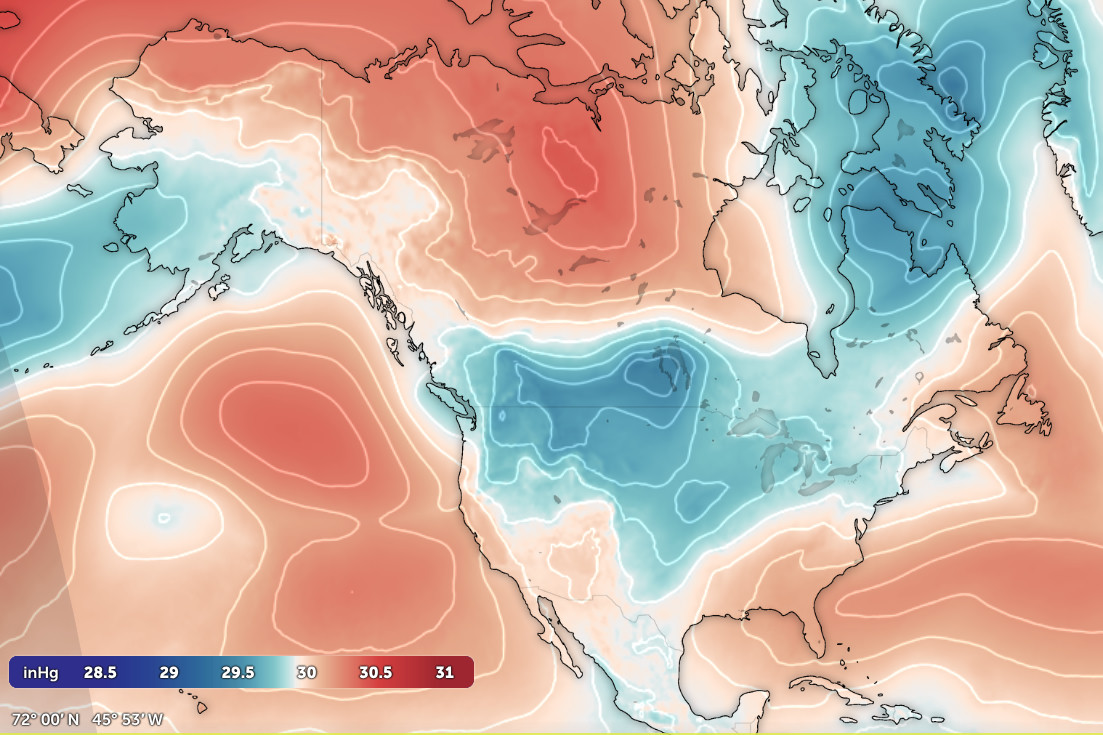
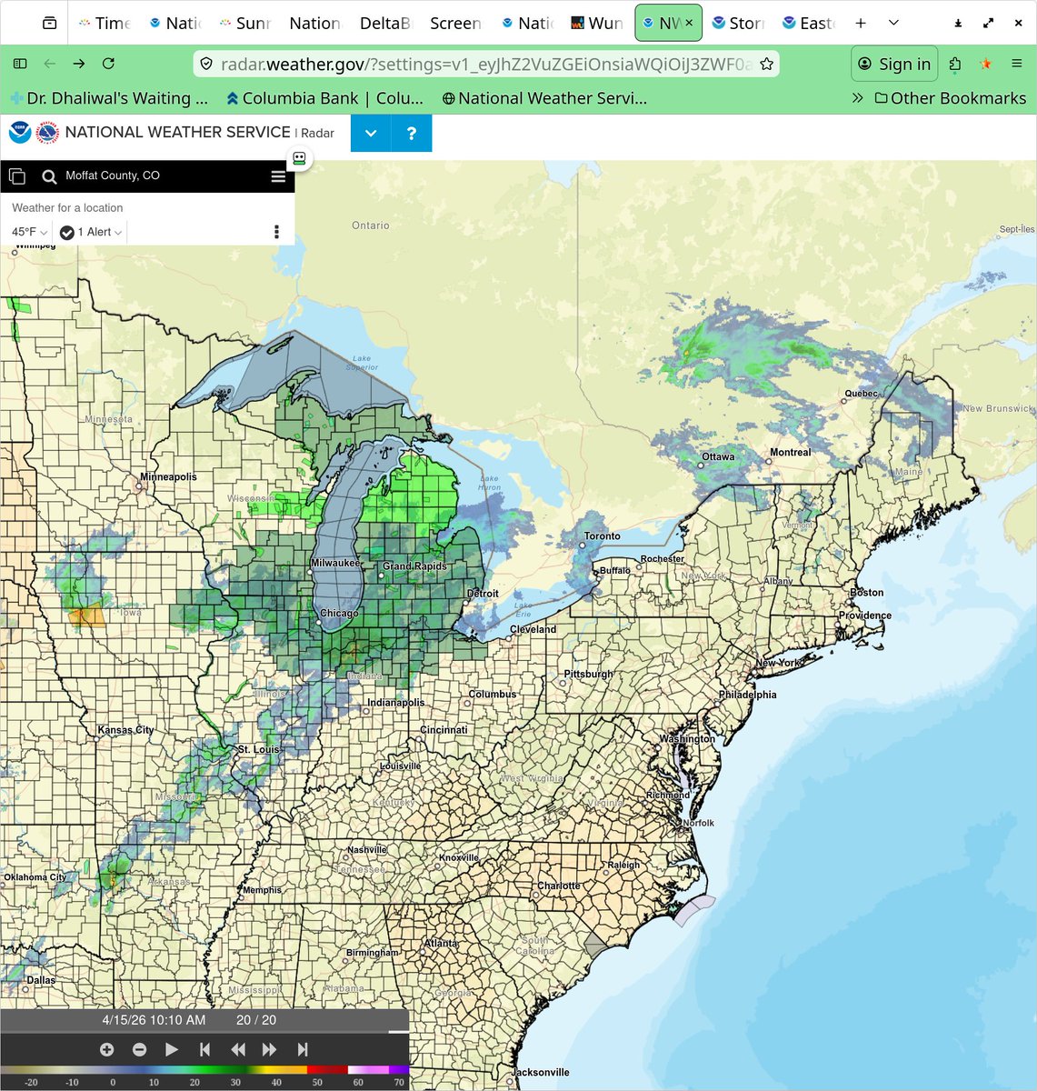
Severe potential across the broad warm sector will be complicated by ongoing thunderstorms/MCVs and associated cloud cover. A neutral to positively tilted upper trough will eject northeastward across the southern/central Plains today, with a broad zone of enhanced mid-level southwesterly winds extending over much of TX/OK into the Midwest/OH Valley and Great Lakes. At the surface, a weak low over southeast NE late this morning is forecast to develop slowly northeastward across IA through the afternoon and evening, with a quasi-stationary front extending northeastward from this low towards southern WI/Lower MI. A dryline extends southward across KS/OK into west TX. Multiple MCVs related to ongoing/earlier convection are also noted in recent visible satellite/radar imagery, and these features may aid additional convective development this afternoon.
...Iowa into Missouri...
Forcing for ascent associated with the ejecting upper trough will overspread the front draped across IA this afternoon. Ongoing supercell in western IA and cloudiness near the front late this morning cast some uncertainty on the degree of destabilization that will occur this afternoon, and the overall intensity of convection. Still, expectations are for additional robust thunderstorms to eventually develop by 19-21Z along/near the front in IA, with steep mid-level lapse rates noted on the observed 12Z TOP sounding supporting moderate to locally strong MLCAPE even if clouds/precipitation hinder daytime heating to some extent. Various NAM/RAP forecast soundings show elongated/nearly straight hodographs at mid/upper levels and 50+ kt of deep-layer shear, which will be favorable for upper-level/anvil venting and hail production with any supercells that form. Large to very large hail will be a concern with initially discrete convection. But, some tendency for clustering and movement north of the surface front casts considerable uncertainty on the wind/tornado potential. Even so, some chance for a few tornadoes and scattered damaging winds may exist along/south of the front across IA into MO with any convection that can develop east of the dryline.
...Southern Plains into the Ozarks and Mid Mississippi Valley...
A seasonably moist low-level airmass remains in place across the southern Plains into the Ozarks and mid MS Valley, with observed 12Z soundings from FWD/OUN/SGF indicating mean mixing ratios ranging 12-13.6 g/kg. However, even with steep mid-level lapse rates noted across TX/OK, profiles are fairly saturated at mid/upper levels, and plentiful cloud cover is present in recent visible satellite imagery across these regions. It still appears likely that surface-based thunderstorms will develop this afternoon (around 19-21Z) along/east of the dryline as MLCIN gradually erodes ahead of the ejecting upper trough. But, overall evolution remains somewhat unclear, with potential for messy storm modes/interactions fairly early in the convective life cycle given a large degree of boundary-parallel flow in low/mid levels. Initial supercells should pose a threat for mainly large to very large hail (isolated 2+ inches in diameter), before clustering and an increase in damaging wind potential occurs. The tornado threat is less clear, as stronger low-level flow will tend to remain focused farther north into the Midwest. Still, sufficient low-level shear should exist this afternoon and evening to support a threat for a few tornadoes with both supercells and embedded within clusters.
...Midwest/Ohio Valley into Western Pennsylvania...
An MCV evident over eastern IL/western IN will continue to track eastward into northern IN and eventually OH this afternoon and evening. Ongoing thunderstorms associated with this MCV have remained sub-severe through much of the morning. But, gradual destabilization of the already moist low-level airmass downstream should support some uptick in convective coverage and intensity across the OH Valley by mid to late afternoon. Localized enhancement to the west-southwesterly low-level winds should focus across parts of northern OH and vicinity, where somewhat greater low-level shear and tornado potential may exist. Strong deep-layer shear will easily support organized convection, including the potential for supercells with a threat for large hail, damaging winds, and perhaps a couple of tornadoes. Additional thunderstorms may eventually develop eastward from the mid MS Valley into IL/IN in association with another MCV. Large hail, damaging winds, and a tornado or two may also occur with this activity, if it develops.


English