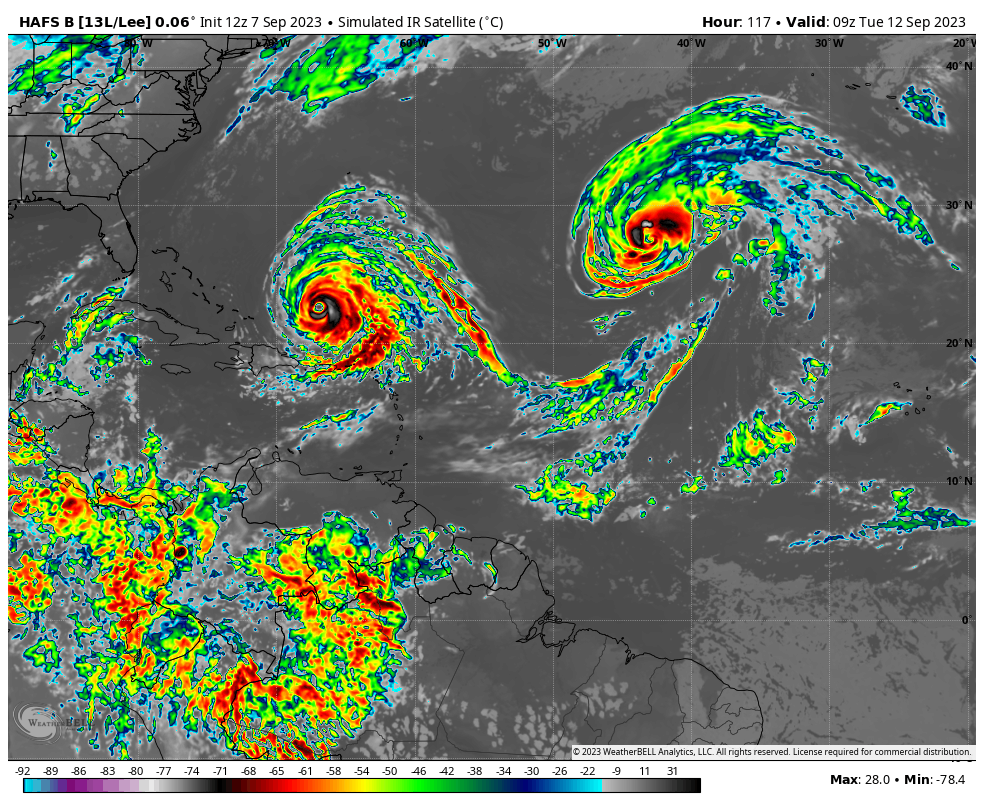
Katie Garner retweetledi
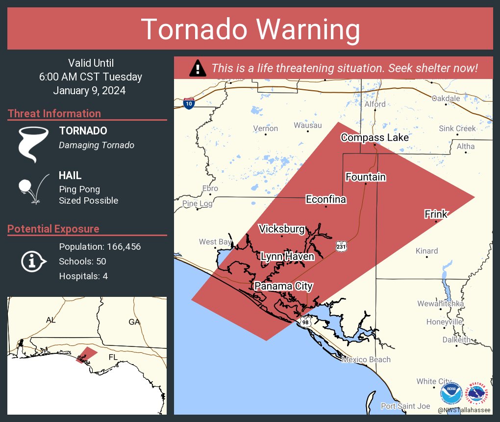
Tornado Warning continues for Panama City FL, Lynn Haven FL and Callaway FL until 6:00 AM CST
Florida, USA 🇺🇸 English
Katie Garner
101 posts


@kgeontv
@KatieGarnerTV was hacked- I made a new account! Hype girl | News4JAX On- Air Meteorologist| Author | D-List Actor | Col: 3:17 |🏳️🌈|Always Laughing|


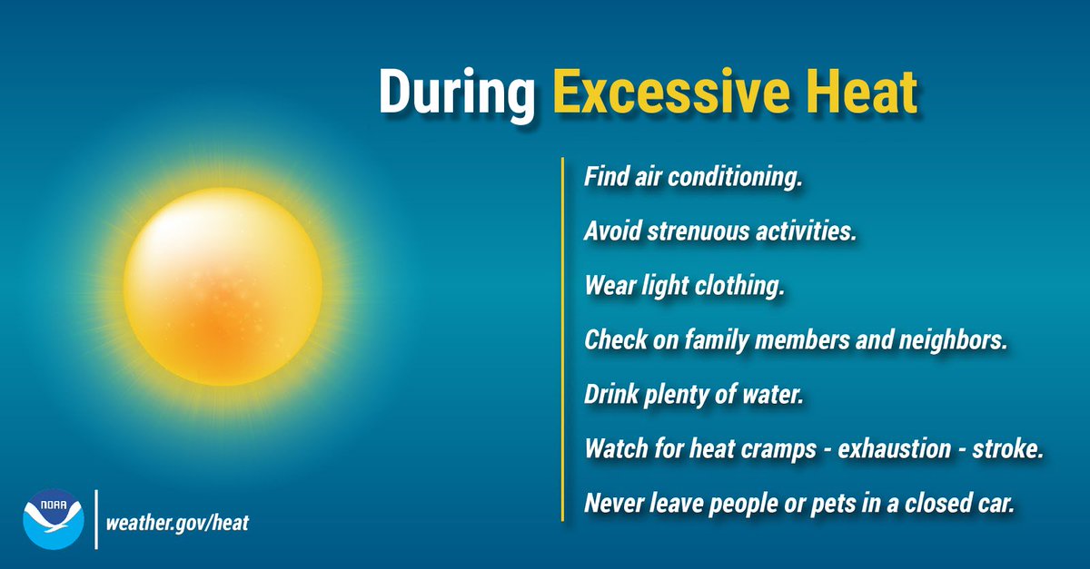
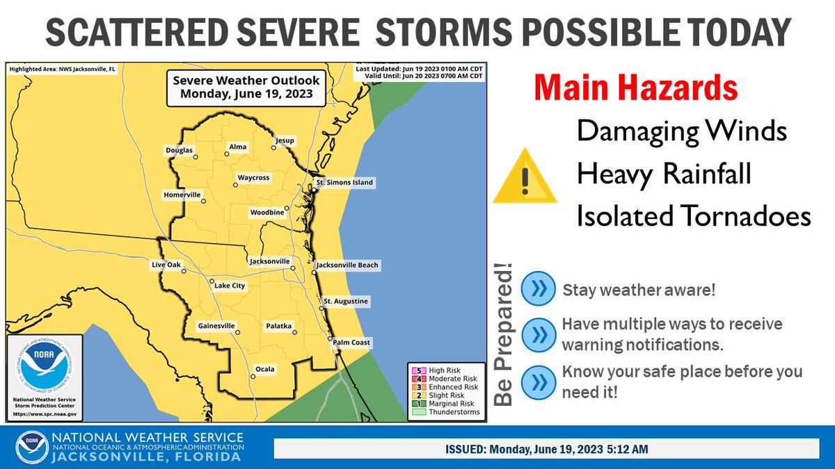
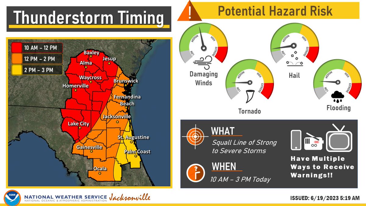
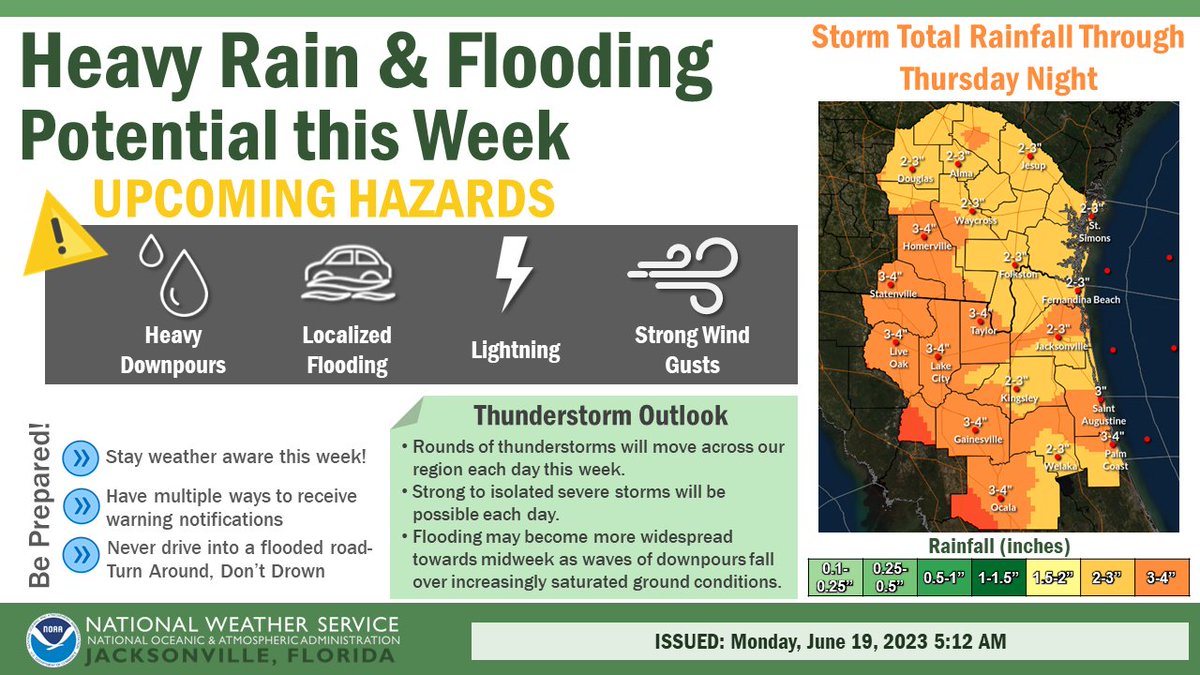
Would this annoy you?

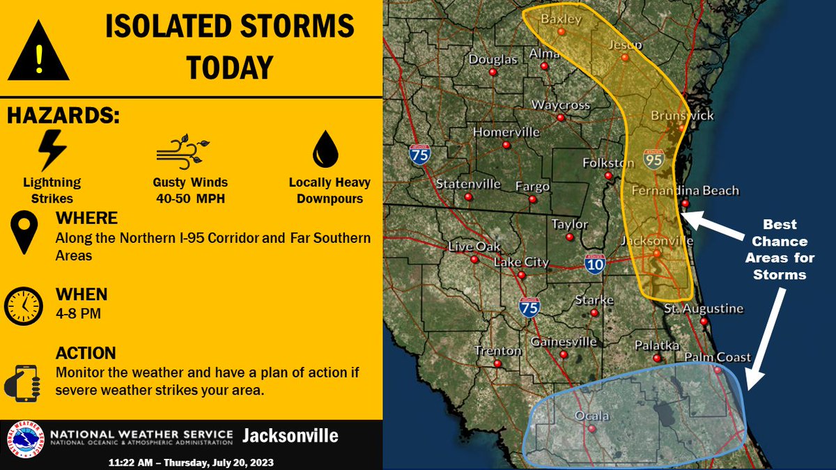
Cleaning out my phone for more storage and stumbled across this…
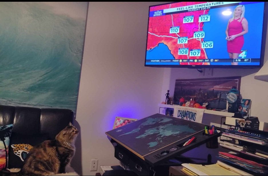
@kgeontv Soooooooo, How you liking DUVAL COUNTY???