AR_Enjoyer

235 posts

AR_Enjoyer

AR_Enjoyer

@nblovesmtns

atmospheric river enjoyer located in the sierra nevada. skier, runner, hiker, climber, etc. SPS peaks: 74/247 weather amateur, machine learning professional

Katılım Kasım 2022
242 Takip Edilen38 Takipçiler
AR_Enjoyer
AR_Enjoyer@nblovesmtns·
@jhomenuk can’t be worse than NAM or NAM 3km, at least in my experience using them for California storms
English
0
0
0
729
John Homenuk
John Homenuk@jhomenuk·
There is no sugar coating it - this is a horrendous decision that will significantly decrease confidence in mesoscale, short term and convective forecasting. The RRFS is terrible. Nobody that I have connected with in the community wants this to happen. Mind boggling.
Braxton Banks@BraxBanksOKWX

This is a big deal. On August 31st, the RRFS and REFS will officially become operational. These models will replace a handful of models that have been in use for years. This includes the NAM and NAM 3k, HREF, SREF, and HiresW (including the ARW, NSSL, and FV3 CAMs). #wxtwitter
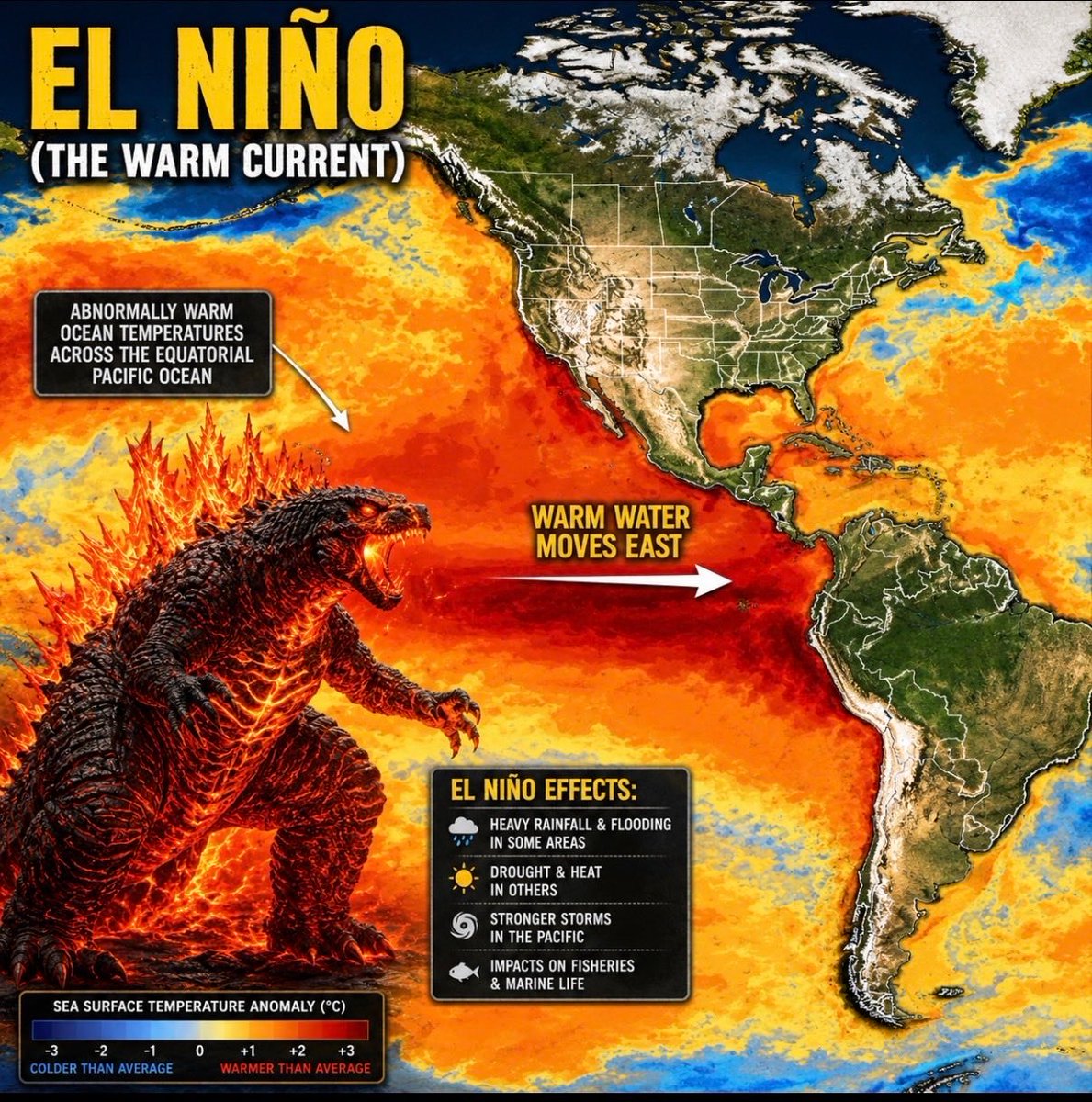
English
37
100
559
113.7K
AR_Enjoyer
AR_Enjoyer@nblovesmtns·
@michael_k_woods by the way, even in the "big winter" of 22-23, only one cat 5 AR landfalled in california, way up on the CA/OR border. wet signal does not mean cat 5 ARs, and it does not mean horrendous flooding.
English
0
0
2
46
AR_Enjoyer
AR_Enjoyer@nblovesmtns·
@michael_k_woods CFS missed on the entire southern half of the United States, but yeah, fair point about the higher res product. My issue is that posting CFS at a 7 month lead talking about flood impacts is horribly misleading hype content. That model is no more accurate than a coin toss
English
1
0
2
54
Ryan Maue
Ryan Maue@RyanWeather·
Los Angeles and Southern California will need to prepare for extreme flooding and mudslides this winter 2026/27 as the Super El Niño intensifies across the Pacific Ocean. Category 5 "atmospheric rivers" will bring enormous volumes (trillions of gallons) of warm precipitation.
Ryan Maue tweet media
English
52
122
828
65.2K
Michael K. Woods
Michael K. Woods@michael_k_woods·
@nblovesmtns It’s seems like it verified pretty well? Δ Went from +10.4% on 11/30 to +19.4% on 2/28. Put another way, 52% of yearly precip typically falls in that time and 61% actually verified.
Michael K. Woods tweet media
English
1
0
1
102
Gaurav kochar
Gaurav kochar@gaurav_kochar·
🚨 CODE RED: A potential “Godzilla” Super El Niño is now tracking toward historic territory. European, U.S. and Australian models are all converging on the same signal: 2026–27 could bring the strongest El Niño in modern history. ECMWF projections are now pushing toward +3°C anomalies in the Niño 3.4 region — beyond the threshold of past “super” events like 1997 and 2015. What happens next could reshape global weather patterns: • Crop stress across Asia & Australia • Flooding risks in parts of the Americas • Drought and wildfire threats in key food-producing regions • Massive disruptions to monsoon patterns • Food inflation and energy volatility worldwide The Pacific Ocean is heating at an alarming pace beneath the surface, powered by an enormous Kelvin Wave now surfacing across the equator. This is not just another El Niño cycle. This is a planetary-scale atmospheric shift with the potential to push global climate systems into completely new territory. If these forecasts verify, 2027 may be remembered as the year extreme weather went fully global. 🌎⚠️
Gaurav kochar tweet media
English
2
7
40
3K
Uncensored.AI
Uncensored.AI@GoUncensored·
The last true Hantavirus "outbreak" in America was in 1993. 50 infected, 20 dead. There's a 33 year difference between 2026 and 1993.
English
100
596
7.5K
373.5K
AR_Enjoyer
AR_Enjoyer@nblovesmtns·
@KTLA no, they haven't done that
English
0
0
2
202
Brandon Yoshizawa
Brandon Yoshizawa@bay_photography·
Is it normal for the Eastern Sierras to get feet of snow mid April?
Brandon Yoshizawa tweet media
English
66
8
197
8.9K
AR_Enjoyer
AR_Enjoyer@nblovesmtns·
Some stats from our historical March snowpack loss. Analysis conducted on 50 years of data across 39 stations in the Eastern and Southern Sierra. Breakdown here: eastsideweather.com/blog/2026-04-03
AR_Enjoyer tweet mediaAR_Enjoyer tweet mediaAR_Enjoyer tweet mediaAR_Enjoyer tweet media
English
0
0
0
34
AR_Enjoyer
AR_Enjoyer@nblovesmtns·
I present an analysis of the snowpack loss over the month of March in the Eastern / Southern Sierra. This analysis finds the worst ever decline in snowpack for the month of March, with an average loss of 8.9" of SWE across 39 stations. Read more here: eastsideweather.com/blog/2026-04-03
English
0
0
0
37
AR_Enjoyer
AR_Enjoyer@nblovesmtns·
@realwxforecast here’s to a great base building storm! i can’t wait to see what the rest of this season does 🫠
AR_Enjoyer tweet media
English
0
0
0
56
J. Mesh, AMS 🇺🇸
J. Mesh, AMS 🇺🇸@realwxforecast·
Alright… we finally broke the pattern—and not quietly. After a 41-day heatwave that absolutely cooked the West and wrecked the Sierra snowpack, we got a legit late-season response from the atmosphere. And up in the Sierra, it showed up in a big way. We’re talking feet of snow at higher elevations, especially above that 8,000–9,000 ft range. Honestly, it was needed. The March heat did real damage—this wasn’t just “above average temps”… it was sustained, relentless warmth that basically fast-forwarded snowmelt and left the snowpack in rough shape heading into April. So yeah, this storm helped. No question. But it’s still more of a stabilizer than a savior. If you want snow totals and such from the resorts that are still open, check out @TahoeWeather and @OpenSnow. @palisadesops just cracked the 300" totals. I predicted 400" for this season, so I was about 100" off, but every little bit counts. With the pending warmup this weekend, most reports might close by the end of next week. Only Mammoth and Palisades might be open by mid month. Utah got hit too, with Alta and Snowbird getting feet. Again, I was suppose to be at @Deer_Valley this week. Anyways....... #SoCal… let’s talk about it!!! Now, Southern California… this is where I’ll take a small step forward and a half step back. I called it a nothing burger. And depending on where you live… that either aged perfectly… or not at all. Some spots over-performed, plain and simple. There were areas that pushed ~0.75" of rain, which is nothing to ignore. That’s a solid event for early April. But then… there’s Santa Monica, or the coastal areas. Because if you were out here, you know the deal—it was basically a glorified mist with commitment issues. Not nothing… but not exactly a headline storm either. 😂 The Weather Weenie Tribunal Now let’s address the backlash… because apparently, I struck a nerve. I got the full treatment— shamed, corrected, fact-checked, emotionally audited… All for saying “nothing burger.” So here’s my official statement: I’ll adjust the rhetoric slightly. Not because I think the take was wildly off—but because I’ve been reminded that precipitation language is a very very sensitive subject for some folks, and again, you don't know what a storm is going to do, until it comes thru. And that’s fair. But let’s also keep this grounded: This was not a major atmospheric river It was not a drought-ending event It was a weak to a run of the mill storm in some areas, with some localized overachievers. And folks - That’s the reality. And for the record, I’m still not hopping on the “Marshall Islands gravy train” of over-the-top narratives. I’ll keep calling it how I see it… just maybe with a touch more nuance for the crowd. Growth, right? 📊 If You Want the Receipts For those who want the clean breakdown—totals, maps, all the good stuff—check out @NWSLosAngeles Los Angeles (NWS LAX). They’ve got the visuals and verified data. - Here is them calling it weak - x.com/NWSLosAngeles/… - Here is them giving you the recap of some areas getting nothing at the coast to higher totals in the foothills, and other areas in #socal getting something - x.com/NWSLosAngeles/… Some folks were upset cause I was right in the OC, getting barely anything to folks in San Diego just pissed off to just getting clouds. Again, all about semantics!!!! But will live and learn from the rhectoric, cause I know people are sensitive about it. 🔮 Looking Ahead… Here’s the part that actually matters… - There are early signs that the pattern may turn more active again after next weekend across California. Nothing locked or set in stone, but The ridge looks like it may back off The door could reopen for storms to drop in And we might get another shot or two at precipitation in #california and #socal Given what just happened with the snowpack, this is the window you want to take advantage of if you’re rooting for a late-season recovery. 🌄 Final Thoughts - Sierra: good dump at higher elevation, but still digging out from a brutal March Heatwave that I experienced up in Tahoe SoCal: Hit or miss depending on location (classic) Me: Slightly humbled… but still standing by the spirit of the take Wishing everyone a Happy Easter and Happy Passover— Appreciate the back-and-forth (even from the critics 😄) We’ll see what next week brings. PS - - Updated the Meteograms and some other models images from the Euro Ens AI. After a warmup starting today thru the next 10 days or so, there looks to be something on the scope the middle of April, as the ridge is migrating further west and the jet might undercut it. Again, this is due to the PV retracting back east. Stay tuned! #CaliforniaWeather #SoCalWeather #SierraNevada #Snowpack #AtmosphericRiver #RainTotals #WeatherTwitter #Forecasting #Meteorology #DroughtWatch #SpringStorm #WestCoastWeather #NWS #SantaMonica #PatternShift #MediumRange #WeatherRecap #StayWeatherAware #cawx #pnw
J. Mesh, AMS 🇺🇸 tweet mediaJ. Mesh, AMS 🇺🇸 tweet mediaJ. Mesh, AMS 🇺🇸 tweet mediaJ. Mesh, AMS 🇺🇸 tweet media
English
13
10
73
9.1K
Jason D Farhang
Jason D Farhang@jason61987·
Tuesday March 31, 2026, 10:26 PM: The main front has brought a taste of winter back to Southern California. We have rain moving into Santa Barbara to Los Angeles County currently as promised after the historic major heatwave. #CAwx
English
14
11
136
6K
AR_Enjoyer
AR_Enjoyer@nblovesmtns·
@jason61987 how much rain are you expecting out of this for LA?
English
1
0
0
91
Jason D Farhang
Jason D Farhang@jason61987·
Sunday March 29, 2026, 9:49 AM: Latest water vapor satellite shows no change in storm intensity in the last 24 hours. The main 552DM low axis is now approximately 325 miles due west of Humboldt County. This system continues to exhibit feeding activity due to warming in the Pacific. Interestingly enough a surface cold frontal boundary will develop by Tuesday at 1PM to Wednesday 6AM. Now there's been a lot of discrepancy about whether the front will make it down into Southern California. The modeling yesterday 18Z GFS, Today’s EU 1 and 0Z GFS, 6Z GFS, 12Z GFS, finally echoes that the front will make it into San Luis Obispo to western Los Angeles counties by late Tuesday evening. I’m watching this developing situation very closely on some April showers. In the video is EU1 and GFS 12Z from today, the latest one for all who need a reference for modeling. The atmosphere and models are finally getting into better alignment for precipitation. As I said before late March and April can be tricky forecasts, especially after such a historic heatwave we just had a little over a week ago. #CAwx
English
4
12
114
6.9K
AR_Enjoyer
AR_Enjoyer@nblovesmtns·
@jason61987 well why does that indicate the models are completely wrong?
English
0
0
0
83
Jason D Farhang
Jason D Farhang@jason61987·
Look at the satellite picture of the actual storm the rapid intensification process continues to unfold. All of the humidity levels have increased significantly across the central and Southern California region in the last 6 hours. A stronger onshore flow gradient l. Is starting to take shape. Another key factor is that the barometer is also starting to fall. In addition to that, we’re seeing the surface high in Northern California starting to move just far enough away to maybe allow the system a little bit further south.
English
1
0
1
149
Jason D Farhang
Jason D Farhang@jason61987·
Saturday, March 28, 2026, 3:58 PM PDT: The latest 18Z GFS and EU1 continue to show a front approaching Los Angeles, CA, Late Tuesday 4PM - Wednesday 4AM. Now, it seems that the storm has intensified over the Central Pacific in the last 24 - 36 hours. There is a lot more wind energy associated with this system as well now. Also, the water vapor satellite shows the high-pressure axis that’s over Texas. The southeast return and Baja disturbance over the Gulf of California may bring some isolated thunderstorms into Southern and Central Arizona and that includes the eastern deserts of Southern California at least a chance by Sunday 11AM to Monday 4AM. Something to look out for the next few days. Also, this time of year, it’s very hard to have a strong storm system with a fueled warming of the ocean and the models become all over the place cause it’s abnormal for this time of year so it's very interesting to watch what occurs in the next 24 - 36 hours. #CAwx
English
7
16
154
11.1K
Jason D Farhang
Jason D Farhang@jason61987·
@nblovesmtns Oh, don’t worry there’s more changes coming. The models are starting to engage with the storm now let’s see how this pans out.
English
1
0
3
266
J. Mesh, AMS 🇺🇸
J. Mesh, AMS 🇺🇸@realwxforecast·
Followers — quick update on the “big pattern change” everyone was hyping. Let’s just call it what it is: Nothingburger!!!! Model trends continue to come in LOWER and LOWER for #SoCal precipitation, it is there is anything at all! Below is my AI wx discussion with some thoughts at the end of this discussion Discussion — Over the past several runs, we’ve seen a consistent signal: → QPF totals trending down → Trough amplitude weakening → Energy shearing east instead of digging → Ridge resistance still present over the Eastern Pacific In other words… the system is losing its teeth as we get closer in time. In fact, I think we are going from one warm pattern to another. I think we have seen this more often than not in #California this season. It is just not our winter folks!! The original idea of a clean undercut of the ridge with a sustained moisture tap has not materialized. Instead, we’re looking at a more progressive, positively tilted, lower-amplitude trough that struggles to overcome the background ridge states and go up and over #California. Translation: This is not a high-impact storm cycle for #SoCal at all! Before are my AI Models images for temps, precp and meteograms....And look — I said this days ago..... I wasn’t impressed with the setup earlier this week. The signal just wasn’t there for a meaningful precipitation event in #socal, and it is getting worse every run. And for that take? I got called: → “Hostile” → “Doesn’t know what he’s talking about” → “Negative” The hits keep on coming....LOL. Bring them on!!!! Now here we are folks, watching the exact trend I talked about play out in real time, and I will still get shamed. Keep it coming folks!!!! Most of the talking weather heads on this medium chase long-range fantasy runs from deterministic GFS/EU1 models. They don't watch trend evolution, use ensemble means, AI ENS runs, and pay attention to how the pattern behaves as it compresses in time. Personally, I have no idea what a lot of them look at, but here we are, and I am the bad guy! What’s actually happening synoptically: → The ridge never fully breaks down — it gets nudged, not displaced → The upper low weakens as it approaches the coast → Jet support is marginal and poorly aligned → Moisture transport is limited — no real atmospheric river connection of any sort. → Result: light, scattered precip at best for #SoCal, and even that is dwindling. Northern/Central California? Sure — they’ll do better. But down in #socal - This is looking more like a glorified marine layer enhancement event with some light rain mixed in...maybe. Even the light rain part is TBD. Mountains still getting crushed Nothing has changed here — in fact, it’s getting worse. We’re still running: → Elevated snow levels → Warm overnight lows → Poor refreeze conditions Resorts are hanging on by a thread trying to make it to Easter… but that’s looking shaky. From what I’m hearing: → Deer Valley Resort — closing Sunday (yep… that was my trip 😑) → Park City Mountain Resort — likely next domino to fall → Widespread coverage issues across the Wasatch and Sierra, and Rockies. Steamboat is closing or is closed now. → Dirt showing up everywhere Depressing, but that is where we are with this winter pattern. Never seen such sustained heat/warmth for such a duration like this season! It feels like mid-to-late April conditions… if not worse. I was set to head out Sunday, but with closures accelerating and finalized, that plan is done. DOA! For those of you that have asked me if the pending snow for next week in NorCal and the Sierra and Utah, will make a difference in the snow pack, the answer is no. If you look at the resorts, in Utah now, they are getting nuked, as I have discussed with you how much of the snow pack they are losing with 60+ degrees per day. Now, Alta and Snowbird, due to their location and elevation usually are able to sustain their snow pack the longest. They might benefit, but the other resorts by this time next week will probably close. Snow Basin is closed, Deer Valley is closed. Park City is rumored to be closed on Sunday. In any case, Alta and Snowbird will probably be the only ones open before they get snow next week. TBD at this point. As for #california, I have posted the Meteograms for snow in Mammoth thru the extended. Not much going on folks, so again, that is where we are. I will update this on Sunday night and see if the models have changed, but frankly based on the trends and the atmospheric pattern out west this season, every day gets drier and warmer next week. Hence why I declared winter was over 2 weeks ago. More on Sunday and if you have questions of any sort, let me know. Stay cool! #SoCalWeather #CaliforniaWeather #WestCoastWeather #ENSO #ElNino #SierraNevada #Wasatch #WeatherModels #Meteorology #SkiSeason #SpringPattern #cawx
J. Mesh, AMS 🇺🇸 tweet mediaJ. Mesh, AMS 🇺🇸 tweet mediaJ. Mesh, AMS 🇺🇸 tweet mediaJ. Mesh, AMS 🇺🇸 tweet media
English
21
6
65
9.7K
AR_Enjoyer
AR_Enjoyer@nblovesmtns·
@HiddenRealityPC @offgriddesigner mostly to support weather observation needs for aviation, and operational reasons. these moves typically resulted in cooler readings than the corresponding city stations, just FYI. also this tweet ignores the fact that these temperature anomalies are verified by many data sources
English
2
0
0
199
AR_Enjoyer
AR_Enjoyer@nblovesmtns·
@SnowBrains the way this is trending i wouldn't even count on that at this point tbh... sad but true!
English
0
0
0
90
SnowBrains
SnowBrains@SnowBrains·
🌨️ Too little, too late? 🥲
SnowBrains tweet media
English
6
1
15
3.1K