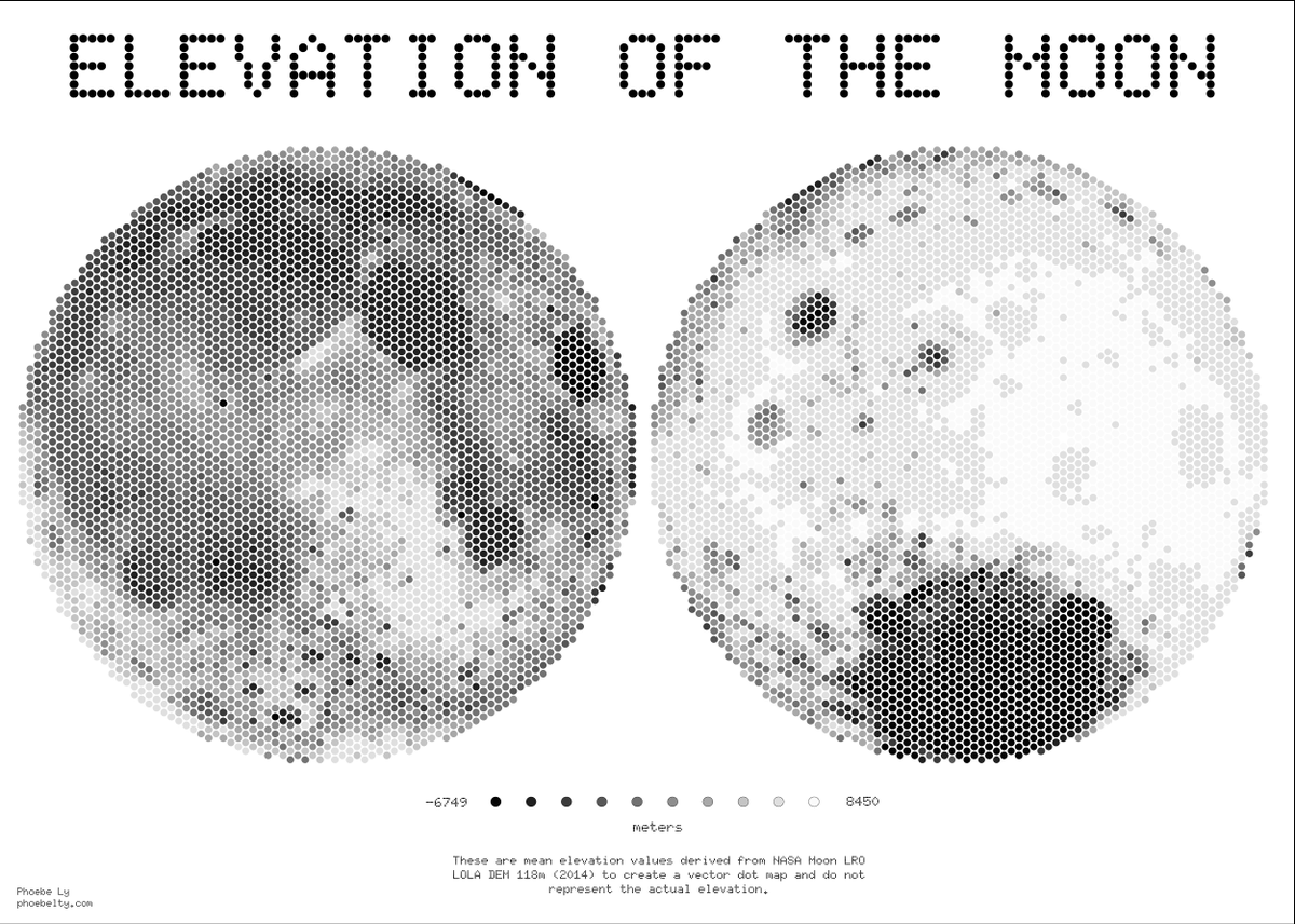

Phoebe L. retweetledi
At a festival with events happening over a week and over a whole city? Dilara Bozkurt explores temporal navigation for festival maps on mobile devices, working out how to incorporate space and time on a small screen like a mobile phone doi.org/10.1080/152304… #GISchat #OpenAccess
GIF
English