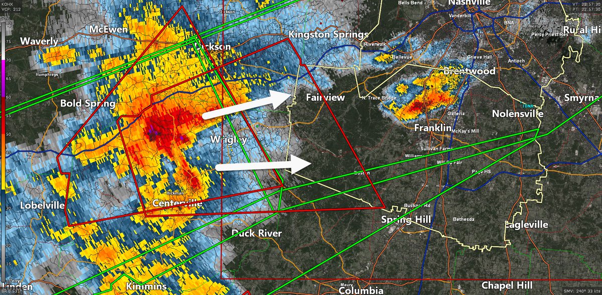
We ride again. Another Tornado Warning for Western Williamson Co! Includes only Fairview and far western areas. Excluded: 65, Leipers Fork, Thomps. Station, Franklin, etc. / 558 PM
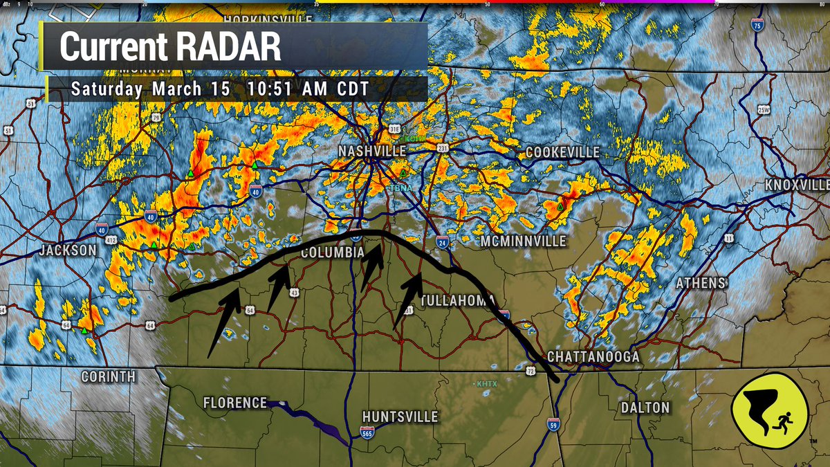
10:51 am, a break in the storms is pushing up I-65. We'll have to watch closely to see if clouds thin out and how much the atmosphere re-energizes for later storms. Good chance to check your safe spot and make sure it's ready to go for later, if needed. We'll be right here watching each radar scan.
@NashSevereWx@Sjs7805 My interpretation is that if it sucks up the energy the line that we’re all worried about will have less juice (potentially) to be bad but I’m just a cinematographer so I don’t really know anything about the weather lol
@LaurenRcliff@NashSevereWx "Flash Flooding - esp N of I-40 - and damaging straight line winds the main concern. Not worried about tornadoes with those right now, but will wait and see. / 639 PM"
Expecting more storms tonight ahead of a main line to come through after midnight. Flash Flooding - esp N of I-40 - and damaging straight line winds the main concern. Not worried about tornadoes with those right now, but will wait and see. / 639 PM
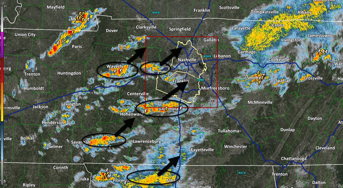
The tornado warning for Nashville has expired. More storms are off to our west. These storms may produce straight line winds and CG lightning for all of Nashville and Williamson Co / 502 PM / We are live here: youtube.com/channel/UC6ajz…
Conditions rapidly improving in Nashville. Mostly concerned about this tornado-warned storm in Columbia moving toward SE Will Co / 1259 AM / We're live here until the storms are gone: youtube.com/live/CHxBw0Iy7…
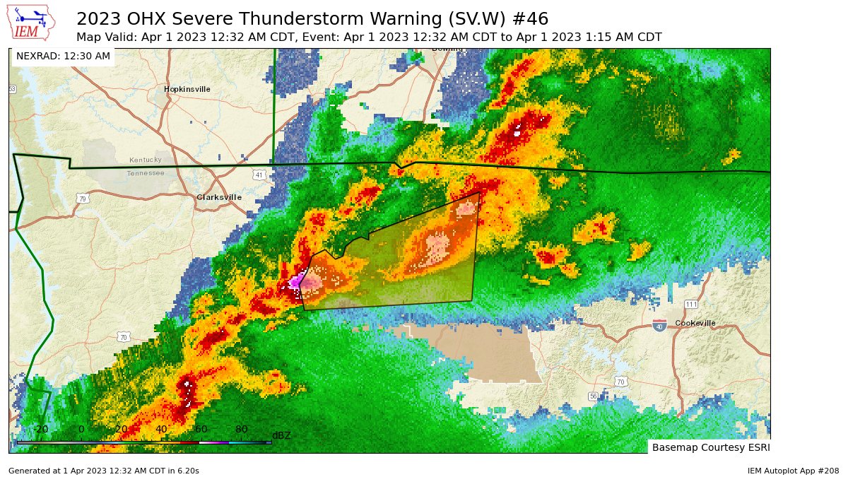
OHX issues Severe Thunderstorm Warning [damage threat: CONSIDERABLE, wind: 70 MPH (RADAR INDICATED), hail: 2.00 IN (RADAR INDICATED)] for Davidson, Sumner, Wilson [TN] till 1:15 AM CDT mesonet.agron.iastate.edu/vtec/f/2023-O-…
@TheUncannyDom Took me entirely too long to realize how invigorating it can be to work with a different creative at times too. Fresh faces/fresh ideas/fresh vibes. 🙌