Trey Stuart
544 posts
Trey Stuart
@treystuart335
Proud dad of Charlieman! Inside Sales at SPEC Building Materials
Kingston Springs, TN Katılım Ocak 2015
856 Takip Edilen240 Takipçiler

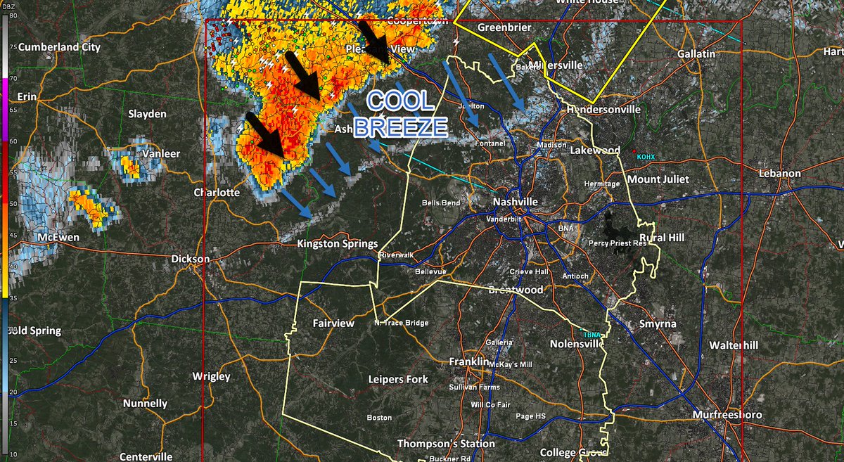
Hail sizes have come way down in the Dickson storm, so I'm not betting on a warning extending our way...but that could change. It'll be gusty for a bit, regardless. If you're outdoors or know someone who is, it's about time to get to a lightning shelter. Pavilions don't count. Cars good that aren't under trees. 6:58 pm.
English
@Josue_H98 @NashSevereWx Lowest level most interior room of your house. Put the most walls between you and the outside. If you have a basement that is best.
English

@NashSevereWx Quick question where we can go if a tornado hit ground ? I’m on Madison aérea
English
Ok, so now that the watch is out. Here's how this will go. Storms have formed in two lines to our west. Damaging straight-line winds remain the primary threat, but a tornado warning here or there isn't out of the question. We're watching every radar scan. Here are some reminders: nashvillesevereweather.com/what-to-do/
English
Trey Stuart retweetledi

Just getting started😤
The Joe B. Hall award is given to the top first-year coach in DI men’s basketball🏀
#ConquerandPrevail #ForTheW

English
@NashSevereWx Right as the front came through after the main line I should say
English

58.7 mph wind gust just reported at John Tune airport. That's right there at severe levels. Anybody experiencing that where you are? #tSpotter
English
Trey Stuart retweetledi

We are now LIVE on YouTube due to far western Davidson Co. being included in a Severe Thunderstorm Warning until 8:15p for damaging straight-line winds up to 60mph. Still watching the Tornado Warned storm as well. / 7:44p youtube.com/watch?v=QW-rAM…
YouTube

English
@NashSevereWx Thanks David! You guys got me and my family to my safe space when a tornado hit my house in 2021 in Kingston Springs. What you have established here matters! Thank you for that! Enjoy the time away!
English
A Letter From David Drobny, Founder of NashSevereWx. nashvillesevereweather.com/2025/06/06/a-l…
English
Rain and lightning continue to move in from the SE. Yeah, that's weird, but it's not unusual for this time of year / 433 PM
English
@NashSevereWx Any chance of more forming on that outflow boundary?
English
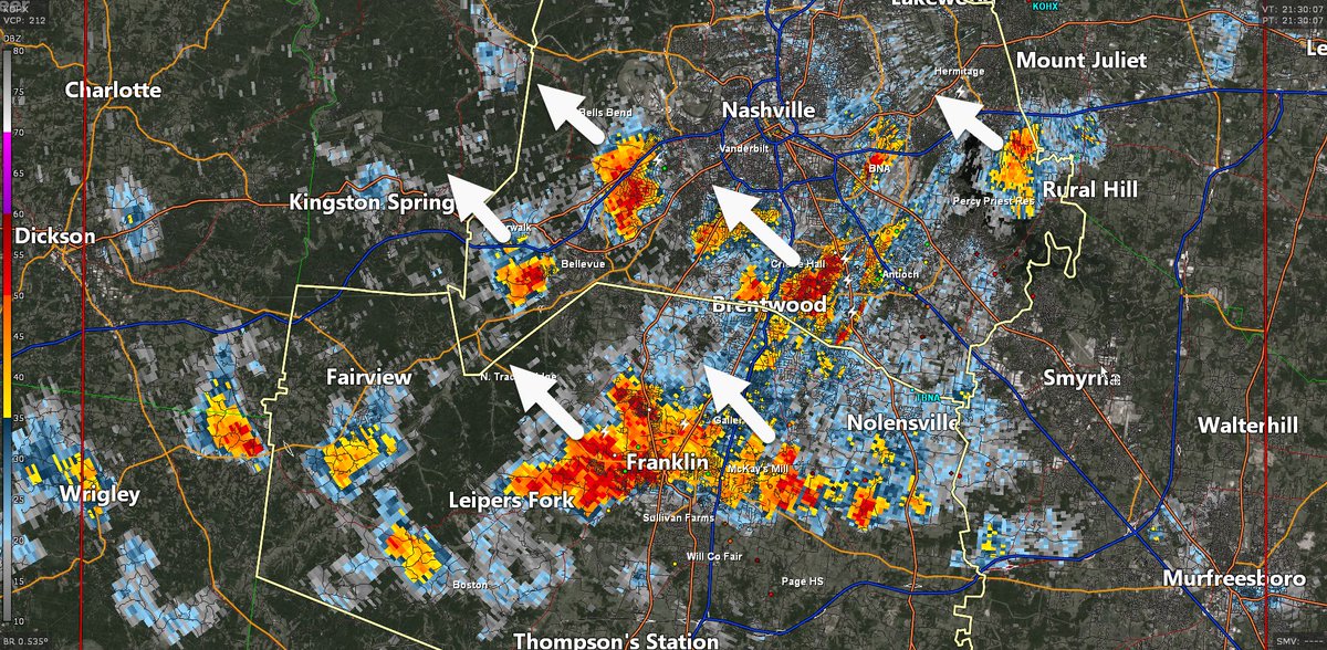
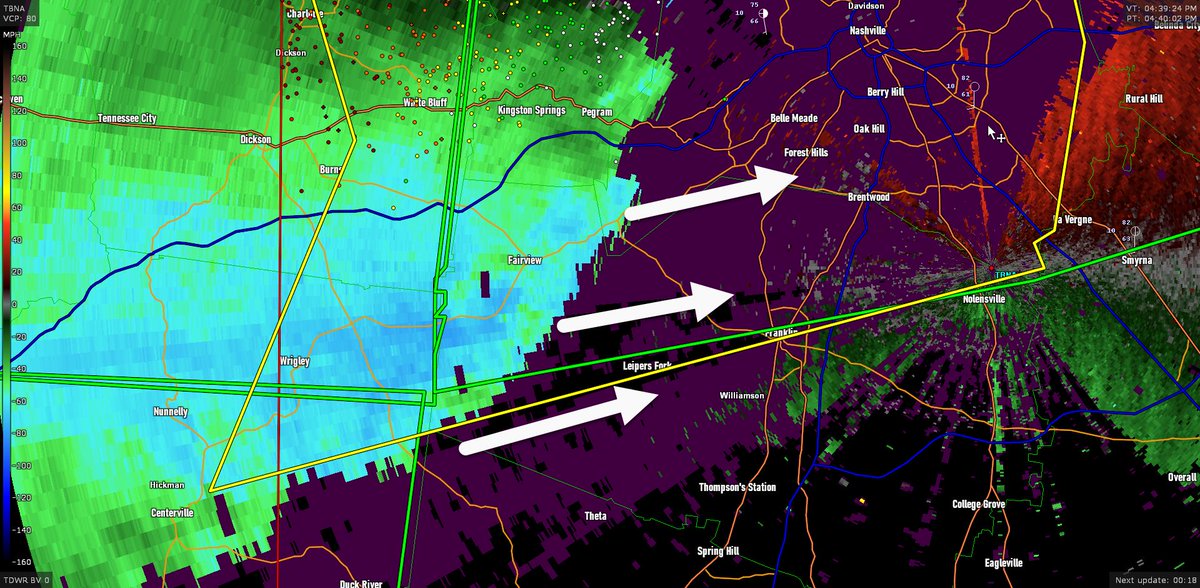
Storm entering Cheatham County will affect areas N of I-40 in Nashville with 40 mph winds and pea-size hail over the next 30 minutes. 9:35 pm
English

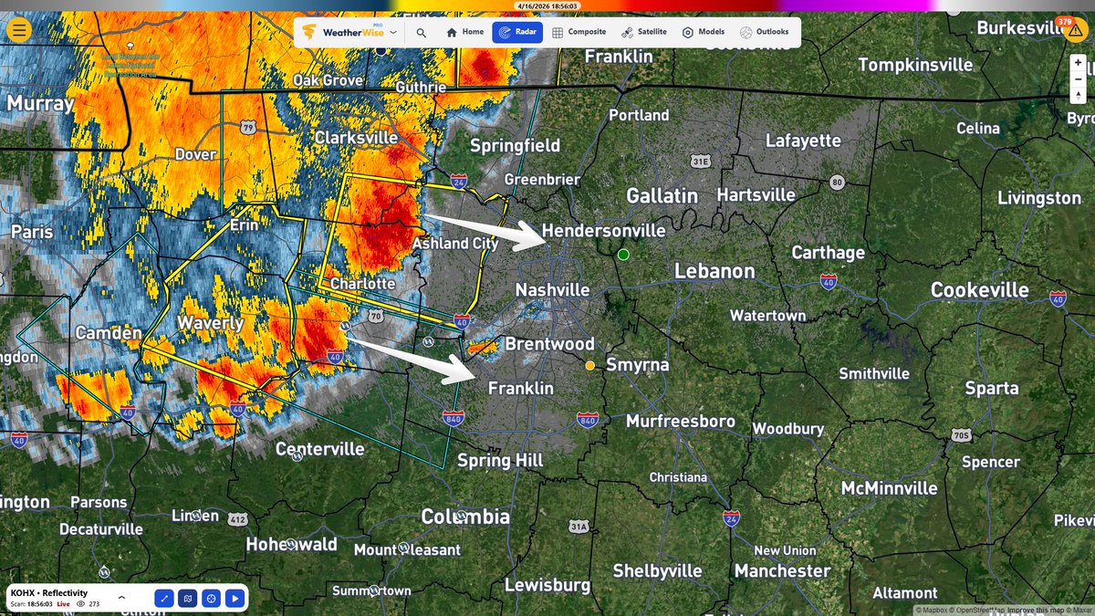
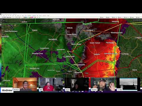
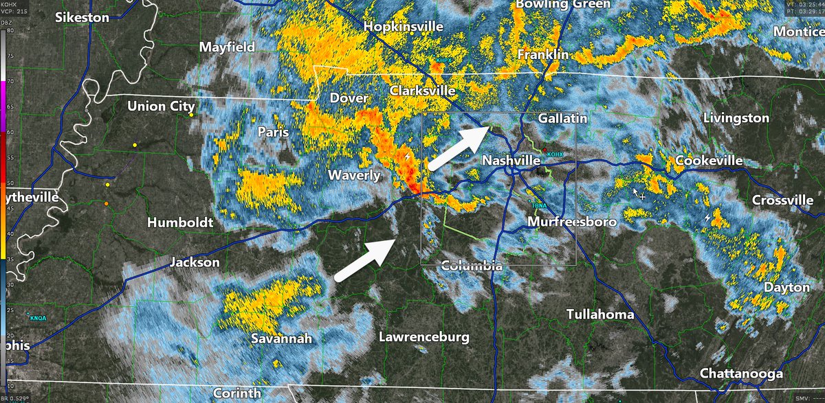
TBNA radar shows 70-80 MPH winds approaching Franklin and points north / 442 PM / Storm caused widespread power outages in Dickson / We're live here: youtube.com/watch?v=ua5QkB…
YouTube
English
@NashSevereWx If the line stalls west of us, is there a chance these renegade supercells continue to develop ahead of it? Seems like a worse scenario
English
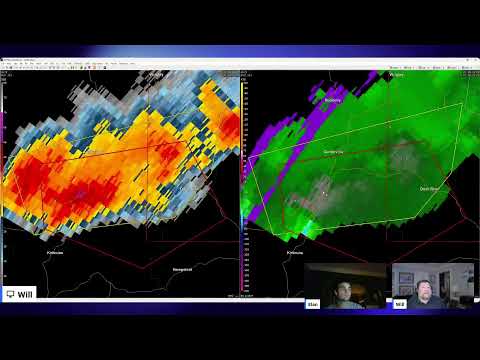
Cap holding strong locally rn. Cap breaking in W TN & N MS, and those storms should turn supercellular and race NNE over the next few hours. HRRR model thinks one of those supercells will come close by us, exactly where is TBD. Then the main line may stall on approach around midnight. We could dodge it, or not. Stay connected / 319 PM

English
@NashSevereWx Tiny hail in this main line coming through Kingstin Springs, really heavy rain 🌧
English
Our local NWS office released a special balloon sounding. *Encouraging News* in this. This is not a worst case scenario sounding. However, it would only take about five degrees of warmth for storms to get a shot of energy. Therefore, it's safe to say tornado chances increase the further south you go from Nashville. We're still watching every radar scan. It deserves our attention.

English
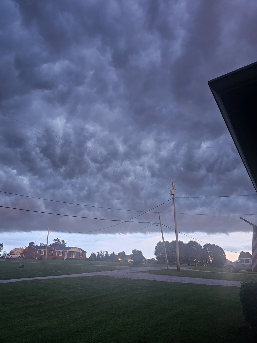
@NashSevereWx Lot of lightning and thunder in Kingston Springs
English
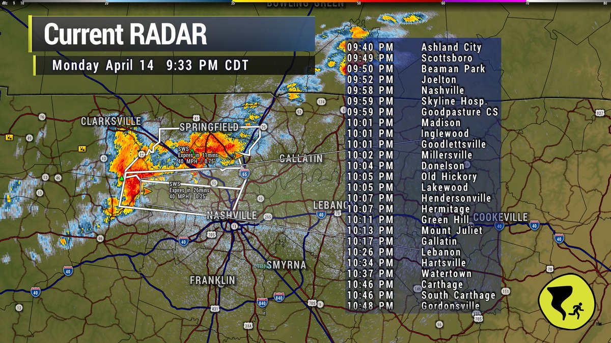
Band of heavier rain will pass to our west and north. It has included lightning. No severe weather concerns tonight. Ponding on the road the main hazard. / 931 PM
English
Sunday’s early AM event will fall *as rain*, then freeze on contact. Don’t be tricked thinking it’s “just rain.” An illustration:
☁️ 🛩️
💧
💧
💧
💧
🧊 🌲🏡🎸
English
Dusting in Greebrier, just north of the Davidson/Robertson Co line
Jerry Bennett@JerryPrivateer
@NashSevereWx Greenbrier TN at 6:30 pm.
English
Quiet evening ahead. Rain sliding slowly east. / 736 PM
GIF
English