@RayPetelinWx Ray, what are your thoughts on this line coming through central Ohio impacting the region? Hoping to see it diminish.
English
Mr. Buzzard's Weather
1.7K posts
@weather_buzz
Not a weatherman, just a BASD Dean who loves the ☃️🌬❄️ All are welcome! Follow for weather,news and my opinion on cancellation/delay chances!


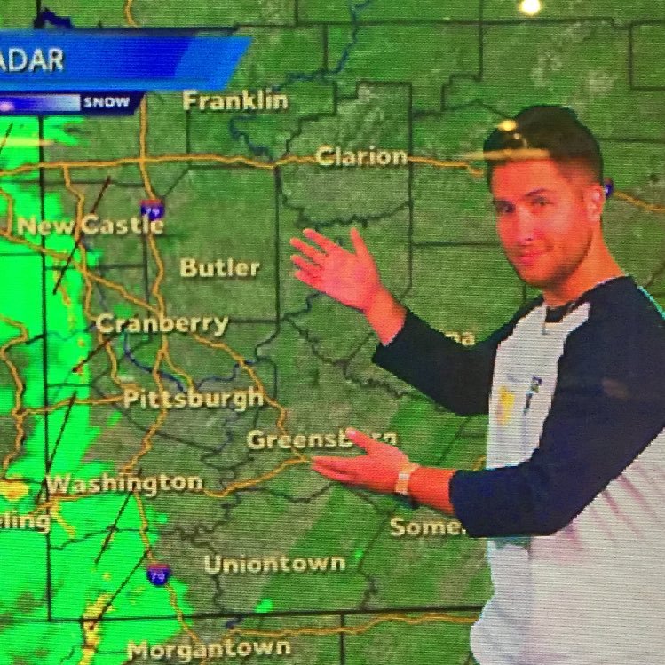
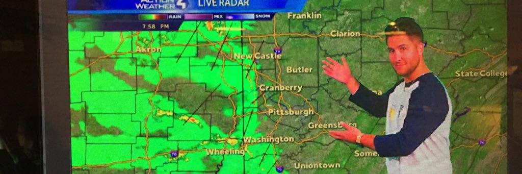
Heaviest banding now setting up between I-80 & HWY 422 and in northern WV. Back edge of the precip is still 1100 miles away in OK/TX. Long way to go with this one. An addition 12-18” possible ON TOP OF what has fallen from the Pittsburgh metro and points north! #pawx

Similar to earlier this week we are still looking at two main scenarios for the upcoming winter storm. Steadier snowfall is expected to begin Saturday afternoon and evening and continue into Monday. The scenarios will be broken down further in comments on this post.
** MAJOR WINTER STORM SCENARIOS FOR PENNSYLVANIA ** I have been hearing for years, "When is the big one coming"? Well, folks, this pattern is what you have been waiting for years or decades. The biggest major winter storm forecast of my lifetime (I am 23 years old) is approaching us this weekend, bringing major impacts to much of Pennsylvania. Hurricane hunters have flown into the storm system over the Pacific overnight, gathering great data to ingest into model guidance. This has led to a large shift toward a more northerly and amplified storm system. ⚠️❄️ ALL OF THE DETAILS ON THE THREE SCENARIOS, TIMING, AND TEMPERATURES ARE ON THE BLOG POST! READ HERE: paweatherplus.com/major-winter-s… Be winter-ready with @DMC_SNOW an exclusive provider of commercial snow & ice management across Pennsylvania, New Jersey, and Delaware. From distribution centers and warehouses to office parks, shopping centers, and retail stores, we keep your property clear and business running all season long.
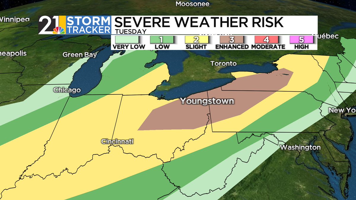
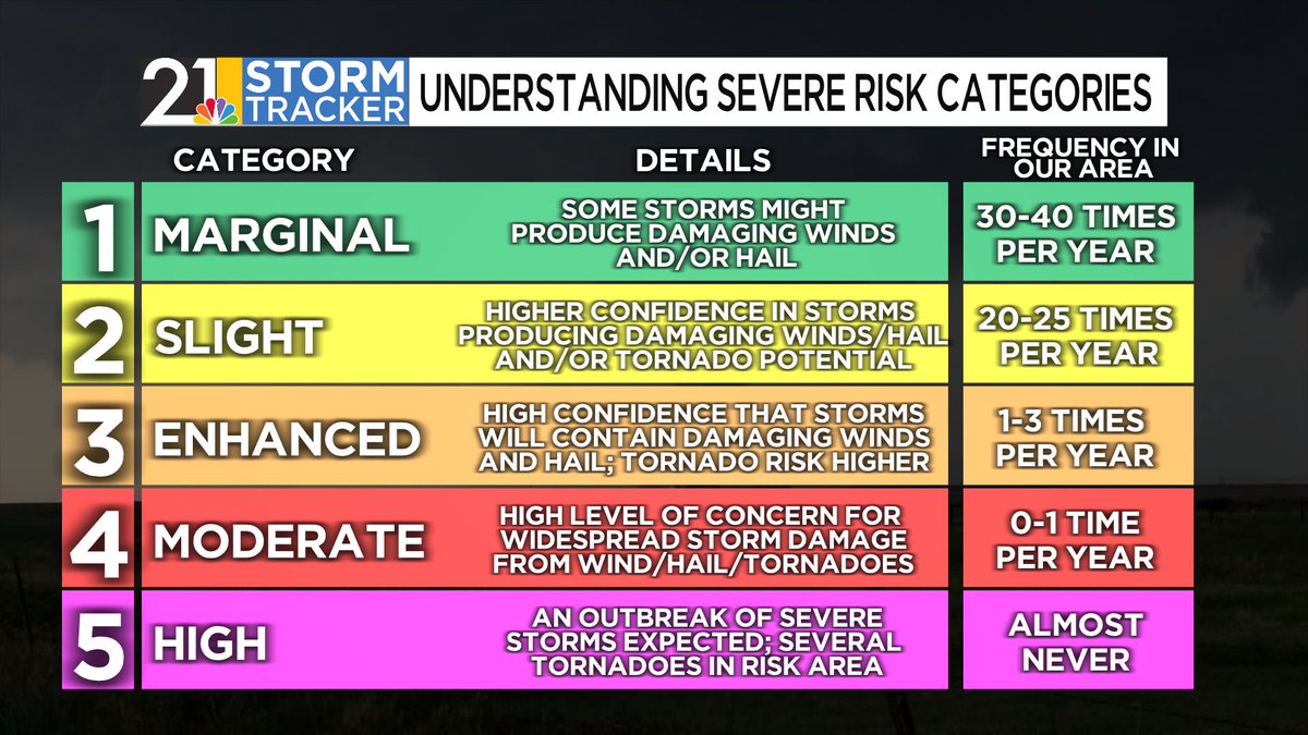
No major changes to Friday’s forecast, but also pay attention to areas outside the current Watch. While a 1/4" of ice is less likely there, confidence is growing for at least a glaze. 🧊 Expect Winter Weather Advisories to be issued for these areas in the next 24h. ⚠️
A Winter Weather Advisory currently spans from Arkansas to New York, including our entire forecast area, for a winter storm that will cross our area tonight and Tuesday. Details below...

Severe Thunderstorm Warning including Pittsburgh PA, Bethel Park PA and Monroeville PA until 5:30 PM EDT. This destructive storm will contain wind gusts to 80 MPH!

Freezing rain could be a big issue for roads Wednesday night and early Thursday in the areas I have outlined. I'm also concerned about power outages in the mountains.
