
Bryan Bennett
17.7K posts
Bryan Bennett
@weatherbryan
Meteorologist, AMS Certified, Emmy awards for coverage of Hurricane Sandy & Irene, Undergrad degree from GT, Graduate degree from MS State.
Tampa, FL Katılım Mayıs 2013
688 Takip Edilen6.2K Takipçiler
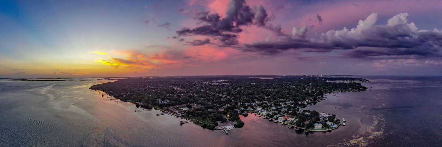
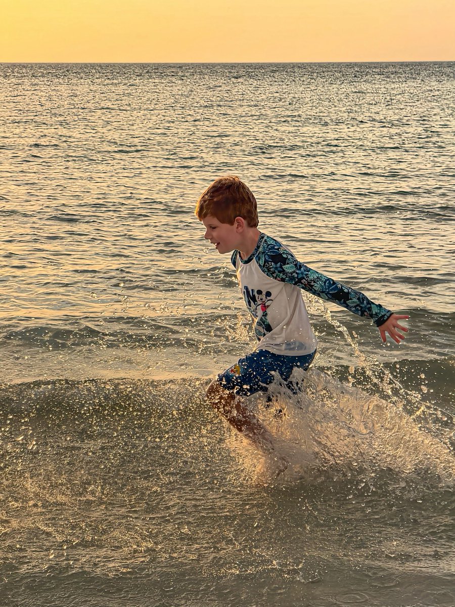
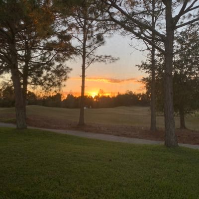
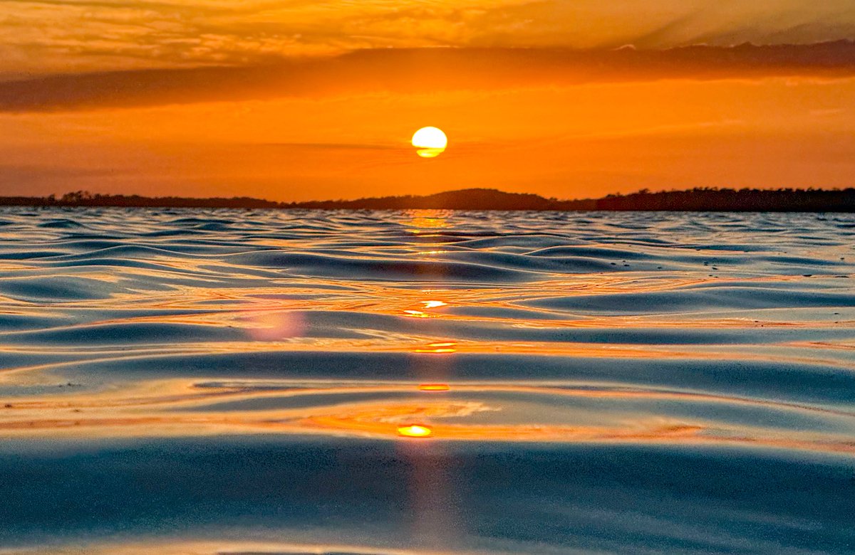
Soaking up those springtime beach vibes 😎🌴 #fort_desoto
⏰Reminder: Clocks spring forward tonight

English
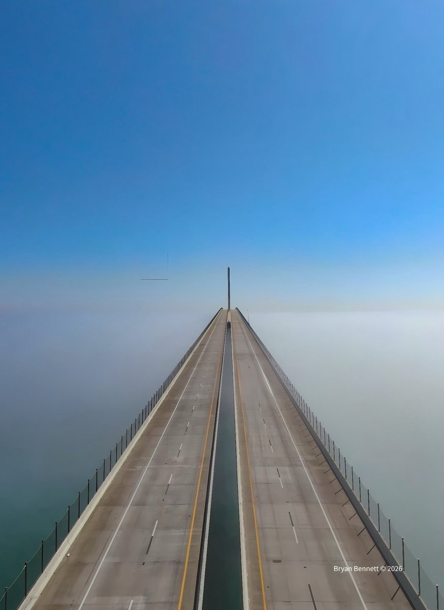
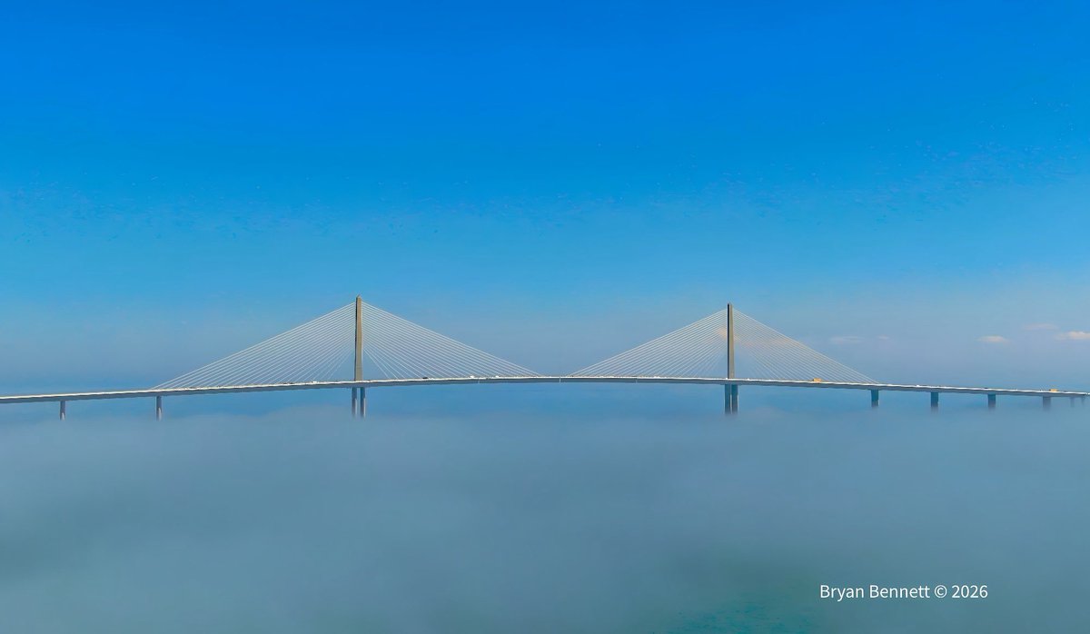
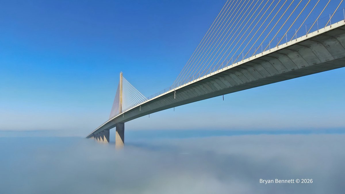
Wow! Cool views of the Sunshine Skyway Bridge rising above this afternoon’s sea fog.
English
Bryan Bennett retweetledi
Today, the Trump administration repealed the endangerment finding: the ruling that served as the basis for limits on tailpipe emissions and power plant rules. Without it, we’ll be less safe, less healthy and less able to fight climate change — all so the fossil fuel industry can make even more money.
English
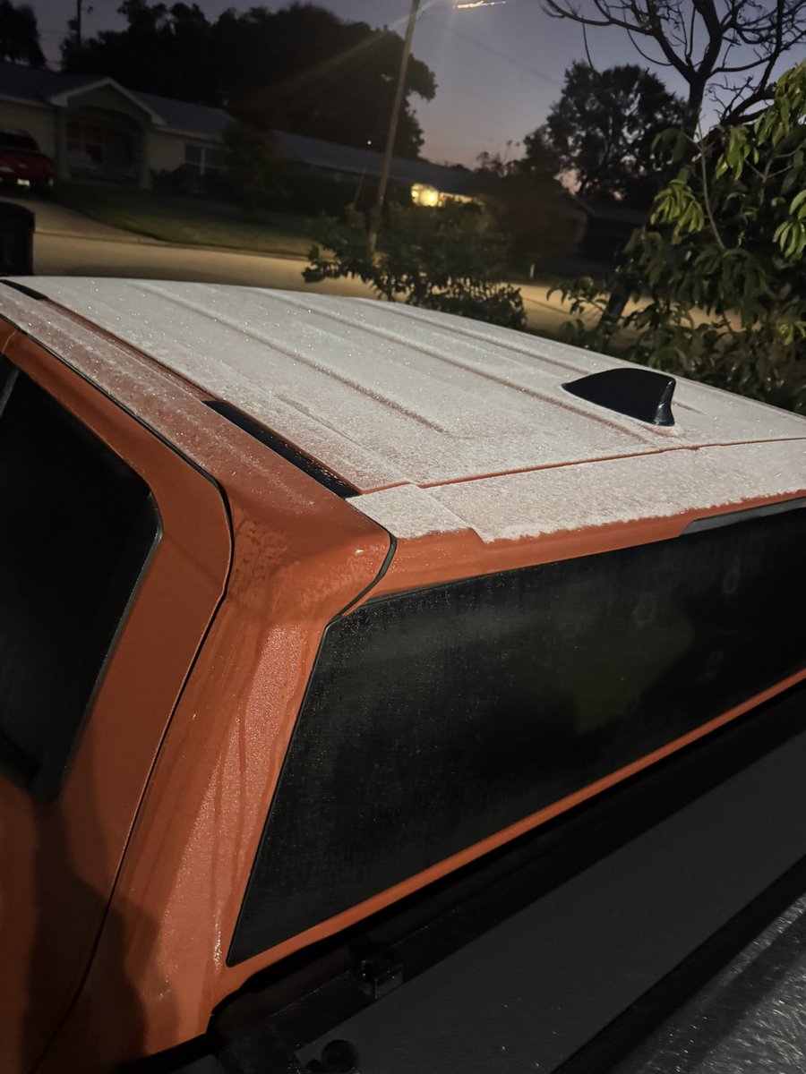
“Frosty the Florida Man” ☃️
Frost on cars this morning was enough to make a 2” snowman. 🥶
(📷 Abigail Mehling)

English
@Meb110803 I like LOL .. lived there the first time we lived in Tampa Bay. Tho it’s grown so much!
English
@weatherbryan We are in Land O Lakes for 9 years now. Hope all is well!
English
Full February “Snow Moon” tonight! 🌕
Request: Anyone able to capture a photo of the bright full moon and newly fallen snow?☃️

English
@Meb110803 Great photo Meghan! Where are you guys living nowadays?
English
Mesmerizing visible satellite. Cloud streets streaking across the Gulf and Atlantic as cold arctic air moves over warmer water.
Snow is covering nearly every inch of the Carolinas.
GIF
English

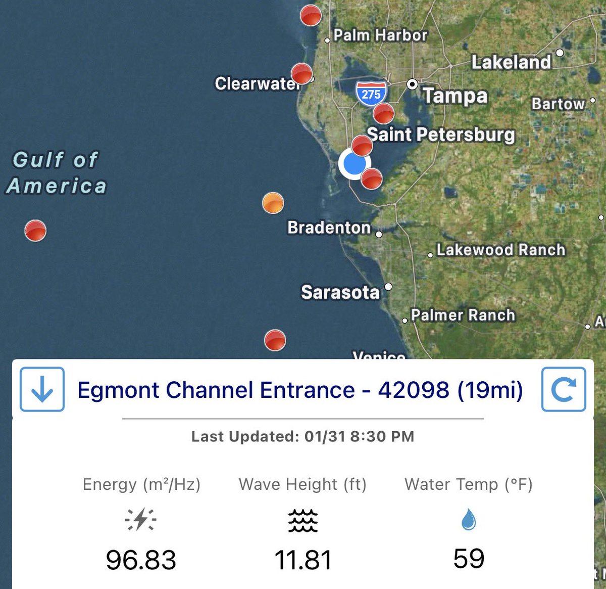
12 ft waves at the mouth of Tampa Bay.. courtesy of wind gusts up to 50mph.
English

Current view from eastern Tennessee! It’s a winter wonderland from E. TN, Virginia, Carolinas, to E. Georgia.❄️☃️#sou’easter
English
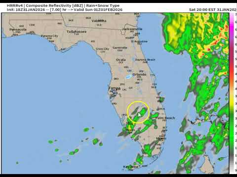
(SAT 7PM UPDATE) Snow flurries have entered the Tampa Bay Area! The Crystal River area is seeing spotty flurries. St. Pete-Tampa-Orlando will have temps cold enough to produce flurries by 9-10pm. Check out the video for more details. youtu.be/8o6Ug_U1U3U
YouTube
English
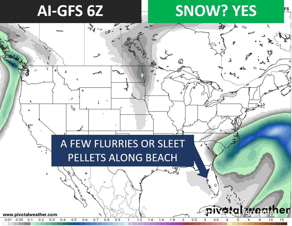
SNOW-WAY! Three hi-res powerhouse models are calling for wildly different outcomes this weekend. From no snow to a record-setting 2" of accumulation. Keep reading to see which is correct:
MODEL FORECASTS:
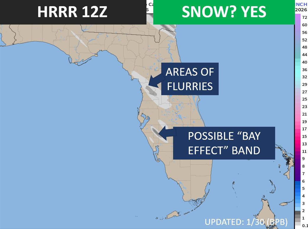
➡️HRRR: Forecasting "Gulf Effect" convective bands across the Tampa Bay Area Sat night - Sun morning. The result would be spotty areas of flurries, sprinkles, & sleet.
➡️RRFS-A: No snow!
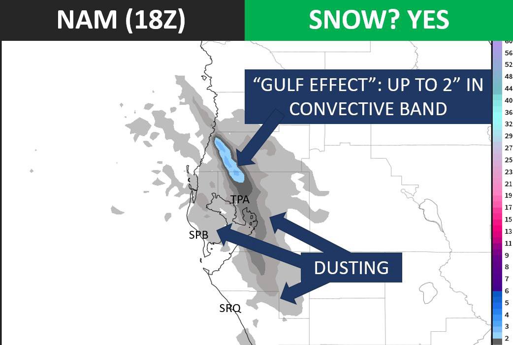
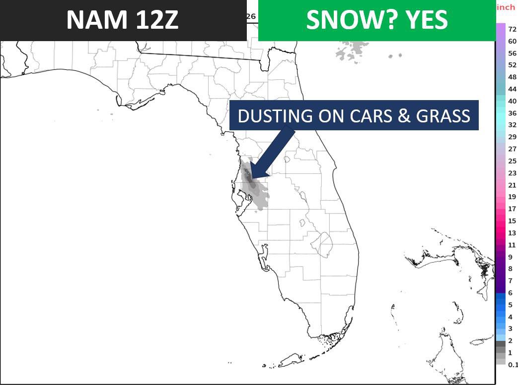
➡️NAM: Showing a record-setting TWO inches of snow accumulation from a "Gulf Effect" convective band just north of TPA.
WHICH IS CORRECT?
➡️The HRRR is the most correct. I anticipate a "Gulf Effect" convective band or two between Saturday night & Sunday morning. The precip will be light and mixed with drizzle, graupel, sleet, & even flurries. No accumulation, but a light dusting on car windshields is possible. Not everyone across central Florida will see frozen precip. I anticipate 20-30% coverage.
WHY IS THE HRRR MODEL MOST CORRECT?
➡️A benefit of working as a meteorologist for 25 years is recognizing trends & knowing model biases. The HRRR has better microphysics & boundary layer prediction than the other two models. HRRR explicitly uses Thompson microphysics which handles marginal warm profiles & convective bands the best. It also uses MYNN PBL for handling turbulent mixing & shallow convection structures.
➡️The NAM is notorious for over-predicting snow totals. Going back to my days working in NYC, I would use the NAM as the absolute ceiling for snow prediction. Don't believe social media hype that is suggesting several inches of accumulation in the Tampa Bay Area.
➡️RRFS-A tends to be too conservative with banding & ice production in very shallow cold-air convection scenarios.
WHAT ABOUT THE AI MODELS?
➡️Machine Learning models like the ECMWF-AI & Google Deepmind are best at scenarios with precedence. This situation is extremely rare and likely hasn't been trained into the models. Additionally, Gulf convective streamers are too small to be accurately forecast by these global models.
BOTTOM LINE:
➡️ Most areas of Tampa Bay will not see frozen precipitation this weekend. Spotty areas will see flurries & sleet Sat PM - Sun AM. Little to no accumulation other than perhaps a light dusting on car windshields. Any precip will evaporate quickly. Aside from the slight snow flurry potential, the extreme cold is the main headline. Stay warm, protect plants & animals, & have a great weekend!


English
WILL IT SNOW IN TAMPA BAY? MOST LIKELY.
Three out of four of the more trusty model runs this morning are indicating at least a few flurries.
DO NOT EXPECT:
❄️The entire Tampa Bay Area will NOT wake up to an area-wide whiteout. This is not a repeat of the 1977 event. Synoptically, we are lacking an upper-level trough or large forcing mechanism to provide uplift. Instead, any snow/sleet will be isolated & be the result of Gulf Effect band(s) induced by incoming Arctic air.
EXPECT:
❄️Most of the Tampa Bay Area will not see a snowflake or a rain drop Sat PM-Sun AM. However, similar to the 2010 event, we will likely have an isolated area or two that manages to squeeze moisture out of the air & produce a few snowflakes.
TIMELINE:
❄️Saturday night - Sunday morning
DYNAMICS (Most ingredients are in place for flurries):
🟢Cold Arctic air
🟢NNW wind bringing moisture off the Gulf
🟢Adequate difference between the Gulf SST & surface air temps.
🟡Questionable: Dry air aloft may limit convection & cloud depth
🔴Lacking: Prominent upper-level trough to provide uplift
MODELS:
❄️The typically trusty HRRR model is being aggressive with available moisture & even indicating the possibility for Bay Effect snow which hasn't happened since 1899. This may be overkill.
❄️The NAM typically overestimates snow potential. So, this model would be the absolute ceiling of what could be expected.
❄️Global models (like the ECMWF, GFS) lack the resolution to pick up these potential mesoscale snow band(s).
STAY TUNED:
➡️I'll continue to watch trends & provide updates for this extremely rare chance for a few flakes in Tampa Bay.

English
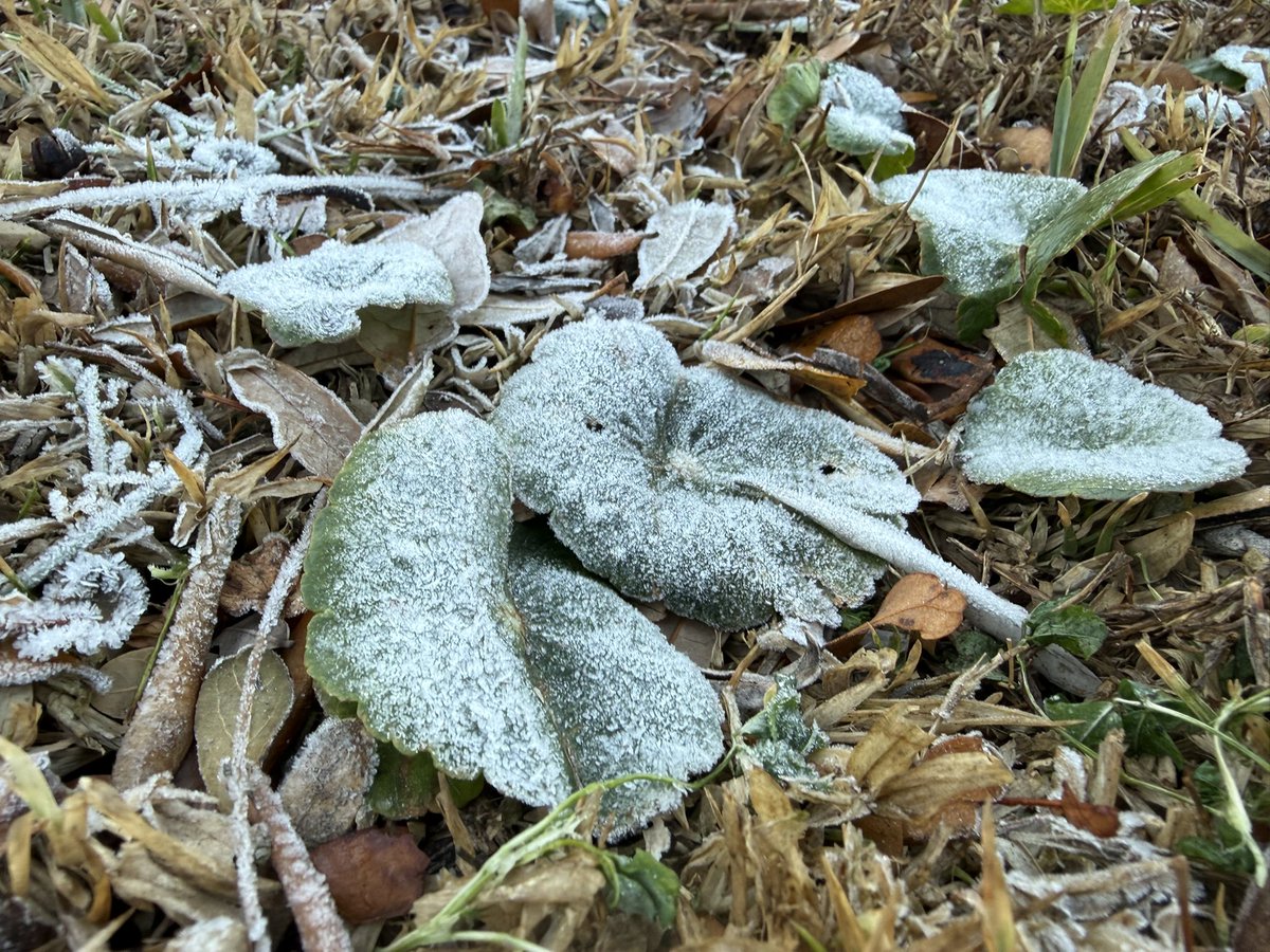
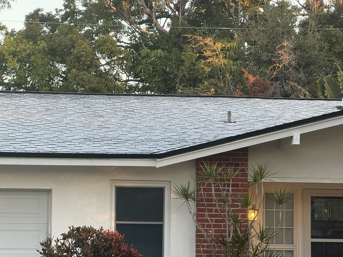
Little bit of Florida “snow” (aka frost) this morning! 🥶❄️
I’ll be diving into the forecast and taking a look at Tampa Bay’s chances for flurries early Sunday morning. Keep an eye out for that post later today!
English
@MattDevittWX A shock for sure. Your credibility and calm delivery set the standard. Wishing you and your family peace now and great things ahead.
English
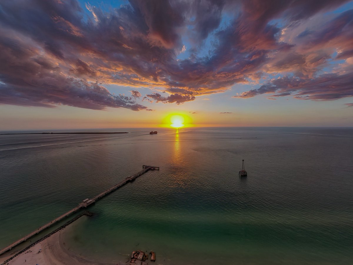
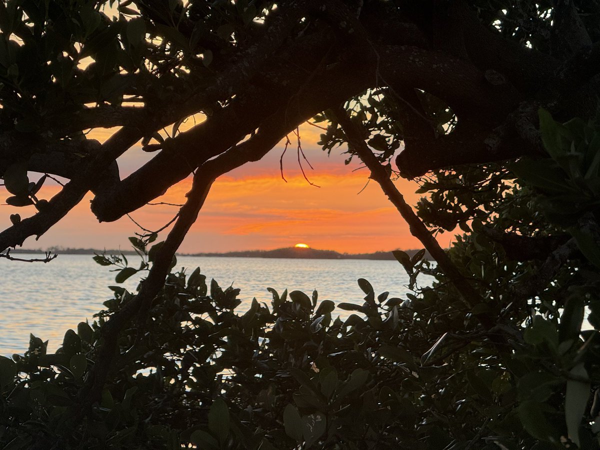
Nature showing off tonight. A superb sunset and super prominent sundog (parhelion). 🏝️🌅


English
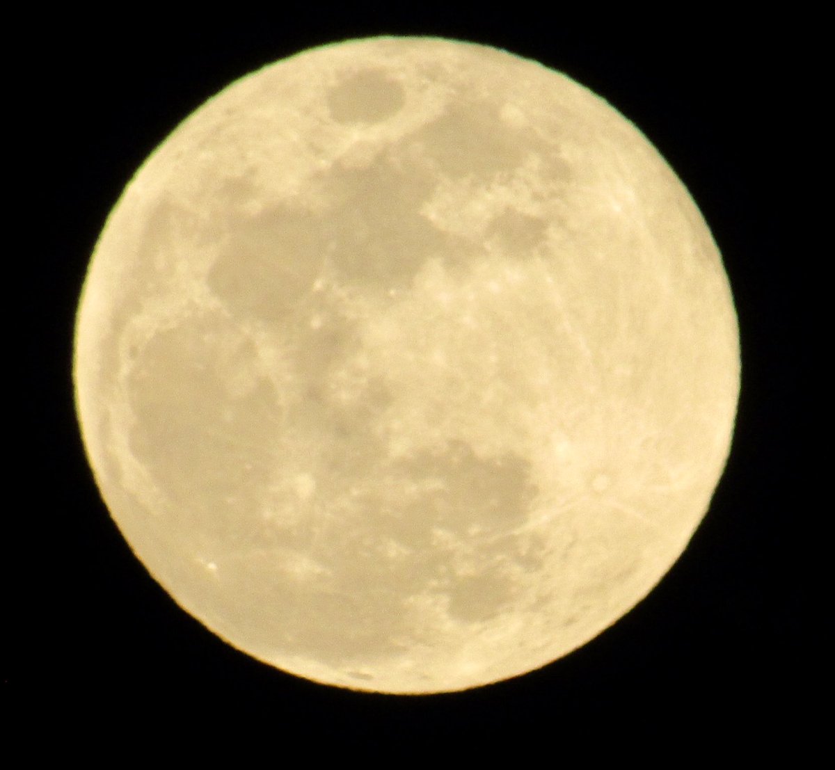
Current view of the first full moon of 2026!
The moon is also a “super moon” (i.e near perigee) making it appear brighter/larger.🌕

English