
That’s roughing the passer???? Is this supposed to be two hand touch now????
Ari Meirov@MySportsUpdate
This might be the worst roughing the passer call so far this season.
English
Weather force
59K posts
@weatherforce11
Tropical cyclone chaser, and certified weather spotter. Providing updates on the tropics and location-specific impacts.
This might be the worst roughing the passer call so far this season.



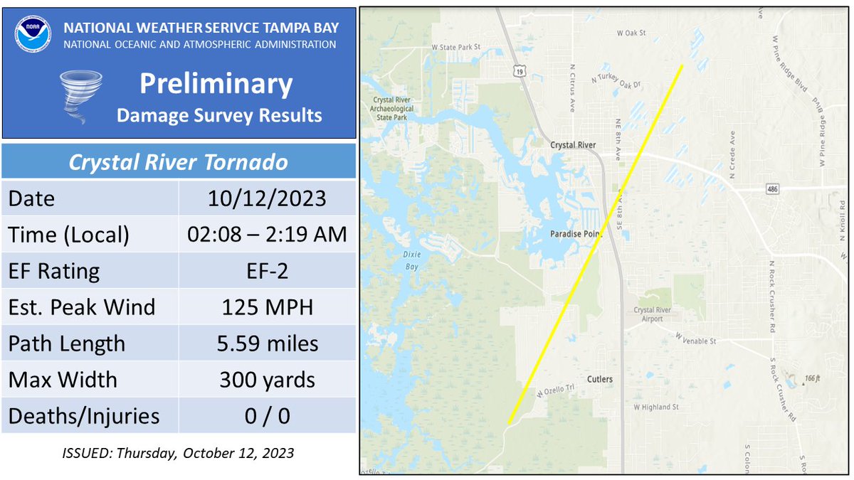
My hometown Oldsmar, FL had a Tornado Warning early AM on 10/12. I was chasing and tracking on radar. My drone footage here looks like it captured it the same area that had some significant damage. @NWSTampaBay



@StormHour My entry to @stormhour #StormHour #POTW competition. Beautiful supercell during this weeks outbreak of severe weather in Brooksville Florida. #Flwx #photography



The 0Z sounding out of Tampa provides some insight into what the limiting factors are for tonight’s severe weather event: For one, the lapse rate (or the change of temperature with height) isn’t all that impressive. This is due to a rather saturated atmosphere from ground all the way up to the top of the atmosphere. This means that storms tonight will have a somewhat difficult time getting their act together and sustaining themselves. In the same token, instability isn’t all that high either with MLCAPE (mixed layer instability) not even in the 600s (yet), this will change some tonight as instability will rise especially along the coast. Further island, instability will be slower to rise, but should be near 700-1000 J/KG by early morning which should be enough to support a conditional tornado threat inland. On the other hand, strong low level shear will aid in any storm that can overcome these obstacles and enable a brief tornado threat to materialize especially near the Big bend of Florida down through Tampa Bay with a more conditional risk inland. #flwx

10:55am CDT #SPC_MD 2245 , #flwx, spc.noaa.gov/products/md/md…
