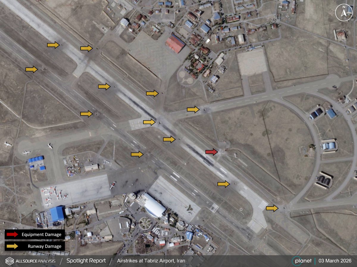
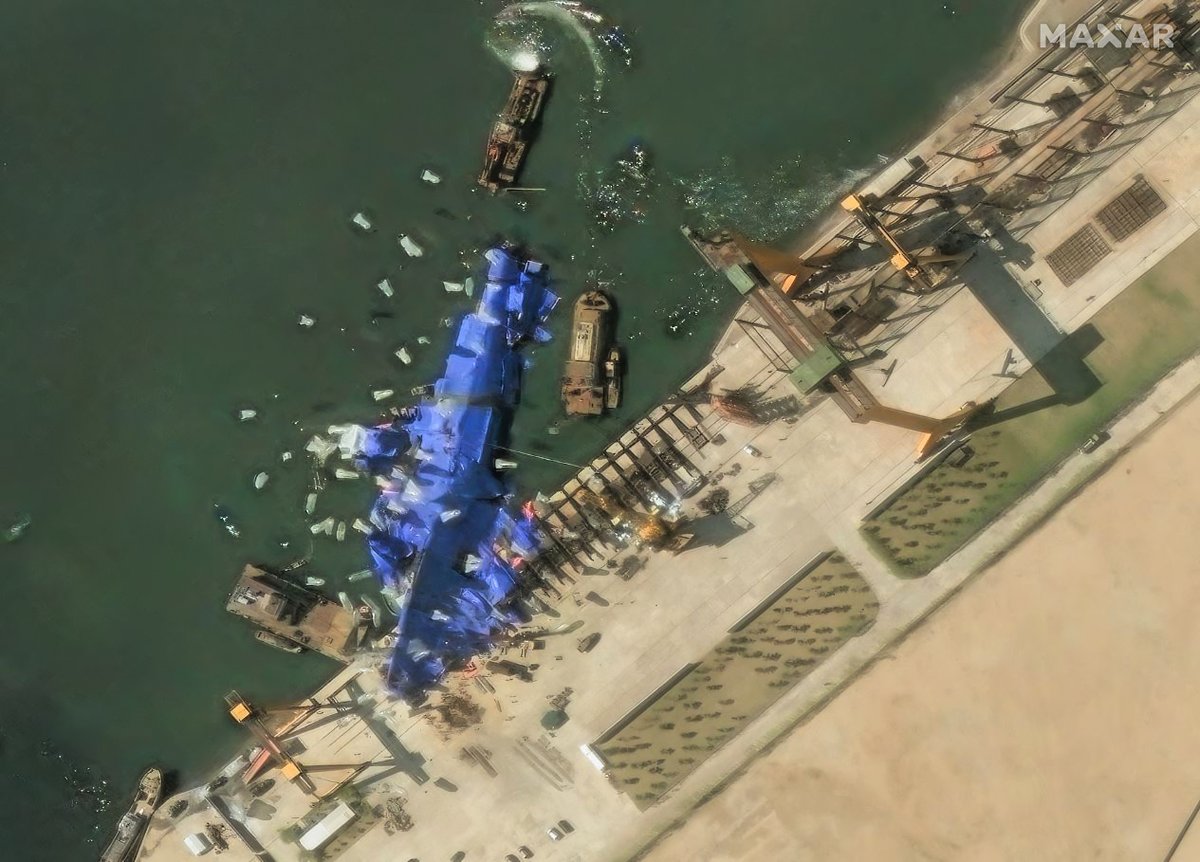
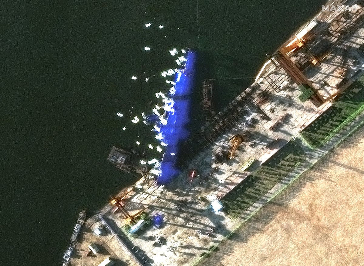
Analysis of GEOINT on 03 March 2026 shows damage to the Tabriz airport in Iran after recent airstrikes. bit.ly/2oeCGCj Spotlight Report - Critical intelligence delivered to your inbox. bit.ly/49i9vEs #GEOINT #Iran
Sim Tack
2.6K posts

@SimTack
Geopolitical/geospatial analysis, strategic intelligence reflections. (reflections are my own) VP for Technology and Analysis @AllSourceA

Analysis of GEOINT on 03 March 2026 shows damage to the Tabriz airport in Iran after recent airstrikes. bit.ly/2oeCGCj Spotlight Report - Critical intelligence delivered to your inbox. bit.ly/49i9vEs #GEOINT #Iran


GEOINT analysis shows the first use of a new drydock for the likely maintenance of a Chinese Navy Aircraft Carrier in the South China Sea. bit.ly/2oeCGCj Spotlight Report - Critical intelligence delivered to your inbox. bit.ly/49i9vEs #GEOINT #China

AllSource has identified and assessed the JDME Shipyard in Taixing City, China to be a critical component in the development of Chinese naval simulation technology supporting weapons development programs. Key findings and full report: allsourceanalysis.com/featured-analy… #GEOINT #China

GEOINT analysis reveals long vehicle queues at fuel stations across Bamako, Mali. bit.ly/2oeCGCj Spotlight Report - Critical intelligence delivered to your inbox. allsourceanalysis.com/spotlight #GEOINT #Mali #Bamako #FuelCrisis


More sat imagery as of today, 2:01 pm, local time, of the N Korean port of Chongjin where a new N Korea naval destroyer was badly damaged during a launching ceremony on May 21. Image 1: prior to launch. Image 2: ship is lying on side, partially covered by blue tarps. 📸 @Maxar

GEOINT analysis of Bamako Airport on 20 Jan 2025 shows the arrival of probable tents and equipment to military areas of the airport, and near a known Wagner facility. bit.ly/2oeCGCj Spotlight Report - Critical intelligence delivered to your inbox. allsourceanalysis.com/spotlight


Using Planet satellite data, AI, and human expertise, our partner @AllSourceA builds comprehensive reports that provide crucial insights for governments and enterprises. “We regularly use PlanetScope data and see very clearly broad scale changes on the Earth,” said Renny Babiarz, Vice President of Analysis and Operations at AllSource Analysis. “Then we can task high-resolution SkySat imagery to get a better look at that location to get more detail.” Hear more from Renny in our video interview with AllSource Analysis:


