Getmapping

802 posts

Getmapping banner
Getmapping

Getmapping

@GetmappingLtd

See More. Know More. Do More. Geospatial data made easy with high-resolution imagery, expert surveys, and on-demand content.

United Kingdom เข้าร่วม Nisan 2010
2.9K กำลังติดตาม1.8K ผู้ติดตาม
Getmapping
Getmapping@GetmappingLtd·
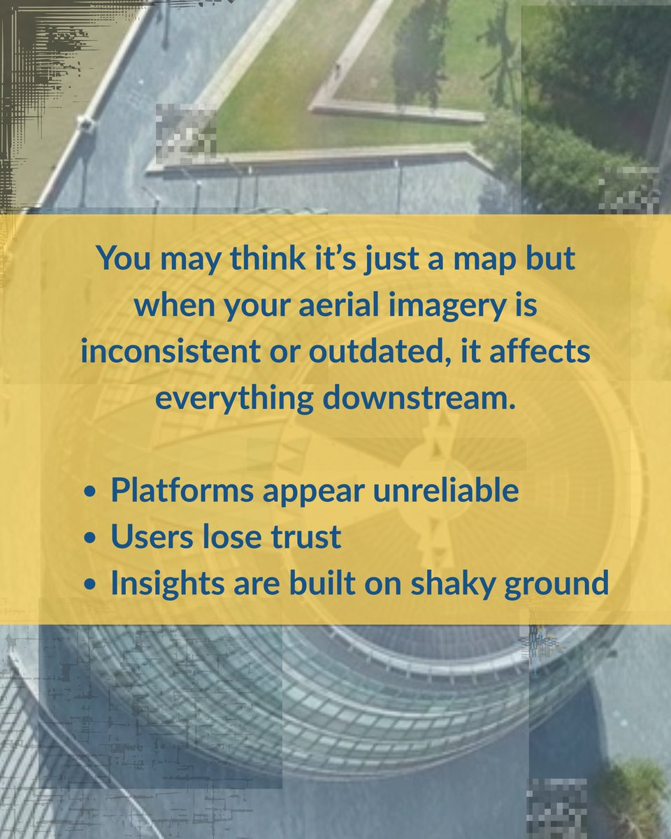
“Good enough” data costs more than you think. Missed details. Misaligned layers. Incomplete coverage. Each issue adds risk, rework, and cost. 
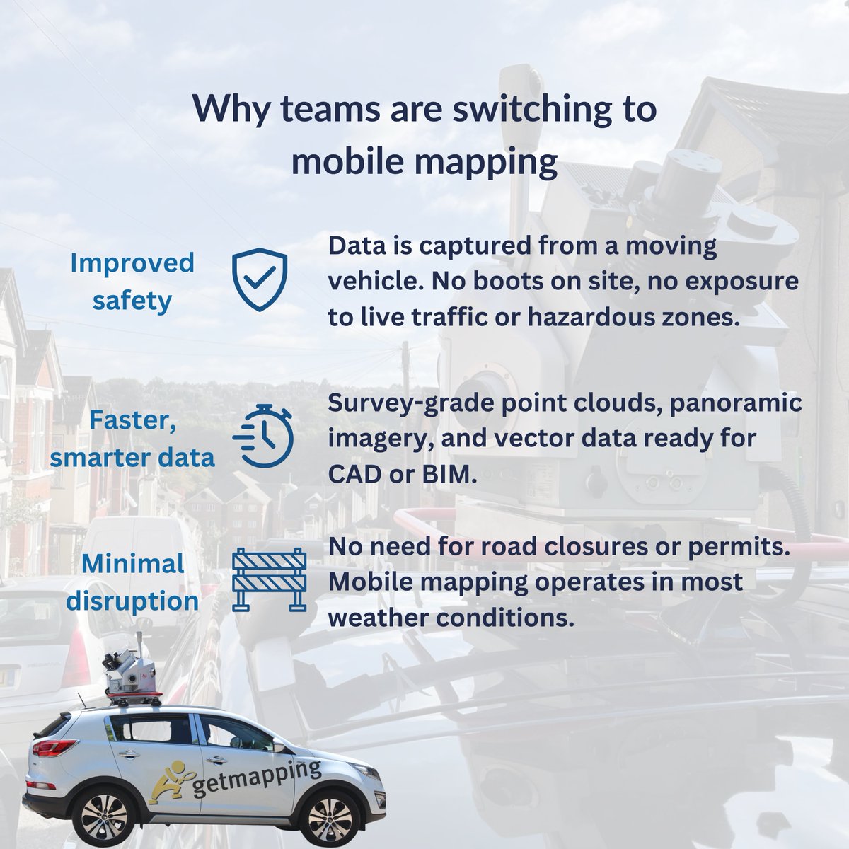
Mobile mapping delivers survey-grade accuracy- fast. Every asset. Every layer. CAD-ready. Let's talk: meetings-eu1.hubspot.com/neil-rennie
English
0
0
0
16
Getmapping
Getmapping@GetmappingLtd·
Not all aerial imagery is created equal. Patchy visuals, missing data, and poor alignment can derail your platform. Getmapping delivers colour-balanced, high-res imagery - UK-wide and platform-ready. See the difference: meetings-eu1.hubspot.com/jake-lauder
Getmapping tweet mediaGetmapping tweet mediaGetmapping tweet mediaGetmapping tweet media
English
0
0
0
14
Getmapping
Getmapping@GetmappingLtd·
What costs more: new tech or lost time? Permits. Closures. Rework. Every delay adds up. Mobile mapping collects all your data in one drive. No workflow changes. No raw data. Just clean, CAD-ready outputs. Book a 15-min call: meetings-eu1.hubspot.com/neil-rennie
Getmapping tweet media
English
0
0
0
11
Getmapping
Getmapping@GetmappingLtd·
Keep your crew out of traffic and still get the data you need. Mobile Mapping captures survey-grade data from a moving vehicle. No road closures. No rework. No delays. Just CAD-ready outputs, fast. Book a quick call: meetings-eu1.hubspot.com/neil-rennie
Getmapping tweet media
English
0
0
0
12
Getmapping
Getmapping@GetmappingLtd·
Could aerial imagery be the missing piece in your property data? Understand: - The amount of green space nearby - Access to transport links - Proximity to flood zones - Neighboring developments Smarter insights. Better decisions. Book a call: meetings-eu1.hubspot.com/jake-lauder
Getmapping tweet media
English
0
0
0
23
Getmapping
Getmapping@GetmappingLtd·
Which data layer is most often overlooked in today’s planning and property platforms?
English
0
0
0
17
Getmapping
Getmapping@GetmappingLtd·
What if your platform didn’t just map the present but shaped the future? At Getmapping, we turn aerial imagery into insight. See where opportunity lives, risk hides, and cities evolve. Ready to see the future more clearly? Book a call with Jake: meetings-eu1.hubspot.com/jake-lauder
Getmapping tweet media
English
0
0
1
20
Getmapping
Getmapping@GetmappingLtd·
In 2024 more organisations will be utilising multi-source data to gain greater intelligence and create digital replicas of the world around us with unprecedented levels of detail. Learn more about this and other predicted trends for 2024. getmapping.co.uk/post/key-geosp…
Getmapping tweet media
English
0
0
3
77
Getmapping
Getmapping@GetmappingLtd·
Geospatial data is a key component of the solution to the problem of how to incorporate EV charging into our already congested kerbsides. Read more about this and other predicted trends for 2024. getmapping.co.uk/post/key-geosp…
Getmapping tweet media
English
0
0
0
52
Getmapping
Getmapping@GetmappingLtd·
We anticipate that 2024 will continue to see the combination geospatial data with advanced AI algorithms, leading to better intelligence and the development of powerful new on-demand solutions. Find out how Getmapping is harnessing the power of AI. getmapping.co.uk/post/transform…
English
0
0
0
44
Getmapping
Getmapping@GetmappingLtd·
2024 is expected to be another dynamic year for the geospatial industry. Discover the key geospatial trends for the upcoming year, as predicted by our CEO, Dave Horner. getmapping.co.uk/post/key-geosp…
English
0
0
0
53
Getmapping
Getmapping@GetmappingLtd·
Happy New Year to all of our valued customers, partners and suppliers. We look forward to an exciting year ahead as we continue to expand our remarkable 5cm CityView content, collaborate with new customers eager to harness the power of geospatial and grow our On Demand Service.
Getmapping tweet media
English
0
0
0
62
Getmapping
Getmapping@GetmappingLtd·
How can we combine mobile mapping with aerial mapping to support a greener future and the road to autonomy? @PeterJHaddock talked to Getmapping's Helen Wattie at @HWYSUK x.com/contentwithmed…
Content with Media@contentwithmed1

How can we combine mobile mapping with aerial mapping and ground penetrating radar to support a greener future and the road to autonomy? @PeterJHaddock talked to @GetmappingLtd specialist Helen Wattie in our @LeicaGeo_UKI studio at @HWYSUK youtu.be/NscgZuEl7qg

English
0
0
0
57
Getmapping
Getmapping@GetmappingLtd·
Getmapping is helping Transport for West Midlands (TfWM), on behalf on the West Midlands Combined Authority (WMCA) to digitise their highways and record all aspects of Traffic Regulation Orders. Find out more about this ground breaking project: getmapping.co.uk/post/digitisin…
English
0
0
0
40
Getmapping
Getmapping@GetmappingLtd·
We recently extracted a range of traffic signage from a the entire road network of a Local Authority client. What would have taken months at huge cost, was completed instantly using AI. Find out more about how AI is transforming geospatial data: getmapping.co.uk/post/transform…
Getmapping tweet media
English
0
0
1
44
Getmapping
Getmapping@GetmappingLtd·
Discover how we are utilising AI to deliver innovative and intelligent such as our Atrium Finder, and how we helped a client identify all of the buildings in Great Britain with atriums or open spaces inside. getmapping.co.uk/post/transform…
Getmapping tweet media
English
0
0
0
33
Getmapping
Getmapping@GetmappingLtd·
Despite the shorter days of autumn, our dedicated #mobilemapping team remains proactive in digitising the highways and recording all aspects of traffic-related orders (TROs) in the West Midlands. To learn more about Mobile Mapping, visit getmapping.co.uk/post/mobile-ma…
Getmapping tweet media
English
0
0
0
67
Getmapping
Getmapping@GetmappingLtd·
At HighwaysUK last month, we heard from clients and partners about the issue of survey equipment theft and the need to hire protection for field workers. They are embracing our Mobile Mapping solution to eliminate this risk.
Getmapping tweet media
English
0
0
0
44
Getmapping
Getmapping@GetmappingLtd·
We have captured significant change during 25 years of aerial imagery, including the construction of solar farms throughout the countryside, including the one below. To celebrate our 25th anniversary, we're offering 25% off all our aerial imagery.
Getmapping tweet mediaGetmapping tweet media
English
0
0
0
45