ทวีตที่ปักหมุด

BREAKING 🚨🚨
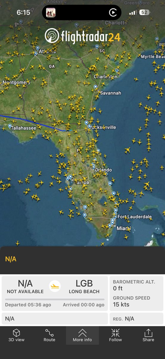
#LosAngeles / #California
Possibly the first appearance in its 50 year + flying history, the Boeing 747 E-4B Nightwatch, also known as the “Doomsday Plane,” showed up at LAX Thursday evening.
That’s new.
English
OC Scanner 🇺🇸 🇺🇸
84K posts

@OC_Scanner
Monitoring Public Safety/National Security/Intel and Geopolitical events in OC/SoCal and beyond. Army Vet. #ScannerOn #OSINT Send News @ [email protected]

Major update to the 𝕏 AI recommendation algorithm rolling out next week. This will be open sourced at the same time.


The Boxer Amphibious Ready Group (ARG), comprised of the USS Boxer (LHD-4), USS Comstock (LSD-45), and the USS Portland (LPD-27) with the embarked 11th Marine Expeditionary Group (MEU), is on its way to the Middle East after departing the U.S. west coast for deployment.
Followers. Here is a an update. The Ridge is Still Running the Show (Shocking, I Know). I mean, I wish I was wrong. but I am not. Quick follow-up here, and if you’re looking for a big change in the pattern… yeah, not happening right now. Sorry. You can shame me all you want, but I don't see any cooler weather for weeks out west. Below is my AI discussion with some key tools I have imputed. Enjoy!! The western US Super Duper Mega ridge remains firmly in control, with 500mb heights still pushing ~594–597 dm over CA/NV, and the downstream impacts are exactly what you’d expect: • Strong subsidence • Compressional warming • Clear skies + maximum March solar input • Snowpack getting absolutely torched. Yes, resorts are starting to close. At this point, this isn’t just a warm spell, it’s a full-on snowpack ablation event. Resorts across the West are now closing daily, and again… not exactly a mystery. When you’re seeing temps pushing 75–80°F at ~8,000–8,500 ft, the snowpack doesn’t “hang on” — it collapses. Once that pack goes isothermal under sustained ridging, high sun angle, and no overnight recovery, you’re just watching liquid water move downhill in slow motion. Like I discussed on Monday, the snow melt is on, anywhere from 6-10", per day of melt. Personally, haven't seen this in a long time for a March! Meanwhile — back east — the atmosphere decided balance is overrated. We’ve got a reloaded polar vortex and persistent eastern US troughing keeping things cooler, unsettled, and cold! I was talking to my super today in NY, and it was 33 degrees, and wasn't happy. So the large-scale pattern remains a pretty clean split: • West: +Height anomalies / ridge dominance / heat • East: -Height anomalies / troughing / cooler & active Now… let’s talk about the part everyone is watching — does this pattern actually break? As we get into the early April window, guidance is starting (and I stress starting) to hint at: • The ridge retrograding westward and weakening • Some degree of troughing trying to undercut into the West Coast • Heights building back into the eastern U.S. If that verifies — and that’s still a big if — you’d be looking at a pattern flip: West cools down / possibly unsettled a bit East warms up / more spring-like But let’s be clear — we’ve seen this movie before, over and over and over again during this winter. The ridge out west, has been incredibly stubborn, and until we actually see a breakdown in the height field, this is just model optimism more than reality. Still… first time in a minute, where the model ensembles are at least raising an eyebrow with some kind of change around Easter week out west. See below what I have posted: - Euro Ens and AI models, showing the Meteograms for temps, Heights out west around the 1st, Precpitation model, which shows something very light, and 850MB temps. There is some hope, I hope! As for the El Niño chatter, which it seems every weather geek on X has transitioned too, here are some thoughts: Some longer-range guidance is beginning to show: • Gradual warming of SSTs in the equatorial Pacific • Early signals of a potential ENSO phase shift toward El Niño by late summer/fall Now before everyone runs with that…We’re heading straight into the spring predictability barrier, where ENSO forecasts historically go to die. Also, the El Nino needs to be at the right ENSO region, so TBD. Plenty of time to discuss and hype! So take it for what it is right now: A signal — not a forecast. But if that trend holds, it could have real implications for the West Coast storm track heading into next winter. Bottom line: • Ridge still parked over the West for next two weeks — and doing damage • Snowpack — getting dismantled in real time • Resorts — dropping operations daily • East — still dealing with troughing / PV influence • Early April — watching for cracks in the ridge out west • Long range — El Niño whispers getting louder We’ll see if the models actually follow through. Will have more tomorrow, but for now, giving you the real facts here. Stay cool and liquid!!!! One post-script - A lot of folks post the GFS, their suites of models and the EU1. Folks, I have time and time again, found that the Euro Ens AI model has been the most reliable model this winter season, which has been challenging. As you know, I am not a fan of the GFS suite of models, nor any deterministic model for long/medium range output. I know everyone on X posts and gets the GFS for free on TT, but try to find the Euro Model AI at a cheap price for next winter. Once you do, you will never go back to the GFS suites...... #CAwx #SierraSnowpack #HeatWave #Tahoe #WestCoastWeather #PolarVortex #ENSO #ElNino #PatternChange #WxTwitter #socal #pnw

The US empire is in decline. Feb. 17, 2026