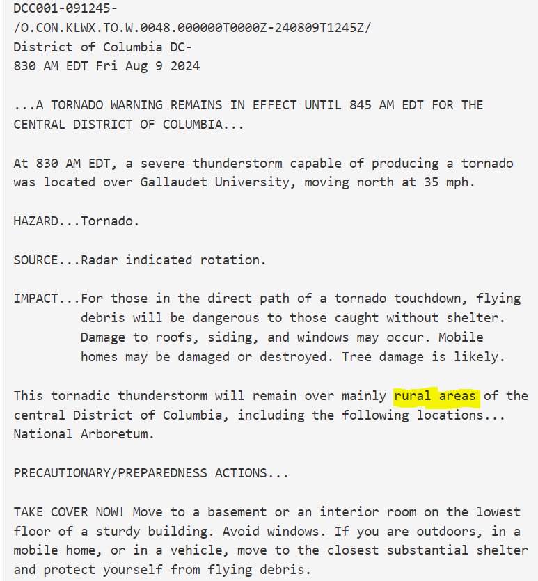
Ah yes, the farmlands of the District of Columbia
West Freehold, NJ 🇺🇸 English
Jordan Tessler
45.8K posts
@TerpWeather
Forecasting weather in Washington/Baltimore. It's a great way to induce hair loss. UMD Alum (14), not affiliated with UMD in any capacity

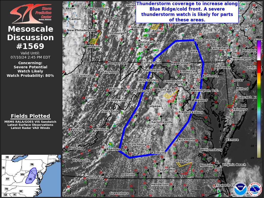


#SPC issues Day 1 Slight Convective Risk at Jul 10, 16:36z for LWX spc.noaa.gov/products/outlo…

#SPC issues Day 1 Slight Convective Risk at Jun 6, 16:27z for LWX spc.noaa.gov/products/outlo…
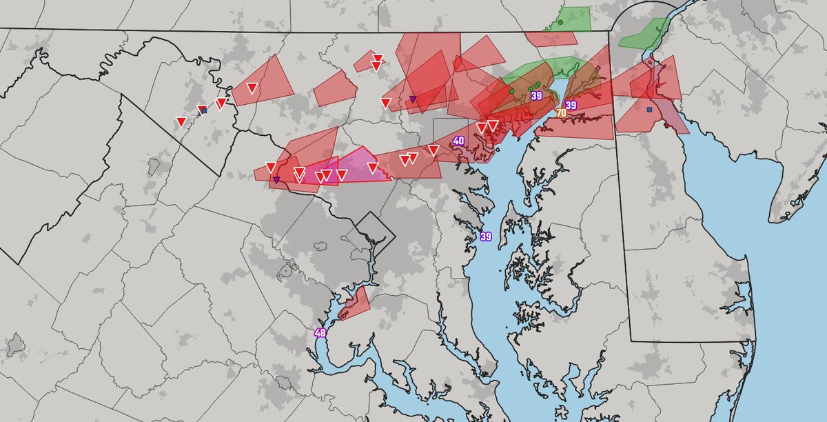
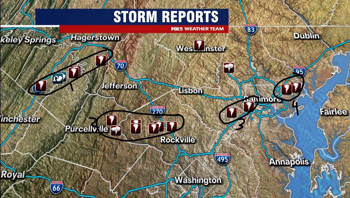
Been a long time since I've seen this many tornado reports in our region, as tornadoes here are typically not long track. When all is said and done, we're likely talking about multiple reports from 3-4 different tornadoes, but survey teams will determine this in the days ahead.