Emory Beck

172 posts

Emory Beck banner
Emory Beck

Emory Beck

@MapHustle

Cartography and Data Visualisation by Maphustle

Wellington, New Zealand Sumali Eylül 2020
202 Sinusundan835 Mga Tagasunod
Naka-pin na Tweet
Emory Beck
Emory Beck@MapHustle·
I've made a website! Early days - will be added to, refined and improved in due course. Please check it out here: maphustle.co.nz
English
3
4
26
2.9K
Emory Beck
Emory Beck@MapHustle·
DSM of 台東区 (Taito City, Japan). Made in QGIS (except for the last image). Data source: Tokyo Digital Twin Project.
Emory Beck tweet mediaEmory Beck tweet mediaEmory Beck tweet mediaEmory Beck tweet media
English
1
1
4
523
Emory Beck
Emory Beck@MapHustle·
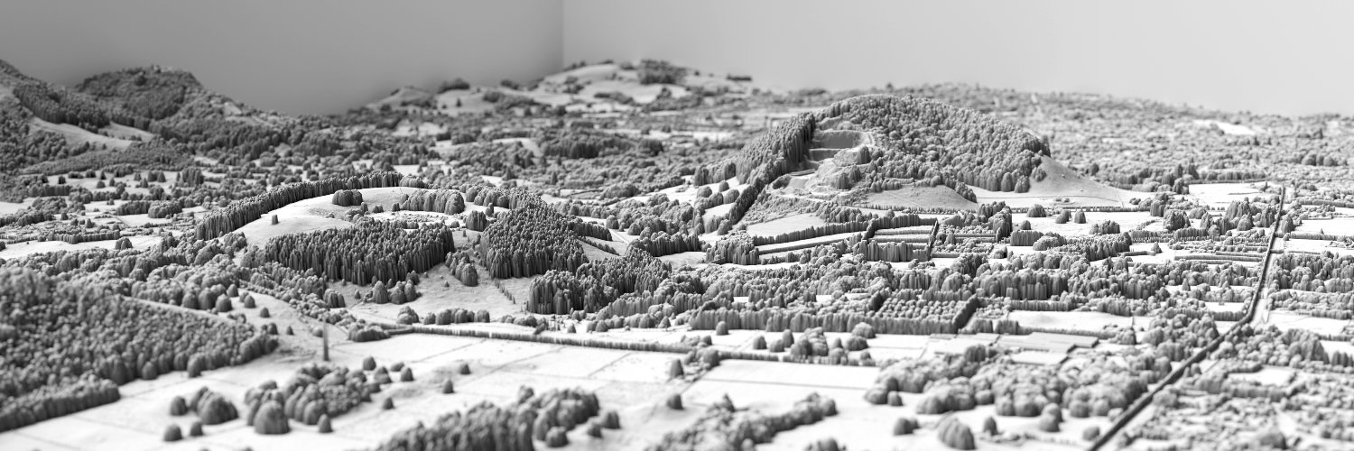
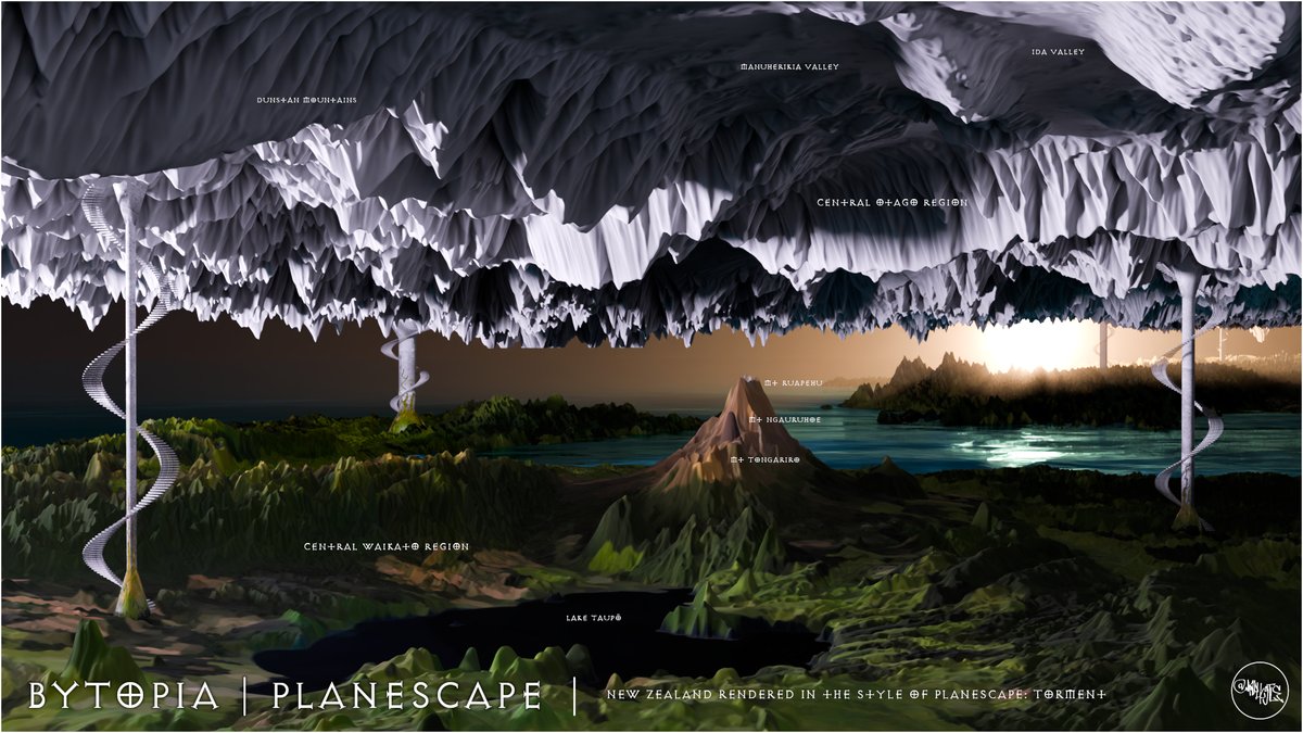
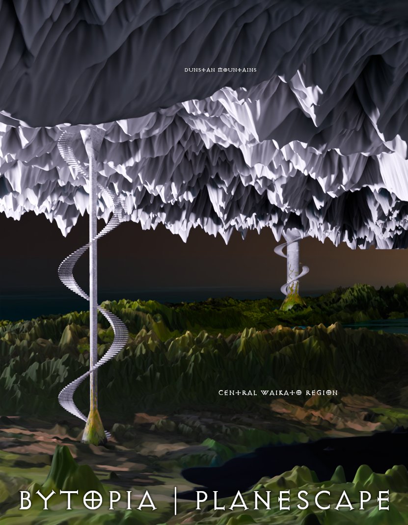
Experimenting with recreating the Planescape multiverse (2e AD&D) using real-world data. Inspired by Planescape: Torment and its low-poly charm. Just finished my first plane, a Bytopia reimagined from New Zealand terrain. It’s random, but a joy to build. lnkd.in/gWNaeUVg
Emory Beck tweet mediaEmory Beck tweet mediaEmory Beck tweet media
English
0
0
0
129
Emory Beck
Emory Beck@MapHustle·
#30DayMapChallenge Day 1: Points. This will likely be my only map and I've opted to make something for the fun of it, and as a bit of a joke. I'll let the map speak for itself. If one is unable to read the text, it re-imagines New Zealand's topographic height points as stars.
Emory Beck tweet media
English
1
0
5
410
Emory Beck nag-retweet
LINZ Data Service
LINZ Data Service@LINZLDS·
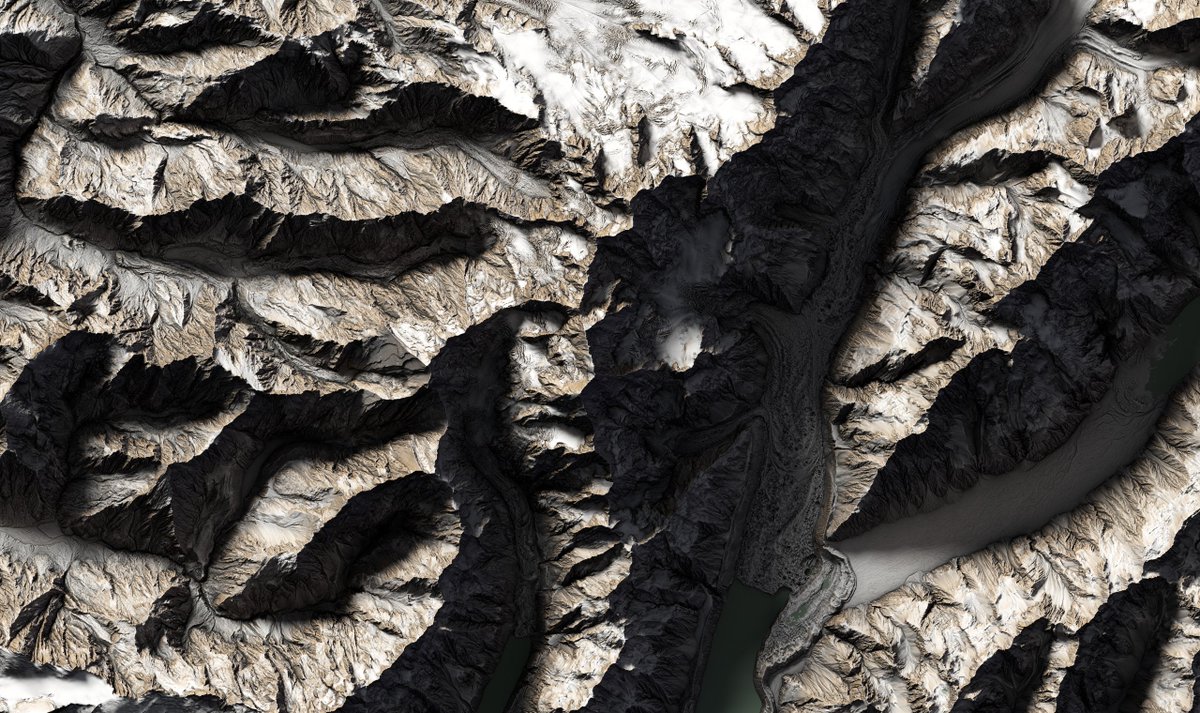
🚨West Coast LiDAR is now complete! The final block of data has landed, bringing full regional coverage. And Aoraki/Mt Cook is fully captured across both West Coast & Canterbury 🏔️✨ Explore now👉data.linz.govt.nz/layer/110163 Images: Top-down & Oblique views of Aoraki/Mt Cook #OpenData
LINZ Data Service tweet mediaLINZ Data Service tweet mediaLINZ Data Service tweet media
English
0
2
10
330
Emory Beck nag-retweet
LINZ Data Service
LINZ Data Service@LINZLDS·
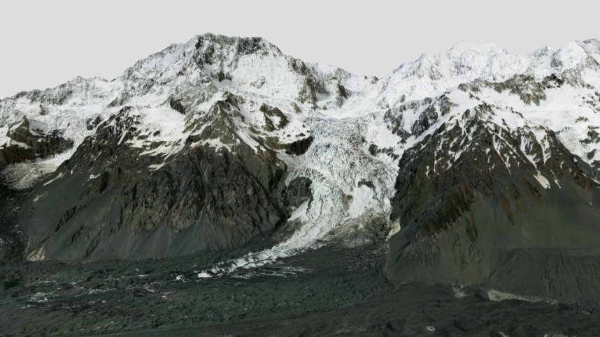
🙌Day 3 of new data drops and we’ve saved a stunner. Feast your eyes on Aoraki/Mount Cook & Cameron Glacier in breathtaking detail👀 (images attached). This completes the final piece of the Canterbury LiDAR release! Dive into the data: data.linz.govt.nz/layer/111133 #OpenData #LiDAR
LINZ Data Service tweet mediaLINZ Data Service tweet media
English
0
3
10
443
Emory Beck
Emory Beck@MapHustle·
Tokyo point cloud data is amazing!
Emory Beck tweet media
English
0
6
39
1.8K
Emory Beck nag-retweet
LINZ Data Service
LINZ Data Service@LINZLDS·
🏔️We’ve updated our West Coast LiDAR dataset with a new block of data covering the Southern Alps, Mount Aspiring/Tititea, and the nearby areas that border the Canterbury Region. 🗺️Explore it at data.linz.govt.nz/layer/110163 (Image: Mount Aspiring/Tititea) #OpenData
LINZ Data Service tweet mediaLINZ Data Service tweet mediaLINZ Data Service tweet media
English
1
4
27
1.3K
Emory Beck
Emory Beck@MapHustle·
Viewshed raster of incremental viewpoints along the Routeburn track, New Zealand. Turned 3D just for a bit of fun. The lighter colours are visible by more viewpoints than the darker colours.
Emory Beck tweet mediaEmory Beck tweet media
English
0
3
16
847
VizArt
VizArt@hellovizart·
@MapHustle The small orange thing, is it a tent? :D
English
1
0
0
52
Emory Beck
Emory Beck@MapHustle·
Barker Hut looking up at Mt Murchison, White and Marmaduke Dixon Glaciers, Canterbury NZ. Data from LINZ Data Service. made using QGIS and AerialOD.
Emory Beck tweet media
English
1
1
6
572
Emory Beck
Emory Beck@MapHustle·
@IsaacBain Thanks mate! I have the means to do it myself, appreciate the offer.
English
1
0
0
25
Isaac Bain
Isaac Bain@IsaacBain·
@MapHustle I'd be happy to 3D print one of these elevation models for you. All I'd need is a GeoTIFF of your favourite area.
English
1
0
1
31
Emory Beck
Emory Beck@MapHustle·
Awakino Ski Field - Canterbury DSM and aerial imagery Made using QGIS and AerialOD
Emory Beck tweet media
English
2
0
14
644
Emory Beck
Emory Beck@MapHustle·
My attempt at instagram-style inspo posting using the smallest amount of geospatial data. Guess the cityscape.
Emory Beck tweet media
English
1
1
4
375
Emory Beck nag-retweet
Dr Mairéad de Róiste @spatialThinkLab@mastodon.nz
GeoCart'2024 is hosting 2 Map Design Workshops facilitated by freelance cartographer, Daniel P. Huffman. A special discounted rate is available for those who wish to attend both workshops as one package. Typography in Cartography: 19 August Cartographic Feedback: 20 August
Dr Mairéad de Róiste @spatialThinkLab@mastodon.nz tweet mediaDr Mairéad de Róiste @spatialThinkLab@mastodon.nz tweet mediaDr Mairéad de Róiste @spatialThinkLab@mastodon.nz tweet media
English
1
3
5
429
Emory Beck
Emory Beck@MapHustle·
@GISTspace Not quite. Created various hillshade layers and blend together.
English
0
0
1
32
Emory Beck
Emory Beck@MapHustle·
Mapping steep and flat relief together can be challenging. Often, one looses detail in flatter areas, like river plains, etc... Here's an example where I have successfully mapped flat and steep relief, together. Tararua Ranges/Wairarapa region in NZ.
Emory Beck tweet media
English
1
0
25
1K