
Isaac Bain
163 posts
Isaac Bain
@IsaacBain
Quantitative Ecologist
Christchurch, New Zealand Katılım Ağustos 2013
309 Takip Edilen60 Takipçiler

@IsaacBain Thanks mate! I have the means to do it myself, appreciate the offer.
English
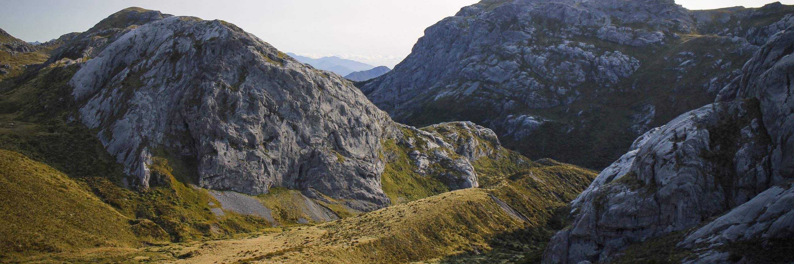
Awakino Ski Field - Canterbury
DSM and aerial imagery
Made using QGIS and AerialOD

English
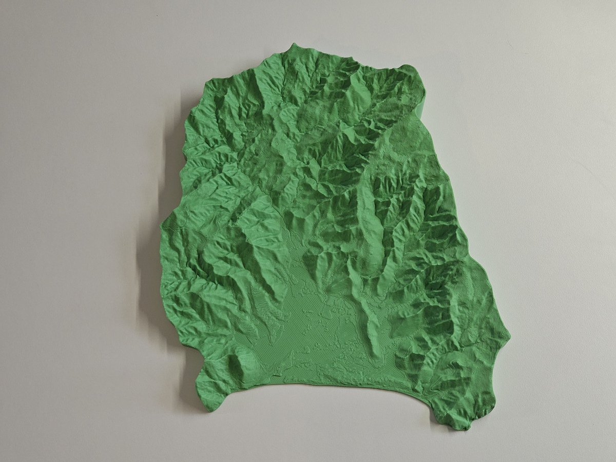
3D printed topographic model of the Otama catchment, made using #Rayshader in #Rstats with #Linz 1m LiDAR DEM.

English
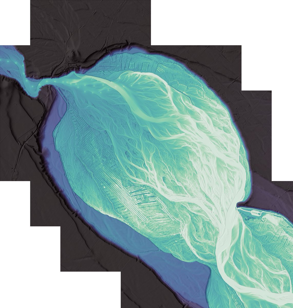
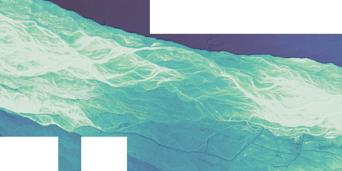
The #python package #RiverREM was a big help in making this Relative Elevation Model of the Waimakariri River. It's not only quicker, but reproducible and scalable too.
isaacbain.com/posts/rem/

English
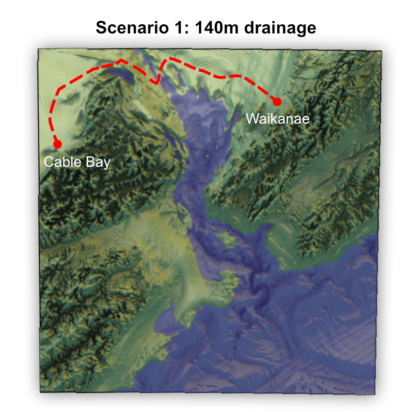
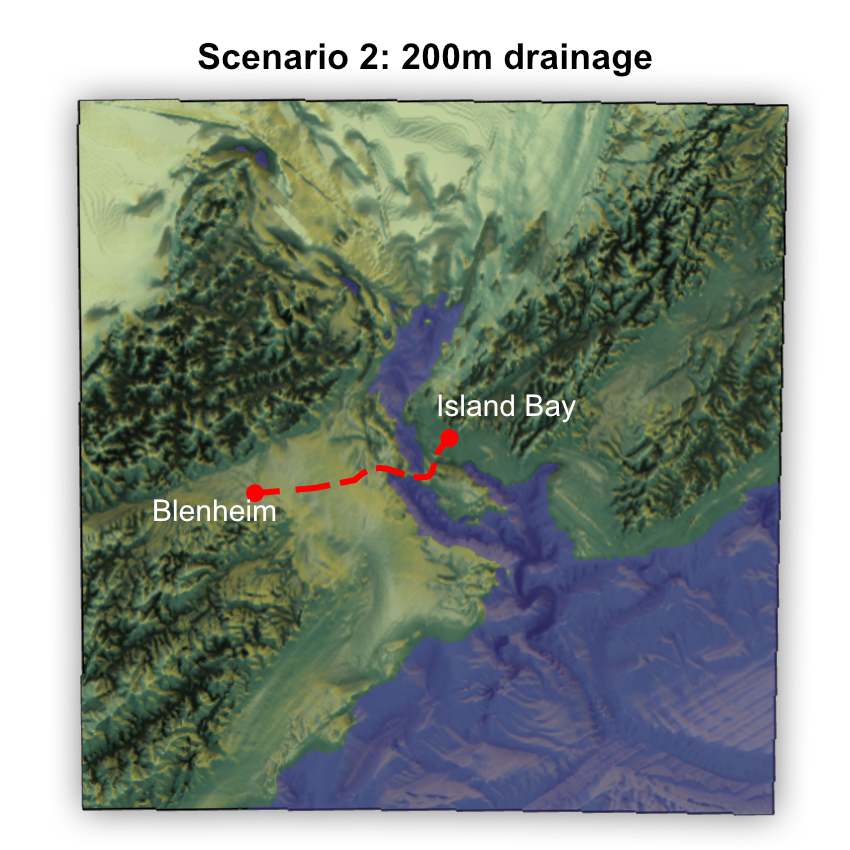
What would it look like to drain the Cook Strait - which separates the North and South Islands of New Zealand? combining @gebcobathymetry with #rayshader.
isaacbain.com/posts/draining…
GIF
English
I love that just using the power of #Rstats and #rayshader its possible to delineate catchment boundaries, download and process elevation data, and create .stl files for 3D printing.
Check out this one for the Upper Ruamahanga: isaacbain.com/posts/upper-ru…
GIF


English
Elevation models of the Whangateau, Kakanui, and Ahuriri catchments.
Read more here: isaacbain.com/posts/3d-print…
English
I've been trying out @kyle_e_walker's new #rstats package {mapgl}. It's pretty incredible to be able to view these 3D rendered hex grid cells of livestock density all in the browser. And compare between two years!
isaacbain.com/posts/livestoc…
GIF
English
This allows you to answer questions such as:
- Which areas are doing well and have comparatively good water quality for a given number of livestock?
- Which areas exhibit poor water quality despite low stocking density, potentially due to other influences such as urban land use?
English
This week, I used bivariate maps to explore the relationship between livestock density 🐄 and water quality 💧 in New Zealand. Bivariate maps are great because they allow you to visualise two variables at once, using a grid of intersecting colour scales.


English
The Climate Data Initiative has released new climate projection datasets for New Zealand. 🌏
Discover more: isaacbain.com/posts/climate-…
GIF
English
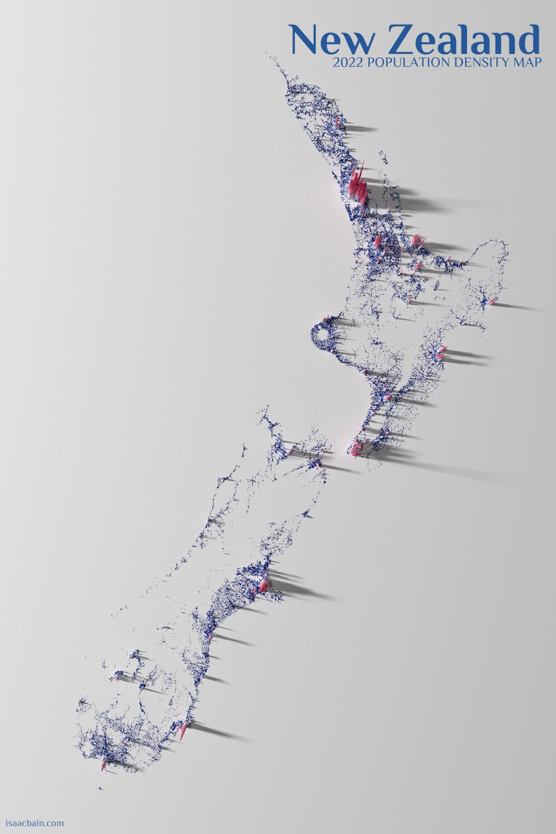
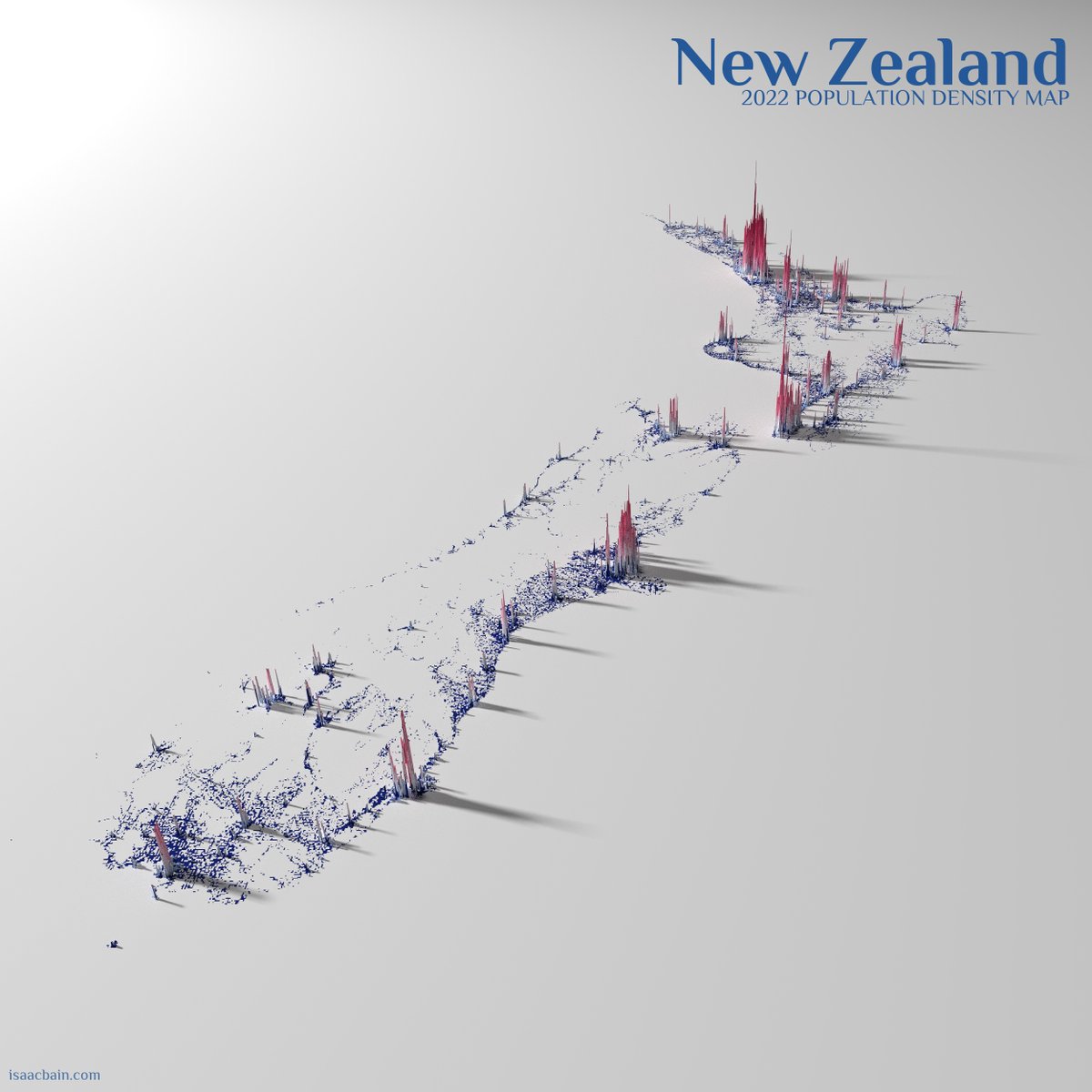
🏡 3 in 4 people (76.3%) live in the North Island of New Zealand.
🌆 1 in 3 people (33.2%) live in Auckland.
🏔️ That leaves around 1.2 million people spread throughout the South Island.
🏙️ And around 0.5 million of those live in the greater Christchurch area alone!
English
English
As a regular user of their website, I noticed it was challenging to explore new huts without an overview map 🗺️. So, I created one and added it to their website! Read more: isaacbain.com/posts/remote-h…
English
If you're a keen tramper 🥾, you likely know about the great work the Permolat Trust does in maintaining a network of 70 iconic backcountry huts 🛖 that are too small or remote for DOC to manage.
GIF
English
I've just published a new blog post on my website exploring Stats NZ's prototype population grids. This high-resolution dataset from Stats NZ provides detailed insights for urban planning 🏙️, environmental management 🌿, and public health 🏥.

English