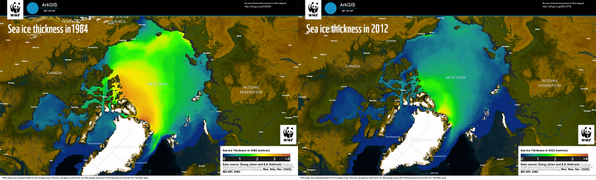
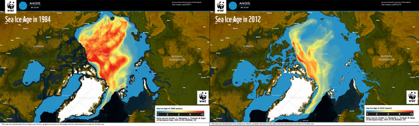
WWF ArkGIS

39 posts

WWF ArkGIS banner
WWF ArkGIS

WWF ArkGIS

@WWF_ArkGIS

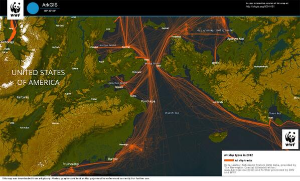
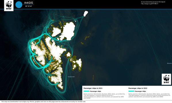
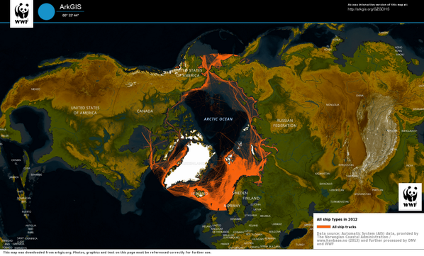
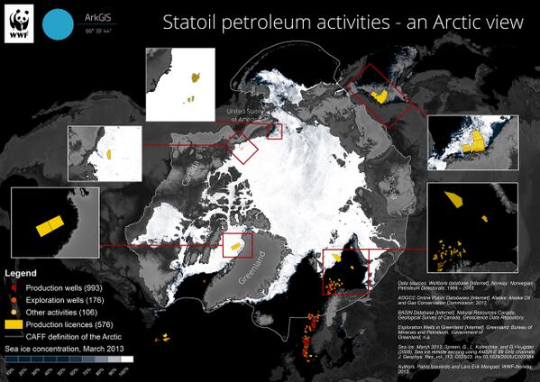
ArkGIS (Arctic Geographical Information System) is a free and interactive mapping tool that combines data about the environment and human activity in the Arctic

Norway Sumali Mart 2014
258 Sinusundan191 Mga Tagasunod
WWF ArkGIS nag-retweet
Lars Erik Mangset
Lars Erik Mangset@lemangset·
Statoil vil satse 22 mrd dollar i vanskelige prosjekter i Arktis (se kart). Finansiell risiko iflg @CarbonBubble.
Lars Erik Mangset tweet media
Norsk
0
8
3
0
WWF ArkGIS
WWF ArkGIS@WWF_ArkGIS·
Map of the day: Arctic ship traffic density in 2011 vs Arctic ship traffic density in 2012. 2011:... fb.me/12Uu8HZwU
English
0
3
0
0
WWF ArkGIS
WWF ArkGIS@WWF_ArkGIS·
Map of the day: Awarded license areas for @Shell , this map show an overview of already awarded oil and gas... fb.me/27OnBv408
English
0
1
0
0