UGRC Utah Geospatial Resource Center #utmap
1.6K posts


UGRC Utah Geospatial Resource Center #utmap
@MapUtah
The Utah Geospatial Resource Center (UGRC) provides mapping technology services to federal, state, and local governments and other organizations.
Utah, USA شامل ہوئے Şubat 2010
48 فالونگ608 فالوورز
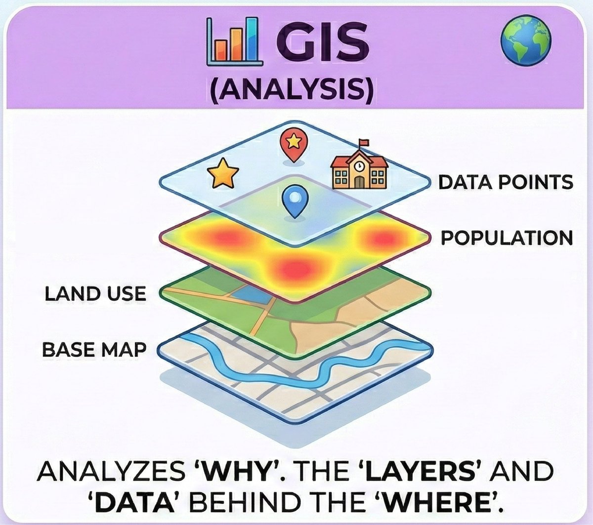
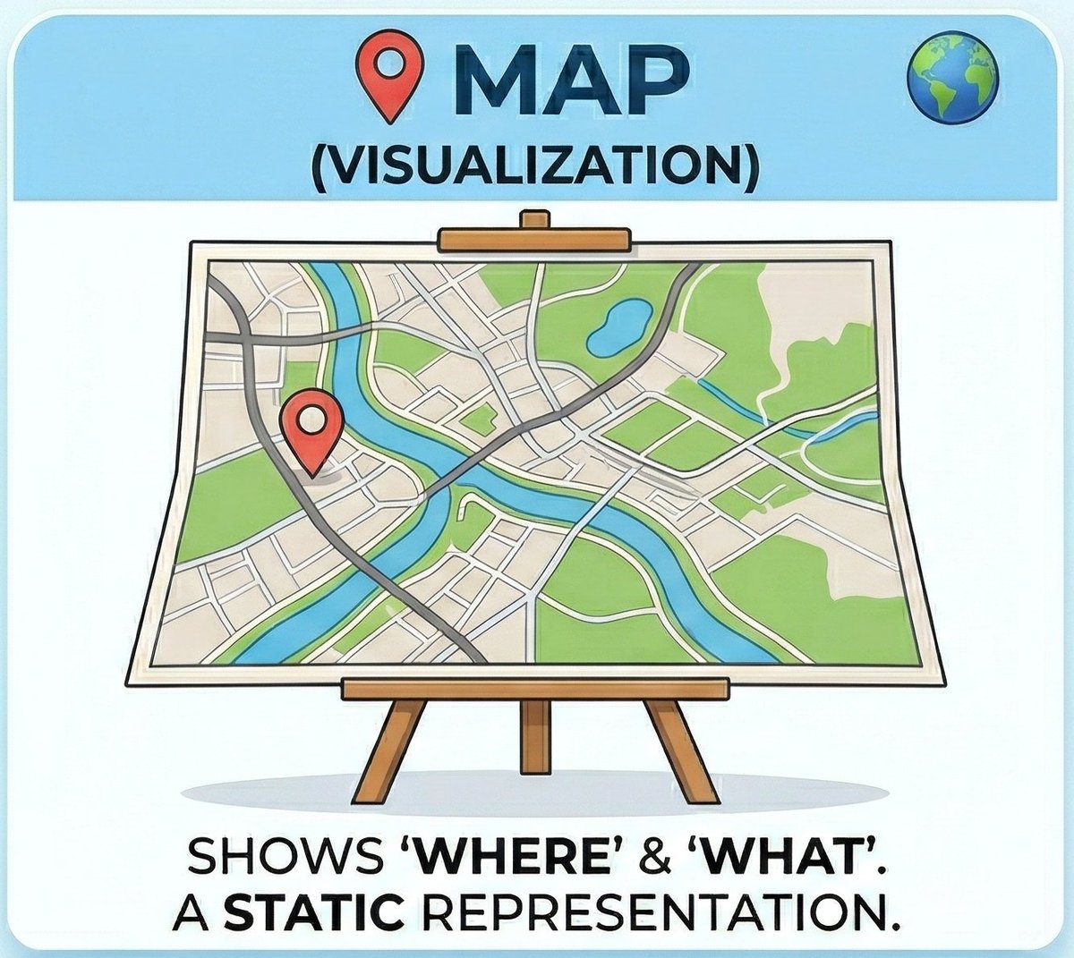
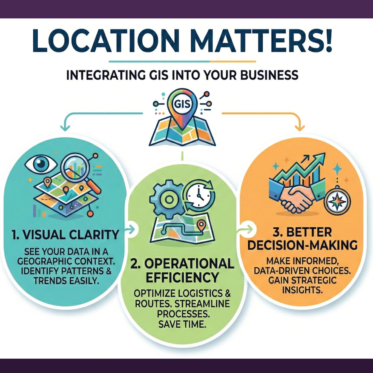
Integrating GIS into your business workflows isn't just about maps - it’s about clarity, efficiency, & better decision-making. From tracking disease outbreaks to managing municipal assets, see how UGRC helps agencies connect mission to location! gis.utah.gov/solutions/gis-…
English
🚮🗑️🚮 Deprecation Notice 🚮🗑️🚮
DistrictCombinationAreas2022 will be removed from the SGID. A new version of the data has been created that uses the new US Congressional Districts.
github.com/agrc/porter/is…
#utmap #ugrcporter
English
Hot off the press 🗞📬📰
Utah SGID Statewide Roads Data Layer Updates
ift.tt/lPY1hxE
#utmap #opendata #utahopendata #utahgis #gis #ugrc-update
English
🚮🗑️🚮 Deprecation Notice 🚮🗑️🚮
USCongressDistricts2022to2032 from SGID has been deprecated due to a recent change in US Congressional Districts.
github.com/agrc/porter/is…
#utmap #ugrcporter
English
🌱🌱The SGID is growing🌳🌳
Add USCongressDistricts2022to2026 from Utah Legislature coming soon!
github.com/agrc/porter/is…
Follow along and comment if you are interested!
#utmap #ugrcporter
English
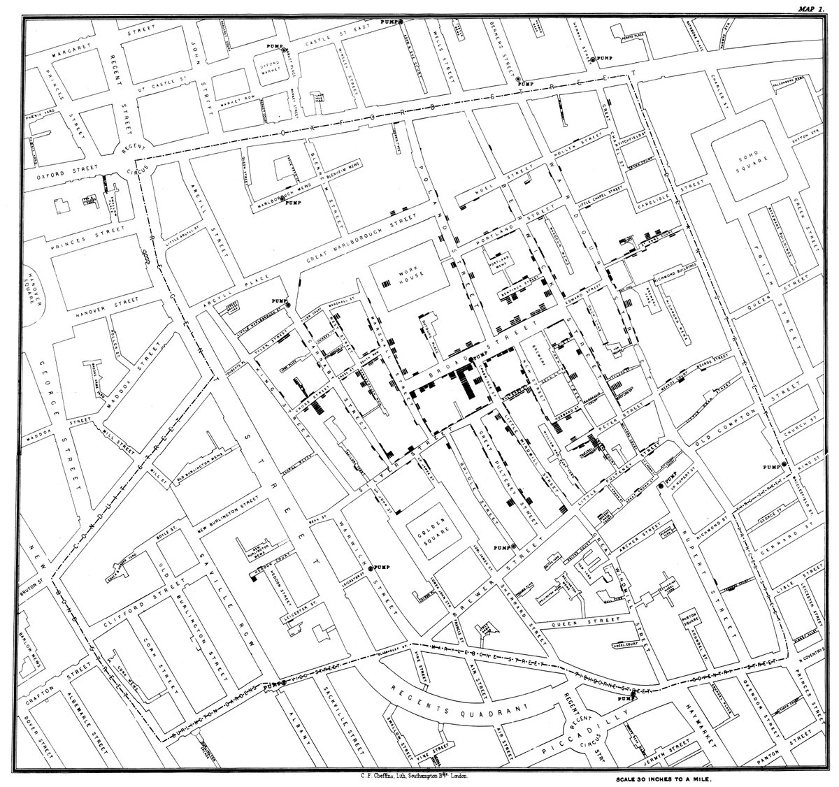
The first "Heat Map" saved London from a plague. 🔥🗺️In 1854, John Snow mapped cholera cases to find a contaminated water pump, birthing Spatial Epidemiology. Data tells a story, but location provides the context. 🌎
#GIS #Geospatial #DataScience #History
English
Hot off the press 🗞📬📰
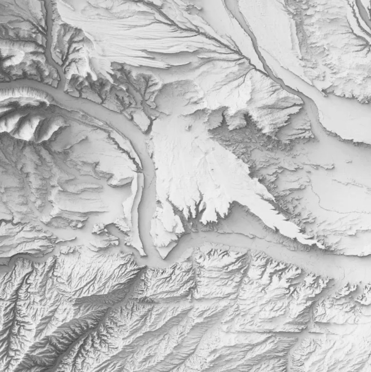
SGID Data Updates: New 10m DEMs
ift.tt/Pvgm9RG
#utmap #opendata #utahopendata #utahgis #gis #ugrc-update
English
🌱🌱The SGID is growing🌳🌳
Updated combination of political districts in Utah coming soon!
github.com/agrc/porter/is…
Follow along and comment if you are interested!
#utmap #ugrcporter
English
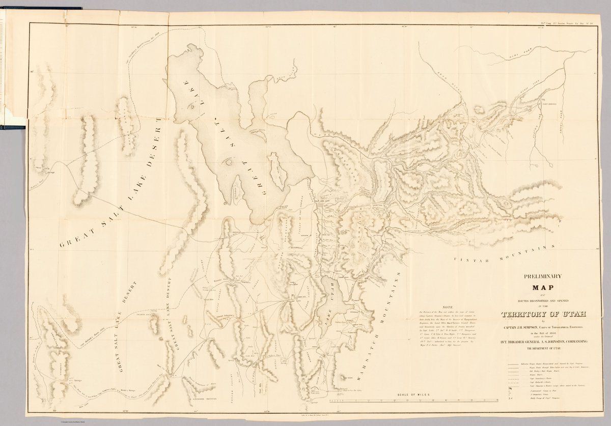
Ready for a trip through time? Let's dive into this 1858 "Preliminary Map of Routes Reconnoitred & Opened in the Territory of Utah"! This isn't just an old map; it's a window into a pivotal moment in American history, born out of the "Utah War" & the drive to conquer the West.
English
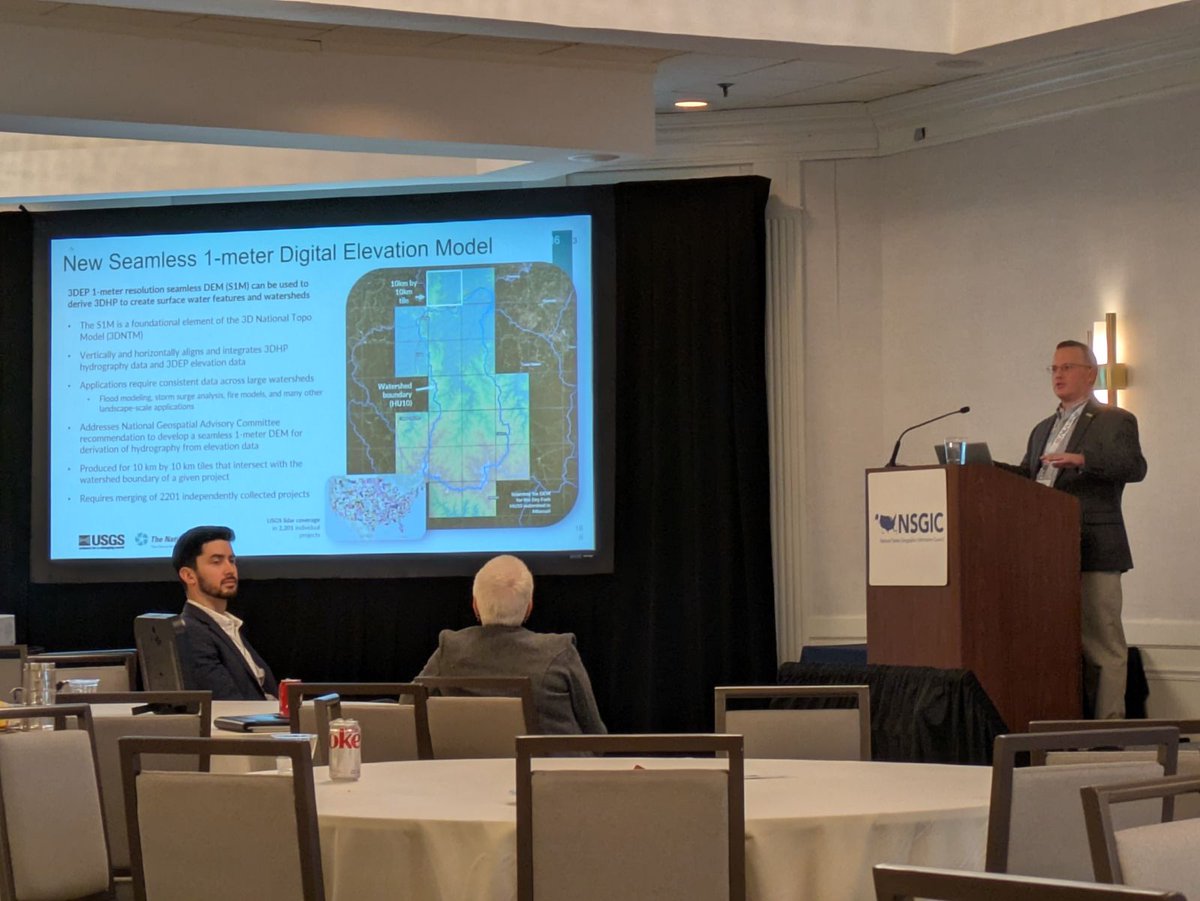
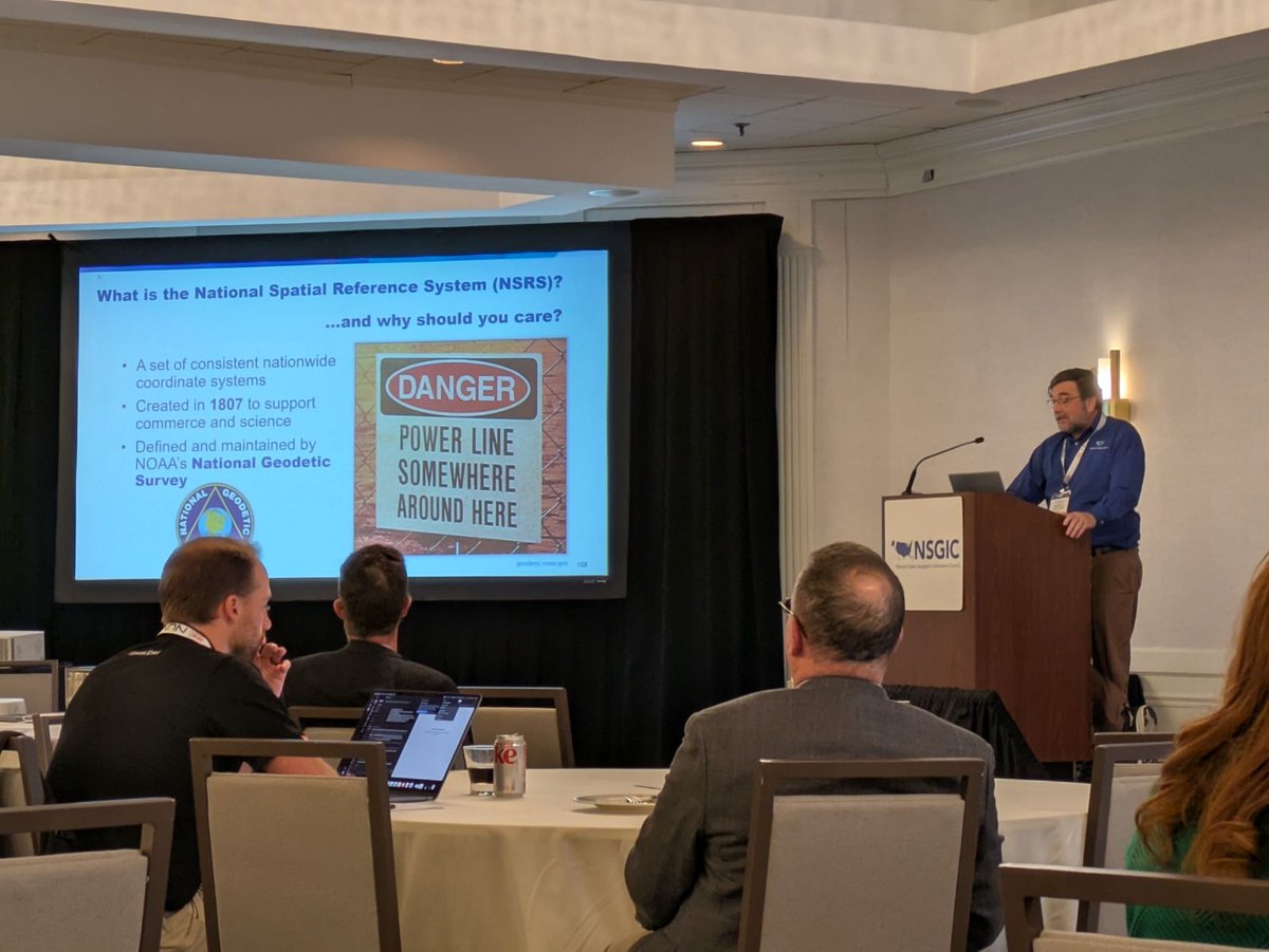
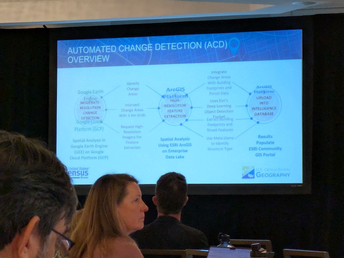
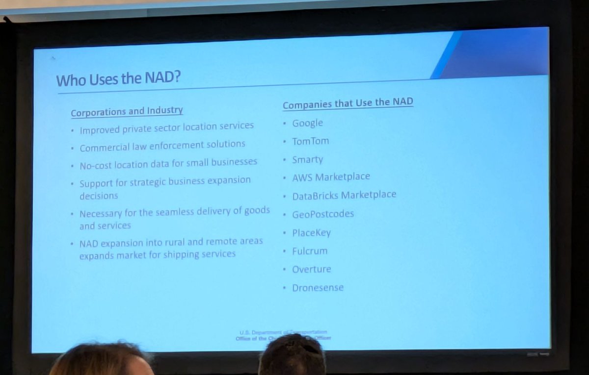
Wednesday was Federal Day at the NSGIC conference! States are hearing updates from federal agencies on National Address Database, Census programs, National Spatial Reference System modernization, and the 3D National Topography Model.
#NSGIC #ugrc #gis #mapping #conference
English
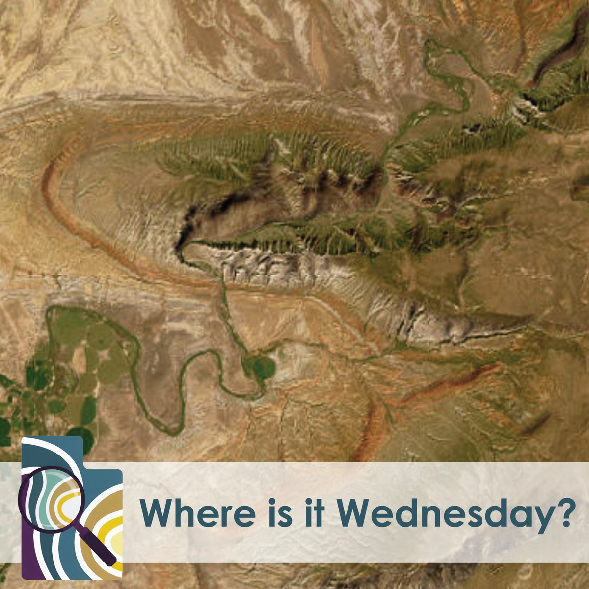
🦖Speaking of Dinosaurs, who knows what National Monument this is? The answer to last week’s WIIW is Red Fleet State Park!
#whereisitwednesday #utah #gis #ugrc #aerialimagery
English
How do surveyors and crews get centimeter-level accuracy? The secret is the CORS Network. The backbone of modern high-precision GPS, CORS is key for smarter data in mapping, ag, and construction. Learn more about how it works here: 👇 globalgpssystems.com/gnss/cors-refe…
#GPS #Surveying

English
From tracking migrations to mapping biodiversity hotspots, spatial data turns reactive measures into proactive protection.
@UtahDWR 's Wildlife Tracker uses real-time data from 10k+ animals to prevent collisions & build safer crossings. 🦌🛣️
See it here: wildlifemigration.utah.gov/stories/wildli…

English
🌱🌱The SGID is growing🌳🌳
Utah Petroleum Storage Tank Compartments from DEQ AGOL coming soon!
github.com/agrc/porter/is…
Follow along and comment if you are interested!
#utmap #ugrcporter
English
🌱🌱The SGID is growing🌳🌳
Utah Petroleum Storage Tank Releases from DEQ AGOL coming soon!
github.com/agrc/porter/is…
Follow along and comment if you are interested!
#utmap #ugrcporter
English
🌱🌱The SGID is growing🌳🌳
Utah Petroleum Storage Tanks from DEQ AGOL coming soon!
github.com/agrc/porter/is…
Follow along and comment if you are interested!
#utmap #ugrcporter
English
🚮🗑️🚮 Deprecation Notice 🚮🗑️🚮
With the new broadband service areas layer, the broadband data in UBBMAP and FiberVerification are no longer being updated/treated as authoritative.
github.com/agrc/porter/is…
#utmap #ugrcporter
English