
Windy.com

10.6K posts

Windy.com banner
Windy.com

Windy.com

@Windycom

🛰️🌎 Windy is an extraordinary tool for #weather #forecast visualization. It's fast, intuitive, detailed & most accurate #app trusted by #professionals

Prague شامل ہوئے Kasım 2014
2.9K فالونگ72.9K فالوورز
پن کیا گیا ٹویٹ
Windy.com
Windy.com@Windycom·
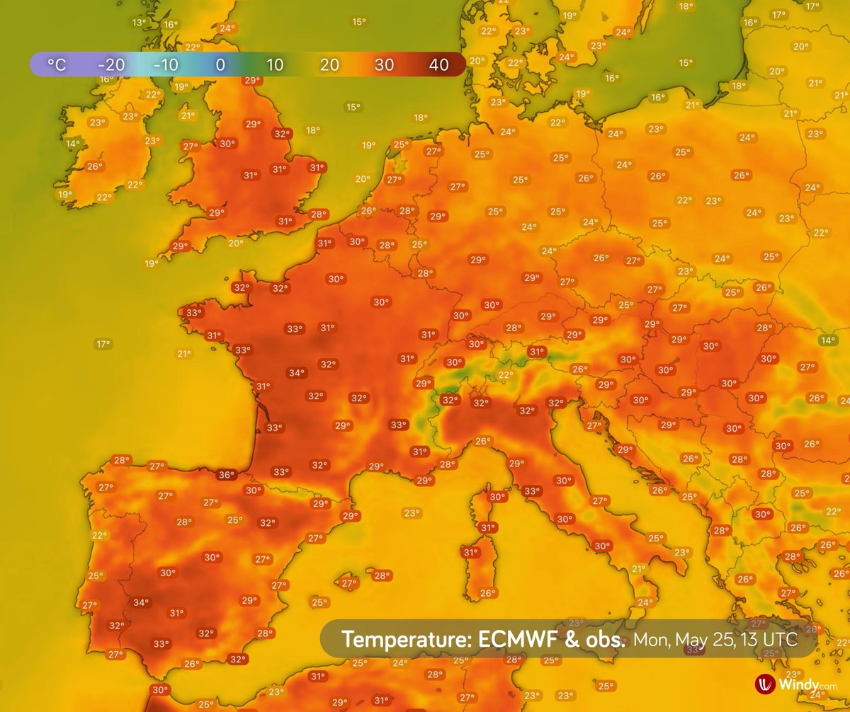
🌡️ Exceptional May heatwave continues in Europe Southwestern and Western Europe, as well as parts of Central Europe, are experiencing very high temperatures. In many places, temperatures have been climbing well above 30 °C for several days. The cause is a large area of high pressure, a so-called “heat dome,” which extends across much of Europe and keeps hot air trapped beneath it. On Sunday, for example, the following temperatures were recorded: 🇪🇸 Spain: 38.1 °C — Montoro, Córdoba 🇵🇹 Portugal: 34.2 °C — Amareleja, Beja 🇫🇷 France: 35.9 °C — Pruniers, Centre-Val de Loire 🇬🇧 United Kingdom: 32.8 °C — Teddington Bushy Park, London 🇩🇪 Germany: 33.2 °C — Regensburg, Bavaria Very warm weather will continue in many places over the coming days. In Central Europe, the heat will temporarily ease on Wednesday as a weak cold front moves southward across the region.
Windy.com tweet media
English
7
18
96
6.6K
Windy.com
Windy.com@Windycom·
🌡️ Unusually intense May heatwave in Europe This weekend will bring very high temperatures to southwestern, western, and partly central Europe, locally up to 15 °C above the long-term average. The reason is a persistent high-pressure system over Europe, drawing in hot air from North Africa along its western flank and acting as a so-called heat dome. Air in the center of the high sinks and warms, suppressing cloud formation and allowing more solar radiation to reach the surface. As a result, hot air accumulates near the ground and continues to intensify. Temperatures may exceed 30 °C in western and central Europe, and reach up to 38 °C in southwestern Spain. Numerous daily temperature records are expected to be broken.
English
4
61
187
12.2K
Windy.com
Windy.com@Windycom·
🌡️ Could southern England see its first heatwave of the season? A blocking high over western Europe will bring warmer air northwards over the British Isles in the coming days. From Friday, temperatures in southern England could locally reach up to 30 °C. While 30 °C in May is unusual, it’s not unprecedented. So, will it officially count as a heatwave? 🤔 For now, it’s still too early to tell. It depends on whether temperatures exceed regional thresholds (typically 25–28 °C in the UK) for at least three consecutive days.
Windy.com tweet media
English
0
3
33
3.3K
Windy.com
Windy.com@Windycom·
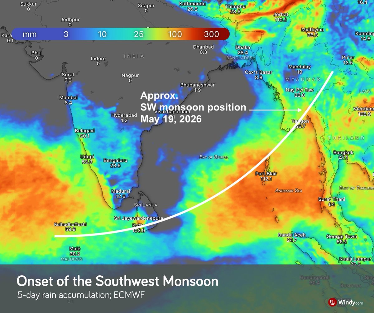
🌧️ Strong southwest monsoon over the Andaman Sea, Thailand, southern Myanmar, and the Gulf of Thailand According to the India Meteorological Department, the southwest monsoon has advanced over southern Sri Lanka, the Andaman and Nicobar Islands, Thailand, and southern Myanmar. In the coming days, it is expected to bring very heavy rainfall, especially over the islands in the Bay of Bengal and along its eastern coast, particularly across Thailand and southern Myanmar. Relatively strong winds are generating waves of 2–3 meters in the upper Andaman Sea, potentially exceeding 3 meters in thundershowers. ⚠️
Windy.com tweet mediaWindy.com tweet media
English
4
19
204
19.4K
Windy.com
Windy.com@Windycom·
🌪️ A significant severe weather outbreak continues across the central USA Numerous severe storms are expected this afternoon and evening across the southern central Plains and the Missouri Valley. Supercells capable of producing very large to giant hail (2”–4”+), damaging winds, and tornadoes, some potentially strong (EF2/EF3+), are most likely over central Kansas and southeast Nebraska, extending into Iowa and northwest Missouri. ⚠️ According to the NOAA Storm Prediction Center, the tornado threat is higher this afternoon and evening compared to yesterday. ⚠️ Intense rainfall associated with thunderstorms may trigger flash flooding. Tomorrow, storm activity will shift farther south and east, bringing showers and thunderstorms to the Great Lakes, and later to the Ohio Valley and the Mid-South. Stronger storms are expected from eastern Texas into the lower Mississippi Valley. On Wednesday, more significant thunderstorm activity should be confined mainly to Texas.
English
0
2
34
2.3K
Windy.com
Windy.com@Windycom·
🌀 Von Kármán vortex streets: a fascinating pattern in the atmosphere These striking cloud formations appear when airflow passes around an isolated obstacle, such as an island or mountain peak, in a stable atmosphere with sufficiently strong, uniform winds. Downstream of the obstacle, vortices are shed alternately, creating a regular chain of counter-rotating structures. These vortices are then advected by the flow and gradually dissipate as they move into the wake. A remarkable example of atmospheric dynamics visible from space. 🛰️
English
0
17
74
2.8K
Windy.com
Windy.com@Windycom·
⛈️ Cold Arctic air is pouring into western and central Europe With this influx, numerous showers are developing across the region, locally accompanied by lightning.
Windy.com tweet media
English
0
3
43
2.6K
Windy.com
Windy.com@Windycom·
🌡️ Up to 45 °C in northern India Temperatures in northern India are rising to as high as 45 °C, and several-day heat waves, locally severe, are expected this week across parts of northwest, western, and central India. India Meteorological Department (IMD) has issued a warning for severe heat wave conditions over parts of western Rajasthan. ⚠️ View current and forecast temperatures on Windy.com, including station observations from the past 10 days.
Windy.com tweet mediaWindy.com tweet media
English
1
11
107
7.5K
Windy.com
Windy.com@Windycom·
🏔️ Return of winter to the Alps ❄️ Cooler weather is set to bring snow back to the Alps, even outside the highest peaks. A cold front arriving during the night into Tuesday will allow colder air to spread southward across the region. On the northern side of the Alps, the snow line may temporarily drop from around 2400 m on Monday to below 1500 m above sea level, while on the southern side it should mostly remain above 1800 m. Locally, more than 20 cm of fresh snow may accumulate. The southern Alps are also expected to experience a strong northerly foehn on Tuesday. Another round of snowfall is likely on Thursday and Friday, driven by a frontal system and a low-pressure area. Especially in the northwestern Alps, the snow line may once again locally fall below 1500 m. By Saturday, snowfall totals could reach 10–30 cm, with locally 50–70 cm in higher elevations.
Windy.com tweet mediaWindy.com tweet mediaWindy.com tweet media
English
0
7
51
3.4K
Windy.com
Windy.com@Windycom·
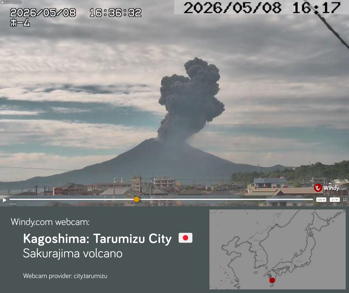
🌋A significant eruption occurred on Friday, May 8, at Sakurajima in Japan. Sakurajima, located within the Aira caldera on the island of Kyushu, is one of the most active volcanoes in Japan. The ash plume rose approximately 3.5 km above the crater, while volcanic ash drifted toward the southeast. ⚠️ Japan’s Meteorological Agency keeps Sakurajima at Alert Level 3, meaning people should not approach the volcano.
Windy.com tweet media
English
2
6
36
2.4K
Windy.com
Windy.com@Windycom·
🌀 Tropical Storm Hagupit Tropical Storm Hagupit has been developing near the Caroline Islands in the western Pacific since Wednesday. Due to moderate wind shear and the intrusion of dry air, the system still lacks a well-consolidated structure. As of Thursday, May 7 at 09 UTC (according to the JTWC): • Location: approximately 570 km southeast of Yap Island • Intensity: maximum sustained winds of 64 km/h, with gusts up to 80 km/h • Movement: moving west to west-northwest at around 15 km/h The system is expected to continue moving generally west to west-northwest through Sunday. Around 12 UTC on Friday, it will begin approaching Yap Island. Hagupit is expected to strengthen gradually today, but from Friday through Sunday, sustained winds are not expected to exceed 75 km/h significantly. Forecast uncertainty increases early next week, but the Joint Typhoon Warning Center currently favors a more northward turn that would likely keep Hagupit from making a direct impact on the Philippines. Hazards for Yap Island: • sustained winds up to 75 km/h, with gusts up to 90 km/h • 80–120 mm of rainfall possible during Friday and Saturday, locally up to 150 mm • high surf and storm surge, with waves possibly reaching 4 meters along the northwestern coast ⚠️ Please follow official weather warnings.
English
1
2
24
2.1K
Windy.com
Windy.com@Windycom·
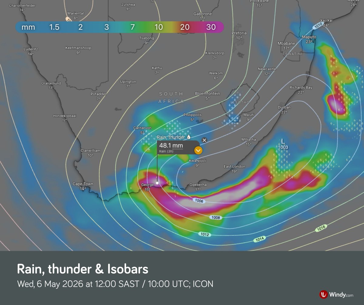
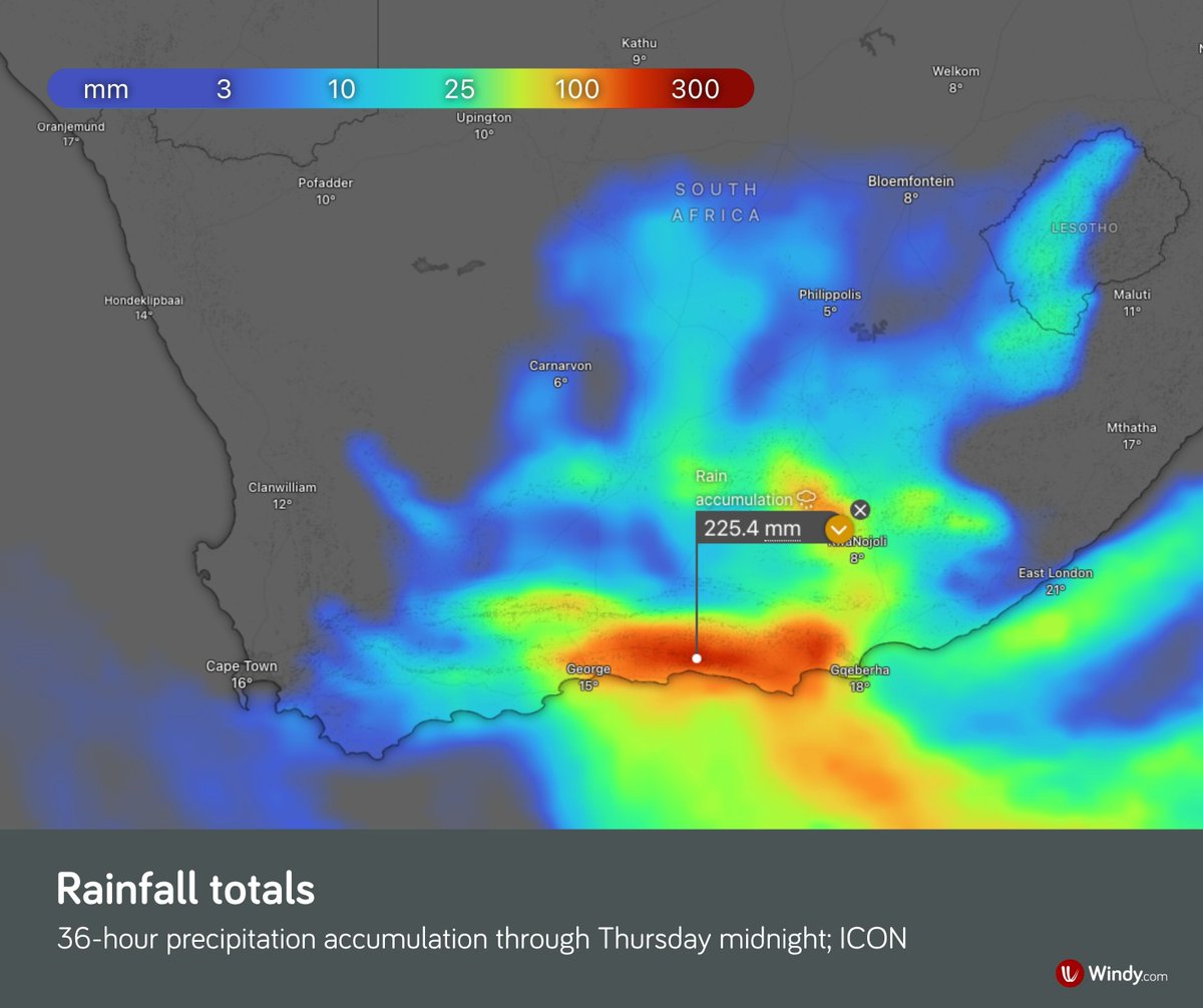
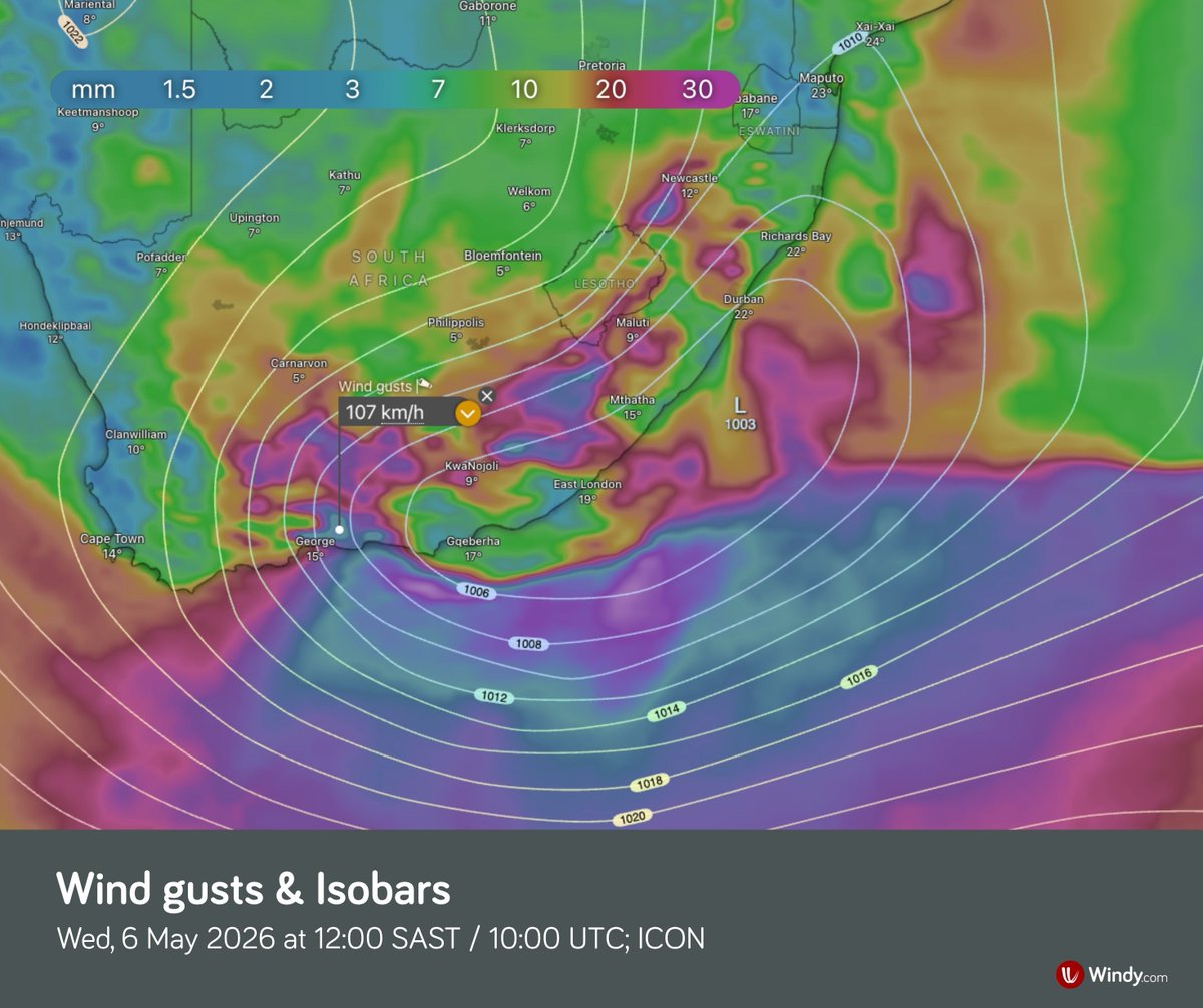
🌧️ Heavy rainfall hits southern Africa A slow-moving low-pressure system over southeastern South Africa is bringing torrential rain to the region. According to the ICON model, some areas could receive up to 300 mm by Thursday evening, roughly one-third of the local average annual rainfall. The most intense rainfall is expected on Wednesday, with conditions gradually easing on Thursday. Main hazards include: • widespread flooding of roads and populated areas • mudslides, rockfalls, and soil erosion ⚠️ Please follow official forecasts.
Windy.com tweet mediaWindy.com tweet mediaWindy.com tweet mediaWindy.com tweet media
English
0
5
42
3.4K
Windy.com
Windy.com@Windycom·
🌀 Tropical system developing in the western Pacific Tropical system 93W, located about 450 km west of Chuuk in the Federated States of Micronesia as of 12 UTC, could intensify into a significant tropical cyclone within the next few hours. Conditions remain very favorable for further strengthening, including: • sea surface temperatures of 29–30 °C • good upper-level outflow • low vertical wind shear Forecast models suggest the system will move westward over the coming days and could approach the Philippines by the end of this week. ⚠️ Please follow official weather forecasts.
English
1
7
34
2.3K
Windy.com
Windy.com@Windycom·
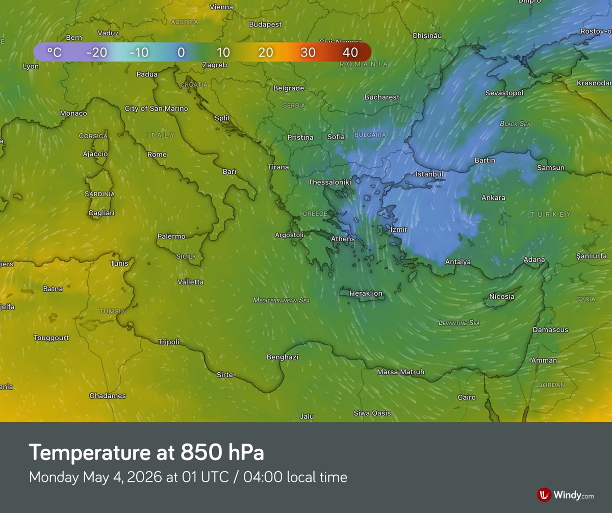
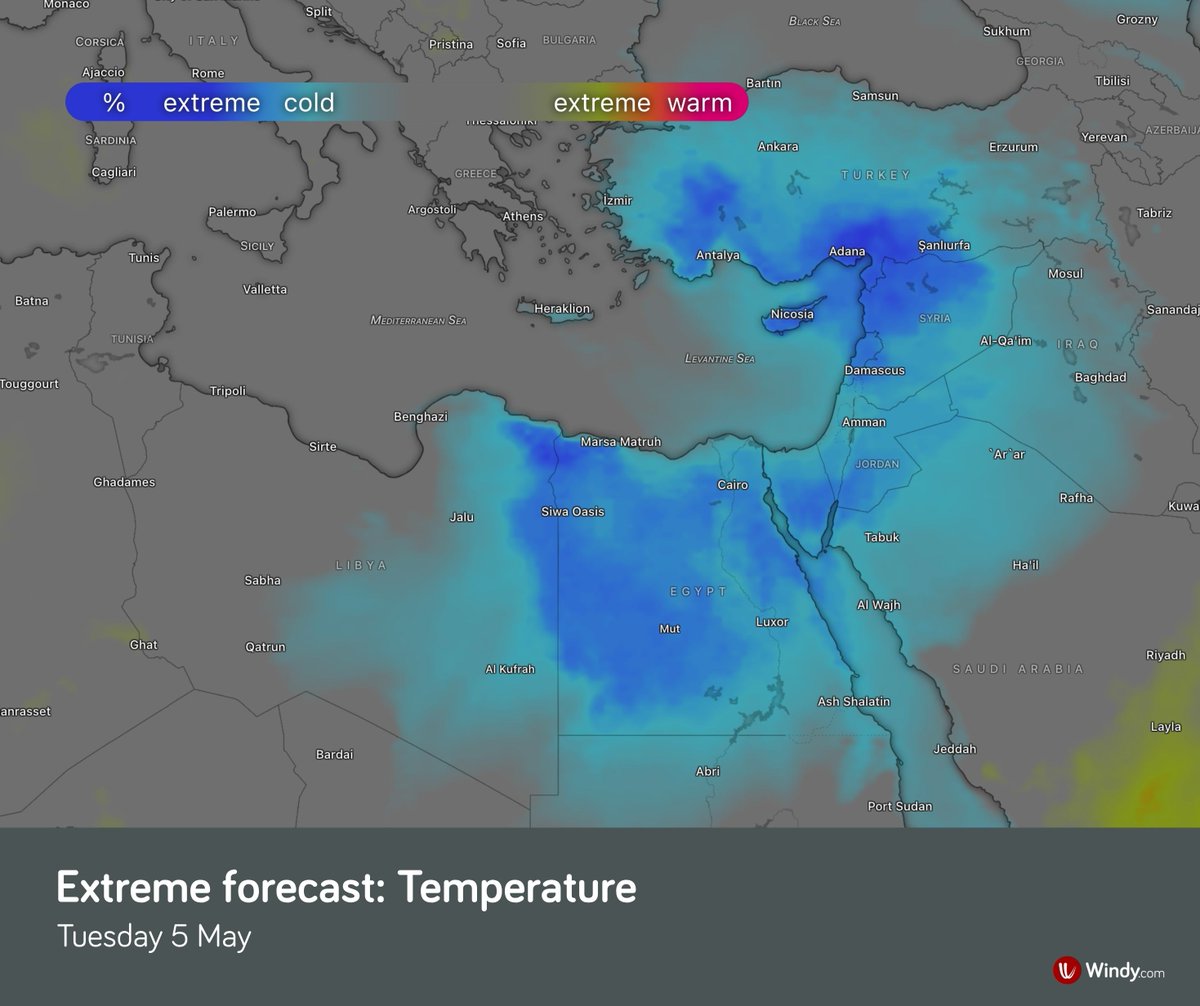
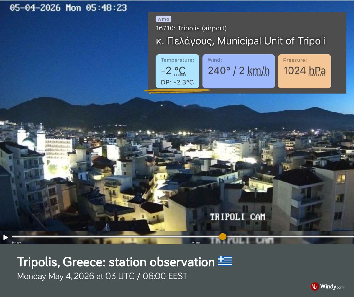
🥶 Unusually cold weather in the Eastern Mediterranean A notable cold spell has been affecting southeastern Europe, Turkey, Syria, Lebanon, Israel, Jordan, and Egypt, with temperatures as much as 15 °C below normal for early May. Monday morning was exceptionally cold in Greece, with frost occurring locally despite the season, and Tripoli dropped to −2.0 °C. Snow also fell overnight in parts of Turkey above 800 m. The cold spell is already easing in Greece, but it will continue in Turkey through Wednesday and in parts of the Middle East until Friday. 💨 Strong gusty winds are also affecting the eastern Mediterranean, with gusts reaching up to 80 km/h, though winds should gradually weaken tomorrow.
Windy.com tweet mediaWindy.com tweet mediaWindy.com tweet mediaWindy.com tweet media
English
2
16
110
8.9K
Windy.com
Windy.com@Windycom·
🌋 Mount Etna, Europe’s highest active volcano, remains snow-covered 🇮🇹 Despite afternoon temperatures rising above 20°C across Sicily and exceeding 25°C in the south, several meters of snow still cover Mount Etna even in late April. In some places, snowdrifts reach up to 6 meters. The exceptional snowpack was built up by heavy snowfall during the winter months of early 2026, particularly during Cyclone Harry’s passage across Sicily around January 20. Snowmelt is expected to slow over the weekend as summit temperatures stay mostly below freezing, possibly allowing a little fresh snowfall, according to the Meteoblue forecast model.
English
0
7
32
2.6K
Windy.com
Windy.com@Windycom·
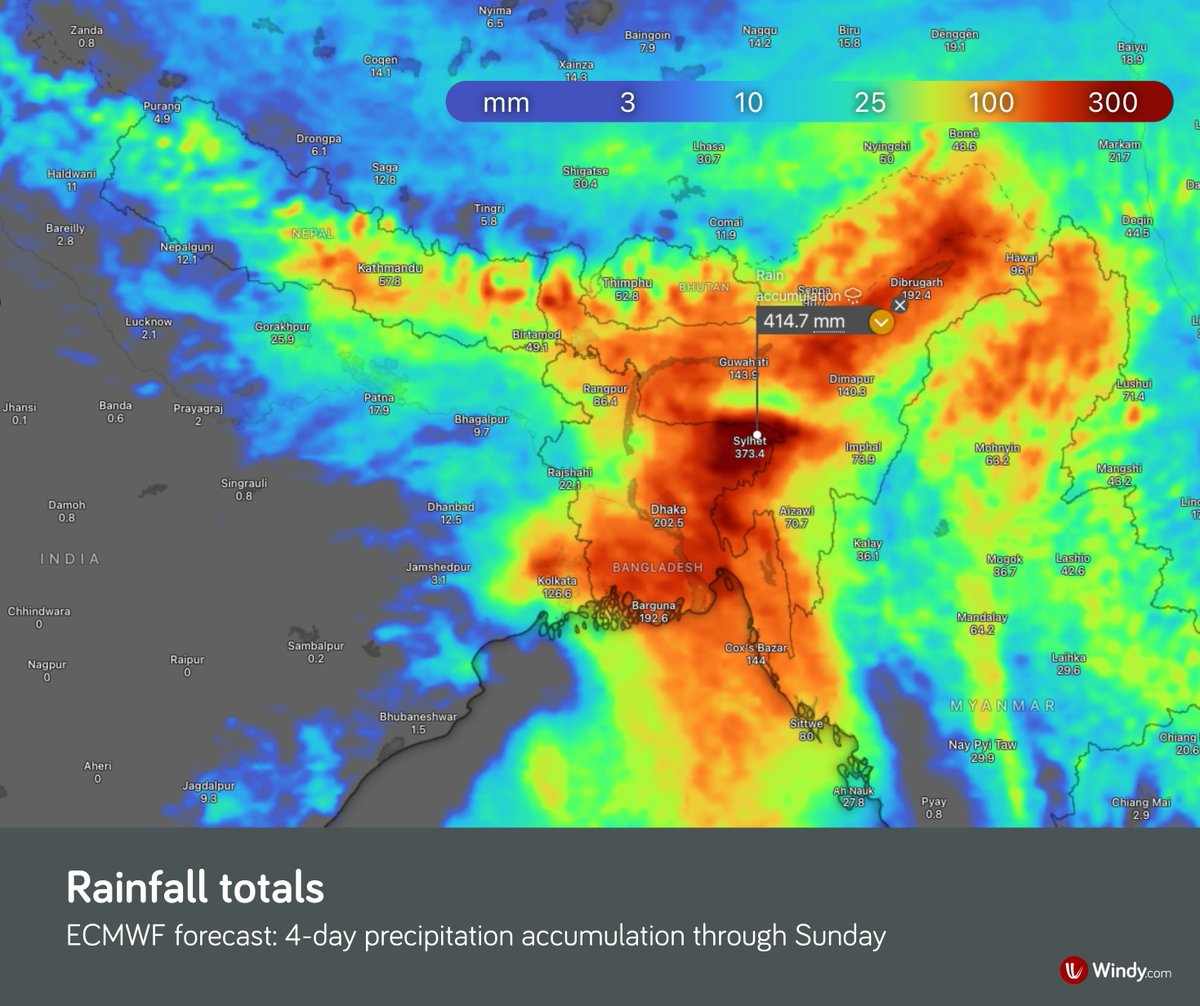
⛈️ Heavy rainfall expected in parts of South Asia Heavy rainfall is expected in Bangladesh, parts of northeastern India, Bhutan, and Nepal over the coming days. High precipitation totals will persist until the beginning of next week. The heaviest rainfall is expected in eastern Bangladesh, where more than 300 mm of rain may fall locally by the end of the week, according to the ECMWF model. ⚠️ Rising river levels and flood risk expected. 🇧🇩 Flooding is relatively frequent in Bangladesh. The country is very low-lying and located within one of the world’s largest river deltas. The confluence of three major rivers – the Ganges (Padma), the Brahmaputra (Jamuna), and the Meghna – contributes to frequent, often extensive flooding.
Windy.com tweet mediaWindy.com tweet mediaWindy.com tweet media
English
3
27
201
13.5K
Windy.com
Windy.com@Windycom·
🌪️ Severe thunderstorms and tornado risk in the Mid-South, Ohio Valley, Texas, and Oklahoma A strong cold front is driving severe thunderstorms across the southeastern United States. Storms in eastern Arkansas, Missouri, Alabama, Georgia, South Carolina, and Tennessee may become very intense, bringing: • possible tornadoes • widespread damaging wind gusts up to 70 mph • hail up to 1.5 inches Severe storms are also developing across southern Oklahoma and western to northern Texas, where very large hail up to 3 inches and damaging winds are possible. 📈 The 2026 tornado season remains slightly above average: 538 tornadoes have been recorded so far this year (about 90 above the long-term average). Source: NWS SPC
English
0
1
10
2.3K
Windy.com
Windy.com@Windycom·
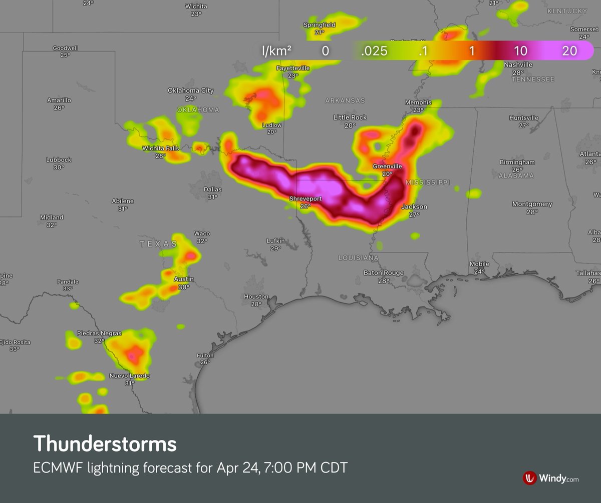
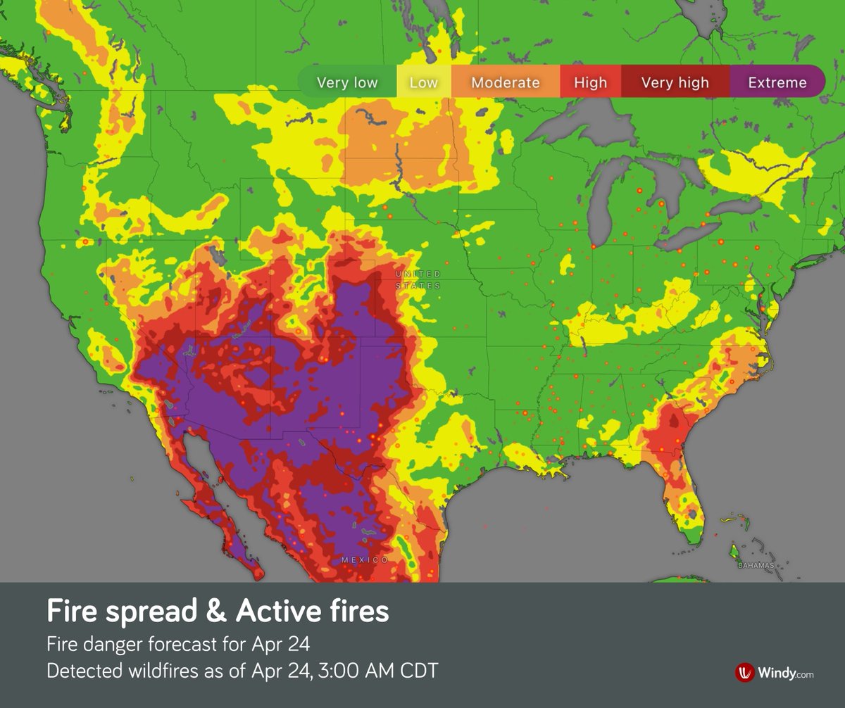
⚠️ Several Days of Severe Weather in the U.S.: Thunderstorms and Wildfires ⛈️ An active spring pattern will bring several rounds of strong thunderstorms across the central U.S. in the coming days. Greatest risk: southern Plains → Mississippi Valley (eastern Kansas to Alabama) Additional heavy rain: Iowa → Upper Michigan Main threats: • strong wind gusts • heavy rain (locally > 3 in) → flash flooding (with repeated storms) • large hail • isolated tornadoes 🔥 At the same time, dry and breezy conditions with dry fuels are supporting wildfire activity across the western High Plains and the Southeast. Critical fire weather is expected, especially in eastern Colorado on Friday, due to gusty winds, very low humidity, and ongoing drought. Stay up to date with official forecasts and warnings.
Windy.com tweet mediaWindy.com tweet mediaWindy.com tweet mediaWindy.com tweet media
English
0
3
16
2.1K
Windy.com ری ٹویٹ کیا
Aigle
Aigle@Aigle_e·
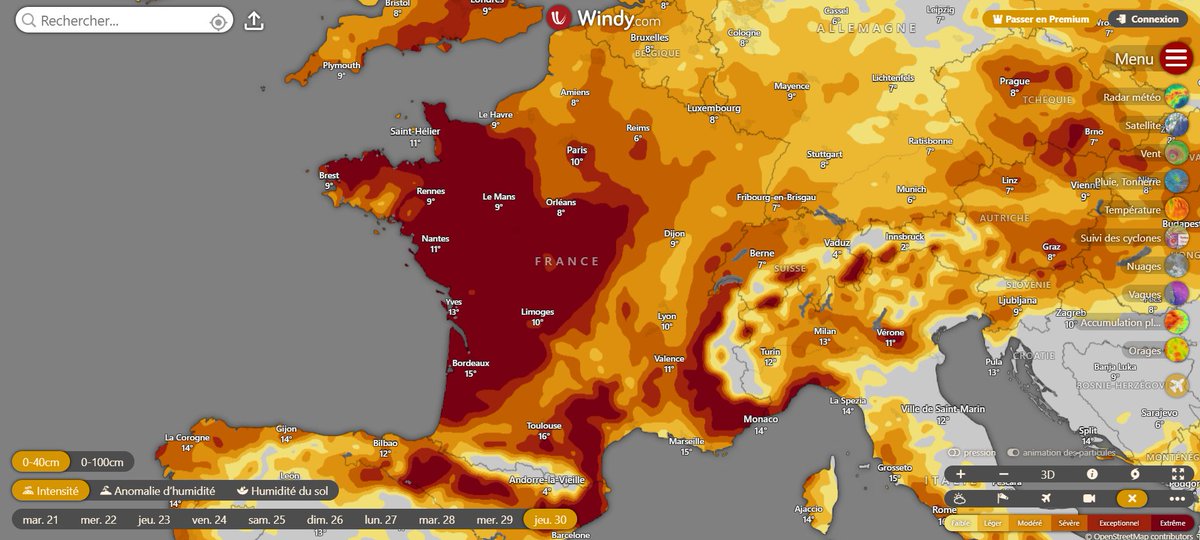
🌾La sécheresse météorologique s'intensifie et se transforme peu à peu en sécheresse agricole. D'ici le milieu de la semaine prochaine, fortes chaleurs et #bise pourraient accélérer la perte de teneur en eau du sol, basculant dans une intensité #extrême sur l'ouest🇫🇷 @Windycom
Aigle tweet media
Français
0
5
41
3K
Windy.com
Windy.com@Windycom·
Elevated fire danger will persist across the Southern High Plains and northern Mexico.
English
0
0
1
996
Windy.com
Windy.com@Windycom·
Wednesday: High Plains, Southwest US & northern Mexico Conditions will deteriorate across the central and southern High Plains. SW winds ~25 mph (gusty), RH <10% → critical conditions across eastern WY & CO, extending into NE NM and the TX/OK panhandle.
English
1
0
1
1.2K
Windy.com
Windy.com@Windycom·
🔥 USA & Mexico: Fire risk is increasing across Florida, the High Plains, and northern Mexico. Monitor the situation closely – conditions may change rapidly.
English
1
4
25
2.2K