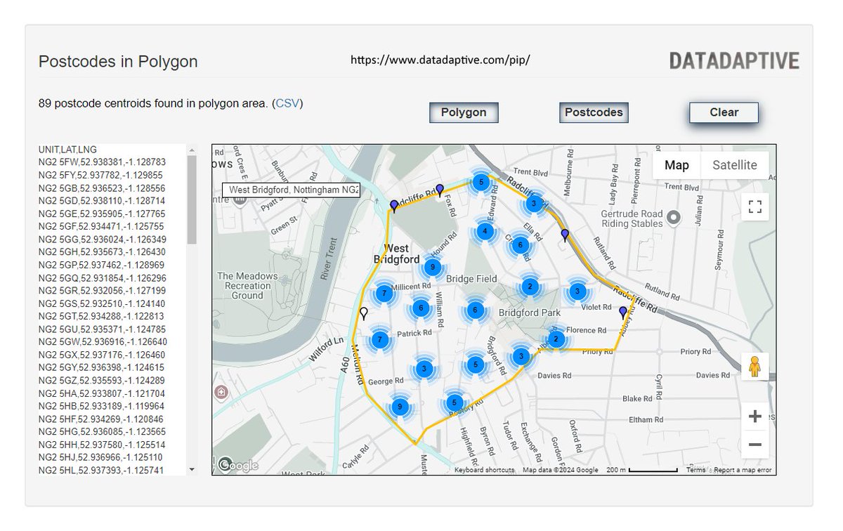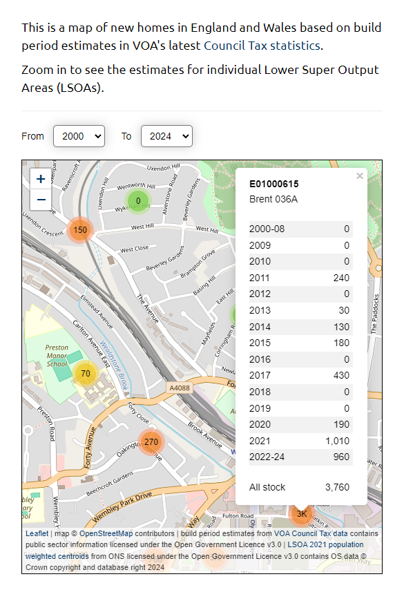

Postcodes in Polygon: an #opendata tool from @datadaptive – draw a shape on a map, get a list of postcodes datadaptive.com/pip/ (Great Britain only)
Now updated with postcode data from the latest release of the ONS Postcode Directory (February 2026)

English