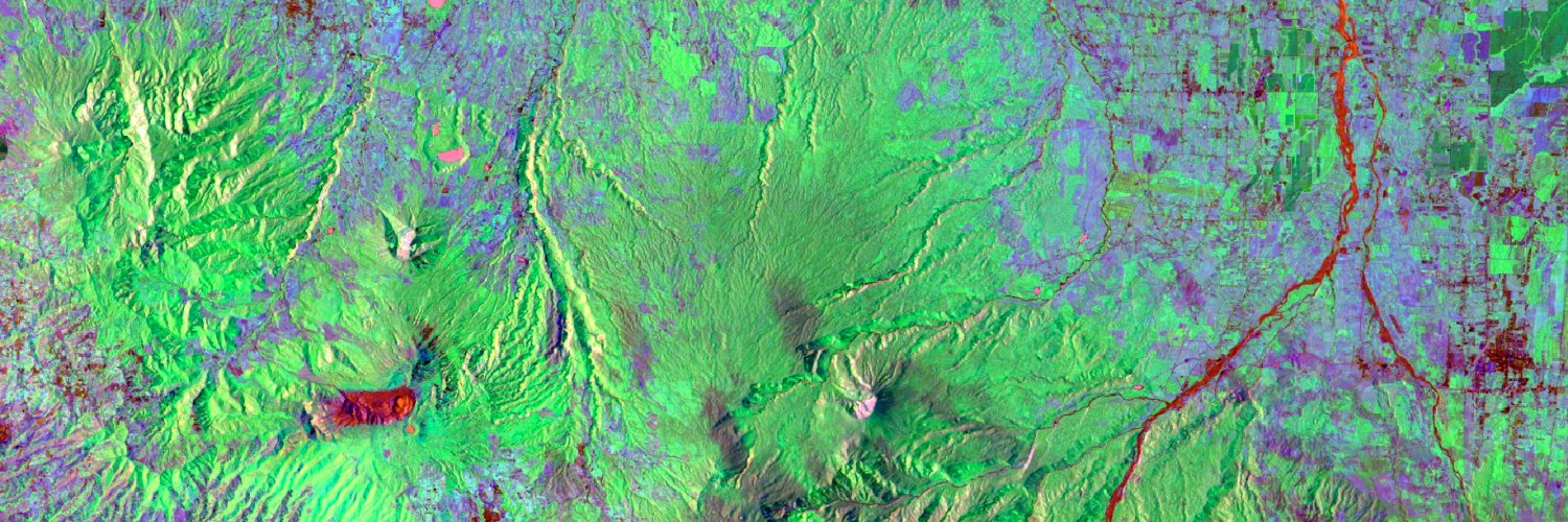
Cristian Aguilar-Barboza
399 posts


#EMSR726 #Wildfires in #Belize 🇧🇿 Overnight, our #MappingTeam delivered the 2nd Delineation Monitoring Product for the Douglas da Silva AoI As of 27 May, at 15:47 UTC ➡️Over 13,900 ha of burnt area has been detected, mostly in forest areas 🔥 🔗rapidmapping.emergency.copernicus.eu/EMSR726/report…

🗺️@Meta, @WorldResources & @landcarbonlab have launched the first #AI-powered, 1-meter resolution global map of tree canopy height🌳 The model & data are made free & available to advance open source monitoring & improve our ability to adapt to #climatechange. More info👉bit.ly/4bav33Y

After just 1 weekend at #JóvenesGeoespaciales, 45 students from el salvador are already applying @NASA data to develop prototypes for #climateresilience, from creating maps for monitoring crop health to creating tools for tracking wildfires.

45 students from #ElSalvador have kicked off their #geospatial journey! 🛰️🇸🇻 We're at the #JóvenesGeoespaciales workshop led by our partners at RAC and @IICAnoticias. Check out their unique approach to connect women & youth with geospatial technology: bit.ly/3U5Zd2R

Read about our work with @sinac_cr & local organizations in Costa Rica 🇨🇷 using radar (#SAR) to see forests and land through the clouds ☁️ servirglobal.net/news/cloudy-da…

Un centenar de mujeres vinculadas al sector agroalimentario y provenientes de zonas rurales de Costa Rica potenciaron sus habilidades en tecnologías digitales y geoespaciales en la sede del IICA. 📰👉:iica.int/es/prensa/noti…


Check our web application to visualize and explore at the country level the datasets created across all the tropics "Spatial and Temporal Availability of Cloud-free Optical Observations in the Tropics to Monitor Deforestation" 👇 africa-uah.users.earthengine.app/view/spatialte… nature.com/articles/s4159…


