Post

Mike Mostwill
Mike Mostwill@MikeMostwill·
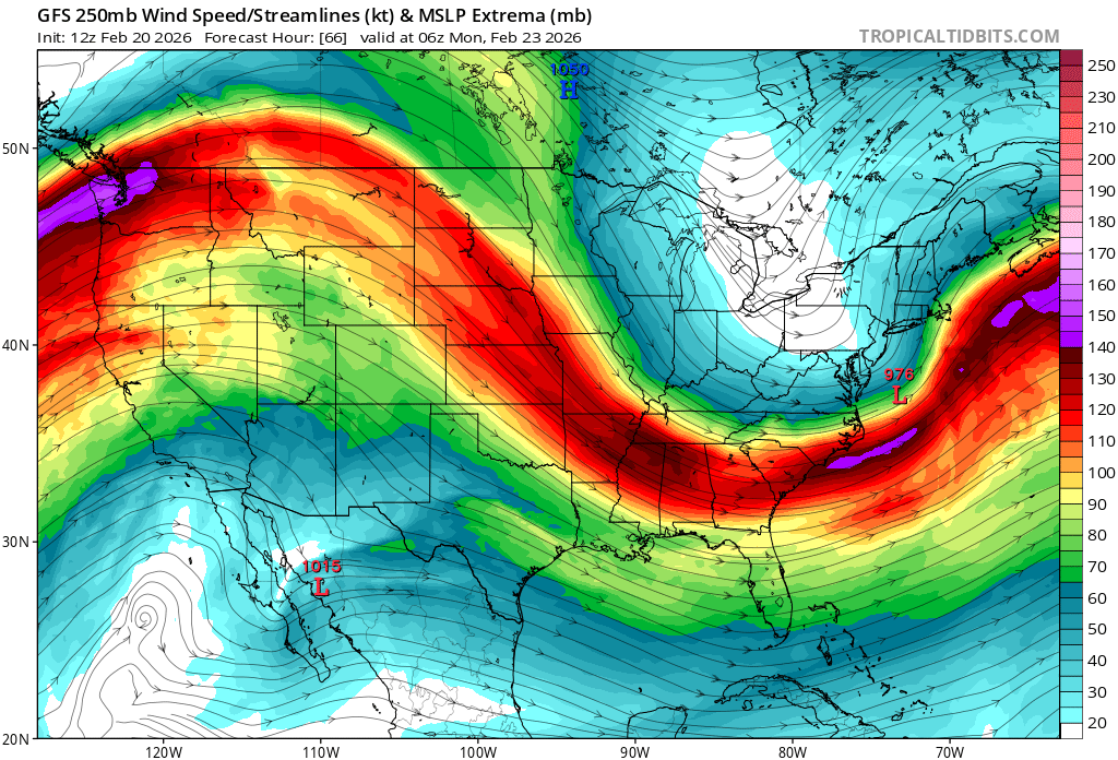
This will now likely be an impactful storm system region wide featuring mod-hvy snow, coastal flooding & power outages w/the highest impacts still focused on the N-Mid-Atl, LI into extreme SNE, with room for this axis to adjust further NW. There are two primary reasons for this:
Mike Mostwill@MikeMostwill

Haven't had much time to dig into this one. Mid-Atlantic seems to be in a favorable spot to see heavy snow from this system. Our region is still TBD, though recent trends favor some flavor of an impactful storm. We'll see how it's looking tomorrow!

English
1
1
3
1.8K
Mike Mostwill
Mike Mostwill@MikeMostwill·
1) Moving up in time on NWP, the Pacific ULL has remained robust & has retrograded=Constructively interfering & engendering a notably amplified W-US Ridge. 2) Today's departing NE storm is moving out quicker, giving room for significant EC height rises. (increased wave spacing)
GIF
GIF
English
1
0
2
290
Mike Mostwill
Mike Mostwill@MikeMostwill·
The GFS doesn't often win many prizes, but in terms of catching onto the synoptics, it has done an admirable job here. I suspect this is partially due to its propensity to be more progressive w/northern stream branches than its counterparts, which are still catching up IMO.
GIF
English
1
0
7
3.4K
Mike Mostwill
Mike Mostwill@MikeMostwill·
The GFS hasn't "won" per say, btw. We're merely closer to working out the finer details is all. Due to the explosive nature of this system, there will be robust deform bands that will lead to steep snowfall gradients, particularly in the absence of RER ULJ support for NW areas.
Mike Mostwill tweet media
English
1
0
4
314
Paylaş