@RonKarlsbergMD @MichaelAlbertMD In an ideal world, CTA over CAC for sure... The problem for the average patient though is💲.
English
Mike Mostwill
7.7K posts
@MikeMostwill
amateur wx forecaster primarily focused on NJ/NYC/EPA. Occasionally dabbling in biology/metabolic heath. All views expressed are my own.


This is the best version of John — the apolitical one. Initial thoughts: I agree. We still do not have a randomized controlled trial showing that coronary artery calcium (CAC) screening leads to a survival benefit or a reduction in major adverse cardiovascular events (MACE). As someone who has published on CAC screening in obesity, I think it’s important to acknowledge that much of the support for screening comes from observational data or randomized trials where CAC was used in secondary analyses rather than as a hard clinical endpoint. I may have more to say once I review the studies informing this new guideline.


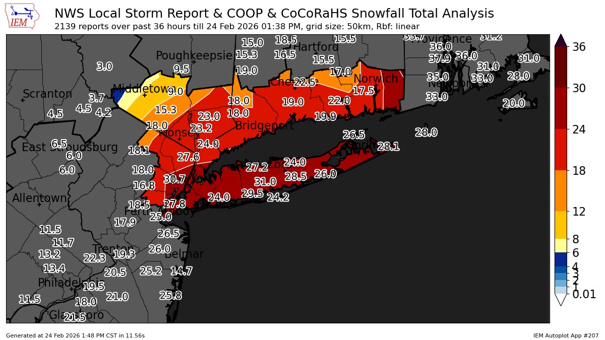
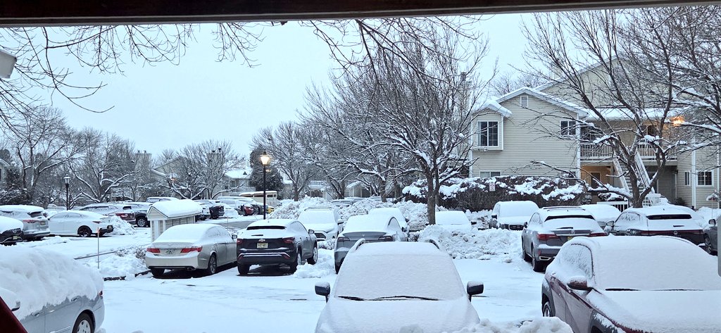
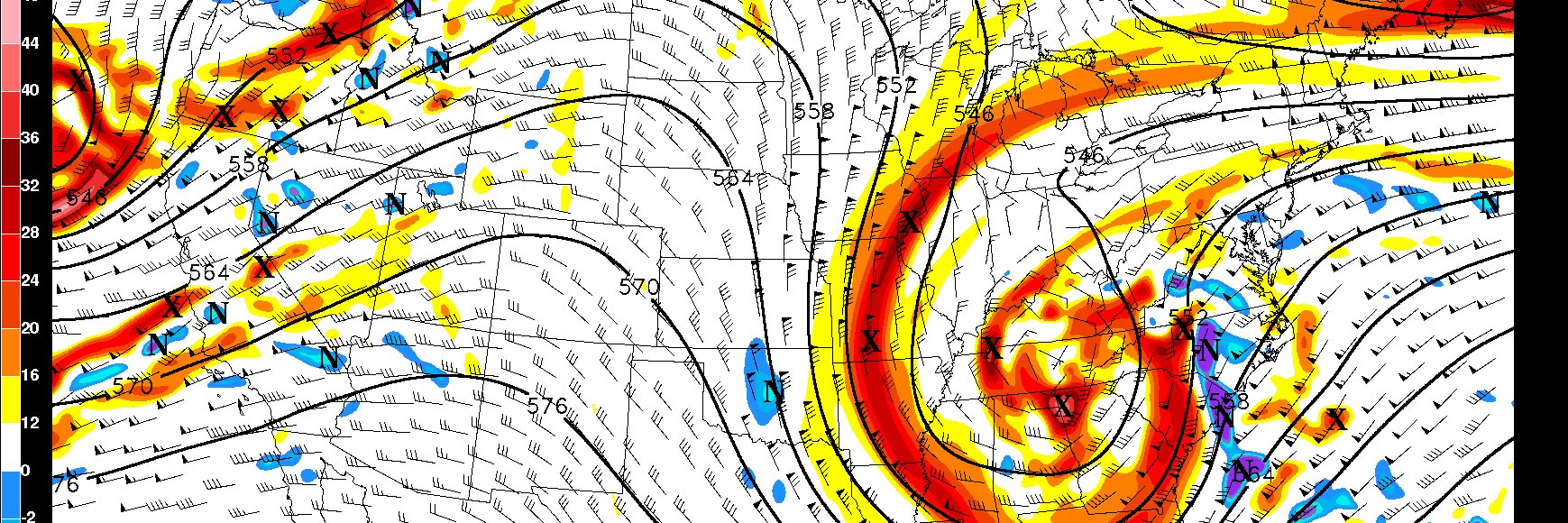
This storm is still ripping over the eastern half of the area, but early interpolated reports would lead me to believe this map will have fallen short of my expectations, a C+ perhaps😑-Too low in DE, too high in NW NJ & not extending the max & 12-18 zone further N & to the SW.

Up to 13.5" in Bedminster, NJ (Somerset County) @NWS_MountHolly SMNJ-115

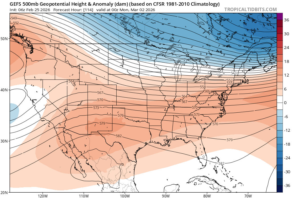
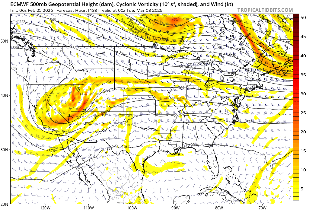
The GFS doesn't often win many prizes, but in terms of catching onto the synoptics, it has done an admirable job here. I suspect this is partially due to its propensity to be more progressive w/northern stream branches than its counterparts, which are still catching up IMO.


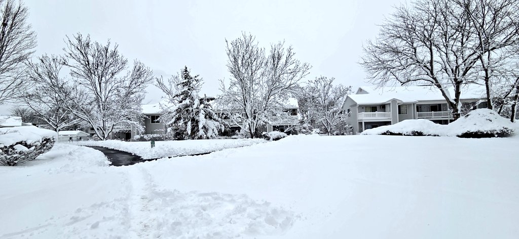
❄️Blizzard of 2026 Final Snowfall Forecast❄️- Scattered to widespread power outages possible. Coastal flooding, dangerous travel conditions expected. Please be safe out there, folks! #njwx #pawx #nywx #nycwx #ctwx