Post

Python Maps
Python Maps@PythonMaps·
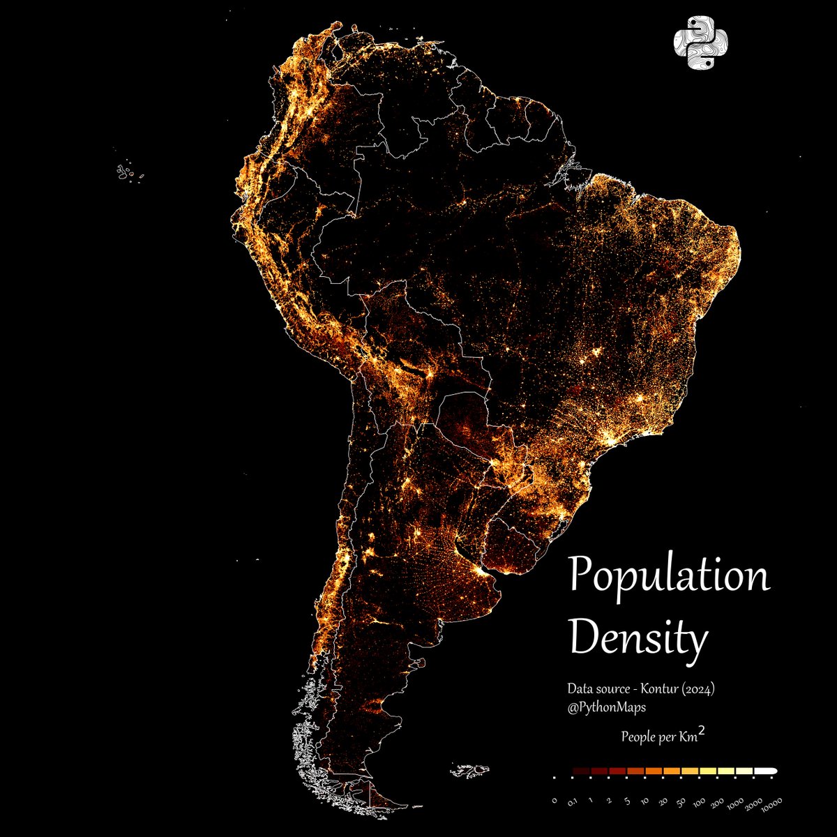
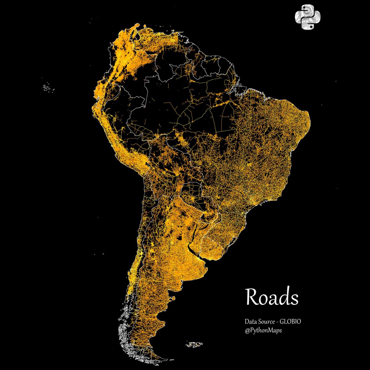
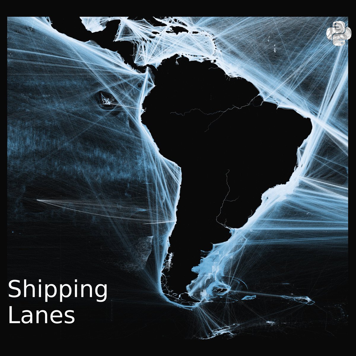
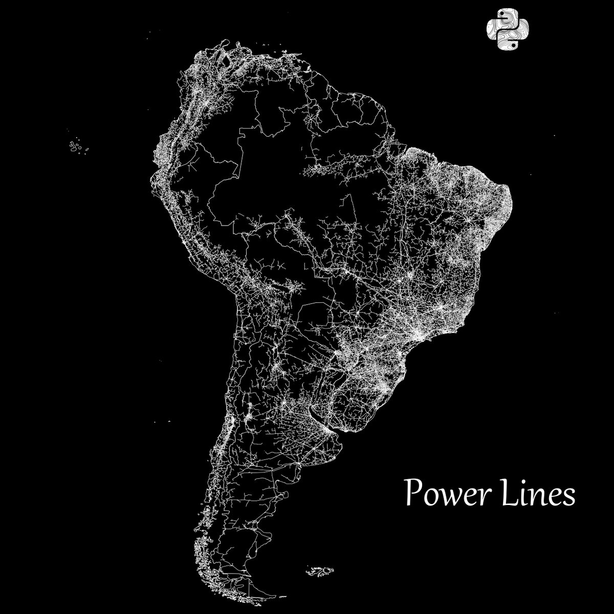
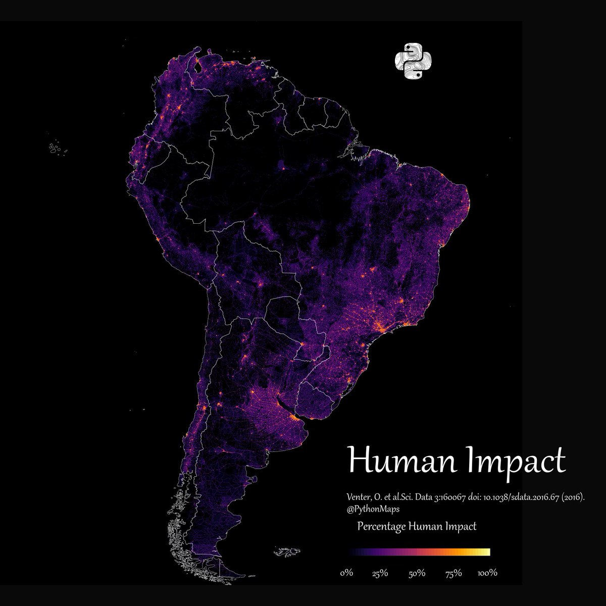
Here is a thread of my favourite maps of South America. Let me know which you like most and give me your best theories for how thel all fit together. Starting with Forests. 1/13
Python Maps tweet media
English
136
595
4.3K
5.5M
Python Maps
Python Maps@PythonMaps·
Grasslands 2/13
Python Maps tweet media
English
11
13
360
198.5K
Python Maps
Python Maps@PythonMaps·
Croplands 3/13
Python Maps tweet media
English
2
12
324
171.3K
Python Maps
Python Maps@PythonMaps·
Population 4/13
Python Maps tweet media
English
4
34
591
189.2K
Python Maps
Python Maps@PythonMaps·
Emissions 5/13
Python Maps tweet media
English
2
9
283
140.6K
Python Maps
Python Maps@PythonMaps·
Roads 6/13
Python Maps tweet media
English
2
12
362
132.6K
Python Maps
Python Maps@PythonMaps·
Shipping Lanes 7/13
Python Maps tweet media
English
1
12
501
122.9K
Python Maps
Python Maps@PythonMaps·
Power Lines 8/13
Python Maps tweet media
English
2
7
310
115K
Python Maps
Python Maps@PythonMaps·
Human Impact 9/13
Python Maps tweet media
English
1
12
262
110.1K
elmelanomalo
elmelanomalo@elmelanomalo·
@PythonMaps Probably a poor choice to draw the power lines in the same color as borders. Makes southern Chile look like a metropolis...
English
0
0
1
66
Paylaş