Python Maps

2.3K posts

Python Maps banner
Python Maps

Python Maps

@PythonMaps

Mapping the world with Python. Contact [email protected] Buy my book here - https://t.co/hAaaAxtaYB

Planet Earth Katılım Ocak 2021
508 Takip Edilen78.1K Takipçiler
Sabitlenmiş Tweet
Python Maps
Python Maps@PythonMaps·
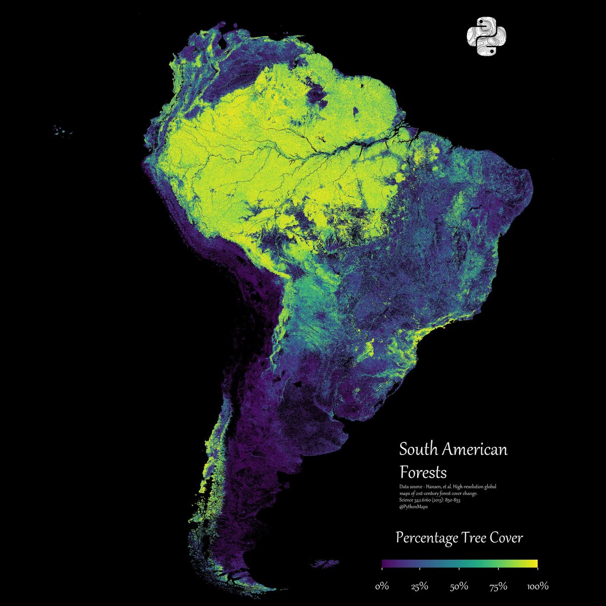
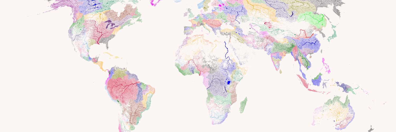
Ending 2023 with my favourite map. South American forests. See you next year!
Python Maps tweet media
English
16
424
2.8K
223.7K
Python Maps
Python Maps@PythonMaps·
@DanNeidle @Heccles94 The ruthlessness with which you pursue and enrage the entire political spectrum is nothing short of commendable Dan.
English
2
0
16
1.4K
Dan Neidle
Dan Neidle@DanNeidle·
@Heccles94 So lying is okay? Or not okay? I think you need to pick one.
English
55
32
1.5K
61.3K
Harry Eccles
Harry Eccles@Heccles94·
When will the Times apologise for misleading the nation for 238 years
English
59
25
177
96.6K
Python Maps retweetledi
Vintage Maps
Vintage Maps@vintagemapstore·
Average colors of the USA from satellite imagery, by Erin Davis
English
7
70
1K
47.7K
Python Maps
Python Maps@PythonMaps·
Mercury! We may as well continue the series and explore the rest of the rocky worlds in the Solar System.
Python Maps tweet media
English
5
12
175
5.3K
Python Maps
Python Maps@PythonMaps·
I made this map for Earth / Mars last week and you seemed to like it so here is it for Venus showing the distribution of elevation levels on the surface. Negative values indicate terrain below the Mars areoid — a gravitational reference surface defined where atmospheric pressure equals 610.5 Pa (the triple point of water) — which serves as the zero-elevation datum in place of a sea level.
Python Maps tweet media
English
12
7
149
8.1K
Python Maps
Python Maps@PythonMaps·
@alsemancher_ I think it’s so prettty that I’ve put this (minus the histogram) on my wall.
English
1
0
8
444
Python Maps
Python Maps@PythonMaps·
I made this map for Earth last week and you seemed to like it so here is it for Mars, the distribution of elevation levels on the earths surface. I have used a blue-red colourmap to give it the illusion of oceans. Negative values indicate terrain below the Mars areoid — a gravitational reference surface defined where atmospheric pressure equals 610.5 Pa (the triple point of water) — which serves as the zero-elevation datum in place of a sea level.
Python Maps tweet media
English
13
27
351
20.8K
Python Maps
Python Maps@PythonMaps·
@Danteawaw Cooking those up now and you get a single peak. Very boring
English
1
0
1
453
Dante
Dante@Danteawaw·
@PythonMaps Now if you compare with other planets and moons I bet all others heavenly bodies have a unimodal distribution.
English
1
0
0
568
Python Maps
Python Maps@PythonMaps·
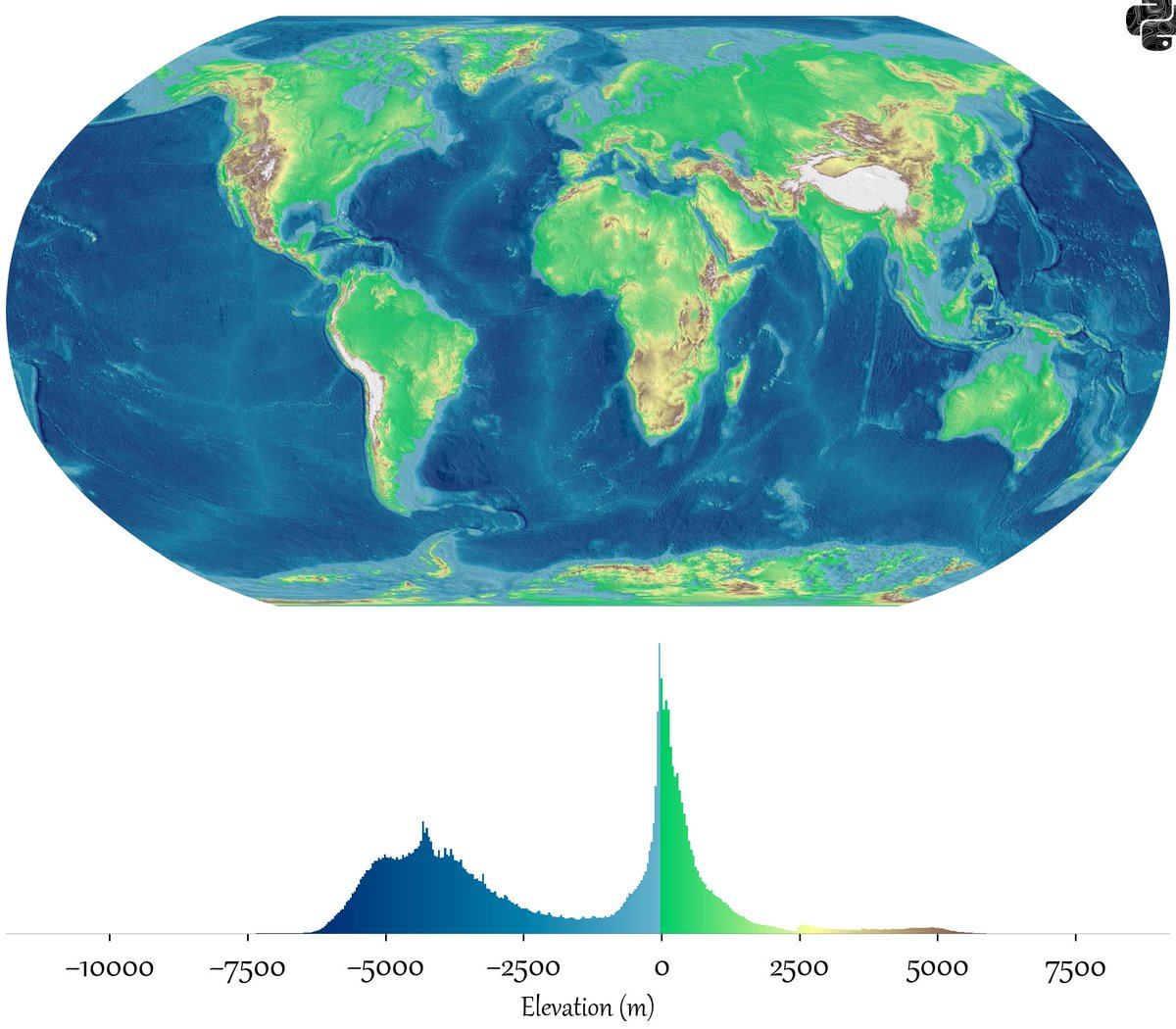
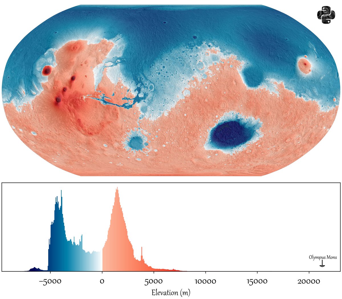
Fun concept, the distribution of elevation levels on the earths surface
Python Maps tweet media
English
36
253
4.7K
380.3K
Python Maps
Python Maps@PythonMaps·
Do you prefer the vanimo colourmap from these posts or bog standard jet?
Python Maps tweet media
English
1
1
19
2.3K
Python Maps
Python Maps@PythonMaps·
Ultimately, I am not a geographer so this may all be wrong but I do enjoy making textbook grade visuals.
English
2
0
9
2.6K
Python Maps
Python Maps@PythonMaps·
Plate Tectonics. A thread
Python Maps tweet media
English
1
21
123
10.9K