
I created a global forest map showing how forests vary by climate zone - Added twist, 90% of the code + the following post was generated by @claudeai
How it was made:
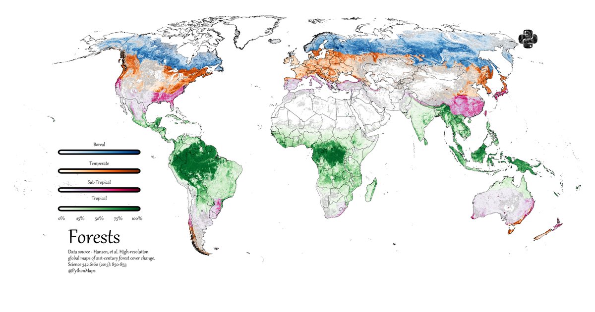
Started with Hansen et al. global forest cover raster (% tree cover per pixel)
Loaded climate zone shapefile with boreal, temperate, subtropical & tropical regions
Masked the forest raster with each climate zone to extract forest cover for that zone only
Assigned distinct colormaps: Blues (boreal), Oranges (temperate), PuRd (subtropical), Greens (tropical)
Overlaid all four masked layers to show global forest distribution by climate type
The overlapping colors reveal where different forest biomes meet across the planet.
Built with Python (GeoPandas, Rasterio, Matplotlib)
Data: Hansen et al. Science 2013
#Python #GIS #DataViz #Cartography #Forests
English