NaderMike
2.3K posts


NaderMike
@TeamGodsFinger
TrineU CpE '29 19-year-old storm chaser and amateur researcher Filmmaker/videographer 🌪️51
Beigetreten Temmuz 2022
231 Folgt521 Follower

NaderMike retweetet

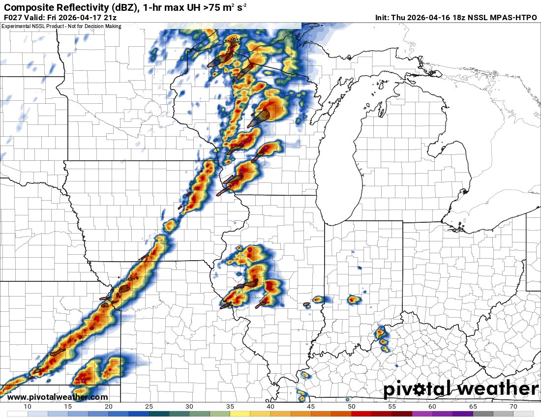
One fly in the ointment for today's northern mode appears to be a modeled zone of elevated moisture ahead of the primary front, which could release elevated buoyancy. This may result in a proliferation of weaker-shear, "popcorn" storms in addition to supercells.


English

the rrfs every setup

Vitor Goede 🇺🇦@GoedeTDS
Honestly, I don't believe in this but it looks funny.
English
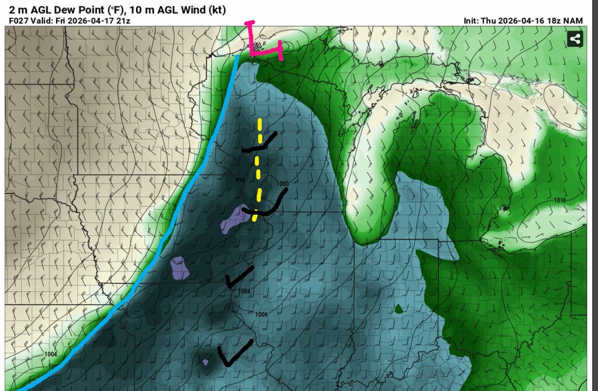
@WeatherIzzi @NorthILWX The area you circled is under convective influence hence the micro scale area of low pressure. But the convergence is quite evident with a longitudinal line of southerly wind barbs and co located southwesterly wind barbs. Likely why we see CAMs try to connect out here.
English

@TeamGodsFinger @NorthILWX Legit question, where do you see sfc confluence? Also, where is the shortwave in model guidance? If anything, looks like very slight sfc diffluence in area I’ve circled. I couldn’t find any model guidance with a shortwave when I did the forecast earlier, I looked hard too!

English
I know it seems bullish at this time BUT the MPAS-HTPO convective signal seems to be on par with the surface pattern progged by the 18z NAM. An area of confluence and a shortwave imbedded on the lead edge of the greater 500mb flow will likely support conv. init.
English

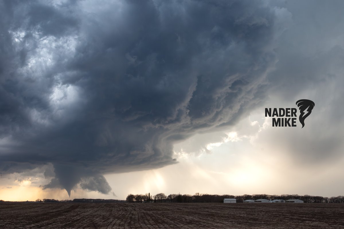
new look to the page 👀featuring my best career tornadoes
English
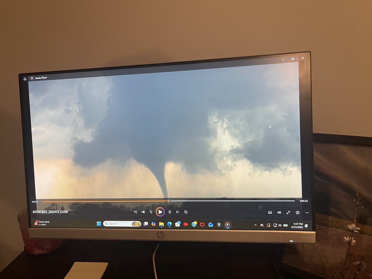
@aaronjayjack Was this near Minnesota Lake? They literally had chasers hemmed in
English

Minnesota sheriff yesterday did his best Kansas sheriff impression . Wouldn’t let me go down a road for intercept and yelled at me. So I just went to the next road east.
English

@TornadoWIS This would certainly be the most potent scenario. ATM it seems like the likely scenario. We will have to keep an eye on surface data tomorrow!
English

@TeamGodsFinger This would be our high risk scenario. Key word being “scenario.” Think the SPC could go moderate tomorrow but storm mode is still uncertain. Ceiling is obviously there however.
English
There will be adequate FFA in the way of curvature divergence and moderate mid-level flow overspreading the warm sector/confluence band. I expect open warm sector convection in the early afternoon Friday, likely around the WI/IL/IA border. All significant hazards will be possible
English
However shear vectors roughly orthogonal to the initiating boundary *could support a discrete mode. This would only be possible if storms can initiate along a potential confluence band ahead of the cold front. The cold front will drive upscale growth later in the afternoon. (2/?)
English