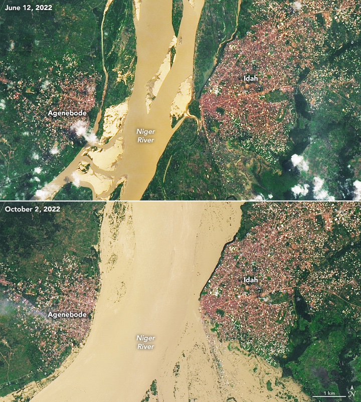

Geospatial Now retweetet

How are we monitoring air quality from space? 🛰️
Following on from the @CopernicusEU #Sentinel5-P satellite, #Sentinel4 and #Sentinel5 will take current air quality measuring capabilities to the next level.
Discover more on @esa's @YouTube channel this Thursday at 16:00 CET: youtu.be/x8uVkWIwvyU?si…
YouTube
English