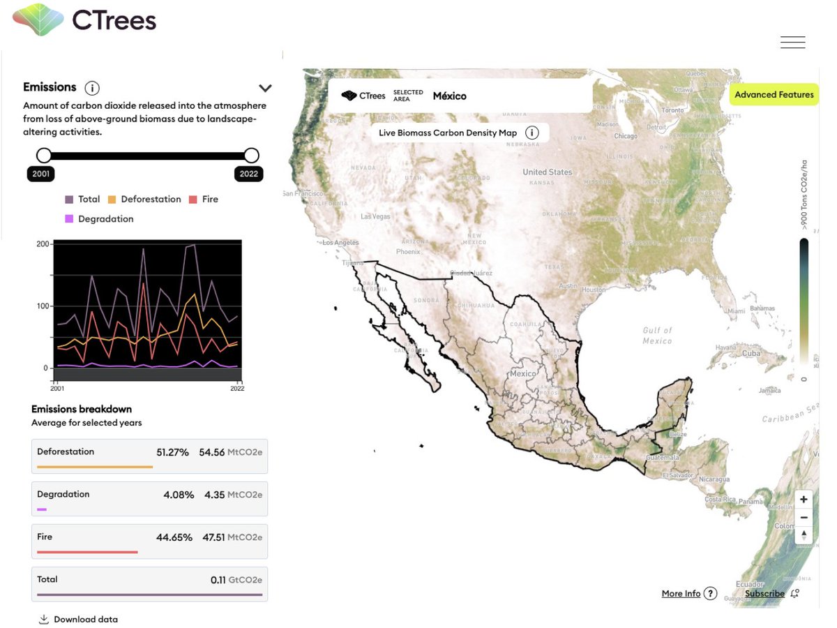

CTrees
110 posts

@CTrees_org
Nonprofit organization tracking carbon in every tree and forest on the planet.


Check out our new REDD+AI platform ctrees.org/reddai that shows tropical forest degradation—from logging, fire, and roads—and tree cover loss in evergreen forests with unprecedented detail. This is v1, so be kind :) v2 coming soon @CTrees_org @RicardoDalagnol @NICFISatData


🌲Our new paper maps state-wide tree cover and forest change using high resolution remote sensing data and a deep ConvNet🧠 "Detection of forest disturbance across California using deep-learning on PlanetScope imagery" doi.org/10.3389/frsen.…


🌿 Join our 13th EEBIOMASS #workshop on “High-resolution satellite imagery & #MachineLearning for #forest monitoring” on MAR 28, 14:30 - 16:30 CET. 👥 Meet our speakers: Martin Brandt, Eric Gorgens, Robson Lima, Ricardo Dalagnol 📢 Register here: survey.academiccloud.de/index.php/1764…

Join us for a panel discussion at @SFClimateWeek to discuss the importance of protecting our endangered forests, the positive impact seen to date, and how we can collectively rebuild confidence in forestry carbon credits! lu.ma/RebuildingConf… #sfclimateweek


RELEASE: CTrees scientists led by @FabienWagner have mapped the height of all trees in California by applying a deep learning model to very high resolution aerial imagery. The result is the most accurate map of the state's canopy height to date 🌐🌲ctrees.org/news/californi…