We've added new lunar examples to celebrate the successful Artemis II launch.
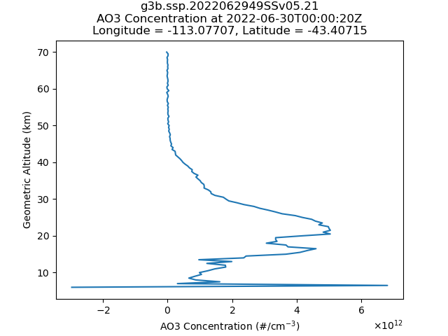
#DSCOVR" target="_blank" rel="nofollow noopener">hdfeos.org/zoo/index_open…
Excited to announce the launch of the OGC Geo for #Metaverse Domain Working Group, which will help the Location communities collaborate and contribute expertise into building and growing the #OpenMetaversebit.ly/3GV8uTJ
A review of Earth Artificial Intelligence sciencedirect.com/science/articl…
"For example, HDF is the official format in NASA, NetCDF is commonly used in NOAA and climate communities, and GeoTiff is popular for georeferenced imagery."
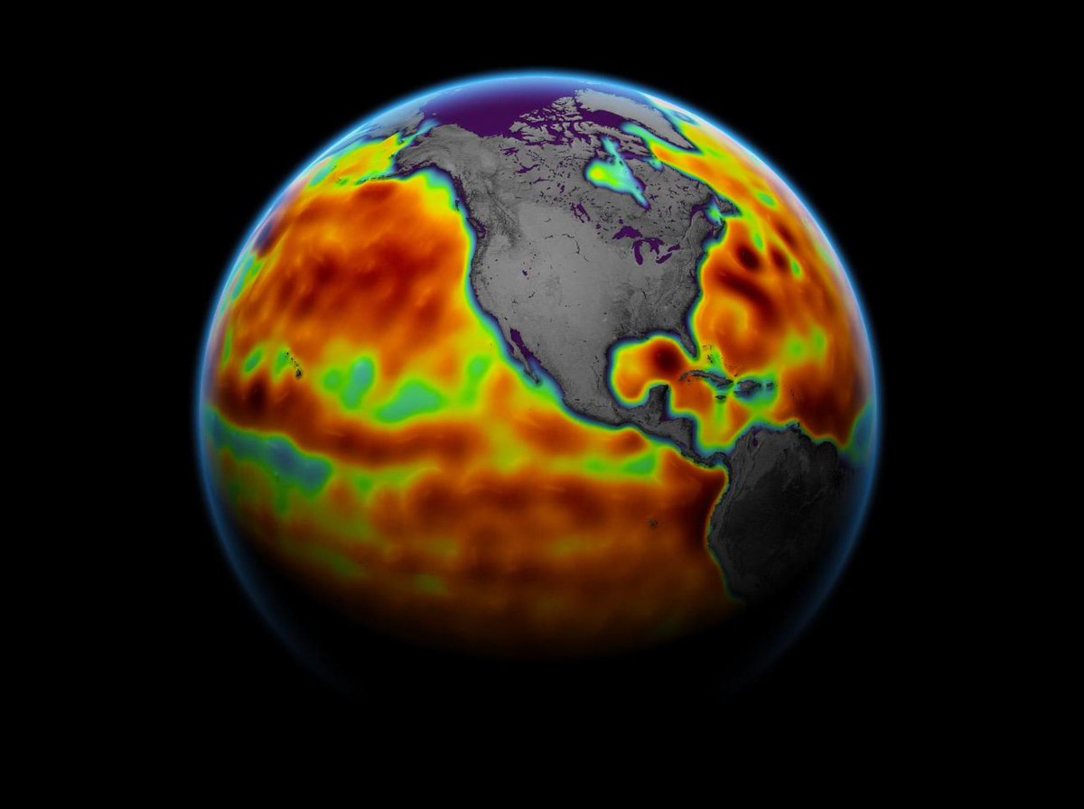
New Sentinel-6 Michael Freilich altimetry datasets are available at NASA's Physical Oceanography DAAC. These high-precision global sea-level measurements build on the previous Jason altimeter series. Discover data: go.nasa.gov/3otaevd Image Credit: NASA/JPL-Caltech
@MathWorks released 2021b! Here's what's new for @hdf5: Support for HDF5 version 1.10, including Single-Writer/Multiple-Reader (SWMR), Virtual Dataset (VDS), and Metadata Cache Fine-Tuning