Anurag Kesar
603 posts

@Expert1202 A couple of hours from now impact is expected or sooner
English
Update 10:20 pm
Intense cloud formation over Rajouri. Expecting clouds to affect parts of Rajouri, Jammu, Udhampur, Ramban, Samba in the coming hours.
Lightning strike can't be ruled out. Stay indoors!
English

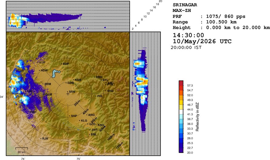
Nowcast J&K @ 2145 hrs:A spell of Rain/thundershower over many places of Kashmir Div, Poonch, Rajouri, Reasi, many parts of Ramban, Doda and Kishtwar with Hailstorm/gusty winds during next 2-3 hrs.
𝘼𝘿𝙑𝙄𝙎𝙊𝙍𝙔 ⚠
●Stay away from electric poles/wires/loose structures etc.


Meteorological Centre Srinagar@metsrinagar
𝙒𝙚𝙖𝙩𝙝𝙚𝙧 𝙐𝙥𝙙𝙖𝙩𝙚 𝙅&𝙆 ●10-12 May:A spell of Rain/thundershower/Gusty winds/hailstorm at many places twrds a/n hrs followed by one/two spells of rain/thunder/Gusty winds towards night hrs. ●13-17 May:Generally dry with brief showers at few places towards a/n hrs.
English
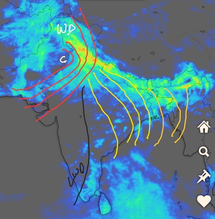
A massive thunderstorm has developed over the Northwestern Himalayas. ⛈️
English

⚠️⚡ #Due to a weak to #moderate Western Disturbance there are chances of rain and thunderstorms accompanied by hailstorms across the #Valley between the 11th and 14th This is expected to bring a #significant drop in the current temperatures
English

Forecast till tomorrow morning
No widespread rain,
short-lived & very localized Main system is missing Kashmir track (staying west-heavy)
#Weatherbyumar #kashmir

English

Important weather update!
Severe storms heading to Delhi NCR b/w 11pm - 2am tonight.
Very strong howling wind gust of 60-100km/h followed by heavy rains & thundershowers to impact entire Delhi, Gurgaon, Faridabad Noida, Ghaziabad.
Seek shelter immediately once you hear thunder.
#DelhiRains
English
Weather Update
Rain activity is expected to remain fairly widespread over the next 36 hours, though with intermittent breaks. A more defined pause is likely between today late morning and late afternoon, before showers redevelop later.
Overall intensity will remain light to moderate, though a few areas may witness brief heavy thundershowers.
On Tuesday, conditions will remain mostly stable during the first half, followed by a chance of thundershowers developing in some areas between afternoon and evening.
Wednesday will see largely dry weather, although a few locations—particularly higher elevations—may still receive brief thundershower activity (towards late afternoon/evening).
From Thursday through Saturday, dry conditions are expected to dominate across the region (Brief activity of thundershowers is expected in Doda, Kishtwar, parts of south Kashmir - Pir Panjal Range - on Thursday late afternoon).
English
Weather Alert - 10:20pm
Widespread convective cloudmass from Pak is heading to impact north #India mid-night into early hours tomorrow.
What to expect:
Strong #Duststorm (40-80km/h) followed by a spell of moderate to heavy intensity rains / thundershowers for 30 - 120mins duration.
Impact and timings estimate:
• #Punjab 11pm to 4am (70 - 100% districts covered)
• Chandigarh 2am to 6am
• #Haryana 12:30am to 7am (40 - 80% districts covered)
• #Delhi NCR 2am to 8am (40 - 70% districts covered)
• West #UttarPradesh 5am to 10am (30-60% districts covered)
The evening storms were way too isolated and weak hence the delay. The current one took all the energy and has not attained a mature state and continuous spreading eastward to impact plains of north west India.
#DelhiRains

English
It was a hectic day but with support of some individuals it was made possible.
Mega Plantation Drive scheduled for tomorrow at Dignibal 10:30 am
500 Deodar Trees to be Planted.
English
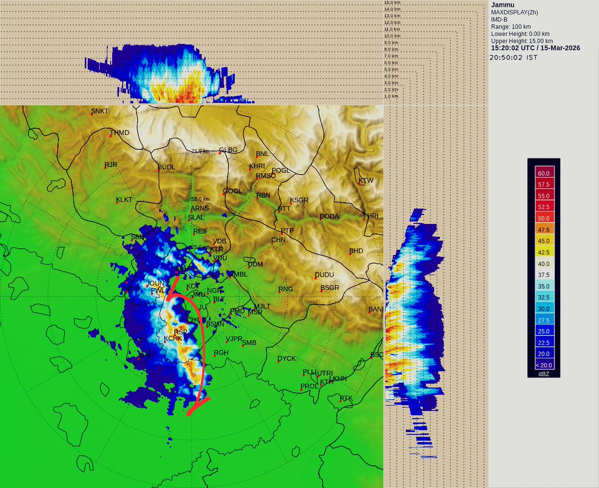
😱😱 In a never-before witnessed event, a tornado was reported in Jammu’s Akhnoor area.
English
@KashmirForecast It was heavy rains but never thought the thunderstorm was this strong
English

In a never-before witnessed event, a tornado was reported in Jammu’s Akhnoor area.
English

This is a WD which is strong but combined with lower CAPE values across Delhi & adjoining areas. So, instead of severe thunderstorms, there is a higher chance of high spread light to moderate rains with embedded weaker thunderstorms & gusty winds in Delhi.
English
@KashmirWeather2 Heavy rain in jammu intermittently with lightning
English
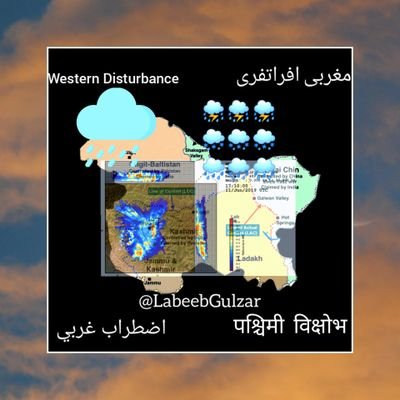
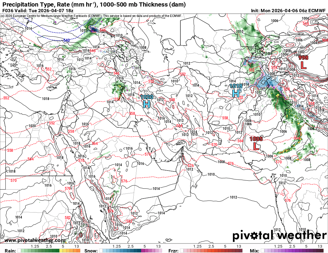
A #Western Disturbance has almost reached Jammu & Kashmir, and its impact has already begun this morning. However, the main activity is expected to start this evening.
This #system will trigger a major spell across all areas of Kashmir bringing widespread moderate to very heavy rain. Some areas are also likely to experience thunderstorms, lightning, and hailstorms
Moderate to #heavy snowfall is expected in high-altitude passes such as Razdan Pass, Sadhna Top, and Zojila
Popular spots like #Gulmarg, Sonamarg, and Doodhpathri could see about 2 to 3 inches of snow accumulation
🔴Be prepared for waterlogging in low lying areas and the possibility of landslides in hilly terrains
Please stay safe and take all necessary precautions
English
This is the #monster Western Disturbance that left an unforgettable mark on the Middle East.

English
@navdeepdahiya55 Jammu me kya impact rahega and thunderstorms hoge ?
English
Major weather update ⚡️
• Active western disturbance to impact north India (19th and 20th March): Moderate to heavy rains, thundershowers likely in #Delhi NCR #Chandigarh #Haryana #Punjab #Rajasthan #UttarPradesh
• On 20th March, winter level day temperatures expected in the range of 18-23°c (Bring out your jackets)
• Heavy snowfall expected over upper reaches of #Kashmir #Himachal & #Uttarakhand, As the event is colliding with the long weekend of #Eid_Ul_Fitr, one can avoid travelling, hisk risk of road blocks persist over #Himalayas.
• Pre monsoon rains and thundershowers will increase further in #Bangalore, #Hyderabad, #Maharashtra, #Telangana and #AndhraPradesh on 18th March - Wednesday. Temperatures to come down.
#DelhiRains #BengaluruRains #BangaloreRains #HyderabadRains
English
@navdeepdahiya55 Currently dry in jammu. Is there any chance of rains now ?
English
Intense storm (Heavy downpour, hailstorm, strong winds) currently wiping out standing wheat crops in south #Punjab & north #Haryana!!!
Districts impacted: Patiala, Ambala, Panchkula, Kaithal, Kurukshetra, Karnal, Yamunanagar and likely to hit Saharanpur, Bijnor, Muzaffarnagar, Meerut overnight. Expect significant damage to rabi crop in mentioned districts.
Next spell of intense storms in north India do major crop damage during 19-21st March. #Farmers only have 3 days window harvest the crops if ready (80-90% wheat is not ready for harvest) Tough times ahead..

English
@KashmirWeather2 Heavy rain occured from last 1 hour. Anything more now in jammu ?
English