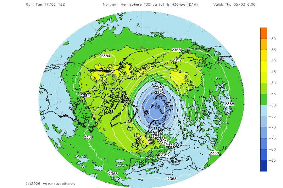
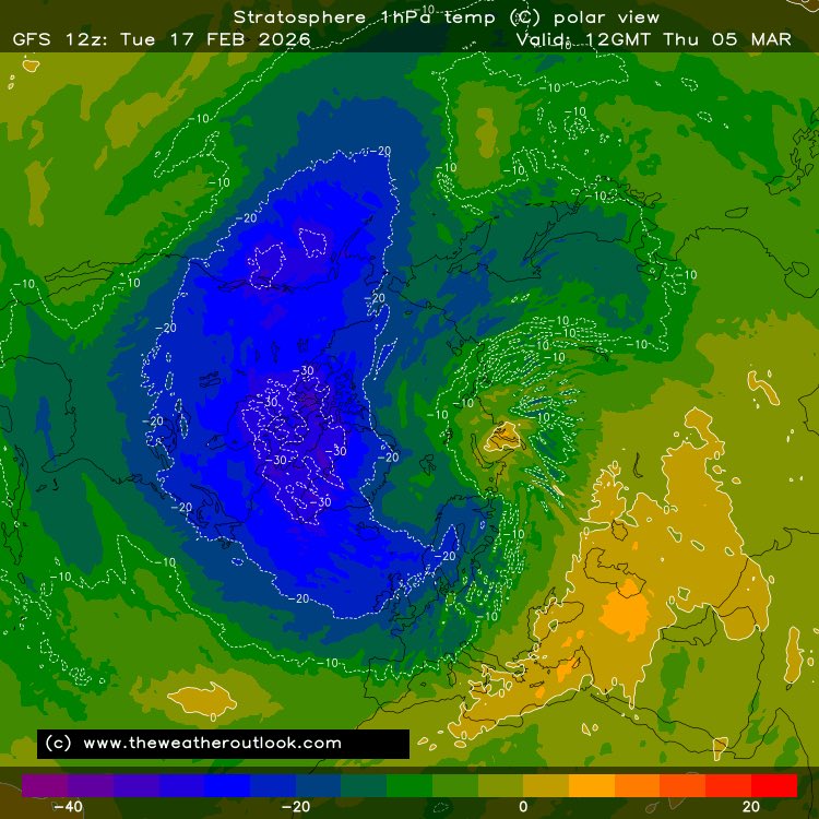
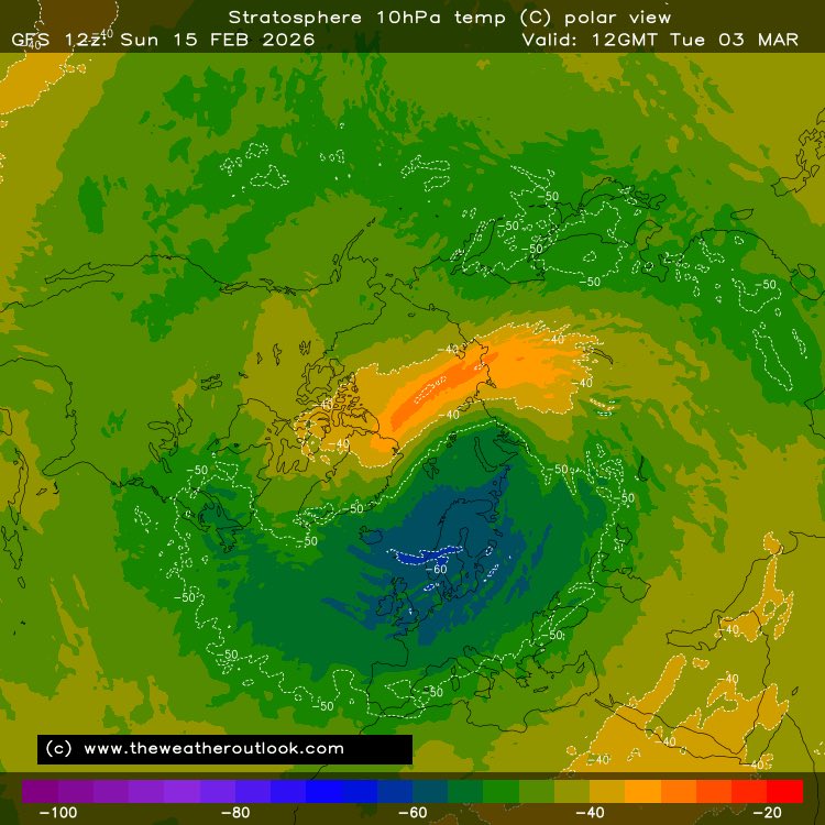
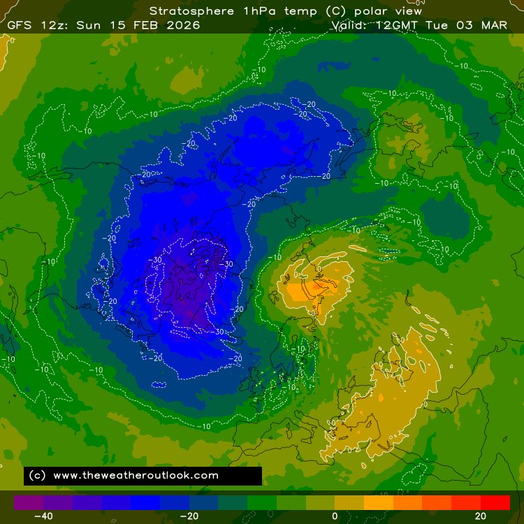
lucas がリツイート
lucas
272 posts

lucas がリツイート
lucas がリツイート
lucas がリツイート

Snow Chance for Wednesday Afternoon into Thursday Morning:
A low pressure system pushing east across the English Channel is expected to bring a warm front from the south and push northwards. There is still a lot of uncertainty on the positioning of the Low (how far north or how far south it will go), but at the moment from latest models and latest Met Office data/ warnings I have made this graphic.
As the front pushes a bit North the rain, which is associated with the front, with bump into the colder air in places across England and Wales and will turn into snow. The event is most likely to be expected to be a more of a hill and higher level event, than a lower level event. But in some places (on lower ground) where the precipitation is heavy enough and the temperatures are low enough, there maybe some snow for a time.
Snow Accumulations:
Snow Accumulation are expected to be 2-5cm across higher ground/ hills and even possibly up to 10cm in some spots where snow is more persistent and Heavier. But where snow does fall to lower ground accumulations of 0-2cm is likely with a small chance of up to 5cm where snow is heavier and more persistent.

English
lucas がリツイート
lucas がリツイート
lucas がリツイート

@SamSouthal1875 @_Malaciaaaa what about east anglia? specifically south norfolk
English

@_Malaciaaaa 2nd snow event of the winter for Wales and the Midlands favourd. Snow 100-200m. Wintry mix to low levels I suspect.
English
lucas がリツイート


@_Malaciaaaa @Londonbusking5 @KennedyJr24 saturday could change the intensity, length and locations. don’t give up hope. also chance for cold early march late feb
English

@Londonbusking5 @KennedyJr24 I give up fr bring on spring! Going away in May will be good
English

Latest UKV is raising an eyebrow with Sunday’s front being active and predominately snow across London & SE, it’s within envelope but I wouldn’t say favoured scenario at present.
I’m thinking the chance of some leading edge snow has increased Sunday morning south of M4 before transitioning to rain. Next 36 hours will be informative.


English

interesting from met office.. potentially a cold spell late feb-early march??. (5 day forecast was for east of england, norwich etc) #uksnow #metoffice #cold


English

I’m seeing a snow risk in our region Friday evening / early Saturday. Namely in showers.
Models have increased depth of cold air, certainly sufficient for falling snow to low levels further southeast with air flow I’d expect North Sea convection. Not the biggest window about 12 hours but one nonetheless.


English


