Zero Meter Chasers

5.9K posts

Zero Meter Chasers banner
Zero Meter Chasers

Zero Meter Chasers

@0meterChasers

Wx team with an acred Met. We provide live wx coverage bcast & with storm chasers. We focus on public safety. Business inquiries: [email protected]
Katılım Nisan 2025
214 Takip Edilen1.1K Takipçiler
Zero Meter Chasers
Zero Meter Chasers@0meterChasers·
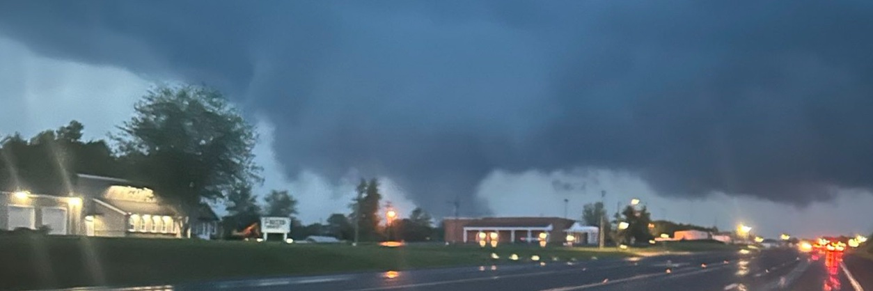
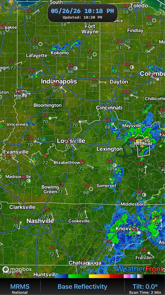
A quiet night in stored as all the storms have fizzled due to lack of instability. Little cluster near Owensboro and another in far Eastern KY. With all the humidity around and calm winds, don’t be surprised if we see some fog into the overnight and early morning. We will stay muggy tonight so temperatures won’t drop a bit. -Mike
Zero Meter Chasers tweet media
English
1
1
1
97
Zero Meter Chasers
Zero Meter Chasers@0meterChasers·
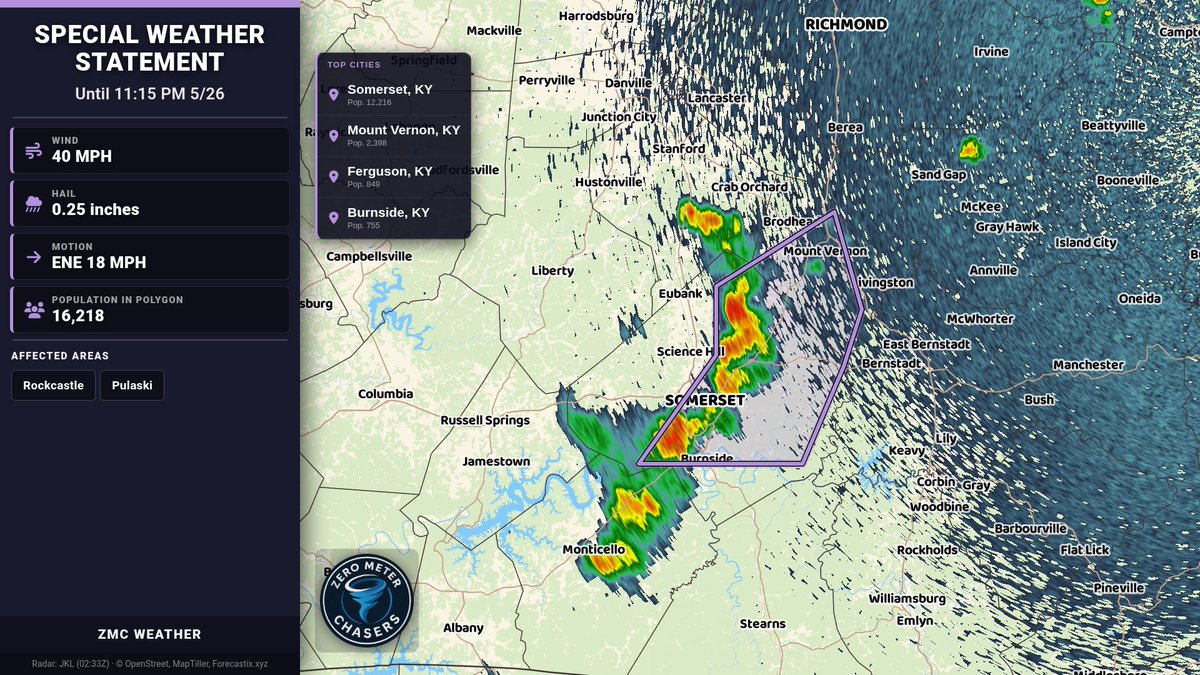
Special Weather Statement for Rockcastle and Pulaski until 11:15 PM 5/26. Strong storms may bring 40 MPH wind gusts and pea-size hail. Torrential rain could cause localized flooding. Seek shelter indoors; don’t drive through flooded roads.
Zero Meter Chasers tweet media
English
0
0
0
93
Zero Meter Chasers
Zero Meter Chasers@0meterChasers·
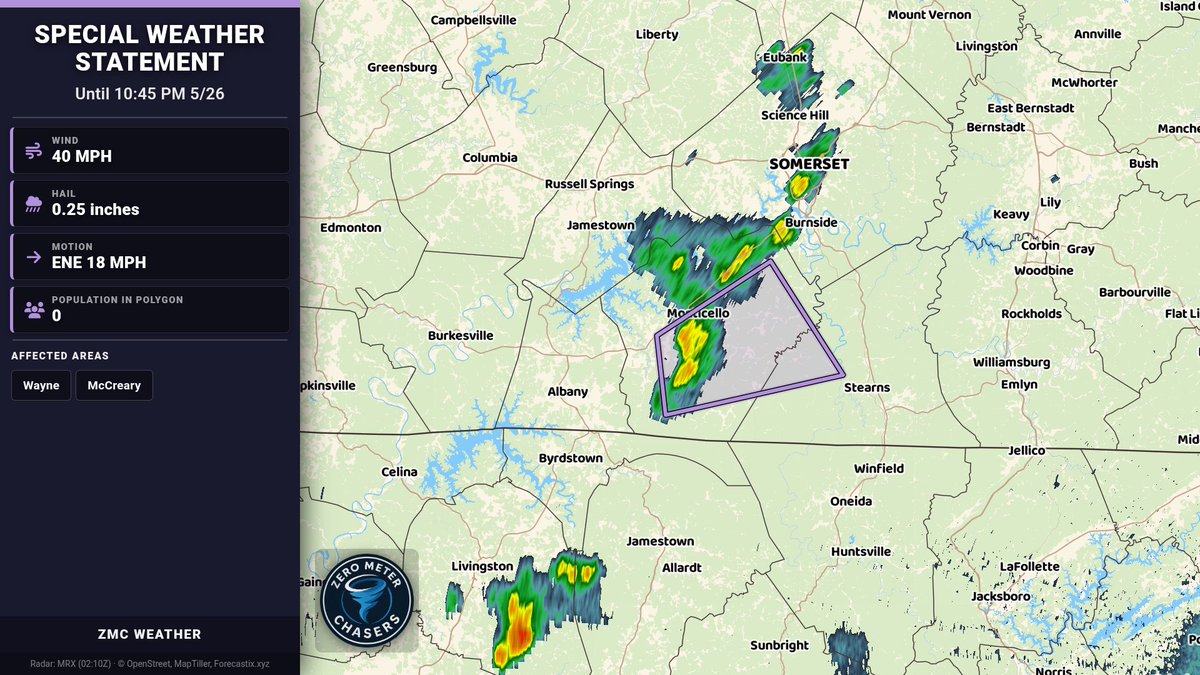
Special Weather Statement for Wayne & McCreary until 10:45 PM 5/26. Wind gusts up to 40 mph and pea-size hail possible. Gusty winds may knock down tree limbs and blow unsecured objects. If outdoors, seek shelter indoors.
Zero Meter Chasers tweet media
English
0
1
1
110
Zero Meter Chasers
Zero Meter Chasers@0meterChasers·
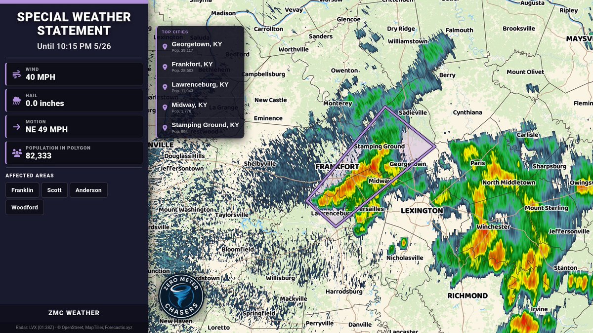
Special Weather Statement for Franklin, Scott, Anderson, Woodford until 10:15 PM 5/26. Funnel clouds possible with gusts up to 40 MPH. Radar indicates a strong thunderstorm near Frankfort. If outdoors, seek shelter inside.
Zero Meter Chasers tweet media
English
0
0
0
75
Zero Meter Chasers
Zero Meter Chasers@0meterChasers·
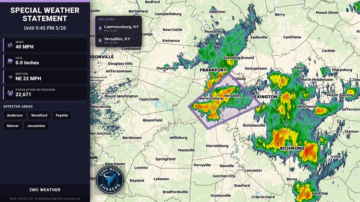
Special Weather Statement for Anderson, Woodford, Fayette, Mercer, Jessamine until 9:45 PM. Funnel cloud possible with wind gusts up to 40 mph. Radar indicated. Gusts may knock down limbs and blow unsecured items. If outdoors, seek shelter indoors.
Zero Meter Chasers tweet media
English
0
0
0
100
Zero Meter Chasers
Zero Meter Chasers@0meterChasers·
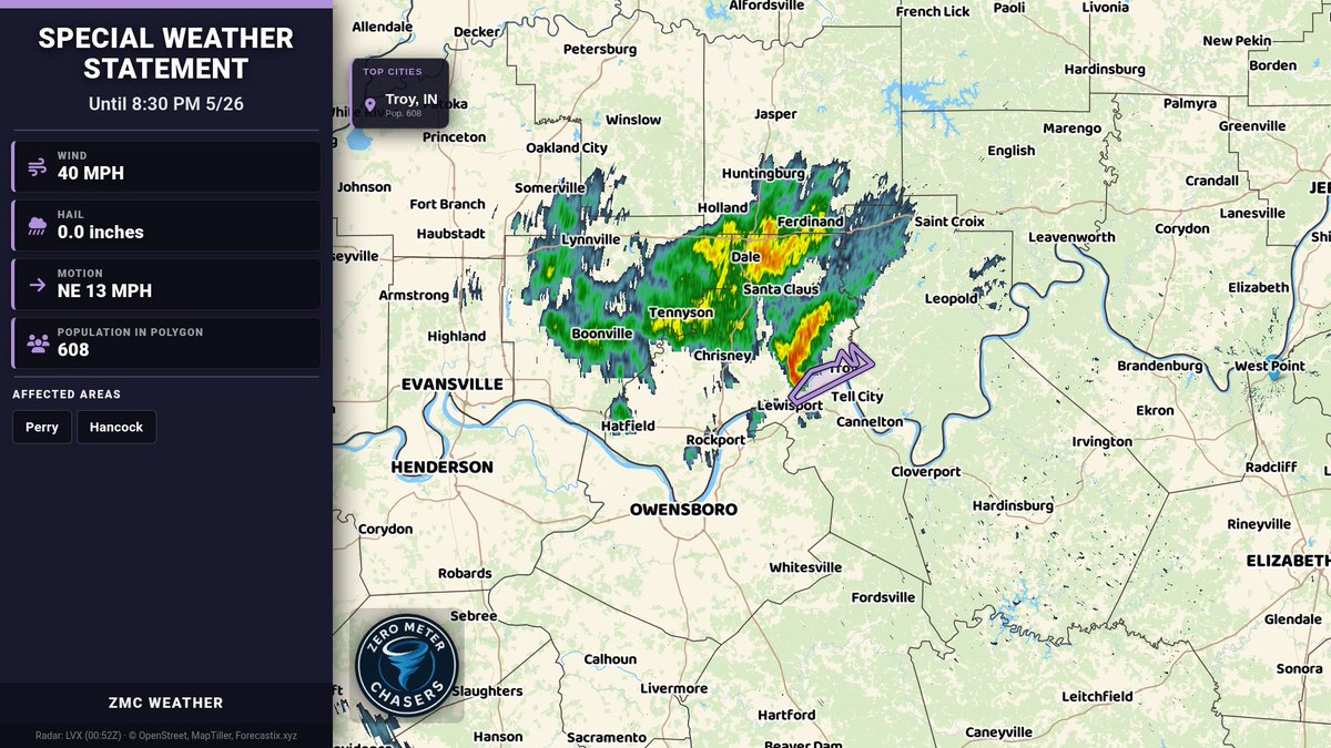
Special Weather Statement for Perry & Hancock until 8:30 PM 5/26. Funnel cloud possible with gusty showers; winds up to 40 mph. Radar indicated. Secure loose items and seek shelter indoors if outdoors.
Zero Meter Chasers tweet media
English
0
0
0
86
Zero Meter Chasers
Zero Meter Chasers@0meterChasers·
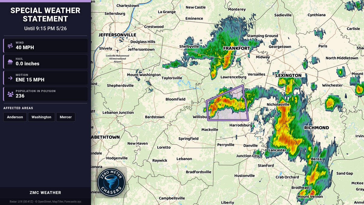
Special Weather Statement for Anderson, Washington, Mercer until 9:15 PM 5/26. Funnel cloud possible and gusty showers may bring winds up to 40 MPH. Gusts could knock down limbs and blow unsecured items. If outdoors, seek shelter indoors.
Zero Meter Chasers tweet media
English
0
0
0
103
Zero Meter Chasers
Zero Meter Chasers@0meterChasers·
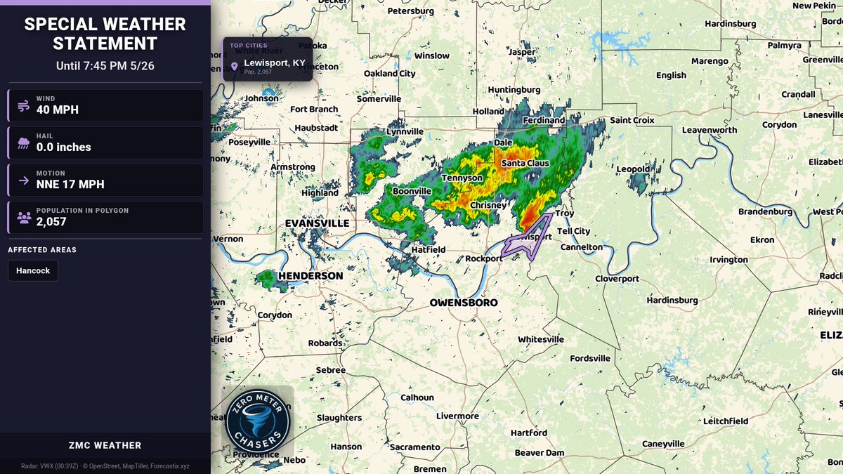
Special Weather Statement for Hancock until 7:45 PM 5/26. Funnel cloud possible and wind gusts up to 40 mph. Gusty showers may knock down tree limbs and blow unsecured objects. If outdoors, seek shelter inside.
Zero Meter Chasers tweet media
English
0
0
0
96
Zero Meter Chasers
Zero Meter Chasers@0meterChasers·
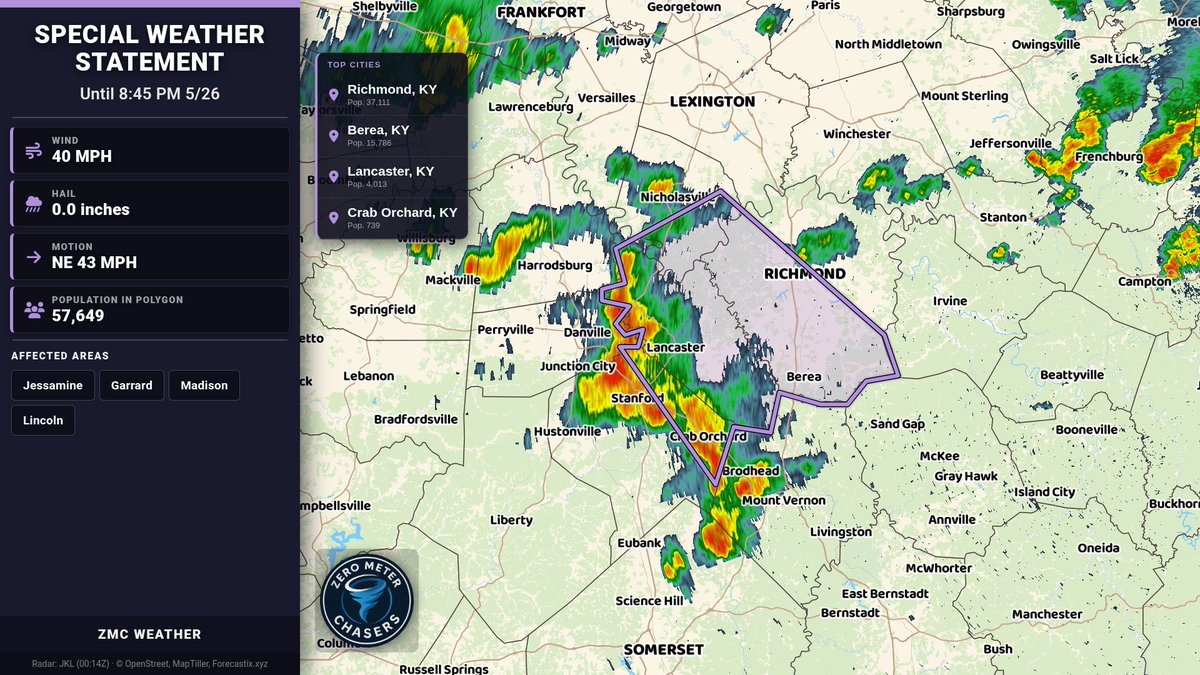
Special Weather Statement for Jessamine, Garrard, Madison, Lincoln until 8:45 PM 5/26. Wind gusts up to 40 mph may knock down tree limbs and blow unsecured objects. If outdoors, seek shelter inside. Watch for brief funnel clouds.
Zero Meter Chasers tweet media
English
0
0
0
82
Zero Meter Chasers retweetledi
Kentucky Weather
Kentucky Weather@Kentucky_WX·
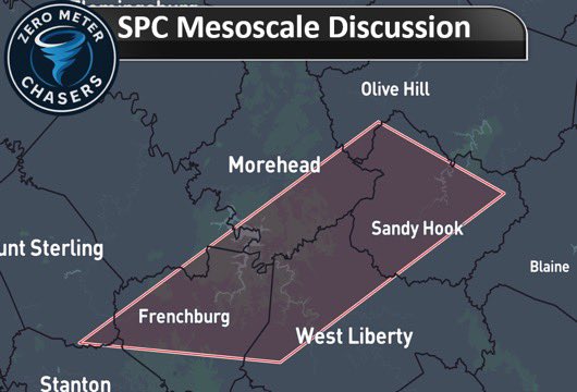
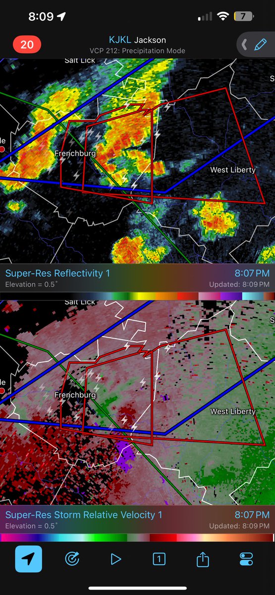
SPC has posted a Mesoscale Discussion for our ongoing supercell in Eastern Kentucky! While it has produced a weak tornado or 2 the SPC expects this supercell to ramp down in the next couple of hours. A tornado is still possible in between Frenchburg and West Liberty, Kentucky in the hour! #KYwx
Kentucky Weather tweet mediaKentucky Weather tweet media
English
1
2
4
771
Zero Meter Chasers retweetledi
NWS Tornado
NWS Tornado@NWStornado·
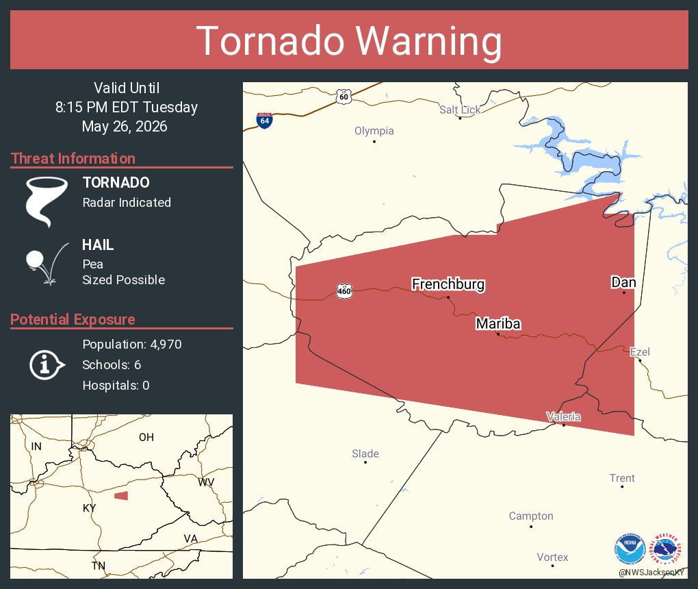
Tornado Warning including Frenchburg KY, Mariba KY and Dan KY until 8:15 PM EDT
NWS Tornado tweet media
English
1
12
28
4.5K
Zero Meter Chasers retweetledi
I-65 Weather (Kentucky)
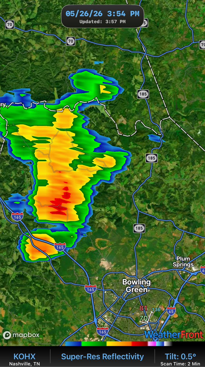
TORNADO WARNING for Eastern KY near Stanton. Nice hook echo with a little couplet attached.
I-65 Weather (Kentucky) tweet media
English
0
3
7
469
Zero Meter Chasers
Zero Meter Chasers@0meterChasers·
A good chunk of storms have been behaving nicely today across South/Central KY after the heavy rainfall this morning. Seems to me the Lower level winds are just not there for any wanting to rotate along the stalled boundary and weak Low Pressure. We’ve had some strong storms in Lexington area but that’s about it. The low end spinup can’t rule out for next few hours as we still have the Daytime heating in placed but I just don’t see it, as compared to Fridays setup. Well keep an eye out if any storms turn Severe. -MIKE
Zero Meter Chasers tweet media
English
0
1
4
184
Zero Meter Chasers retweetledi
I-65 Weather (Kentucky)
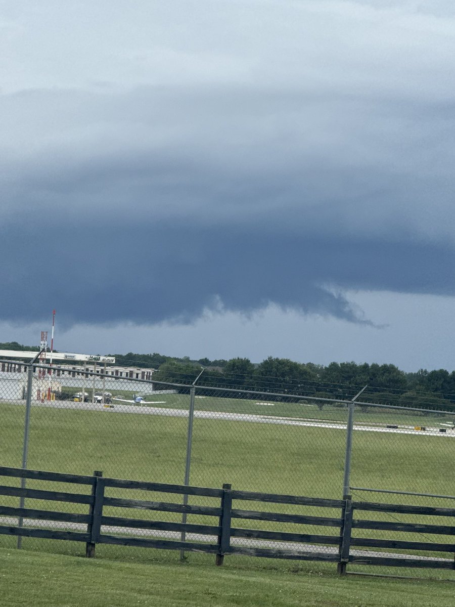
May have been some SLC’s (scary looking clouds) today with all these showers but these are harmless. *NO TORNADO* like chances so far today but this was sent to me by @RyanPol58610356 of the cell looking at the Airport in BWG toward Hadley. Lots of scud (rising air) into the ⛈️.
I-65 Weather (Kentucky) tweet mediaI-65 Weather (Kentucky) tweet media
English
1
3
11
584
Zero Meter Chasers
Zero Meter Chasers@0meterChasers·
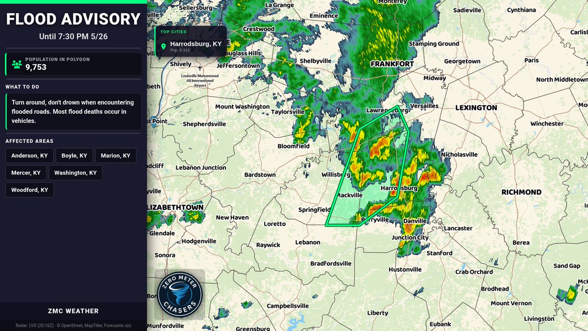
Flood Advisory for Anderson, Boyle, Marion, Mercer, Washington, and Woodford, KY until 7:30 PM EDT. Minor flooding in low-lying/poor drainage areas; some low-water crossings may be impassable. Turn around, don’t drown—avoid flooded roads.
Zero Meter Chasers tweet media
English
0
0
3
128
Zero Meter Chasers
Zero Meter Chasers@0meterChasers·
Special Weather Statement for Anderson, Woodford, Washington, Mercer until 4:30 PM 5/26. Wind gusts up to 40 mph. Torrential rain may cause localized flooding. Seek shelter indoors; don’t drive through flooded roads.
Zero Meter Chasers tweet media
English
0
0
2
109
Zero Meter Chasers retweetledi
NWS Louisville
NWS Louisville@NWSLouisville·
A special weather statement has been issued for Bloomfield KY, Chaplin KY and Fairfield KY until 3:45 PM EDT
NWS Louisville tweet media
English
0
2
3
1.2K
Zero Meter Chasers
Zero Meter Chasers@0meterChasers·
Special Weather Statement for Spencer, Anderson, Nelson, Washington until 3:45 PM 5/26. Wind gusts up to 40 mph. Torrential rain may cause localized flooding. If outdoors, seek shelter inside. Don’t drive through flooded roads.
Zero Meter Chasers tweet media
English
0
0
1
102