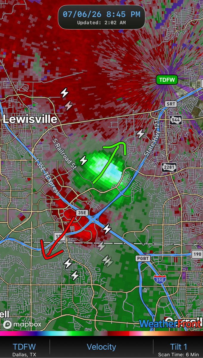
@WxFront Is the satellite dish in the image supposed to represent where the radar is originating? Otherwise it's not clear from the image exactly where the origin of the radar is for each of the two scenarios
HOW TO READ VELOCITY
1. Locate the radar relative to where you are
2. Green = TOWARD the radar & Red = AWAY FROM the radar
3. Imagine or draw arrows and then determine whether it’s divergence (air spreads out), rotation, or convergence (air collides)
Velocity is a powerful tool meteorologists at the NWS use when monitoring for potential tornadoes!
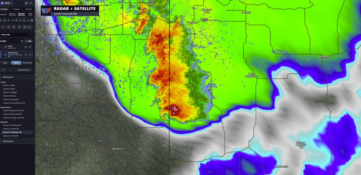
If you haven't already hopped on the @WxFront train, what are you doing? The new overlay features are gamechanging. Never have I been able to overlay radar with RTMA, satellite, and other standard/dual pol products so easily.
CONSIDERABLE FLOODING
Torrential rainfall northwest of San Antonio, TX has prompted a Considerable Flash Flood Warning.
Check out the SIGNIFICANT increase in streamflow along Medina River and Leon Creek south of the city!
It’s crazy how much we know about future weather patterns.
Sure, there is still plenty of need for improvement. But the field of meteorology and weather modeling has come so far!
@WXL39_nerd@AutomatedTBW The native Android app will be so much more functional than what you're getting with the web app on a mobile browser. Looking forward to getting it out to everyone!
@WxFront@AutomatedTBW I'm still anticipating the app to come out on Android. I can't wait! I know I can view it via the browser, but it's always better in an app.
🚨 WF Web App v1.2.0 is now LIVE 🖥️
🥞Overlay radar, satellite, and observations
📍Find cities with ease using the location search function
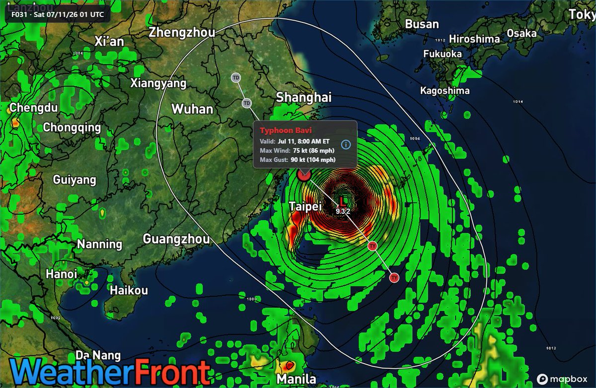
🌀View Joint Typhoon Warning Center outlooks
🏫Display points of interest
iOS AND Android users can refresh your browser tab or go to app.weatherfront.com to try it now!
📲iOS v1.22.1 is now LIVE and also includes JTWC Outlooks --> update or download today!
🤖Android is getting really close! We're in final testing before release. Thanks for your patience!
🥞Overlay Mode: Follow the instructions in the graphic
📍City Search: Click the pin icon on the web app Tools Menu
🌀JTWC Outlooks: Turn on NHC Outlooks and they'll display
🏫Points of Interest: Menu --> Maps --> Points of Interest
@WxFront a few days back when the typhoon was at guam I could get south korean radar. now nothing from them or japan. any chance you guys can get anything close enough to bavi to get a radar image?
UNIQUE TYPHOON VISUALIZATION
You’ve probably looked at tropical cyclone wind/pressure fields before.
But have you ever looked at surface temperature? Pretty neat to see the warm core in the eye and the relatively cooler outer rainbands!
CLASSIC DOWNBURST SIGNATURE
The terminal Doppler weather radars in Dallas picked up a textbook downburst last night.
You can see the green (inbound) velocities race toward the radar and red (outbound) velocities race away as the cold dense draft hit the ground and spread out in all directions.
Reflectivity, meanwhile, showed a thunderstorm pulse up and then collapse, sending a nearly-circular outflow boundary out from the center of the storm (coincident with the divergence signature on velocity).
Here’s to @DualDoppler for the great find!
COMING INTO VIEW: The eye of Super Typhoon Bavia is now visible on the @NWSGuam radar.
This powerful storm will continue its trek west today, bringing significant impacts to the Northern Mariana Islands over the next 24-36 hours.
Follow along with FREE 24-hr radar loops in WF!