Dr. Andrew Annex

698 posts

Dr. Andrew Annex banner
Dr. Andrew Annex

Dr. Andrew Annex

@AndrewAnnex

Senior Software Engineer @Planet, Ph.D. @JohnsHopkins, Postdoc @Caltech. Author of #spiceypy Python package. My opinions are my own. @[email protected]

Pasadena, CA Katılım Şubat 2017
716 Takip Edilen353 Takipçiler
Sabitlenmiş Tweet
Dr. Andrew Annex
Dr. Andrew Annex@AndrewAnnex·
My summer is going to be more fun: I got into Planetary Science Summer School at @NASAJPL !!!!!!!!!!!!!
English
10
0
113
0
Dr. Andrew Annex
Dr. Andrew Annex@AndrewAnnex·
@bradneuberg Nothing that surprising here, but good that I can point to this for a project I’m on to avoid bad choices
English
1
0
1
31
Brad Neuberg
Brad Neuberg@bradneuberg·
"Based on our findings, we recommend the following practices for training on cloud raster imagery: match the patch size to the underlying tile structure of your GeoTIFF files (typically 256 or 512 pixels), use block-aligned sampling to prevent inefficient partial tile reads, prioritize high worker counts (32–64) over threads, consider LERC-ZSTD compression to balance transfer and decompression, and implement aggressive pre-fetching (factor of 8)."
English
1
0
4
351
Brad Neuberg
Brad Neuberg@bradneuberg·
"Training deep learning models on petabyte-scale Earth observation (EO) data requires separating compute resources from data storage. However, standard PyTorch data loaders cannot keep modern GPUs utilized when streaming GeoTIFF files directly from cloud storage. In this work, we benchmark GeoTIFF loading throughput from both cloud object storage and local SSD, systematically testing different loader configurations and data parameters. We focus on tile-aligned reads and worker thread pools, using Bayesian optimization to find optimal settings for each storage type. Our optimized configurations increase remote data loading throughput by 20× and local throughput by 4× compared to default settings. On three public EO benchmarks, models trained with optimized remote loading achieve the same accuracy as local training within identical time budgets. We improve validation IoU by 6–15% and maintain 85–95% GPU utilization versus 0–30% with standard configurations. Code is publicly available at github.com/microsoft/pyto…"
English
2
5
23
1.1K
andi (twocents.com)
andi (twocents.com)@Nexuist·
Here's my list of ~180 people I've found who I qualify as indie hackers / build-in-public software developers. The entry requirement is to make a post about something you've built, revenue optional, but the thing has to be publicly available online. x.com/i/lists/183763…
English
5
1
25
2.4K
Dr. Andrew Annex
Dr. Andrew Annex@AndrewAnnex·
@garrettkjohnson I have a titiler extension that should generate 3Dtiles on the fly, underlying Python can easily be adapted to precompute tiles (Something I’m hoping to get to at some point).
English
0
0
0
21
Garrett Johnson
Garrett Johnson@garrettkjohnson·
The tiles here are generated using gdal2tiles but I'm considering using rasterio to generate tiles to see if I can speed up the process.
English
1
0
2
528
Garrett Johnson
Garrett Johnson@garrettkjohnson·
Slowly but surely I've been working on getting Mars terrain loading in 3D Tiles Renderer. This is using TMS tiles to load color data so next I'll be looking at generating the DEM data tiles. Data set courtesy of the Tianwen-1 CNSA mission. #threejs #3dtiles #gis #webgl #mars
English
5
14
130
8.7K
Casey Handmer
Casey Handmer@CJHandmer·
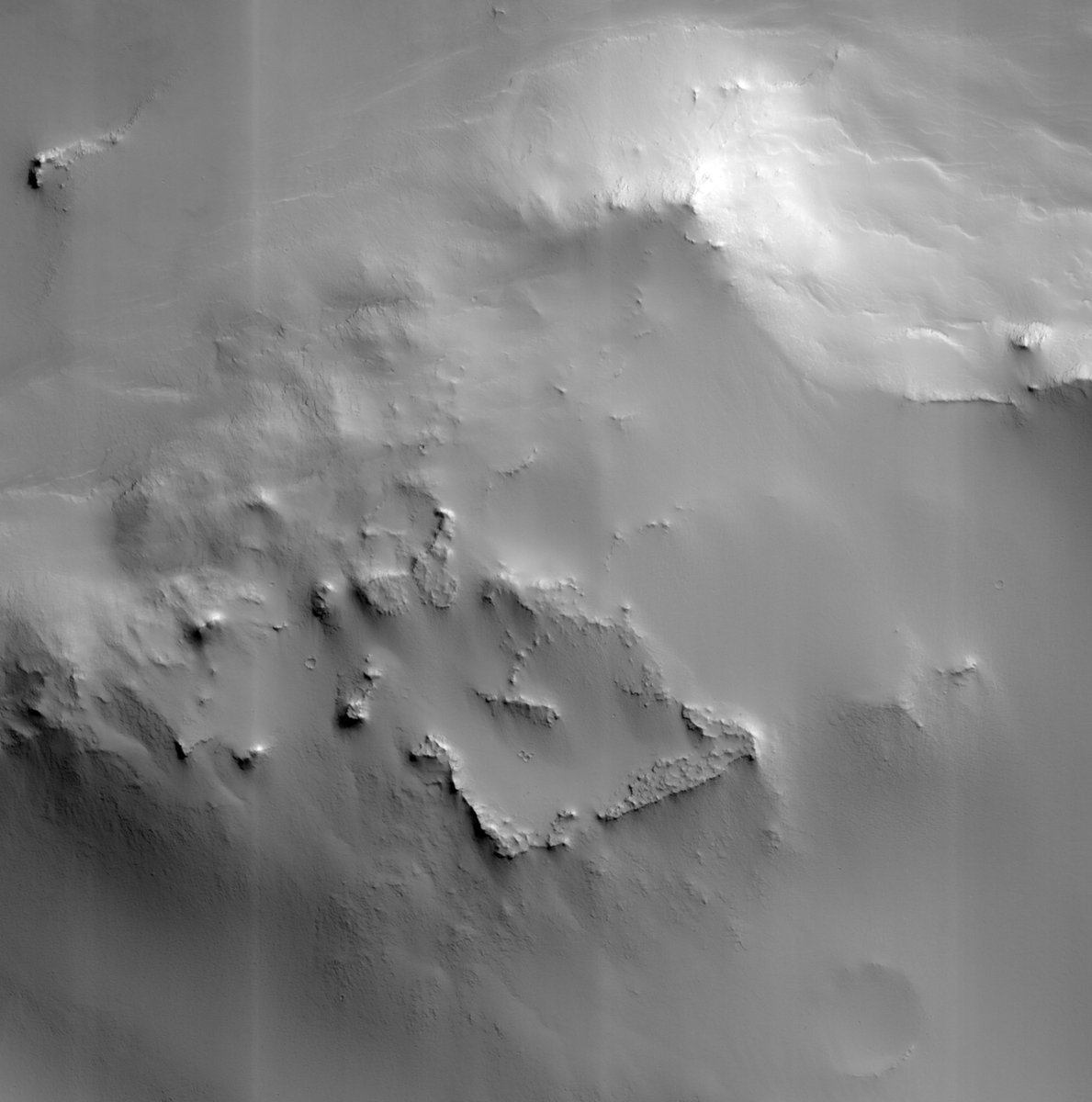
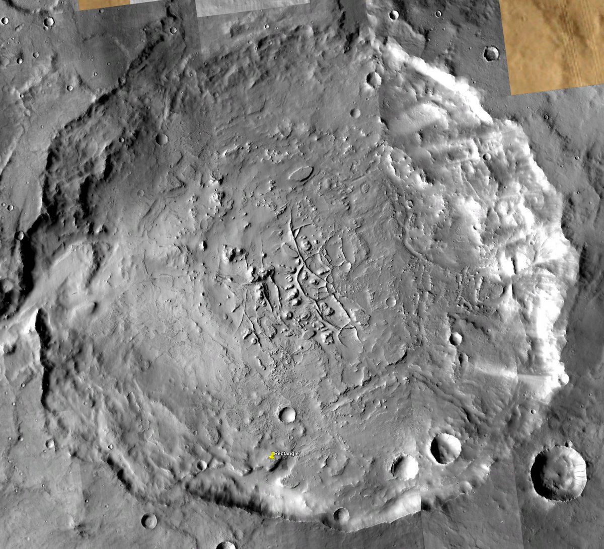
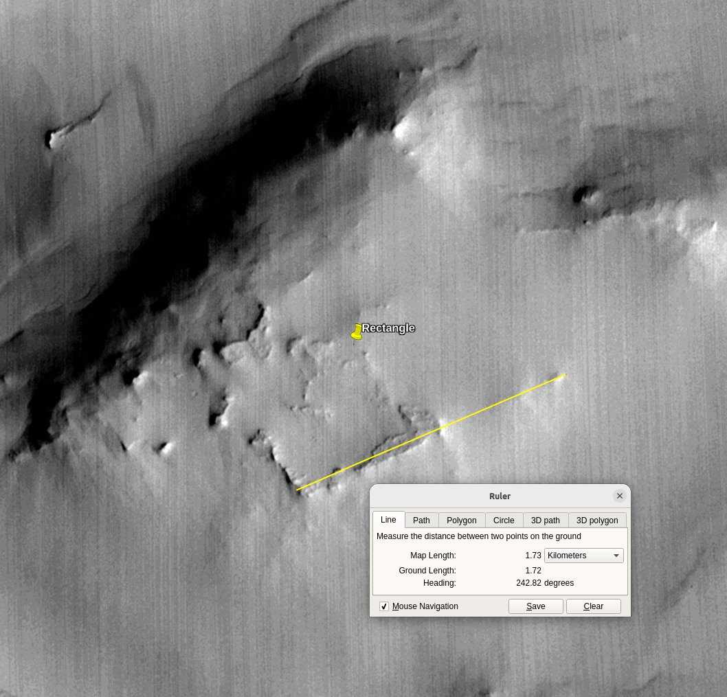
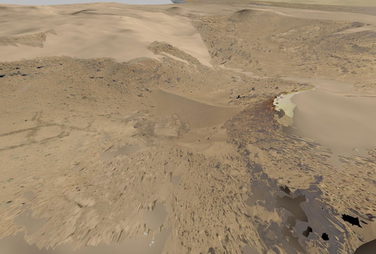
Cool feature, natural. All kinds of weird stuff in that crater. Maybe it was a lake once. The feature, here imaged with MRO's CTX camera, is about a mile across. It's not square either.
Casey Handmer tweet mediaCasey Handmer tweet mediaCasey Handmer tweet mediaCasey Handmer tweet media
Jay Dook@JayDook

@chrisramsay52 Here is the link to the official image. #T=2&P=E1000462" target="_blank" rel="nofollow noopener">viewer.mars.asu.edu/planetview/ins…

English
22
13
258
58.3K
Jeff Harrison
Jeff Harrison@JeffHarrison·
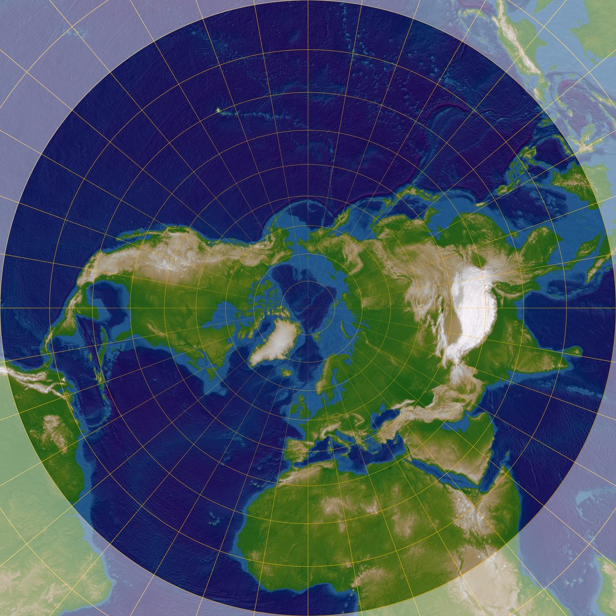
Just wondering, what @opengeospatial WMTS software supports Polar Stereographic projection (EPSG:5041) …
Jeff Harrison tweet media
English
4
3
5
457
Dr. Andrew Annex
Dr. Andrew Annex@AndrewAnnex·
@Albedo Speaking for myself and no one else and nothing else: continuity in capabilities for VHR imaging and stereo of Mars is critical for science and landing site characterization.
English
0
0
2
102
Dr. Andrew Annex
Dr. Andrew Annex@AndrewAnnex·
@PBNiles Feel like it’s the heat shield and etc, MAV is big/ we need to develop larger diameter landers
English
0
0
1
40
Paul Niles
Paul Niles@PBNiles·
Anyone know what he is talking about? What are the commonalities between a msr mav and a human ascent vehicle?
Gene J. Mikulka@genejm29

#NASA #MEPAG - Jim Green - We need to think about MSR as part of a long-term campaign that we develop to bring back samples has to evolve to a human MAV. One location does not tell us everything about Mars. Have to make sure HQ allows MAV to evolve or we'll never go with humans


English
2
0
0
123
Dr. Andrew Annex
Dr. Andrew Annex@AndrewAnnex·
@howardbutler in my response I mentioned that some work to make tiling schemes via TMSv2.0 should be more uniformly supported across other drivers/cli tools, COG driver supports TILING_SCHEME input, but what if gdal2tiles.py did too? gpkg, pmtiles, mbtiles, etc
English
0
0
1
39
@hobu@fosstodon.org
@[email protected]@howardbutler·
The first ever GDAL Users Survey is now open for feedback at docs.google.com/forms/d/e/1FAI… The survey is an attempt to provide structured guidance for the maintenance program to focus its efforts in the coming year. Please contribute and help us circulate it!
English
5
22
36
6.6K
Dr. Caitlin Ahrens ✨🚀
Dr. Caitlin Ahrens ✨🚀@AhrensScience·
Anybody have experience in using ML/AI to determine shapes/polygons/create contours in a given image? Essentially make an outlined image output? 🤔 (geologists help??)
English
2
0
1
512
Dr. Andrew Annex
Dr. Andrew Annex@AndrewAnnex·
@garrettkjohnson I have interest in using it via lithosphere, currently trying to sort out tilematrixsets for other planetary bodies though
English
0
0
1
35
Garrett Johnson
Garrett Johnson@garrettkjohnson·
Can people who have used/are using 3DTilesRendererJS for #threejs share their usecases & any screenshots or demos if you can? I'd like to share how the library has benefitted other applications with NASA JPL to help bolster the case for some more open source work #3dtiles #gis
Garrett Johnson tweet mediaGarrett Johnson tweet mediaGarrett Johnson tweet media
English
9
10
55
6.9K
Dr. Andrew Annex
Dr. Andrew Annex@AndrewAnnex·
Any know of good examples of using power point presentations as training data for M-LLMs?
English
0
0
2
296
Joe Morrison
Joe Morrison@mouthofmorrison·
SAM was an important gut check for the earth observation industry - fine tuning it yielded close to SOTA results with much, much less work than the SOTA approaches. I wonder if fine tuning SAM 2 will eclipse alternatives. Cool moment for the industry.
AI at Meta@AIatMeta

Introducing Meta Segment Anything Model 2 (SAM 2) — the first unified model for real-time, promptable object segmentation in images & videos. SAM 2 is available today under Apache 2.0 so that anyone can use it to build their own experiences Details ➡️ go.fb.me/p749s5


English
4
5
53
4.6K
Brad Neuberg
Brad Neuberg@bradneuberg·
Really interesting work from my Planet colleague Adam van Etten on identifying moving cars in Planet high and medium resolution imagery: Vehicle Vectors and Traffic Patterns from Planet Imagery “We explore methods to detect automobiles in Planet imagery and build a large scale vector field for moving objects. Planet operates two distinct constellations: high-resolution SkySat satellites as well as medium-resolution SuperDove satellites. We show that both static and moving cars can be identified reliably in high-resolution SkySat imagery. We are able to estimate the speed and heading of moving vehicles by leveraging the inter-band displacement (or "rainbow" effect) of moving objects. Identifying cars and trucks in medium-resolution SuperDove imagery is far more difficult, though a similar rainbow effect is observed in these satellites and enables moving vehicles to be detected and vectorized. The frequent revisit of Planet satellites enables the categorization of automobile and truck activity patterns over broad areas of interest and lengthy timeframes.”
English
2
1
13
1.9K
Joe Morrison
Joe Morrison@mouthofmorrison·
I had a cursed thought just now…there are for sure some babies out there named Jira
English
6
0
29
4.5K
Brad Neuberg
Brad Neuberg@bradneuberg·
@itsHesamSheikh Exactly. It has a low status taint to it that is exactly opposite of its importance in the real world — you don’t get AlexNet without the ImageNet work of Fei Fei Lee and few years earlier.
English
1
0
2
75
Brad Neuberg
Brad Neuberg@bradneuberg·
Machine learning PhDs publishing new open, large datasets are doing more important work than PhDs attempting obscure algorithmic machine learning algorithms. Both matter but data publishing is more important. Remember Suttons bitter lesson: data + compute will override your fancy algorithm over time.
Brad Neuberg tweet media
English
7
3
40
3K
Brad Neuberg
Brad Neuberg@bradneuberg·
In theater before you go on stage they try to say the worst possible thing that could happen to not create bad luck, which is “break a leg”. What’s the equivalent to “break a leg” for programmers? I think it’s “crash a database!”, or maybe “build the wrong product!”
English
15
0
14
1.9K
Dr. Andrew Annex
Dr. Andrew Annex@AndrewAnnex·
@bradneuberg I want all the time I wasted using ffmpeg to convert gifs to video files for google slides back.
English
0
0
1
25
Brad Neuberg
Brad Neuberg@bradneuberg·
In the year of our lord 2023 Google Slides finally got the ability to insert reaction GIFs into presentations, took about 10 years too long but still appreciate having the feature now!
Brad Neuberg tweet media
English
3
1
3
611