Jeff Harrison retweetledi

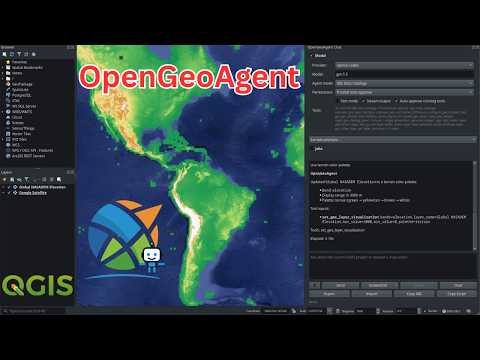
QGISのプラグイン「AI Edit」に新機能「Vectorize」が登場。
航空写真から作成した土地被覆データの上で、抽出したい色を選択して実行するだけで自動でベクトル化(線や面のデータに変換)できる模様。
簡単4ステップで導入も容易とのこと。
詳細はリプ欄。
日本語
Jeff Harrison
9.8K posts


@JeffHarrison
Working on interoperability, geosocial networking and democratic access. Recovering entrepreneur, intelligence officer, open geospatial guy.


Shapefiles have officially landed on Earth. goo.gle/422v5sv By simply uploading a .zip file, you can render features and attributes as flexible, cloud-native data layers. This is the ultimate silo-breaker for professionals who need to combine local zoning data, property boundaries, and more to get a complete geospatial picture. Add your first Shapefile to Google Earth now.