
Carlos Calderón retweetledi

Mapa topográfico de la #CiudadDeMéxico podemos ver claramente como la ciudad es una cuenca y no un valle.
SHAHNAB AHMED@AhmedShahnab
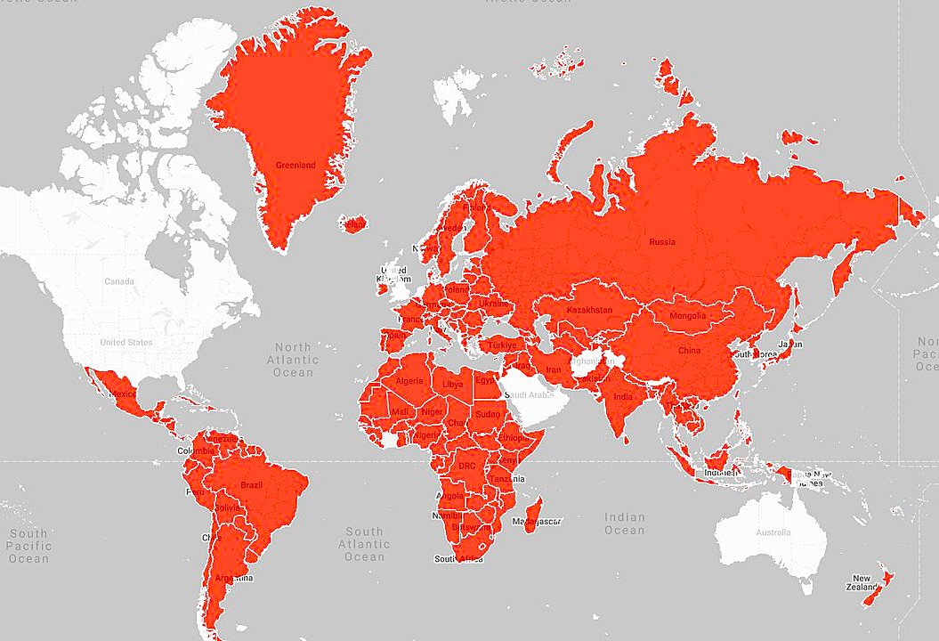
Bored of boring flat heatmaps? Introducing Topographical Explorer that turns any country into a real-time tactile landscape Search any country → watch real elevation data come alive as thousands of satisfying 3D blocks. Built entirely client-side with: - React Three Fiber + Three.js - AWS Terrain Tiles + OpenStreetMap - Real-time boundary @threejs @reactthreefiber #DataVisualization #Geospatial #CreativeCoding #BuildInPublic
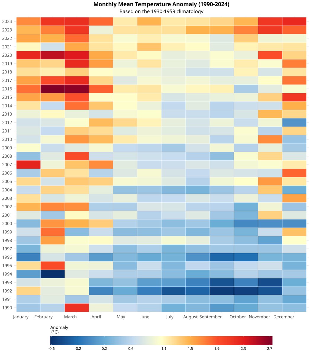
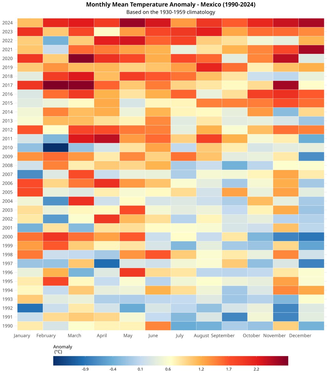
Español