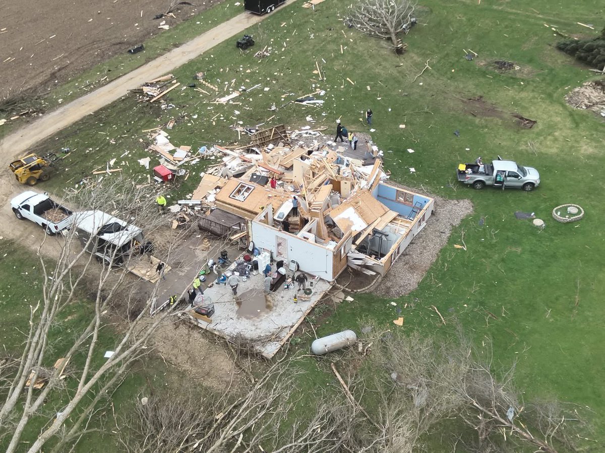
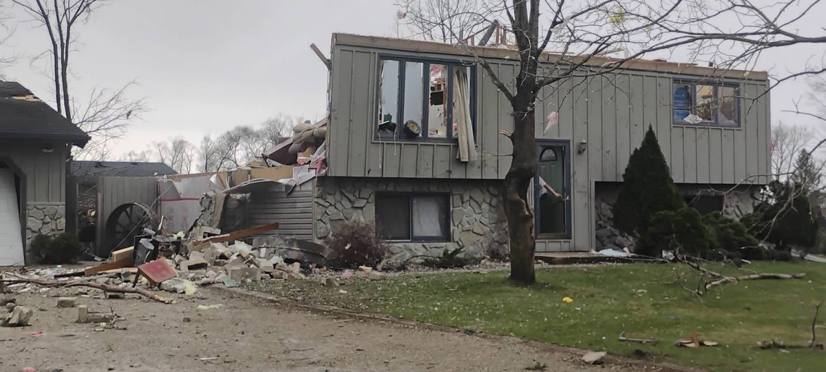
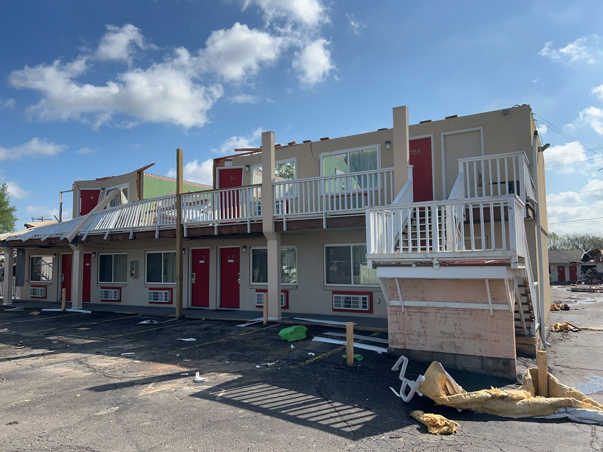
Good news out of Buffalo County, Wisconsin, Sheriff’s Office reports no injuries after a house was struck by a tornado.
Heavy damage being reported across the state, but thankful everyone is safe here.
#wiwx#Wisconsin#tornadodamage
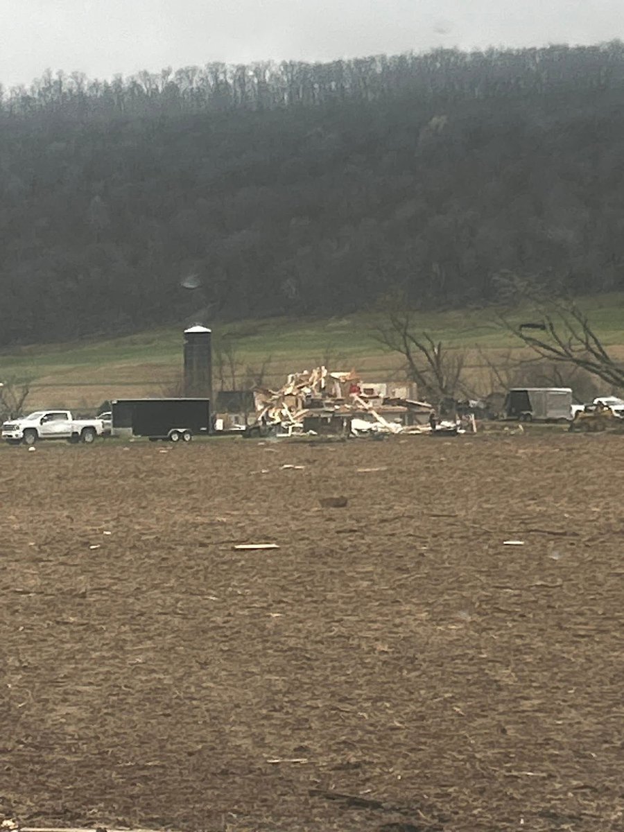
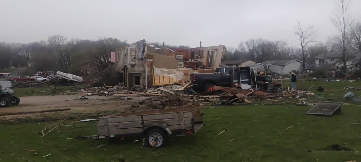
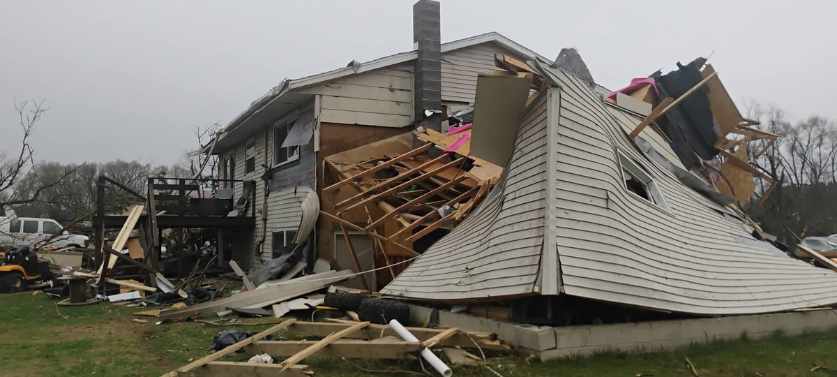
Intense tornado damage coming in from Marion, MN. Thankfully, so far no injuries or fatalities that I’ve heard of.
Credit: facebook.com/share/v/1GQmFa…
Insane video coming in from the tornado that impacted parts of Marion, MN. It does seem like there was a lot of debris in the air, hopefully everyone is alright.
Credit: Emily Ann (On Facebook)
@AnubizzzBurner@chazzzwx I called it from this morning, I will hold my breath to see what really happens, but I feel people were too quick to jump the gun on the northern mode.
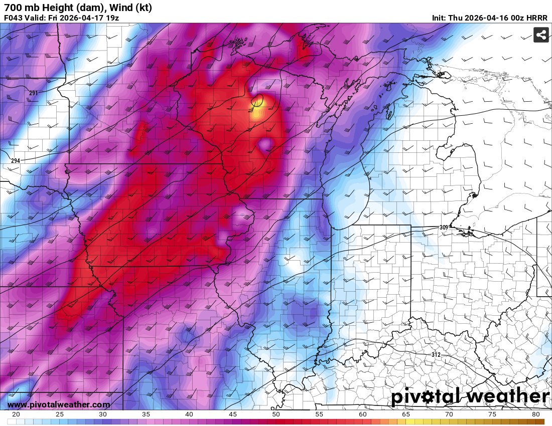
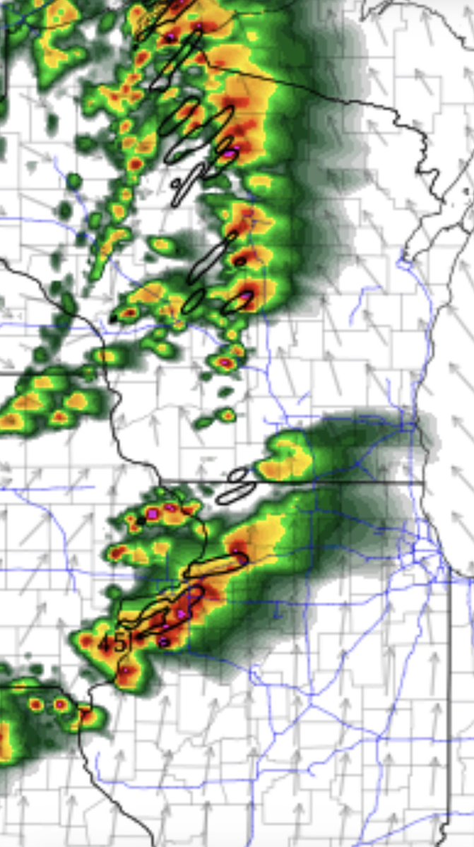
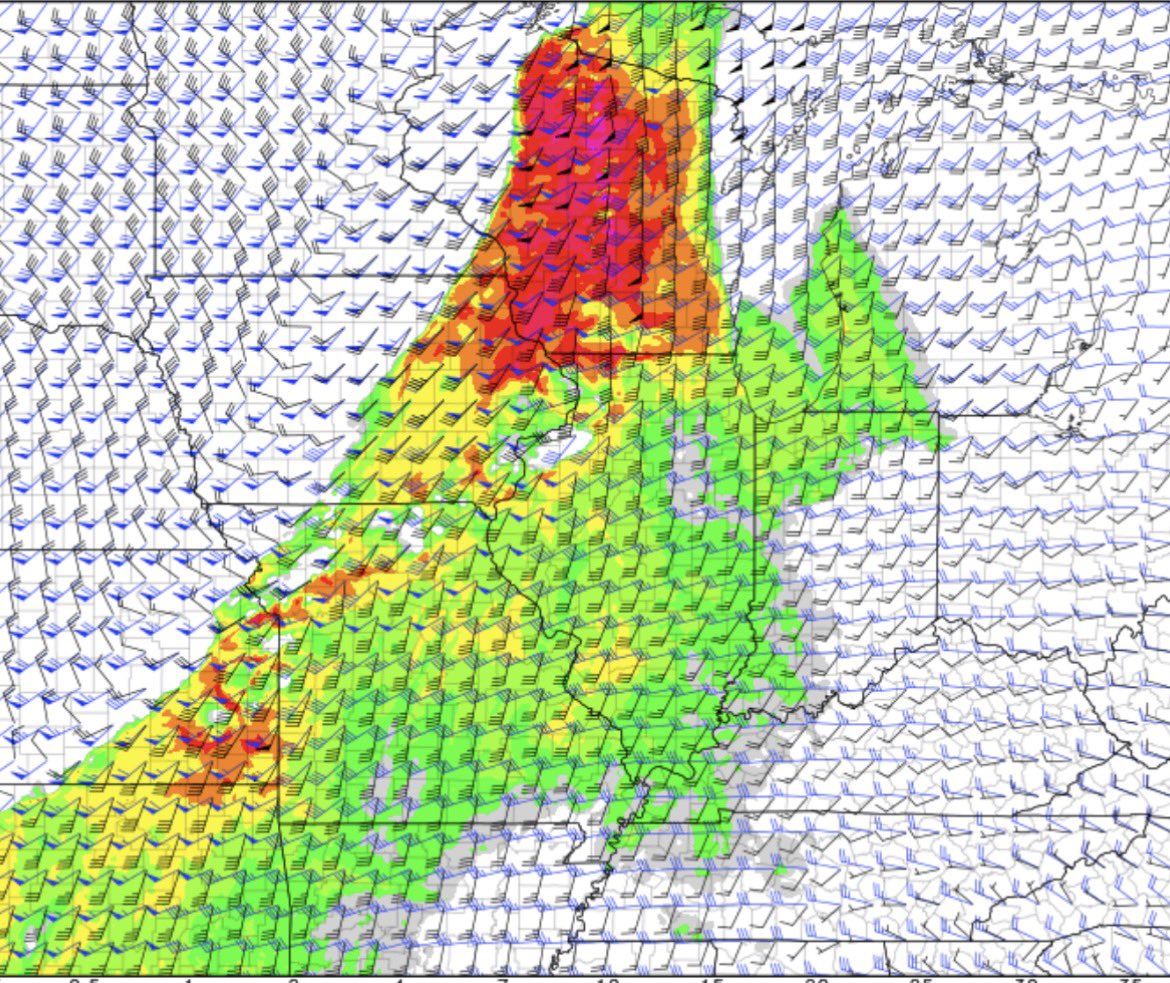
@StarInBoxWx What I do notice, is unlike Tuesday, Tomorrow is forecast to have a stronger and earlier LLJ overspread most of WI, by 1-4 pm at least by most HRRR runs. Early storms could cause serious issues before upscale growth, depending on how fast that happens.
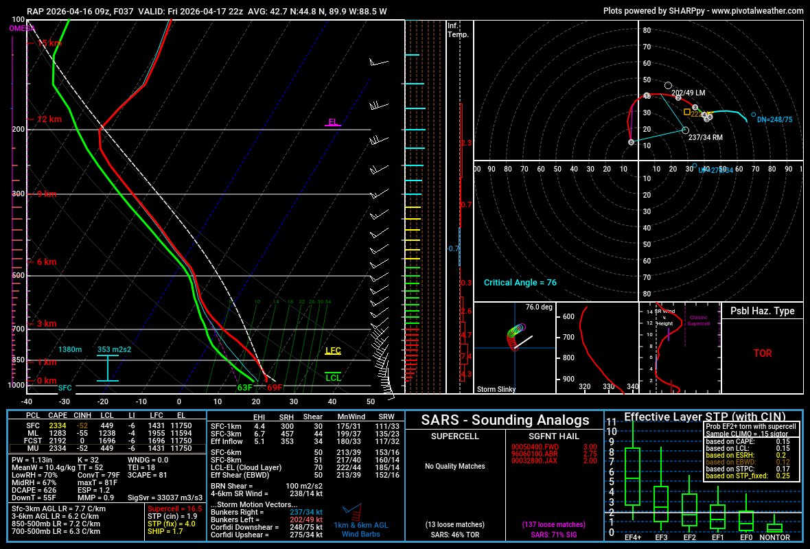
This doesn't mean a high-end event won't materialize, but it could be subdued by a messier storm mode. Still, any supercell that can take advantage of this volatile environment will be capable of producing strong-intense, long-tracked tornadoes and very large hail.
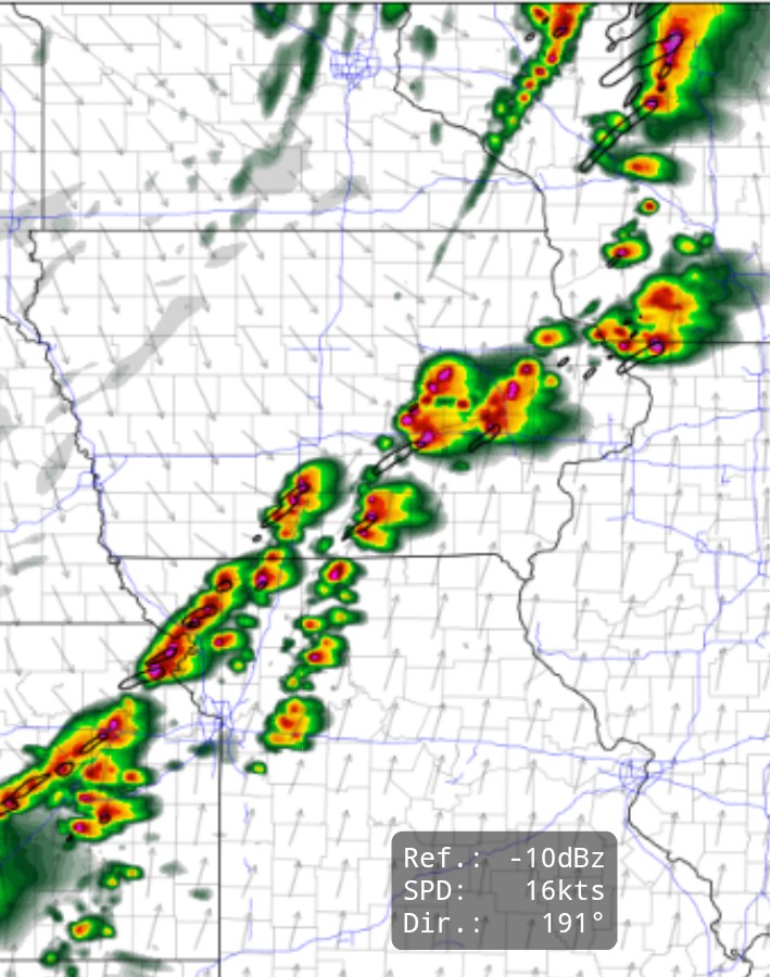
I'm inclined to believe that the storm mode could get quite messy in WI/IA/IL tomorrow. While shear vectors are more orthogonal and synoptic forcing isn't too strong, high-CAPE, with a more saturated profile is a recipe for tons of storms across the OWS.
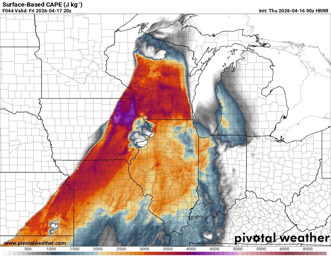
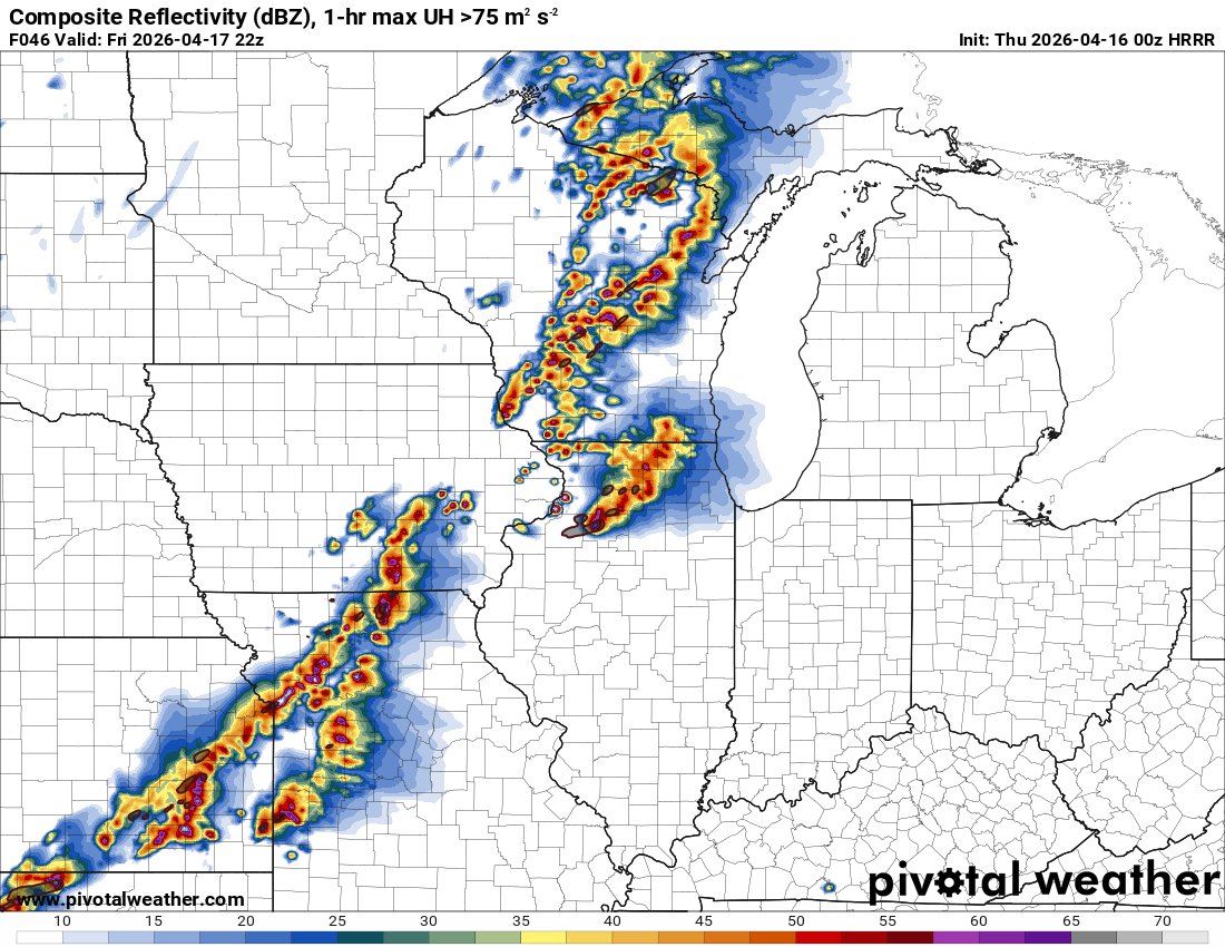
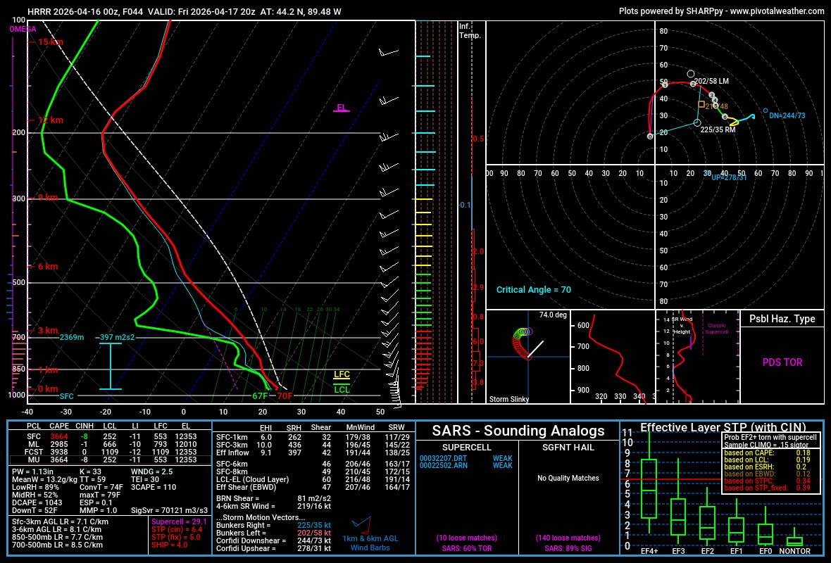
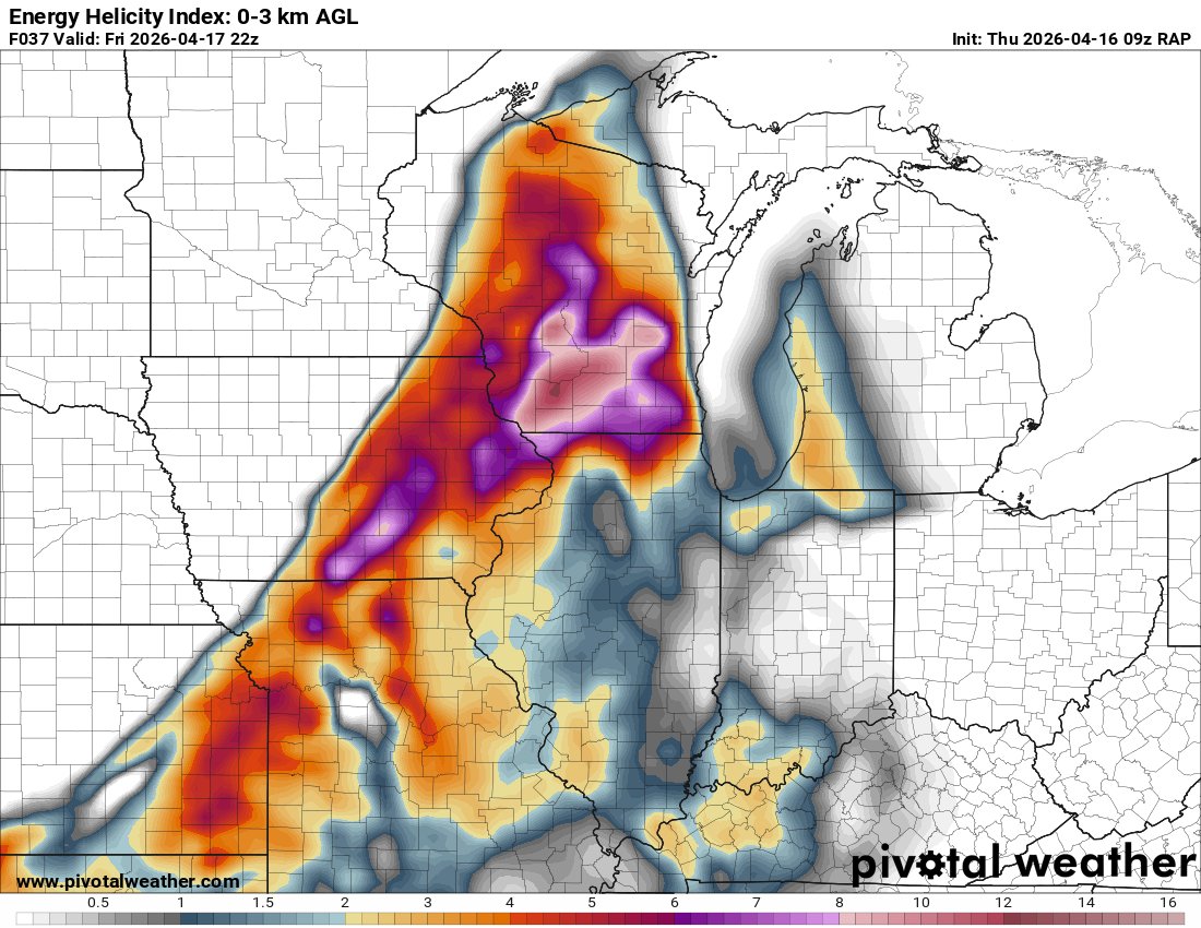
Well...that is certainly an intriguing 00z HRRR run for the severe threat on Friday, April 17th. This depicts a potent supercell/tornado risk across Wisconsin. Very impressive thermos w/enlarged hodographs. Plenty of things to iron out in 48 hours, but interesting nonetheless.
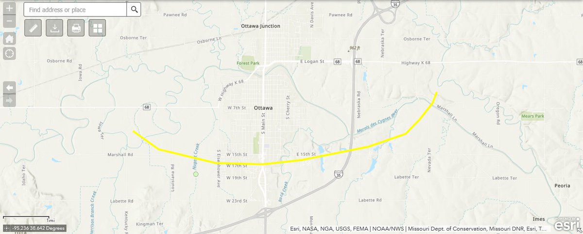
- Damage Survey Update -
The tornado that impacted Ottawa, Kansas on April 13 has been rated mid-range EF2, with peak estimated winds of 125 mph, according to the National Weather Service office in Topeka, Kansas.