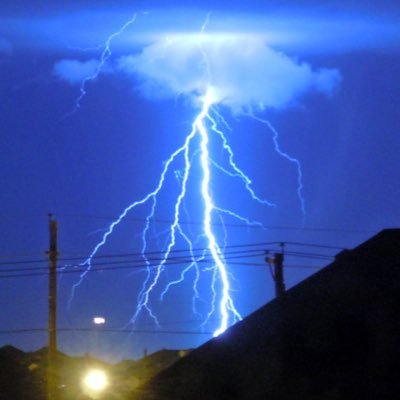
Star

22.1K posts

Star banner
Star

Star

@StarInBoxWx

20 | ✝️ | Severe Weather Analysis | National Wx: @weathertrackus

Alabama Katılım Eylül 2016
110 Takip Edilen3.7K Takipçiler
Sabitlenmiş Tweet
Star
Star@StarInBoxWx·
🧵ALABAMA Wx - Accounts to Follow! National Weather Service Offices: North AL: @NWSHuntsville Central AL: @NWSBirmingham Southwest AL: @NWSMobile Southeast AL: @NWSTallahassee Map attached below. Find your county, and follow your respective NWS WFO.
Star tweet media
English
3
1
20
8.1K
Star
Star@StarInBoxWx·
Today's event isn't over, but honestly I think our forecasts didn't do too bad. Quantitatively wise, was on the lower end, but intensity wise, it seems like we did have at least one likely intense (EF3+) tornado in NE. 1 thing I wish we did was communicate the wind threat more.
Star@StarInBoxWx

Still going against the grain a little for today, with some stronger wording. There's a possibility today doesn't end up as bad as it looks (for people), but with a line of supercells, whether they're discrete or embedded, entering a potent environment, it's a recipe for trouble

English
0
0
1
384
Star
Star@StarInBoxWx·
Very stationary storms...
English
0
1
1
170
Star
Star@StarInBoxWx·
53kt VROT TORE... Interesting.
Nederlands
0
0
24
571
Star
Star@StarInBoxWx·
Even though the cold front was a bit faster than modeled, we had at least 1 SigTor so far today... and I'm watching a couple more cells starting to enter a more favorable environment in NE.
English
0
1
26
704
Star
Star@StarInBoxWx·
A bookend with a supercell. Alright...
Star tweet media
English
0
0
12
690
Star
Star@StarInBoxWx·
Hmmm...
Star tweet media
0
1
7
639
Star
Star@StarInBoxWx·
There will be landspout tornadoes in Colorado today.
Star tweet media
English
0
0
19
554
Star
Star@StarInBoxWx·
Even on the lower-end, I think the 10/15% tornado risk areas will still see a few-several tornadoes, along with 2"+ hail and a swath of damaging winds. Unless we end up with a lot of mixing or an instantly linear storm mode, a significant tornado event is looking quite likely.
English
0
0
4
347
Star
Star@StarInBoxWx·
Still going against the grain a little for today, with some stronger wording. There's a possibility today doesn't end up as bad as it looks (for people), but with a line of supercells, whether they're discrete or embedded, entering a potent environment, it's a recipe for trouble
Weather Track US@weathertrackus

We're still concerned about the potential for several-numerous tornadoes, along with a few that could be strong to intense (EF2-EF3) across parts of Nebraska, South Dakota, Iowa & Minnesota, including the Siouxland region later this afternoon and this evening. There remains some uncertainty as far as how quickly storms along the cold front will grow upscale, which will determine the ceiling of today's tornado threat. If storms remain more discrete for longer, the hail and tornado threat will be maximized, but if storms congeal into a line earlier on, the damaging wind threat will be maximized. Still, even embedded supercells can produce large hail and strong-intense tornadoes, so the concern remains quite elevated regardless of storm mode. Further south along the dryline, the threat for severe storms/tornadoes is a bit more conditional, but the signal is there for at least isolated supercells developing late this afternoon, capable of producing large-very large hail, and perhaps a few tornadoes. A couple strong tornadoes will be possible as well. Stay tuned to weather information throughout the day, and monitor watches/warnings when they're issued this afternoon and tonight.

English
2
3
29
2.4K
Star
Star@StarInBoxWx·
@computerman318 Definitely stays MDT. I don’t see them downgrading.
English
1
0
0
55
Star
Star@StarInBoxWx·
Today is going to be an interesting one… Fairly high ceiling, capable of supporting EF3+ tornadoes, perhaps even a couple long-tracked tornadoes (>25mi), but storm mode will be the main determining factor in that ceiling. Even a more linear mode could still produce a few EF2+.
English
1
2
69
3K
Star
Star@StarInBoxWx·
Somewhat surprised at the lack of a CIG2 tornado risk for today, but I can see how storm mode could limit the more intense tornado threat. I foresee that changing in future outlooks, though. Today could be quite serious, even if the greatest threat is more localized.
Weather Track US@weathertrackus

Enhanced Risk of severe storms today across parts of the Northern Plains. All severe hazards are possible, including the potential for several-numerous tornadoes, a few of which may be strong. An intense tornado or two will be possible, mainly dependent on storm mode. Very large hail and damaging winds are likely as well.

English
0
3
29
2.1K
Star
Star@StarInBoxWx·
This could be a very interesting situation on Monday... Sun night's storms leave an OFB in KS/NE, which storms that develop off the cold front could eventually interact with by late afternoon. The question will be just how quickly storms will grow upscale.
English
2
12
124
6.8K
Star
Star@StarInBoxWx·
I said this on WTUS earlier, but while Monday is very uncertain, and it looks like the dryline threat may be on the more conditional side, but I wouldn't get *too* much into the weeds, or let your guard down. There's still over a day of runs to go through to figure things out.
Star tweet media
English
1
2
17
931
Star
Star@StarInBoxWx·
As far as the dryline in KS, it's quite questionable if anything robust will develop before the CF crashes southward. Robust ascent may be displaced just to the north, and strong low-level mixing could choke updrafts.
Star tweet mediaStar tweet mediaStar tweet media
English
1
1
14
821
Star
Star@StarInBoxWx·
500 tornadoes
Star tweet mediaStar tweet mediaStar tweet media
English
1
3
61
5.5K