Sabitlenmiş Tweet
Chucky💫
10K posts


Chucky💫
@ChuckySmiths
Weather Nerd | FFXIV |🏳️🌈|
Highland MD Katılım Haziran 2017
128 Takip Edilen299 Takipçiler

Chucky💫 retweetledi

The terrifying view of the tornado near Enid, Oklahoma this evening as it crossed the road. Join our live streams & watch the full chase edit coming up via @DanielShawAU/" target="_blank" rel="nofollow noopener">youtube.com/@DanielShawAU/

English
Chucky💫 retweetledi

I forgot about that sound of the door opening when one of your friends would hop online
English
Chucky💫 retweetledi

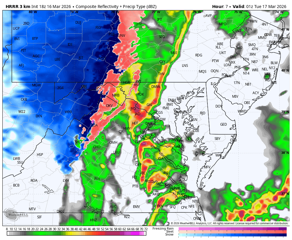
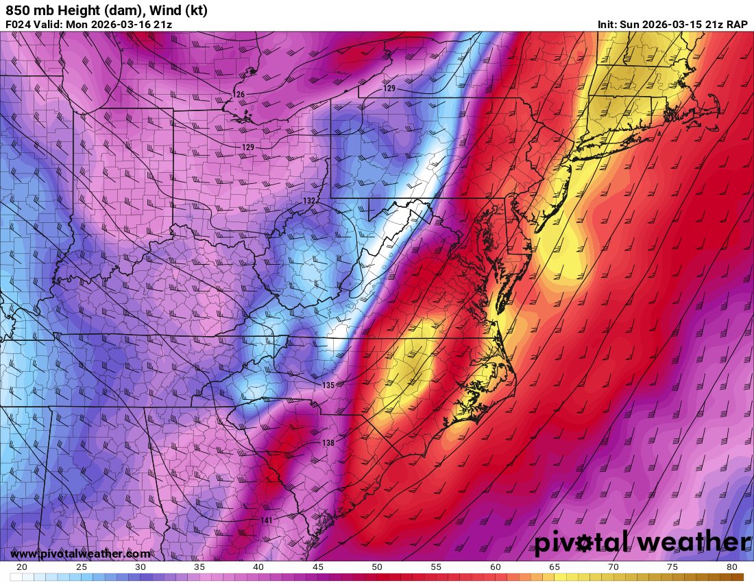
We have used up all of the instability, but wind shear and the LLJ remain very strong. A skinny QLCS is expected to move in later tonight, with widespread wind gusts 50-60mph, and isolated gusts to 75mph possible.
English
Chucky💫 retweetledi
Tornado Watch, canceled. One last chance for damaging winds with a cold front that moves E across the area 6-10pm. Possible a Severe Thunderstorm Watch gets issued for that. Regardless, it will be gusty with & after the front with temps dropping 20-30 degrees overnight.
English
Chucky💫 retweetledi
Prefrontal supercells or not, the QLCS should be a rather prolific tornado and wind damage producer. A 50-60kt LLJ, >300m/s 0-1km SRH, sickle shaped hodos, very low LCLs, all indicate a high end QLCS with potential for hurricane force gusts and numerous tornadoes.

English
Chucky💫 retweetledi

I have declared a State of Preparedness ahead of significant risk for widespread, severe storms and a heightened tornado threat across the state tomorrow, with @MDMEMA coordinating readiness efforts across state government.
The safety of Maryland families comes first, and I am urging everyone to prepare early, stay informed, and adjust plans – including postponing travel – as conditions change.
Please review preparedness recommendations at go.md.gov/StormPrep
English
Chucky💫 retweetledi

Ahead of tomorrow afternoon's severe weather risk, many school districts are opting to close early! Below is a map of currently reported early dismissals. I will work to keep this map updated! You can also stay up to date on early dismissals and closings at jbweather.net/closings
In our local region, this includes: Anne Arundel, Charles, and King George County Schools!

English
Chucky💫 retweetledi

Chucky💫 retweetledi

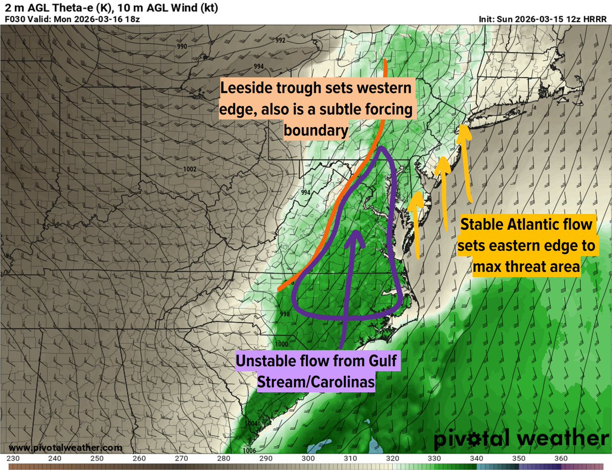
Our maximal threat region is likely to experience some sort of QLCS in association with our cold front, and may additionally see prefrontal convection (supercells) that fires along our leeside trough. Regardless of how exactly this evolves, the low-level parameter space...(1/3)
English
Chucky💫 retweetledi

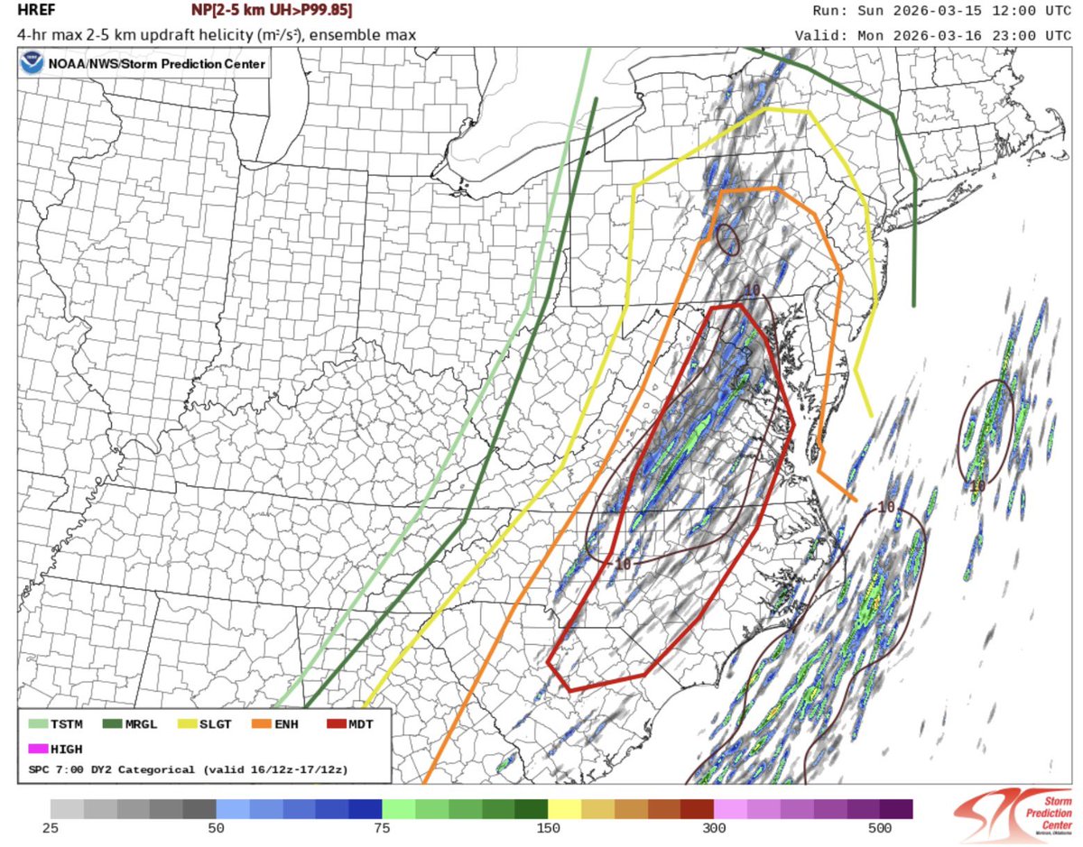
New HREF analysis from the SPC showing plenty of rotation centered right in their moderate risk area, including right around the DC metro, but especially central Virginia.
English
Chucky💫 retweetledi
Chucky💫 retweetledi
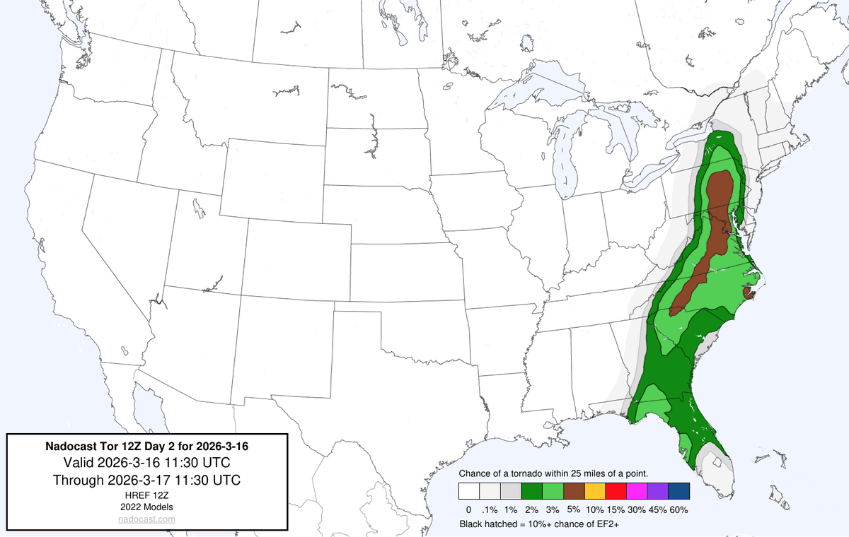
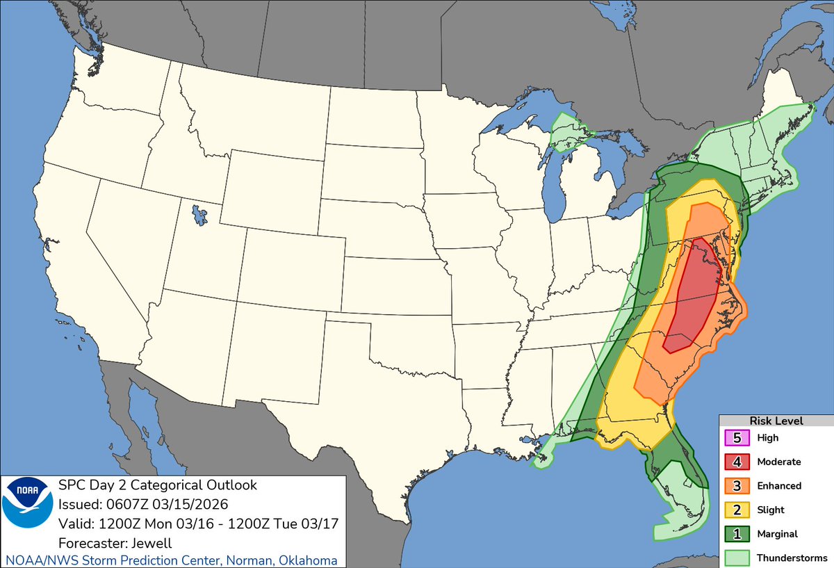
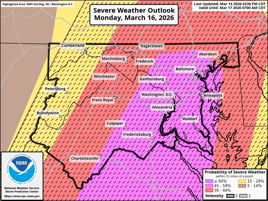
MODERATE RISK issued for the DC Region for thunderstorms Monday! ⚡️⛈️🌪️
This is the second highest level that the SPC issues. Monday’s severe weather has the potential to be serious. They’ve gone 15% significant tornado risk, and 60% significant wind damage risk.
To give you an idea how rare this is for our region, DC has not been included in a DAY 2 moderate risk for severe weather in over a decade…since June 12th, 2013! And that was back before the level 3 “enhanced” category existed.
Take the threat seriously. The SPC does not issue these lightly.

English
Chucky💫 retweetledi

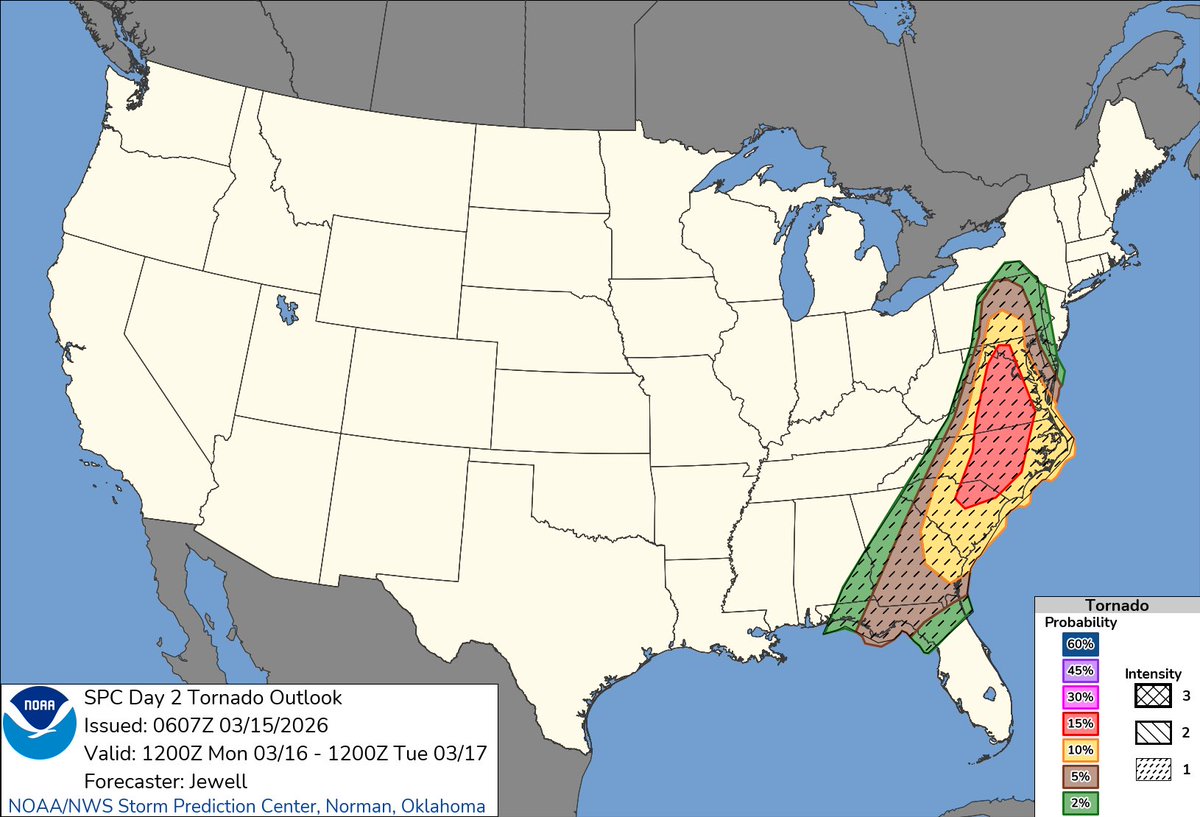
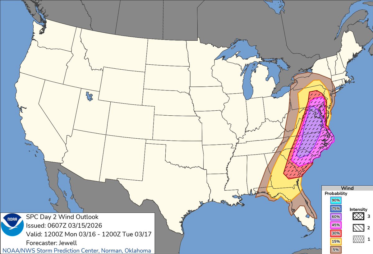
1:09am CDT #SPC Day2 Outlook Moderate Risk: from northern South Carolina across North Carolina and into Virginia and Maryland spc.noaa.gov/products/outlo…
English
Chucky💫 retweetledi

The first D2 moderate risk ever issued in the states of Virginia, West Virginia, and Maryland in the month of March since SPC moved to 5-level outlooks in 2015.
TLDR: Monday harbors very rare severe potential on the East Coast for this time of year.

English
Chucky💫 retweetledi

I am definitely concerned about the potential for hurricane force damaging wind gusts across the Mid-Atlantic from PA to GA from a QLCS.
I believe this is the most potent setup we have seen since August 7, 2023 and the most significant early season setup in around a decade.
English
Chucky💫 retweetledi
In their latest discussion, SPC is considering upgrading our region to a level 4 of 5 MODERATE RISK for severe weather on Monday.
We have only had a handful of these issued for our region as far back as records go. Really speaks to the magnitude of how concerned they are about wind damage potential here Monday.
English
Chucky💫 retweetledi
Chucky💫 retweetledi
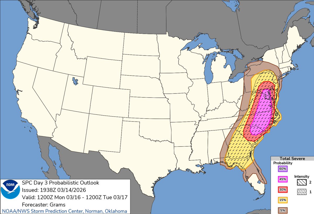
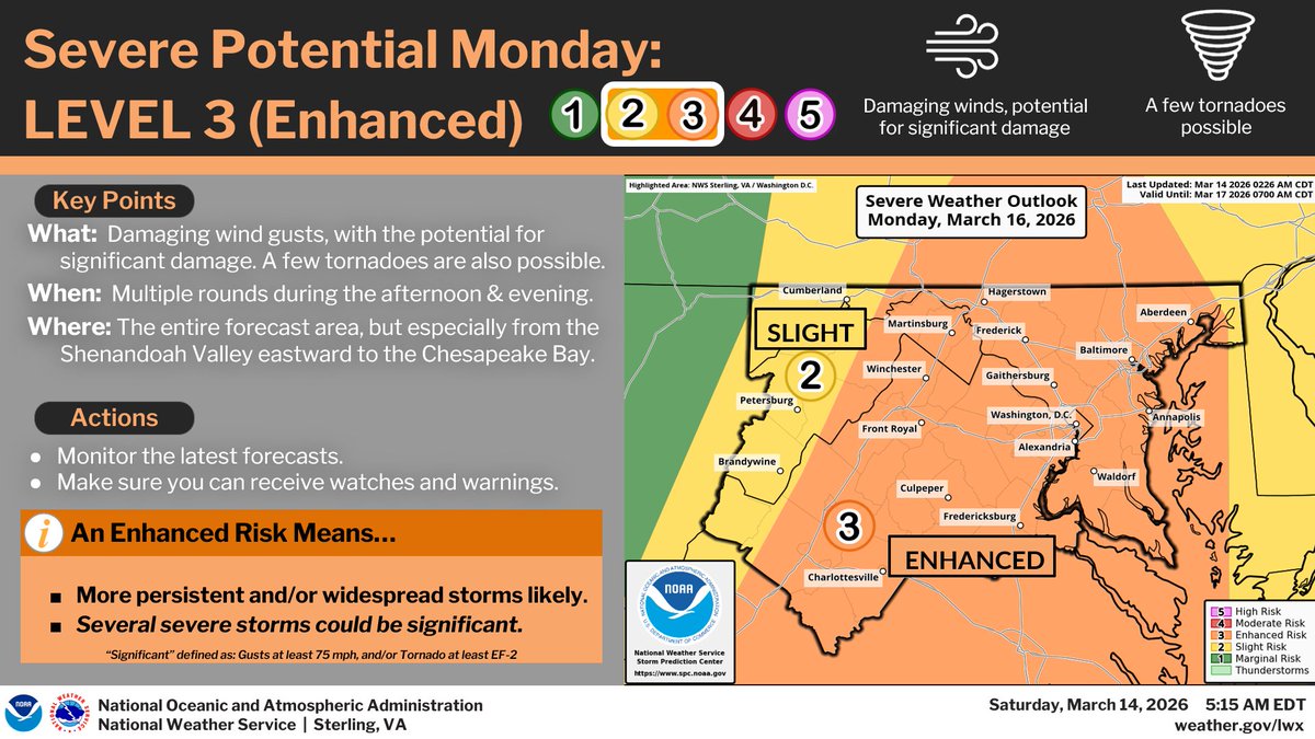
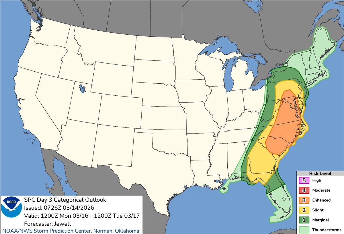
2:28am CDT #SPC Day3 Outlook Enhanced Risk: over much of the Carolinas, Virginia, and extending northward into southern Pennsylvania spc.noaa.gov/products/outlo…
English