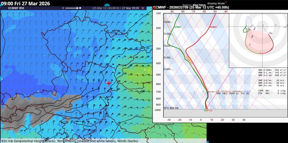
Will I get the most interesting snow situation on Friday in Wiener Neustadt this year? Frontogenesis on steroids with strong WAA hodograph in prevailing N-ly flow. Bring it on!
English
Tomas Pucik
5.1K posts
@Djpuco
Researcher and trainer at ESSL, forecaster at ESTOFEX


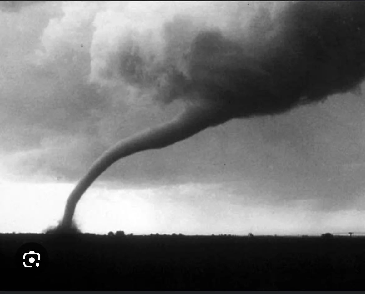
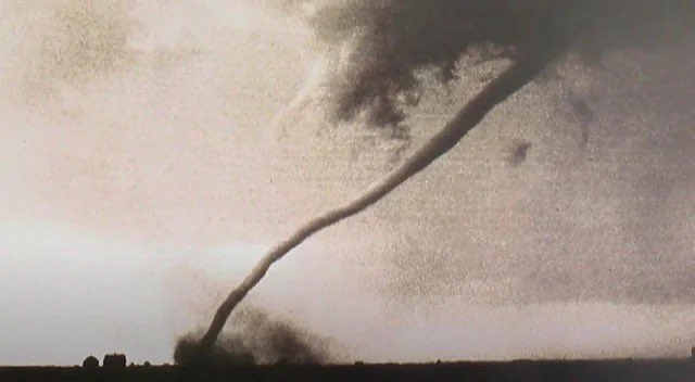
LINK: youtube.com/watch?v=9bLgmX… Meteorological breakdown of the tornadic supercell that tracked across NE Illinois/NW Indiana back on March 10. In it, @CameronJNixon and I take a deep dive into the synoptics behind the event, what may have caused the drastic change in behavior as the storm approached Kankakee, and how giant hail and tornadoes were able to occur simultaneously with this storm.

Very large hail seen here destroying the roofs of buildings & vehicles in Vientiane, #Laos. Hail sizes seen in this hand look at least 2in (5cm; lime 🍋🟩 sized) though there could be bigger hail sizes. 📷: Chandany Cooper (Facebook; link below) #LAOwx #severewx


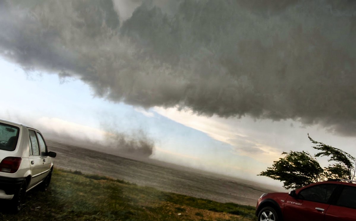
Radar vs the shot Ranger, TX May 18, 2025


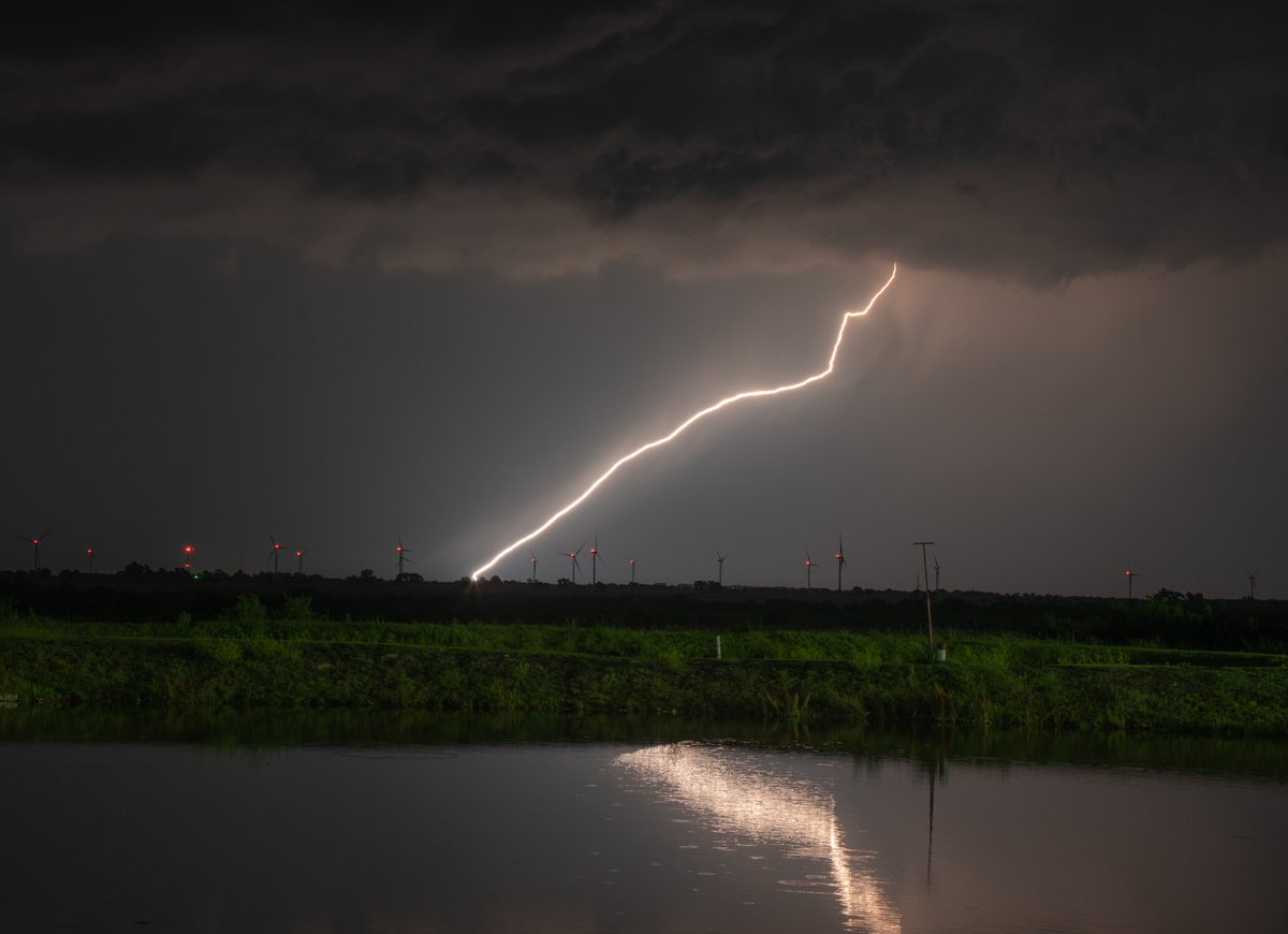

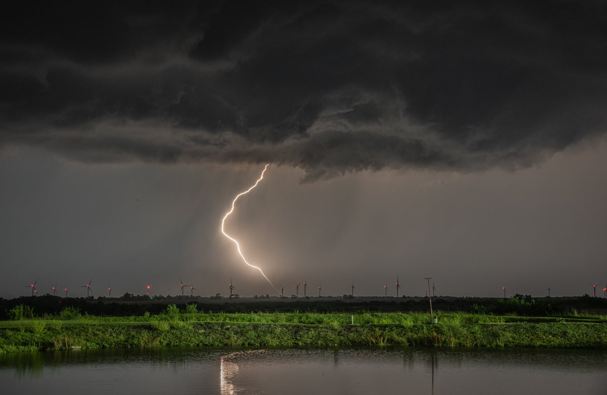
Lightning and storm from Tornado Warned Storm near Henry, IL from Tuesday Night. I was up in the hook just E of Henry but none of my shots showed the tornado. It’s crazy knowing that there was a confirmed tornado thru there as I was in 55-57 degree temps (I was just S of core so was looking S even SE at circ). #ilwx

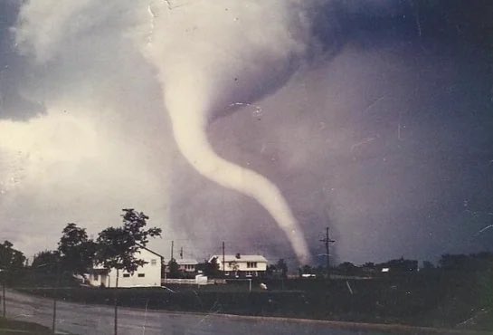
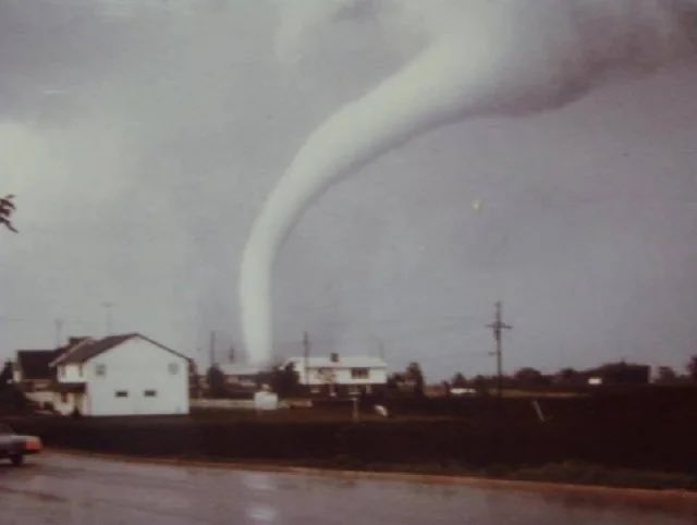
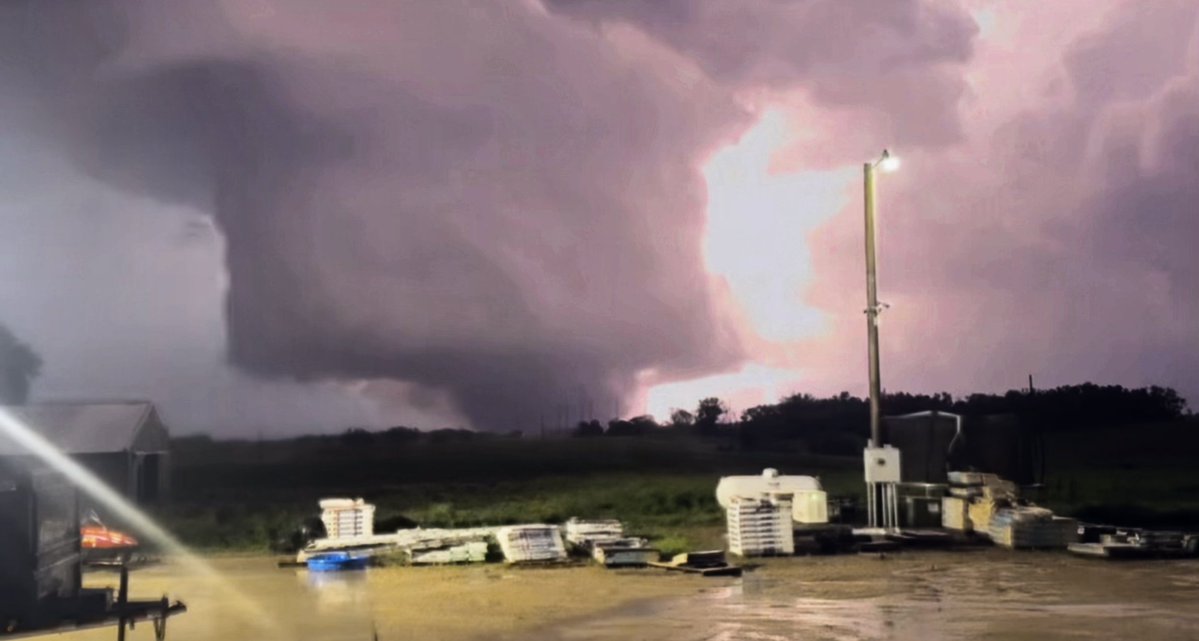
Here’s what the Kankakee supercell looked like from distance while it rapidly re-intensified and put down the EF-3 tornado along with possible record size hail #ilwx


Updated animation: cimss.ssec.wisc.edu/satellite-blog…