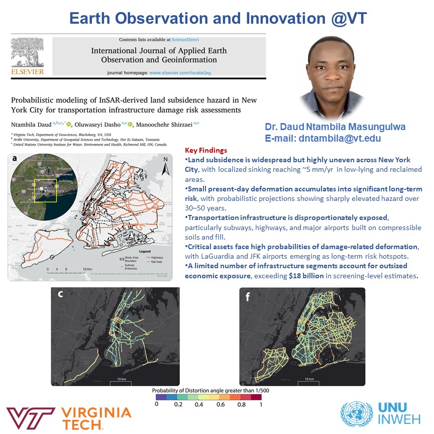
Earth Observation & Innovation @VT retweetledi

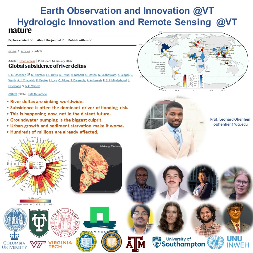
*** New Paper Alert ***
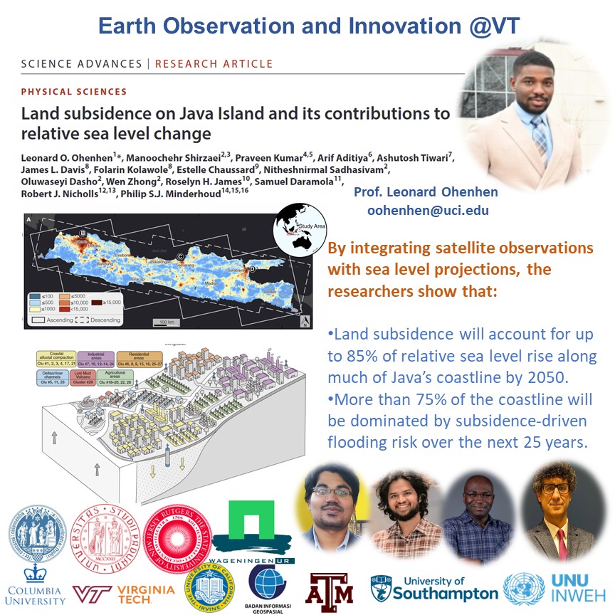
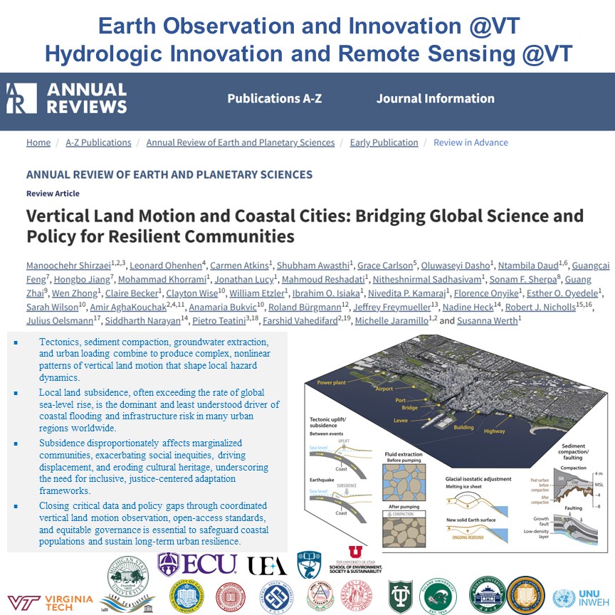
Pleased to contribute to this new study published in @NatureComms, led by @JuliusOelsmann demonstrating that #land #subsidence is already #doubling relative #SeaLevelRise experienced by many #coastal #populations worldwide. Integrating #satellite #geodesy and ground observations reveals that subsidence is a critical but often #overlooked driver of coastal #flood risk and climate vulnerability.
@EOI_lab @UNUINWEH @vtgeosciences @VT_Science
pub: nature.com/articles/s4146…

English