
Marin Govorcin
350 posts
Marin Govorcin
@Govorcin
JPL Postdoctoral Fellow @NASAJPL Statements and opinions posted by me are my own and not those of my employer.
Pasadena, CA Katılım Kasım 2009
431 Takip Edilen337 Takipçiler

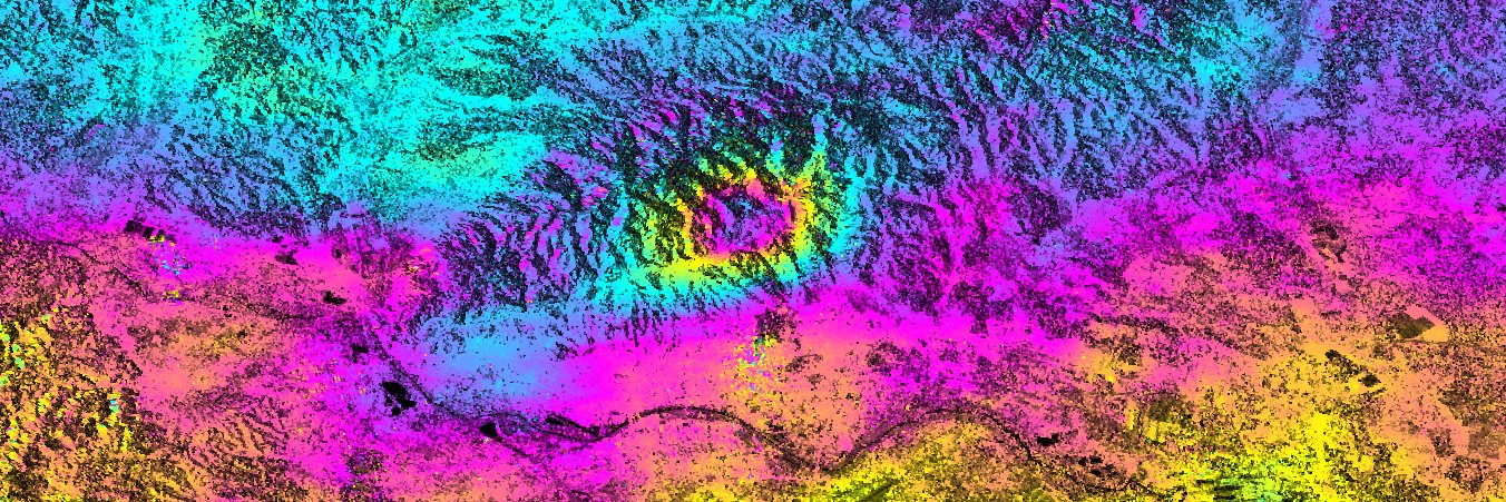
The 2024 magnitude 7.5 Noto earthquake in Japan occurred on a fault system that has seen repeated seismic swarms since 2020. New research in Science deciphers the intense ground motion of the event.
Learn more in this week's issue: scim.ag/86Y

English
English
Marin Govorcin retweetledi

Deeply honored to receiving this award for #SAR capacity building from @IEEE_GRSS. Thanks to the many of you I’ve had the pleasure of working with to make #SAR data more accessible.
#GoldenAgeOfSAR @Ak_Satellite @UAFGI
IEEE Geoscience and Remote Sensing Society@IEEE_GRSS
🏆 This year's IEEE GRSS Education Award was presented to Prof. Franz J. Meyer "in recognition of significant education contribution to geoscience and remote sensing." 🌍🛰️ #IEEEGRSS #EducationAward #Geoscience #RemoteSensing
English
Marin Govorcin retweetledi

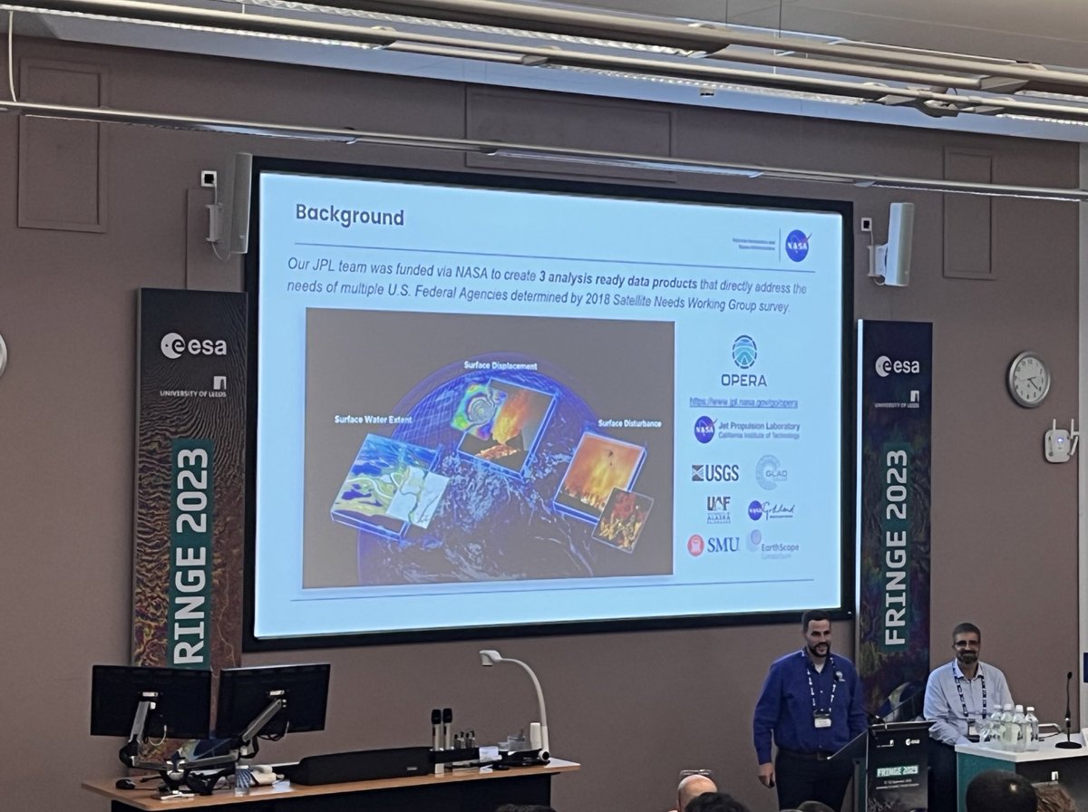
Come and see what the OPERA team has in store for near global remote sensing! @J_P_Olofsson @SARevangelist @iamgracebato @gfun @HereshF @NatashaSadoff
Alexander Handwerger@TheHandwerger
OPERA will host a free hybrid (online + in person) workshop on Friday, July 19, 2024, from 8:30 am – 1:05 pm Pacific Time at the Liberty Station Conference Center, San Diego, CA. To register please see our website jpl.nasa.gov/go/opera/opera…. We hope to see you there!
English
Marin Govorcin retweetledi

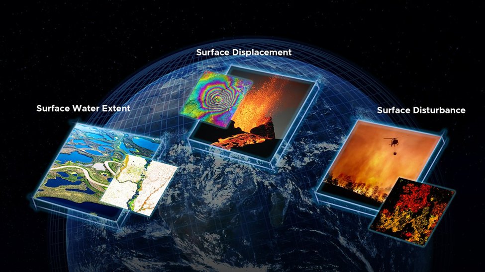
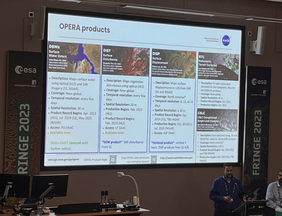
NASA's OPERA project released two new analysis-ready products. The OPERA project uses data from satellite radar and optical instruments to produce surface water extent and surface disturbance data products.
Learn about the new RTC SAR Backscatter Product: go.nasa.gov/3NKOxDp
English
Marin Govorcin retweetledi
Out today! The product of years of work by many talented people (and me)! A consensus geodetic dataset for southern California, with velocities and time series from both GNSS and InSAR! We nerded out about the details so you don't have to!
Download here: zenodo.org/records/100768…

English
Marin Govorcin retweetledi

Alert 🚨 Funding opportunity for students! NASA FINESST, due Feb 6 2024. Eligibility: any student who by Feb 6
has
applied to, or is admitted to, or is enrolled as a Master’s or Ph.D. student in an Earth- or space sciences-related discipline, at an accredited U.S. university.
English
Marin Govorcin retweetledi

Earth's seas – at a glance 🌍
During its first 21-day science orbit, the SWOT satellite captured data used to create this detailed global composite of sea surface heights.
SWOT's nearly complete view of Earth is revolutionary for #TrackingWorldWater. go.nasa.gov/40xLrb3
English
Marin Govorcin retweetledi

This is one of the clearest satellite views you will ever see of California.
Breathtaking satellite image today of California, one of the most beautiful places on the planet.

English
Marin Govorcin retweetledi

There was a Sentinel-1 acquisition in Afghanistan today, about 7 hours after the earthquake. The @NERC_COMET @COMET_database system was activated automatically and produced results this afternoon.
Event page with links to download data:
comet.nerc.ac.uk/earthquakes/us…

English
Marin Govorcin retweetledi
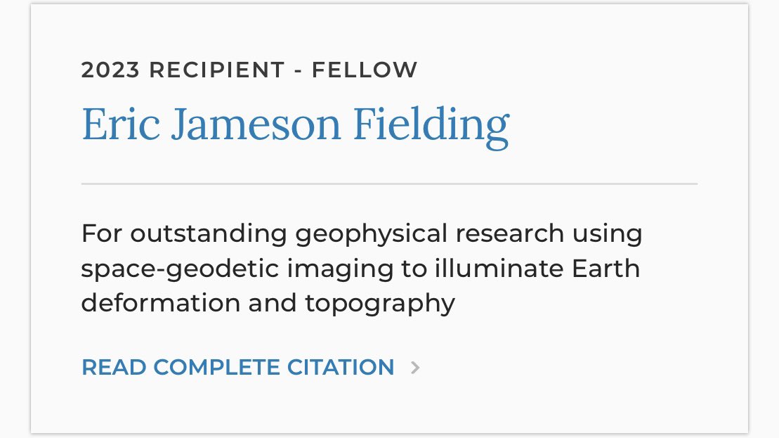
🚨#SAR Twitter🚨
One more fantastic news for all y’all. Our colleague and friend @NASAJPL Eric Fielding (@EricFielding) became AGU’s Fellow. Congratulations Eric and thanks for all you do for the community!
Excellent choices @theAGU ! 🥳
#GoldenAgeOfSAR
English
Marin Govorcin retweetledi
Marin Govorcin retweetledi

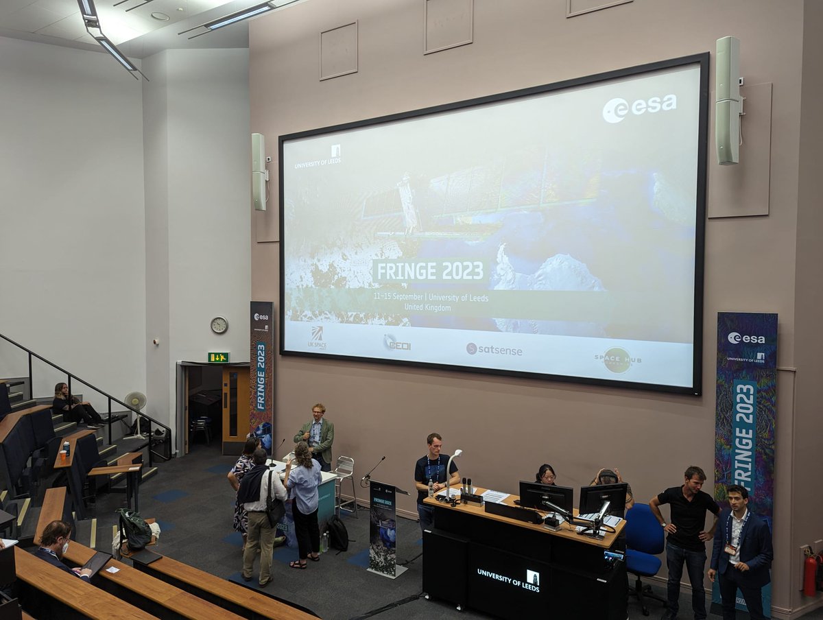
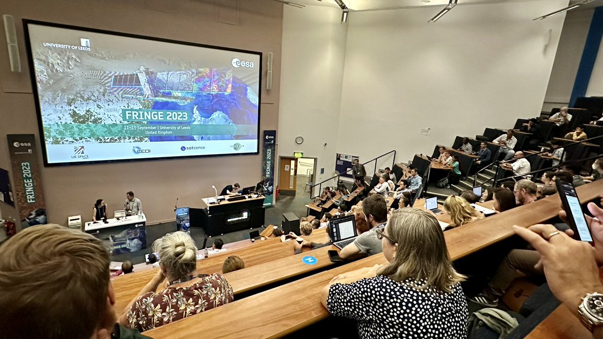
@esa #ESAFringe23, live now from @UniversityLeeds Auditorium1 Opening Session. Live at fringe2023.esa.int/live-stream/

English
Marin Govorcin retweetledi


Marin Govorcin retweetledi

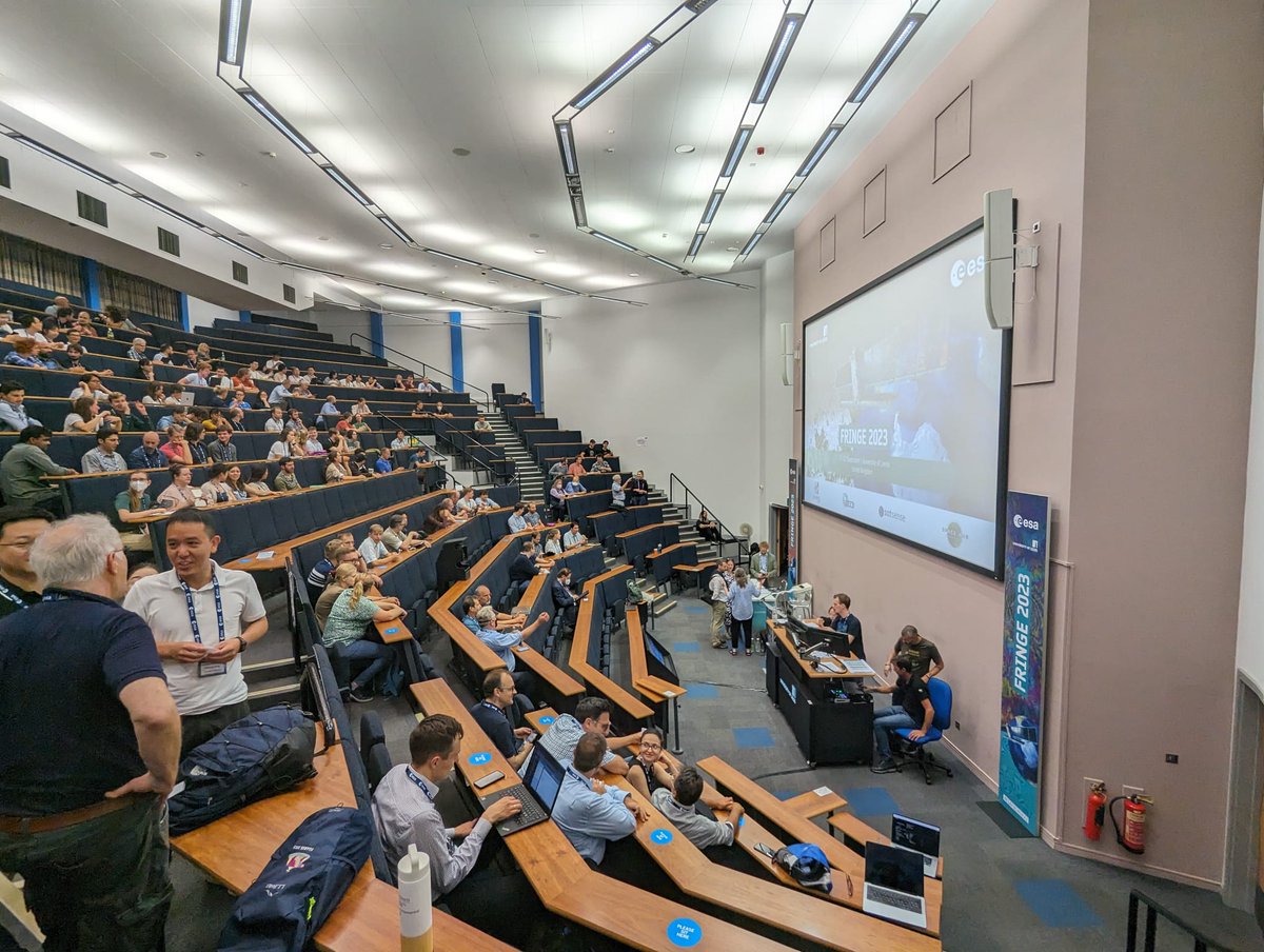
@ESA_EO #fringe2023 Day 2 - @SStanie talks about novel algorithm designed for OPERA Surface Displacement (DISP) products

English
Marin Govorcin retweetledi
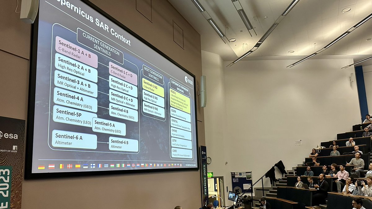
🚨Updates from @ESA_EO #InSAR #FRINGE Workshop🚨
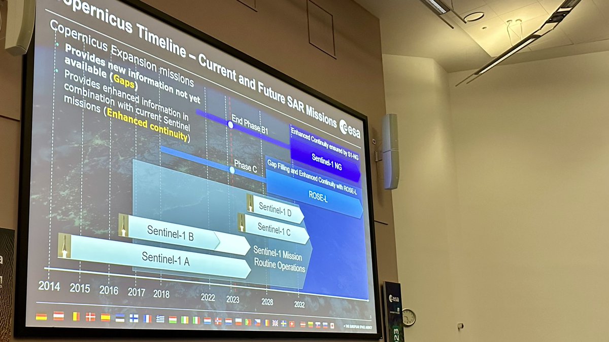
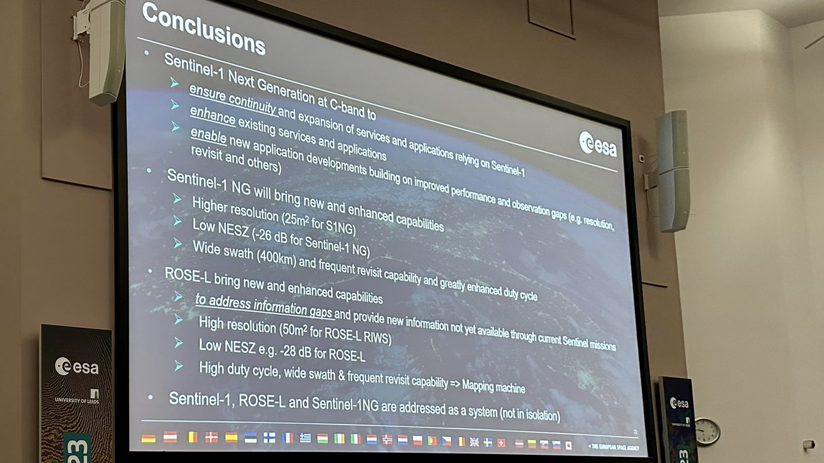
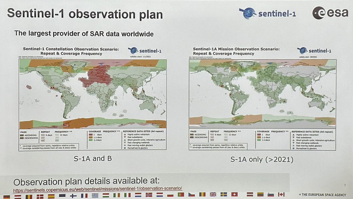
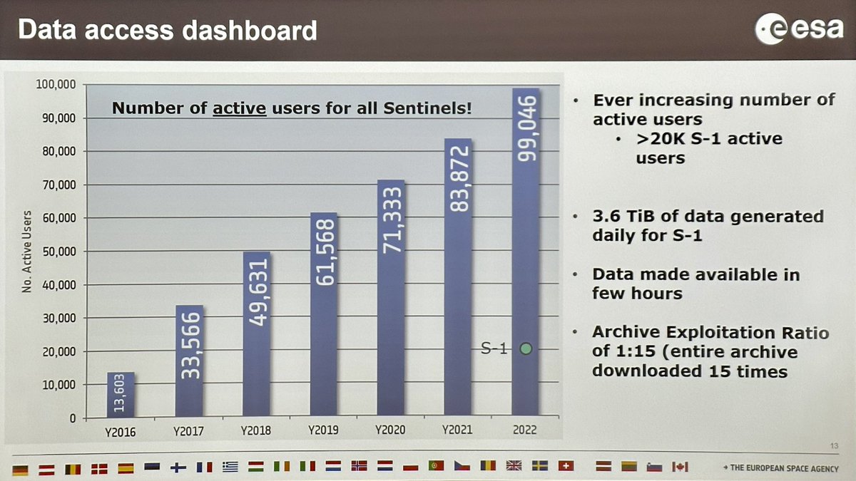
Kicking it off with session on @CopernicusEU #Sentinel1. Nuno Miranda sharing exciting #Sentinel1 updates (adjustments to acquisition plan; growing user base; S1C launch; new cloud services) 🥳.
#GoldenAgeOfSAR #FunWithFringes

English
English
Marin Govorcin retweetledi
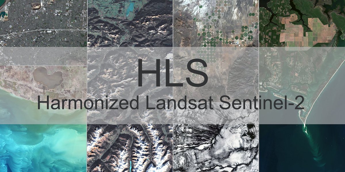
Historical processing of the complete Harmonized #Landsat and #Sentinel-2 (HLS) data and imagery archive is complete. Users can now access continuous HLS data and imagery from 2013 to present.
Read more: go.nasa.gov/3sAW3Zz
English