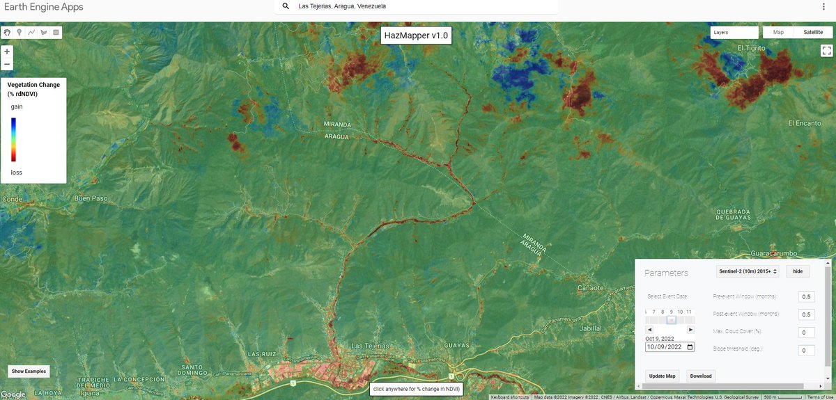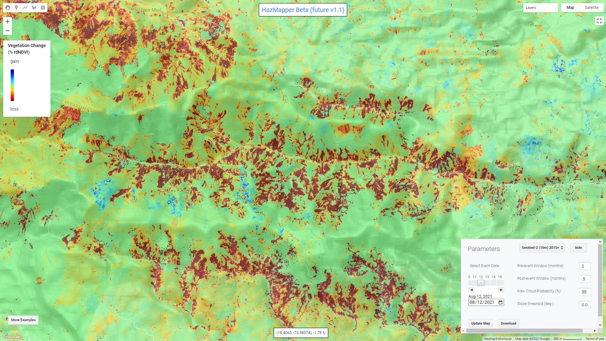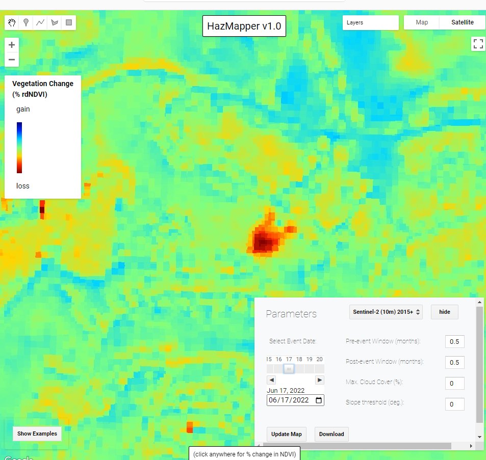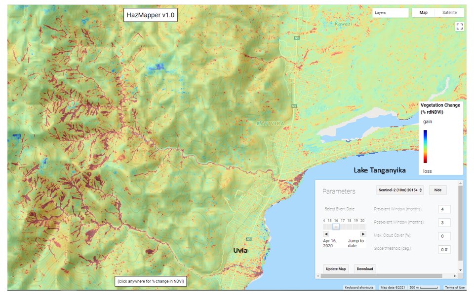

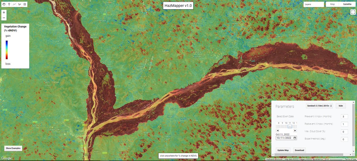
October flood woes along the #Niger and #Benue Rivers is clearly visible using #Sentinel2 imagery and the @HazMapper #rdNDVI algorithm. Contiguous red areas = loss of vegetation during #NigeriaFloods inundation. Explore yourself with the direct URL at #lon=7.005157562197417;lat=7.927958595372147;zoom=11;dataset=0;prewindow=3;postwindow=1;maxCloudCover=0;slopeThreshold=0;eventDate=20221011" target="_blank" rel="nofollow noopener">cmscheip.users.earthengine.app/view/hazmapper…;
English