Hünkar Gülümser
117 posts
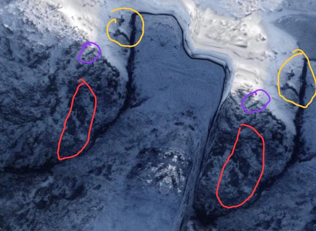

İnternette dolaşan buna benzeyen bir videoyu görmüşsünüzdür, bakıp bulamayan, yalan bu görüntü diyenler var, ben de bir bakayım dedim.
Baktım ve görüntü gerçek.
Hatta dolaşan videoda olmayan bir görüntüyü daha farkettim, o da videonun sonunda mevcut.
Bu nasıl olur? Amacı nedir?
Bu zamana kadar nasıl fark edilmemiş anlamadım ama sizin için ekran görüntüsünü kaydettim :)
Türkçe
@phh6kkp9dm @Maviturkk Bunun gibi bir çok hata var google haritalarda veya earth te. Hatta yandex haritalarda bile var. Haritalamada doğal oluşan boşlukları otomatik kapatma yapılırken bunlar oluşuyor. Otomatik kapatmaları daha az dikkat çekmesi için aynalama ve tonlama yöntemi kullanılıyor. Sonuç bu.
Türkçe

@Hunkargulumser @Maviturkk Tamamda böyle denk gelmesi, varsayım üzerinden birkaç varsayım fazla bence, ortadaki nasıl denk geldi ozaman, onun hiçbiryeri işaretlenmemiş? Ne olduğunu nasıl oluştuğunu bende bilmiyorum ama, net bilgi lazım, ve niye düzeltmiyorlar?
Türkçe

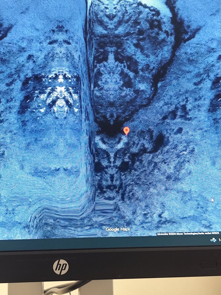
🔴 Google Earth görüntüsü ,koordinat 55°32'39"S 69°15'56"W
Gezegenimizin eski sakinleri olan Annunakilerin bıraktığı izlerine bakın...

Türkçe


Patagonia is weirder than I thought! 😲
What is this weird landscape on the border between Chile and Argentina, near Antarctica? How can this be a coincidence, what are they hiding there?
Strange faces and a large human figure, what is this island about?
Skeptics will say this is just symmetrical mirroring of the map and some artifacts, but I doubt that, because there is another weird face in Antarctica close to this location!
Open Minded Approach@OMApproach
The Piri Reis map was created in 1513 from older sources, only 21 years after Christopher Columbus set foot in the Americas. On the map, one can clearly see that the now-submerged Bimini Road was once part of an island. The submerged Bimini Road was discovered in 1968 — how is that possible? The map also appears to show a connection between South America and the coastline of Antarctica in great detail, without any submerged portions. The sources used for this map seem to predate one of the past geophysical events, and I suspect they originate from before 1200 BC, possibly prior to the Sterno-Etrussia geomagnetic excursion.
English


Bunun ne olduğundan emin değilim ama kesinlikle bunu görmememiz gerektiğini düşünüyorum 😳
Türkçe


Google Earth görüntüsü ,koordinat 55°32'39"S 69°15'56"W
Gezegenin eski sakinlerinin bıraktığı hangi izleri fark ettiniz burada ?

Türkçe
@huseyinkanturk Sadece haritalama hatası. Dünya şekli yuvarlak (elips, geoid vs) olduğu için 2 boyuta indirgemek hata veriyor.
Uzaylı filan yok yani😏

Türkçe

Tam da Antarktika’mın dibinde .. Grok doğal oluşum demiş… Size doğal bir oluşum gibi geliyor mu… ? :)
Türkçe
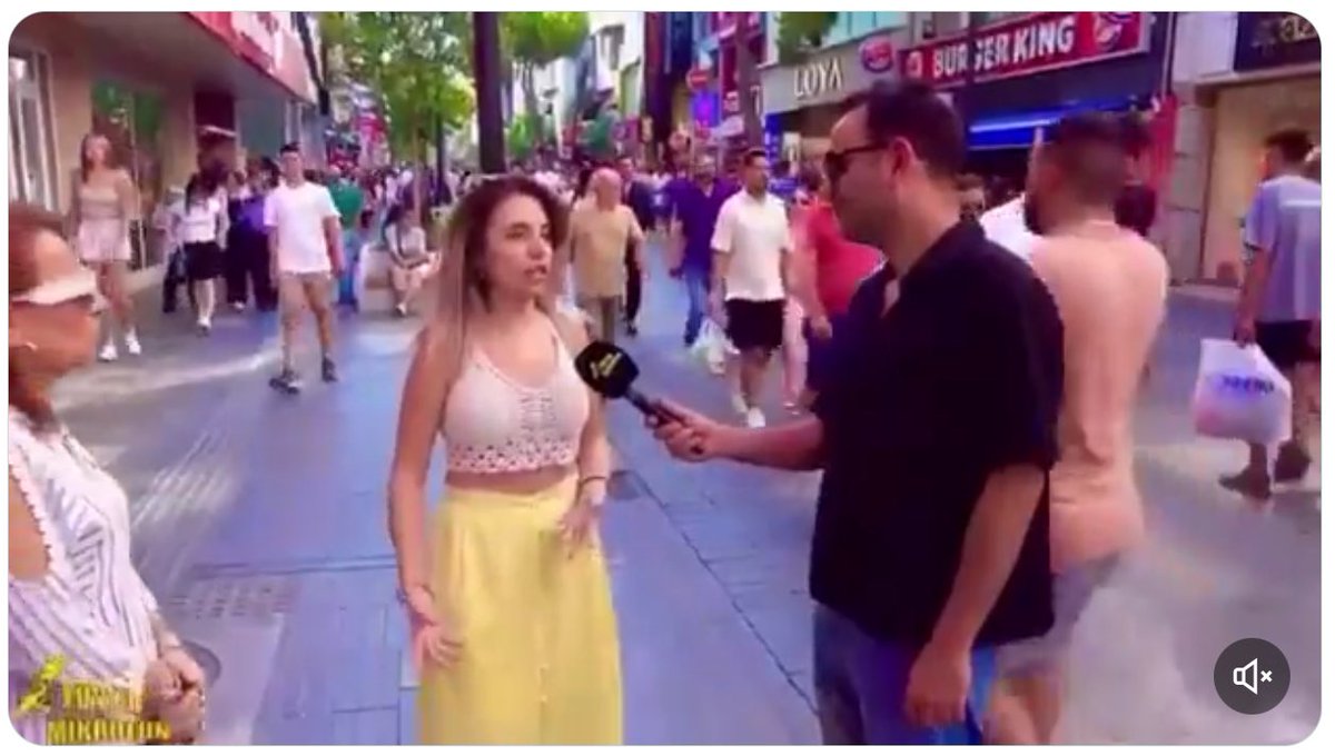
@cnnturk Venezuellada dönercilik yapan adama politik, sosyolojik, siyasi analitik bilgi gibi konularda sorular sorulup cevapları dinleniyor ve dinletiliyor. Bu kadar ayağa düşürmeyin lütfen...
Türkçe

🔴 #CANLI | TRUMP: VENEZUELA'YI BİZ YÖNETECEĞİZ twitter.com/i/broadcasts/1…
Türkçe
@ww3mediaa Çoğu kişi oraya gitmenin imkansız olduğunu düşünür. Fakat gerçekte 10 yıl gibi bir sürede gidilebilir. Fakat dönüş için aynı şeyi söyleyemem. Gitmek; giden kişi için 10 yıl gibi bir süre olsada aynı zamanda dünyada 100binlerce yıl geçmiş olur. Düşünüldüğü kadar aciz değiliz...
Türkçe
🔴#SONDAKİKA
Bilim insanları, Dünya'nın 4 katı büyüklüğünde yeni bir “Süper-Dünya” keşfetti: GJ 251c.
▪️Dünya’dan sadece 20 ışık yılı uzakta.
▪️Yüzeyinde sıvı su olabileceği düşünülüyor.
▪️Araştırmacılar, bu gezegeni yaşam ihtimali en yüksek adaylardan biri olarak değerlendiriyor.

Türkçe

#SonDakika | CHP’nin Konya mitingi için çalışan İl Başkan Yardımcısı Mustafa Durmaz ve Merkez İlçe Başkan Yardımcısı Muhammet Keskince silahlı saldırıya uğradı.

Türkçe
@KirmiziKoseMMA Hayır olay bu değil. Acil çıkış kapısına oturma şartlarını kabul ediyor. Fakat yan tarafta oturan kadın bunları tanımıyor ve görüntüsünden rahatsız olup şikayet ediyor. Hostes şikayeti ciddiye alıyor. Yer değiştirmeleri isteniyor. Ama khabib kabul etmeyip uçaktan iniyor.
Türkçe

🚨 Khabib Nurmagomedov, hostesle yaşadığı anlaşmazlık nedeniyle uçaktan indirildi!
Acil çıkış kapısında oturan Khabib, acil durumda yapması gerekenleri başta anlamadı. Daha sonra kabul etti fakat hostes ikna olmadı. Daha sonra da Khabib uçaktan indirildi
Türkçe
Burası Yozgat değil, Konya değil kardeşim, atamazsın çöpünü!!!
İlgili firmaya ve araç sahibine 14.407 TL ceza tebligatı gönderildi.
Ben sizin belediye başkanınıza benzemem. Türkiye’nin en temiz şehrini kimseye kirlettirmem!!!
Türkçe
@Yilmaz_Ozdill İfade özgürlüğü bir partinin destekçilerine hakaret etmeyi meşru mu kılıyor? Bir cok insanin takip ettiği bir gazetecisin. Sana bunu savunduracak kadar nasıl gözün dönmüş olabilir ki?? Ya da nasıl bir çıkarın olabilir?!
Türkçe
Haniye öldürüldü diyorlar, halbuki Türkiye’de ifade özgürlüğü öldürüldü.
Türkçe
@dusunbildergisi Daha çok Coca-Cola nin reklami gibi geldi bana.. Gerisi bahane..
Türkçe

Nazik olmanın en iyi ve en güzel faydalarından biri dünyanın karşılık vermesini izlemektir.
Türkçe
Havva İşkan@HavvaIskan
Bu Dünya’da başka #Göbeklitepe yok.Meslektaşım @necmikarul rehberliğinde devam eden kazı çalışmalarını ve son bulguları yerinde görebilmek büyük bir bilimsel kazanımdı.Göbeklitepe sadece “bilim”le açıklanır.Onu uydurdukları hurafelerle kimliksizleştirenleri şiddetle kınıyorum.
QME

Sözde (kürtçü) Yazar Fatma İzol: "Kürtçe Göbeklitepe'de kadınların inşa ettiği bir dildir. Arkeolojik araştırmalarla Kürtçe ile ilgili sürekli yeni veriler elde ediliyor. Yani Kürtçe ne kadar uğraşılsada yok edilemez!"
Demiş.
Şimdi bunların iddiaları bitmez taaa HZ. Ademe kadar gider!!
Ama işin esası şudur.
Kürtler'in dil yapısı Farsçadır! yani İrani dildir.
Zaten kendileri de İrani kavimlerden.
Türkçe
@mustafarmagan @tc_cimer Sahil şeritlerindeki isletmeler kimler hangi gruplar tarafından isletiliyor. Asıl buna bakılması lazım. Bu sorun çözülürse her şey normale döner.
Türkçe

Bu kimin marifeti?
Marmaris'te Kanuni Sultan Süleyman Han'ın yaptırmış olduğu menzilhane birahane olmuş.
Kim bunun sorumlusu?
Allah rızası için ilgilenelim
@tc_cimer
Türkçe