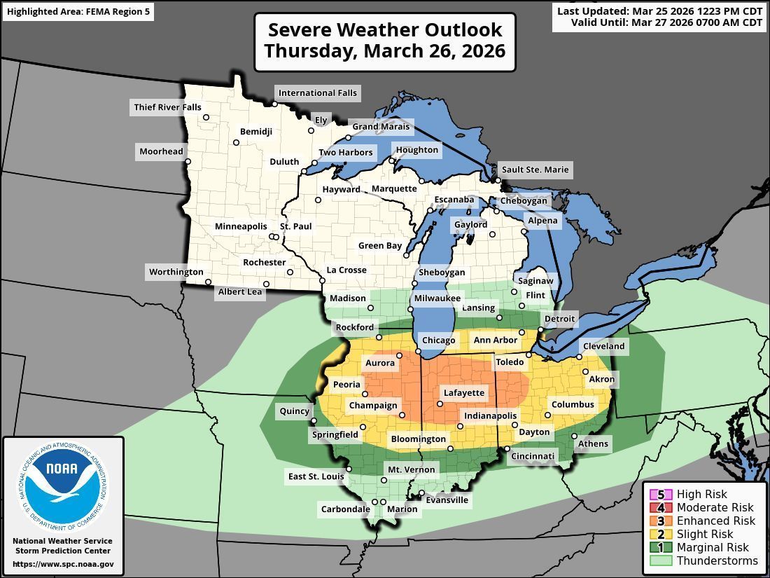
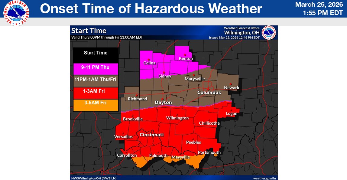
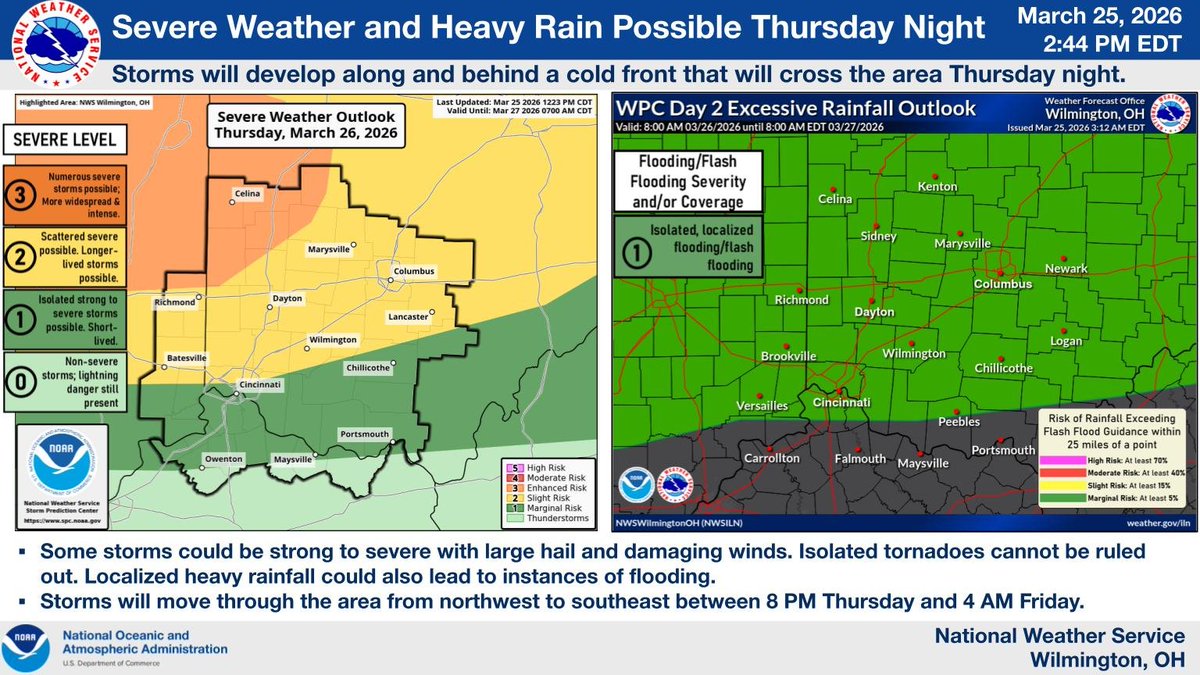
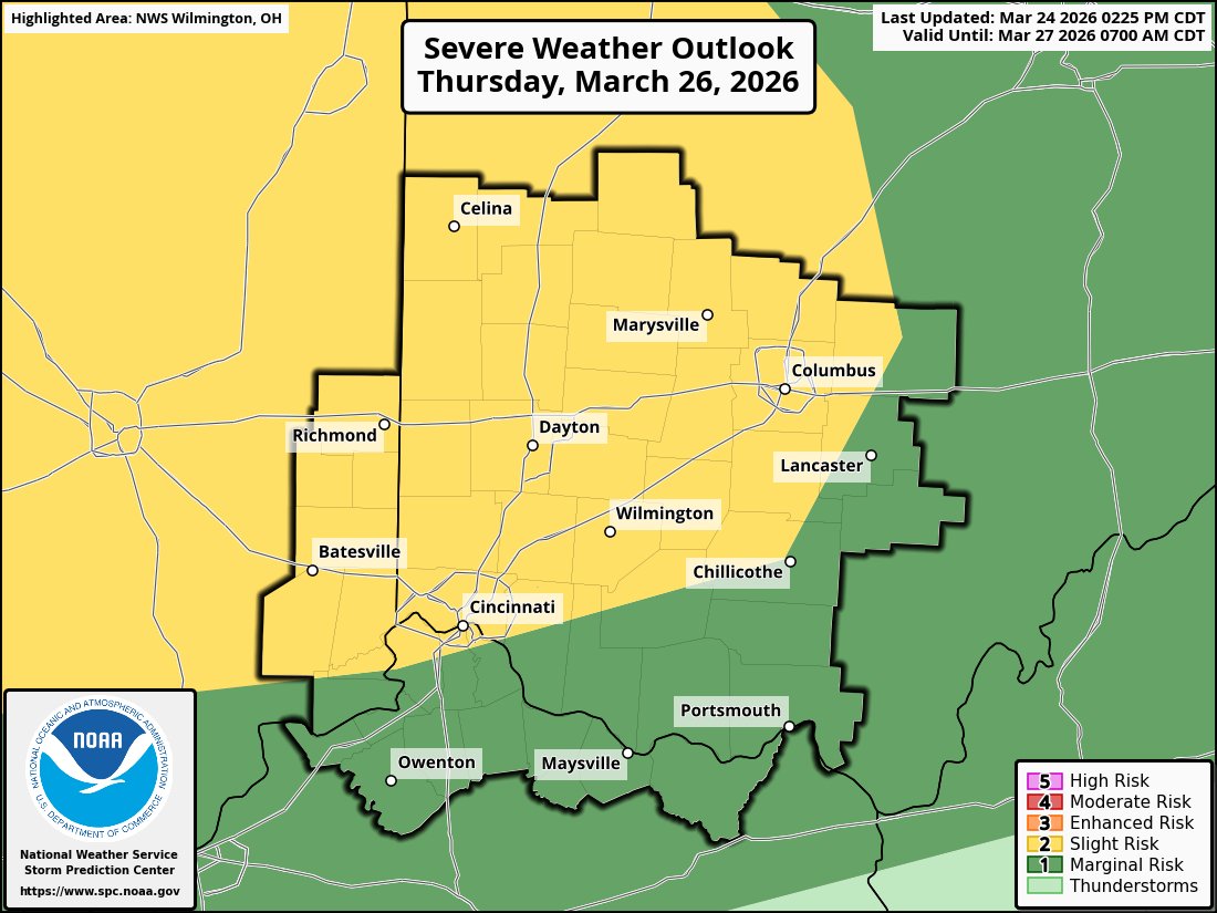
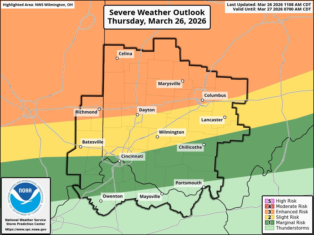
@NWSILN Unlikely a severe thunderstorm watch be issued for Ohio
English
Jacob Thornton
335 posts

@JacobTh16722853
I’m a storm spotter for Wilmington Ohio national weather service 6yrs
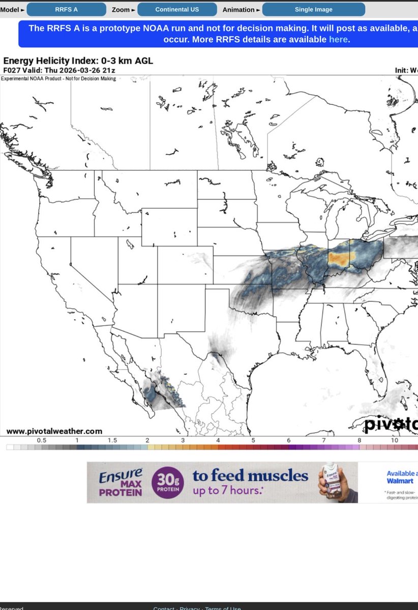
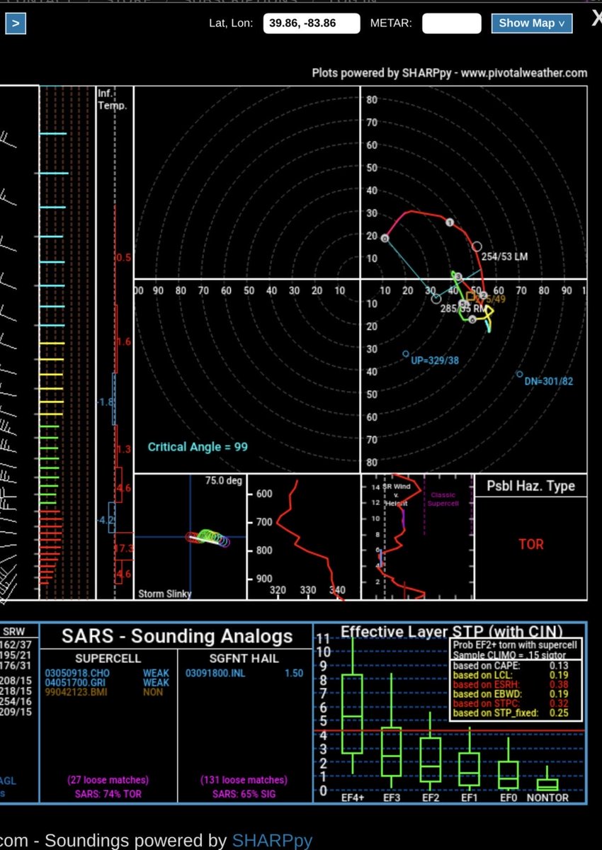
7:11pm CDT #SPC_MD 0581 , #kywx #inwx, spc.noaa.gov/products/md/md…