Jeff Smith retweetledi

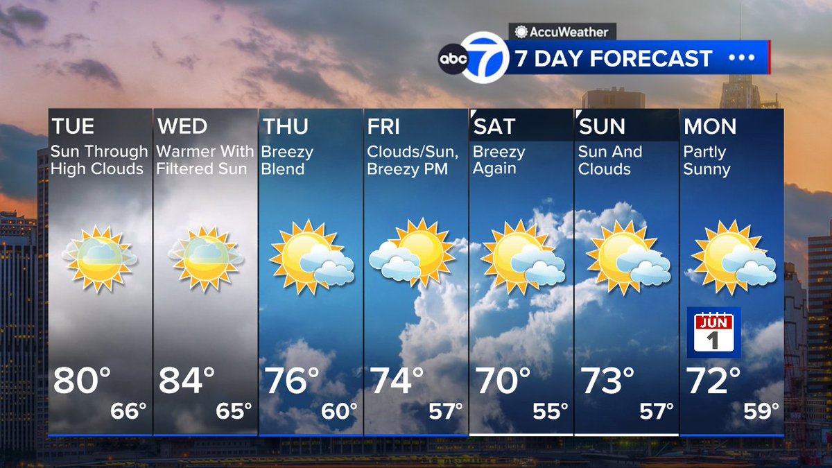
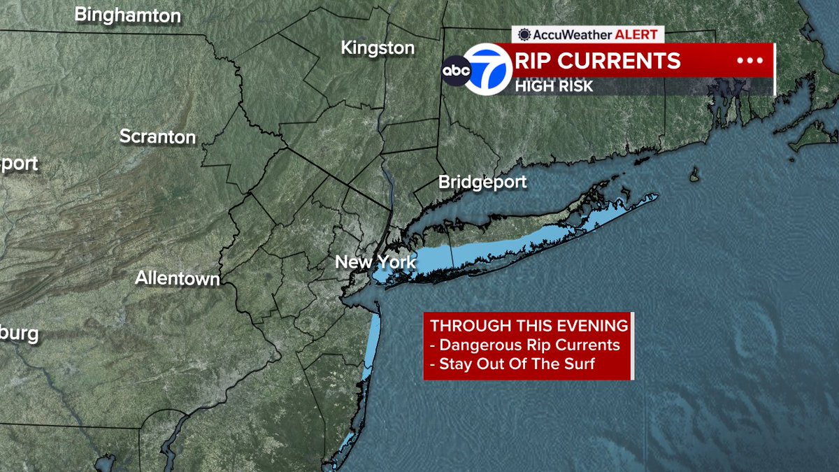
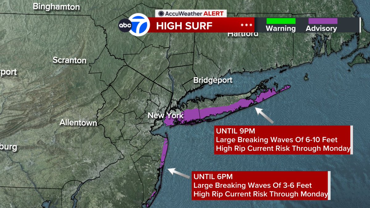
After a Memorial Day weekend washout, the flash flood threat persists across several states in the South, stretching from the north-central Gulf Coast up to Tennessee. @JeffSmithABC7 shares the forecast. abcnews.link/KPcBJHk
English