The Tornado Cowboy

546 posts

The Tornado Cowboy banner
The Tornado Cowboy

The Tornado Cowboy

@MatthewWatersWx

Atmospheric Scientist/Meteorologist, Open to Work, Storm Chaser, Go Bolts⚡️

Austin, TX Katılım Nisan 2022
331 Takip Edilen1.2K Takipçiler
Sabitlenmiş Tweet
The Tornado Cowboy
The Tornado Cowboy@MatthewWatersWx·
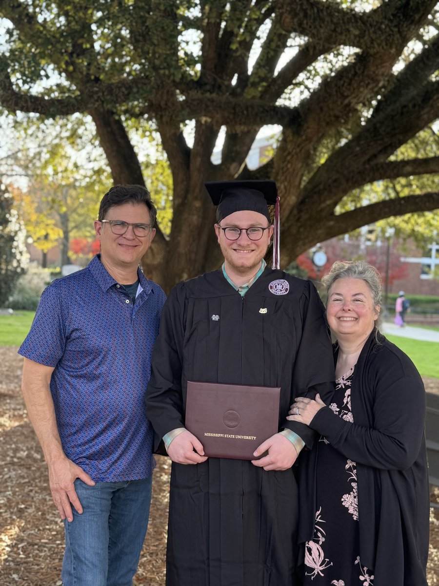
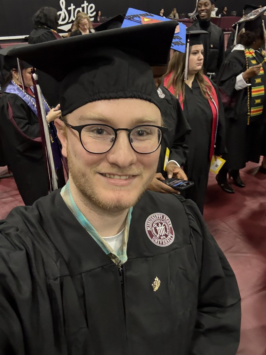
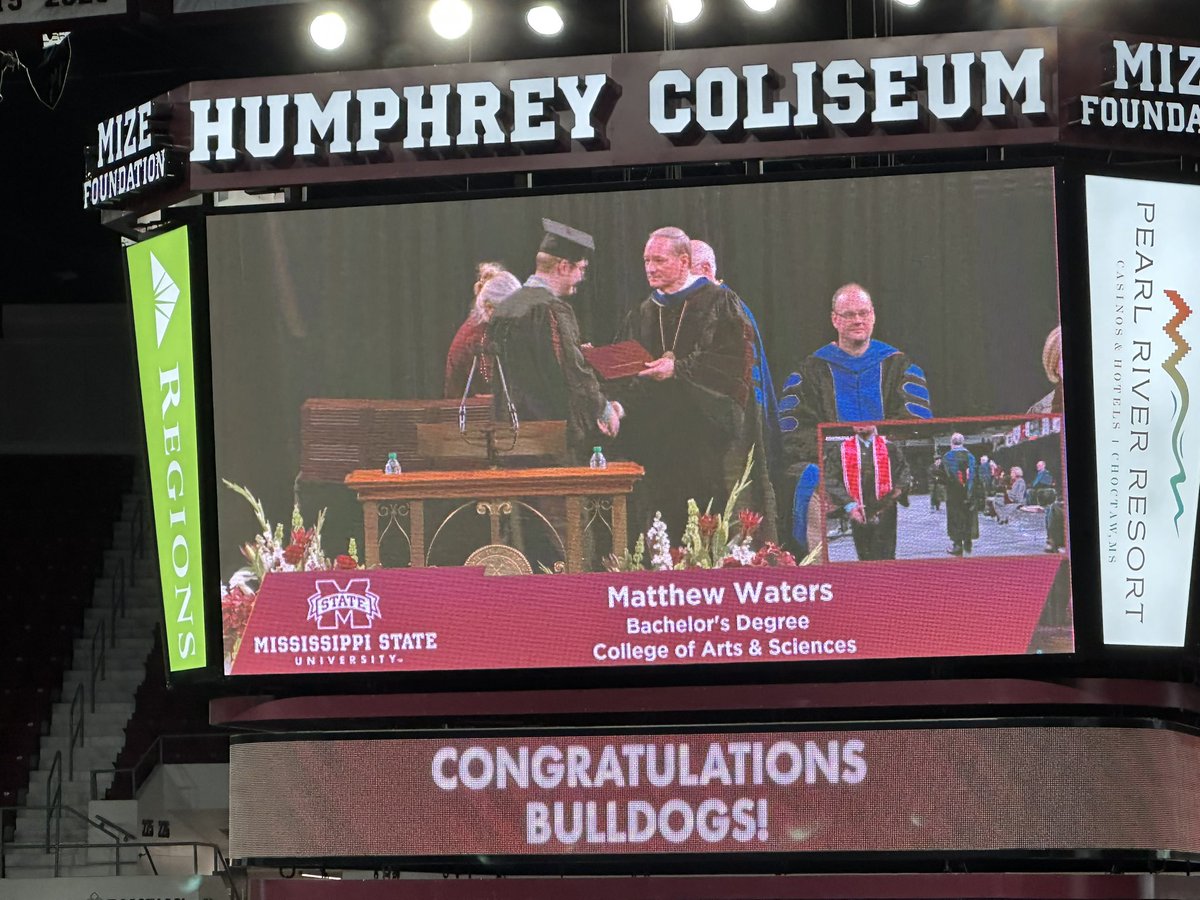
On December 12, 2025, my childhood dream came true and I became a degreed meteorologist. This was made possible by the unwavering support from my amazing family unit and the great professors of Mississippi State University. Looking forward to future connections and collaborations!
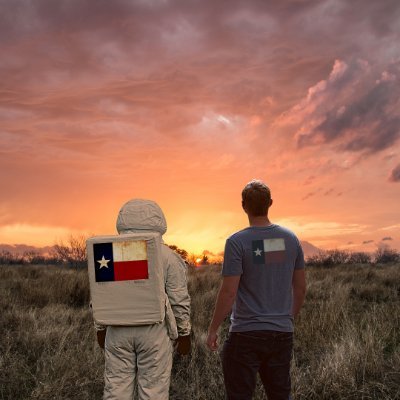
 #HailState #txwx
The Tornado Cowboy tweet mediaThe Tornado Cowboy tweet mediaThe Tornado Cowboy tweet mediaThe Tornado Cowboy tweet media
English
2
0
7
491
Amelia Urquhart 🏳️‍⚧️
‼️SOUTHERN MODE BUST CHASERS‼️ If you have photos of the agitated cumulus on the dryline yesterday, the eventual weak/storms after dark, or any information that may be helpful for future study, feel free to reply to this post. This will help us at the Chase Archive…
English
20
7
49
4.3K
The Tornado Cowboy
The Tornado Cowboy@MatthewWatersWx·
My hypothesis on the SW Oklahoma bust: The cold/stationary front (purple), dry line (yellow), and warm sector winds collided perpendicularly to create an almost stream-wise current feeding the north-central Oklahoma supercells. Further south, winds aligned more tangent to the convergence axis (see surface observation). A shortwave overspread northern Oklahoma deepening surface pressure. After 00z, the low-level jet ramped up and caused the southern portion of the dry line to retreat rapidly, effectively cutting off efficient mixing. The cirrus deck arriving around 23-00z caused a negligible decline in surface temps as shown by observations, leading me to believe it was wind vector based (and closer to the low). #okwx #txwx #wxtwitter
The Tornado Cowboy tweet mediaThe Tornado Cowboy tweet mediaThe Tornado Cowboy tweet mediaThe Tornado Cowboy tweet media
English
0
0
3
110
The Tornado Cowboy retweetledi
NWS Austin/San Antonio
NWS Austin/San Antonio@NWSSanAntonio·
An additional 2 to 4 inches of rain is possible through tonight which could lead to scattered instances of flash flooding, particularly over the Hill Country, I-35 corridor and Coastal Plains. Know how to get to a safe location if flooding does occur over your area! #txwx
NWS Austin/San Antonio tweet media
English
4
16
72
7.2K
The Tornado Cowboy
The Tornado Cowboy@MatthewWatersWx·
Tornado Warning and Flash Flood Warning….One of those rare cases of “get to higher ground” and “take shelter in the lowest level” #txwx
The Tornado Cowboy tweet media
English
0
1
2
177
The Tornado Cowboy retweetledi
Hunter Williams
Hunter Williams@Hunt_Wx·
The WPC has issued a new outlook highlighting the Austin-area and coastal plains for increasing flood potential this afternoon. Still some uncertainty in how/where the heaviest axis of storms develops, but where that happens flash flooding will be possible. The WPC even highlights potential for “significant flooding” if this axis sets up over our flood prone urban areas. Bottom line: still a fluid forecast today that could feature significant flooding if things come together. Have a way to get alerts.
Hunter Williams tweet media
English
0
5
30
3.4K
The Tornado Cowboy
The Tornado Cowboy@MatthewWatersWx·
Noon through midnight tonight, the ingredients for flash flooding are in place in Central and SE Texas. Widespread 2-3 inches with pockets of up to 8 are possible. #txwx #flashflood #flood
The Tornado Cowboy tweet mediaThe Tornado Cowboy tweet mediaThe Tornado Cowboy tweet media
English
0
1
3
220
The Tornado Cowboy
The Tornado Cowboy@MatthewWatersWx·
@DylanBaddour Somebody must have been praying for rain because as small as the watershed is, they got blessed with a deluge yesterday. Hoping with the coming El Niño we get more precip.
The Tornado Cowboy tweet media
English
1
0
0
47
WeatherNation
WeatherNation@WeatherNation·
@MatthewWatersWx Great footage! Did you film this? If so, may WeatherNation have permission to play your video on-air/online with full credit to you?
English
1
0
0
148
The Tornado Cowboy
The Tornado Cowboy@MatthewWatersWx·
Very thick moist layer from Corpus Christi sounding at 18z. There is also scattered heavy/intense pockets of rainfall that may lead to flash flooding along the Rio Grande and Nueces Rivers and their tributaries. #txwx #flood #flashflood
The Tornado Cowboy tweet mediaThe Tornado Cowboy tweet media
English
0
0
3
93
The Tornado Cowboy
The Tornado Cowboy@MatthewWatersWx·
Potential flash flood risk in central/south Texas through midnight as moisture continues to push inland and pressure falls mixed with saturated low levels are allowing for the production of heavy rain. #txwx #flood #flashflood
The Tornado Cowboy tweet mediaThe Tornado Cowboy tweet media
English
0
0
3
115
The Tornado Cowboy
The Tornado Cowboy@MatthewWatersWx·
Finally got around to estimating the sizes of the other hailstones from my Waco, TX 2023 chase and I estimated based on the one I measured a stone above 5 inches! #hailstones #txwx #hail
The Tornado Cowboy tweet media
English
0
0
2
105
Nick 🐲🌪
Nick 🐲🌪@Stormin13Norman·
@MatthewWatersWx @225MPH_EF4 Oh sweet, thanks for the pics! Yeah I can't imagine seeing those things falling in real time. I can't wait until I core punch my first softball+ storm hahahaha
English
1
0
1
51
Nick 🐲🌪
Nick 🐲🌪@Stormin13Norman·
Preliminary hail swath paths for the March 10th Kankakee & Darien supercells. These are just 2 of the ~1000 cases in my ongoing research into the climatology of 3.5"+ hailstorms from 1998 to present. Suggest your favorite large hail case below and I'll analyze it next! #wxtwitter
English
13
28
194
23.5K
The Tornado Cowboy
The Tornado Cowboy@MatthewWatersWx·
The 2026 hurricane season landfall risk areas are highlighted in red. While it may seem like almost all of the coast is under a higher risk this year, the breakdown by month clarifies when and where storms are expected. *Note: This is experimental. #2026hurricaneseason #Tropics
The Tornado Cowboy tweet mediaThe Tornado Cowboy tweet mediaThe Tornado Cowboy tweet mediaThe Tornado Cowboy tweet media
English
0
0
1
83
The Tornado Cowboy
The Tornado Cowboy@MatthewWatersWx·
Progression of the cold front with 90s ahead and 70s behind will bring much needed relief but with extreme fire danger risk. Winds behind the front are about 25 mph sustained with gusts up to 55 mph. #txwx
The Tornado Cowboy tweet mediaThe Tornado Cowboy tweet media
English
0
0
0
106