⚠️ ALERT: #GasPrices are highly likely to spike soon in MI, IN, IL, WI and OH, wholesale gas prices have already surged and retailers have not yet passed the increase on. Prices are likely to jump 50-80c/gal in this area very soon. Refinery issues and rising oil prices to blame.
OK, the data is back up and flowing for radar, warnings and text products. We know what is causing this, and we're looking at a workaround to keep this from happening again. I apologize for the inconvenience. -Gilbert (who really, REALLY needs sleep)
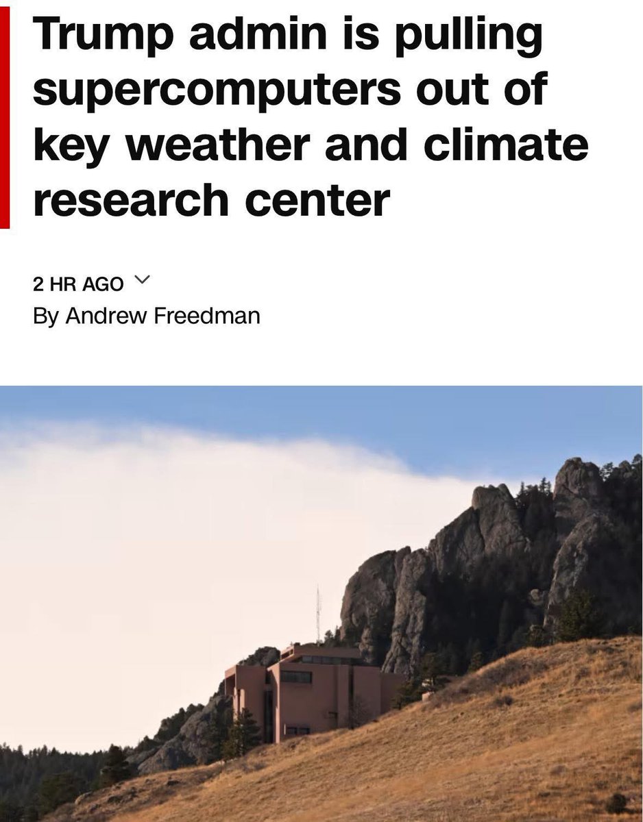
I’m surprised no storm chasers or meteorologists in this community are taking about how a huge nail to our community is occurring.
The Trump Admin is going forward removing the supercomputer at NCAR.
This supercomputer is where we develop research for weather models, physics cores, climate dynamics, MPAS, ensembles, WRF and improving the current models we use daily.
Taking this away would deprecate the meteorological community significantly.
@NWS_MountHolly@amburr_nicold@grok@DbDartman Honestly, this exchange emphasizes why I find the general public so exhausting in conversations about the weather. They misremember and misrepresent so much regarding previous events and forecasts. And then use that to argue for cynicism of the NWS, forecasts, etc.
Risk of a big winter storm continues to grow, tho uncertainty remains on how much snow falls, & any poss. mixing with ice &/or rain. Consider your plan of action regarding a large snow storm. Travel may be very difficult Sunday, even Monday. Further clarity as we get it.
@PepeGibby216@DaX05@NWSNewYorkNY Exactly. A good AFD has to contain technical jargon. Weather is extremely complicated, and there is just no getting around that. Simpler, streamlined messaging belongs elsewhere.
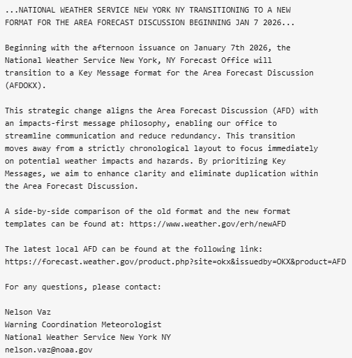
The NWS New York, NY will be transitioning to a new format for the Area Forecast Discussion (AFD) on January 7, 2026. Attached is our PNS regarding this change. #NYwx#CTwx#NJwxweather.gov/erh/newAFD
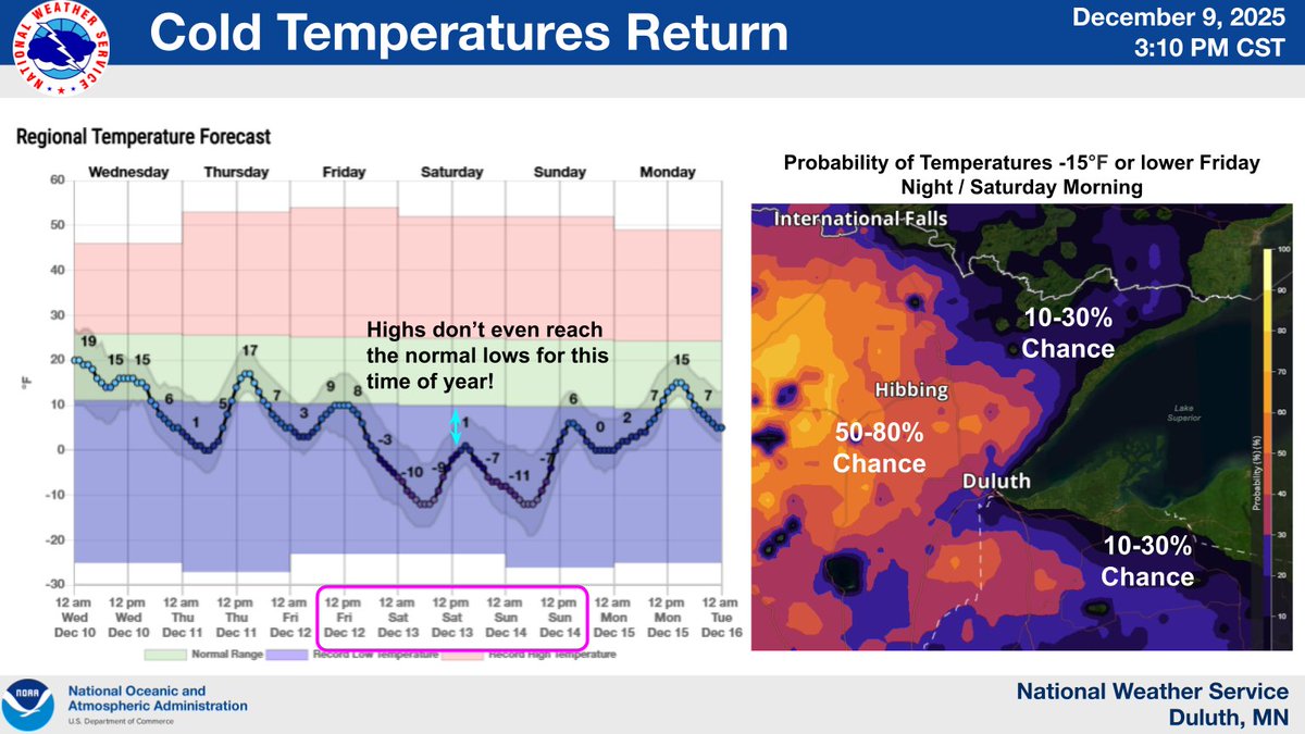
"Why do I live in a place where the air hurts my face?" will be a common question this weekend as dangerous wind chills and air temps return. Arctic air will make spending time outside dangerous if you don't cover exposed skin and dress in layers. #MNwx#WIwx
Highway department mentioned that there were blizzard like conditions in Hibbing in some of these snow showers behind the front. They shouldn't last long though.
Strong wind mostly goes straight SE, so again, per previous tweet, from Devils Lake to Fargo and points south and west of that line getting the higher wind today. Mostly in areas that recorded little snow and temps warm enough to have capped the snow that was on the ground.
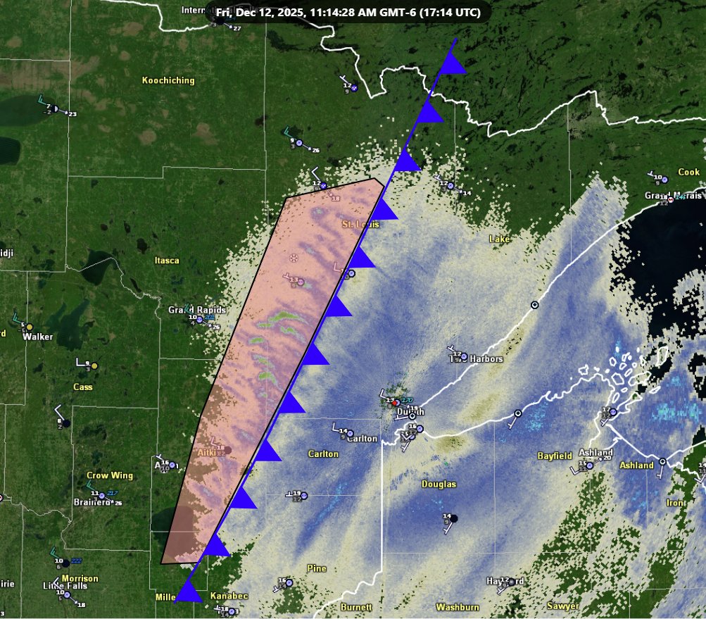
A winter storm will continue to move through the Northland through tonight, with the worst impacts expected from the Brainerd Lakes to Spooner. Snow amounts have decreased on the northern gradient with lesser amounts now expected along Highway 2 and the Twin Ports. #mnwx#wiwx
@NWSSWPC I just want to emphasize that there are a lot of citizens who appreciate what the NWS (and other NOAA operations) do to keep us informed and safe, especially with the current political environment. Thank you very much and great content.
Here's our final SWPC walk-through video to give you the latest space weather info about this past few days of activity. Thanks for your comments, it's quite clear you appreciate these & want to see them again for future significant events. We'll do our best to make that happen.
@WeatherGamer21 I know the exact one you’re talking about, definitely a memorable one. It reminded me of an IL derecho. Truck is ok from what I hear, but much of the Range area is without power. The CtG lightning for this was wild, probably the loudest storm I’ve personally witnessed.
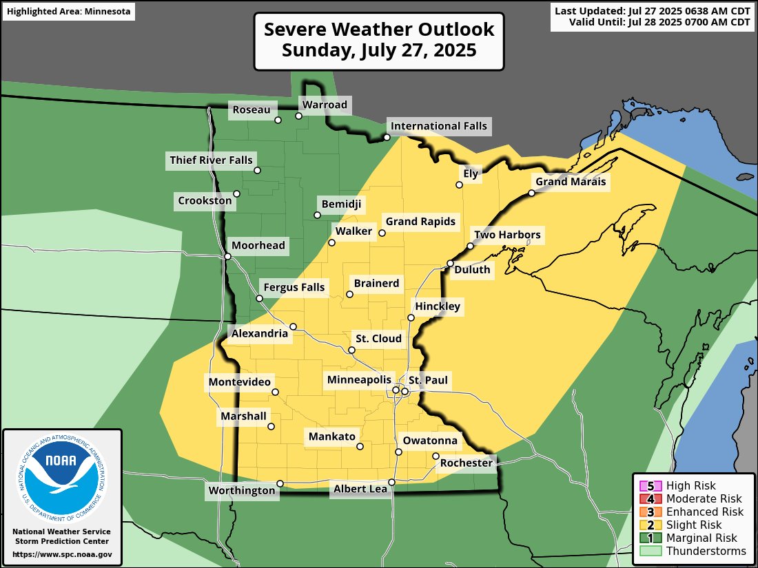
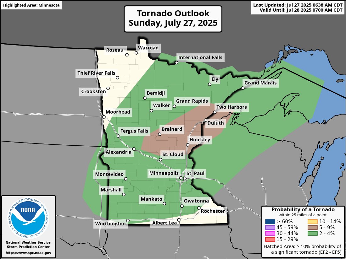
Severe weather is possible today across much of #mnwx and western #wiwx with all hazards possible! A few tornadoes are possible today as well! I do believe there is a chance we see an upgrade to enhanced across central MN if a MCS becomes more certain heading into the afternoon! Clear skies across the region this morning should aid in the severe threat including the extreme heat! Stay weather aware today!