@Jasiri_ACM Word. Especially formers directors. Theyll hope from conferences to another with claims they pioneered sijui what plans, but none of them ever brought down illegal buildings. None!
English
Abyssinian Carto
8.3K posts
@MidoCollins
Code, Stats, Maps, Data, Cities & 2D

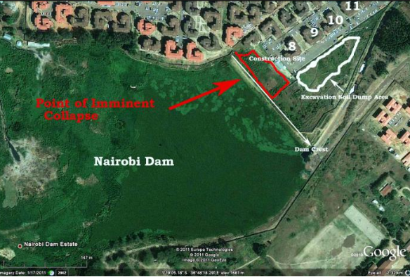
Who allowed this to happen?😭 Arrest all City planners now!😡

As a long-term friend of the late Johanna Ngeno, I hosted his family at my Nairobi home today. It was a follow-up visit after the demise of the Emurua Dikirr MP. Even after the burial, our ties remain strong, and we're committed to strengthening family bonds.


My favourite thing about Parklands Baptist church is that it is in Westlands. There must be a reason why it was not called Westlands Baptist


Could be Nairobi parks if Sakaja wasn’t in office


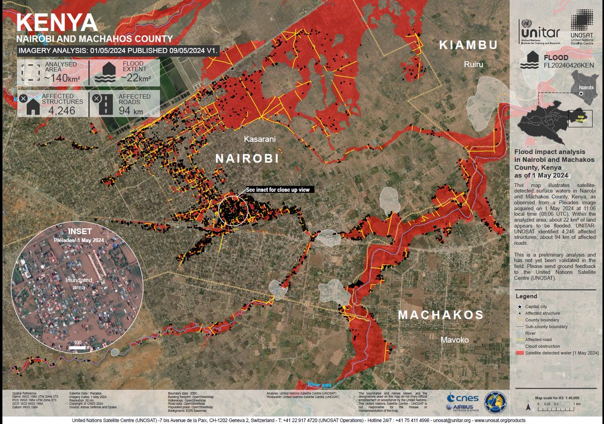
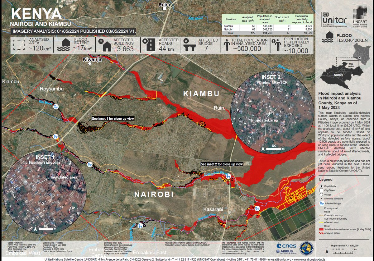
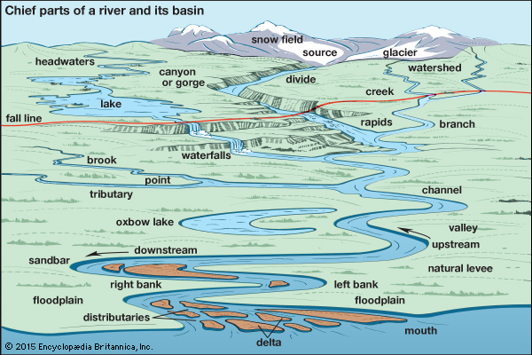
Nairobi Flood Alert: A critical new mapping exercise has identified 37 neighbourhoods across Nairobi that are now officially classified as high-risk. The Nairobi Rivers Regeneration Programme has mapped out the most vulnerable spots. #NTVWeekendEdition @Karanja_Ibrah
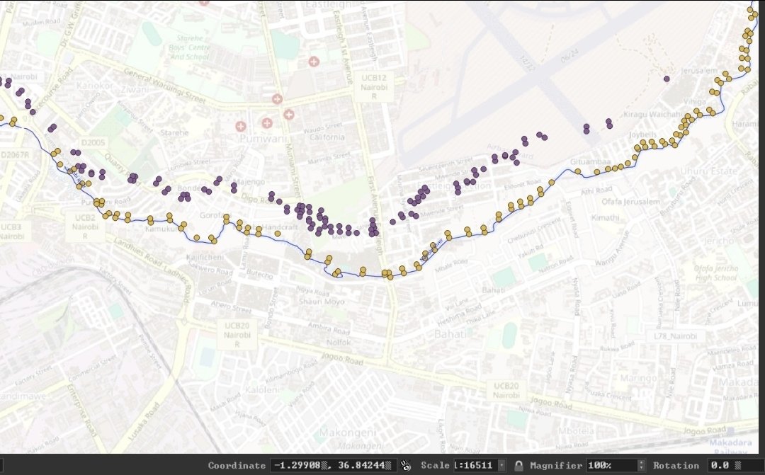
Traders in Kamukunji and surrounding areas like Gikomba and Shauri Moyo have been issued with a 14-day notice to vacate. The notice, issued by the Water Resources Authority (WRA), cited that structures were built within a 30-metre riparian reserve along the Nairobi River!