MyWeather
1K posts


MyWeather
@MyWeatherUK
Your UK Weather Guide - featuring advanced warning graphics, Severe Weather Outlooks, Weather Pattern Scenarios and much more! Stay Alert, Aware, Safe


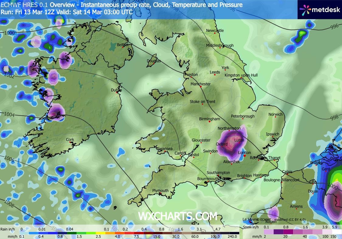
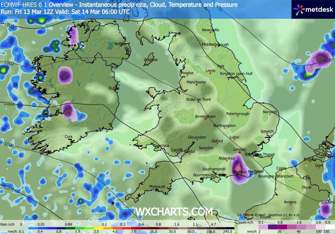


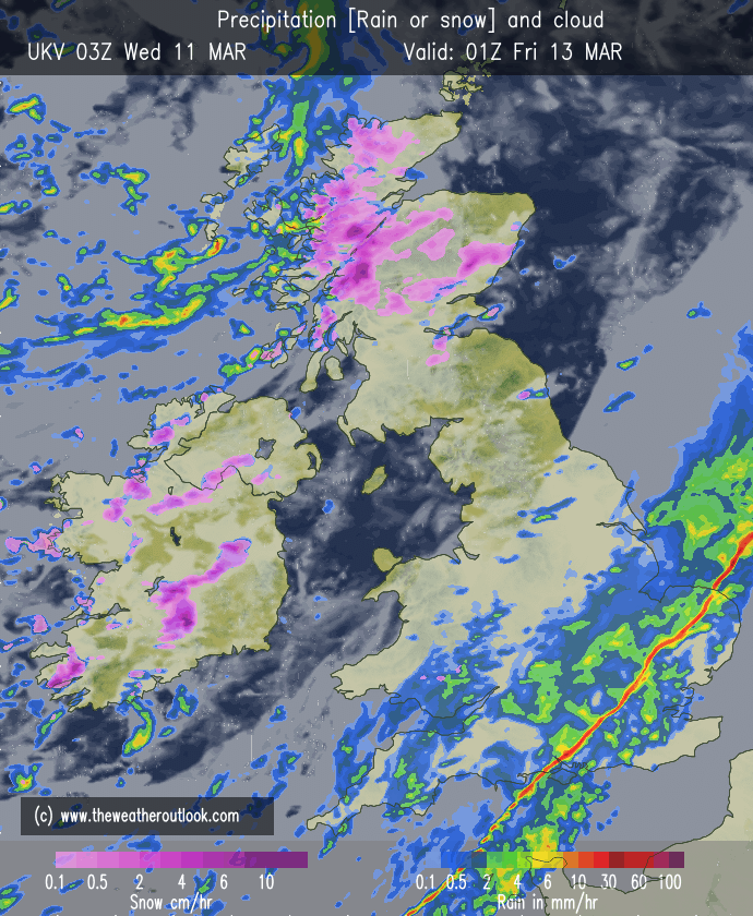


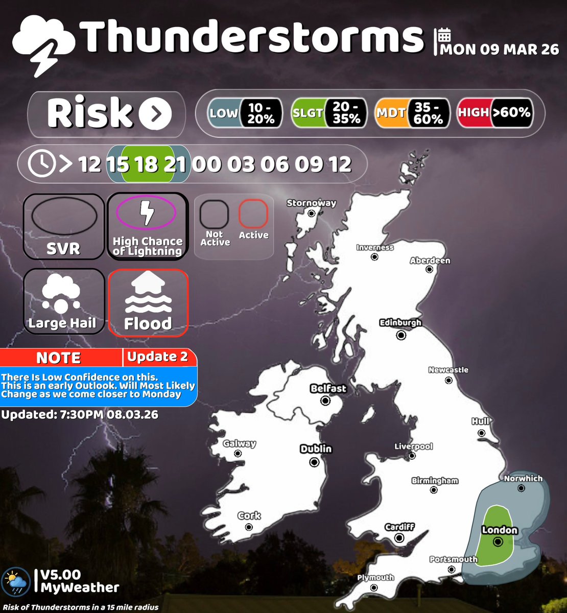
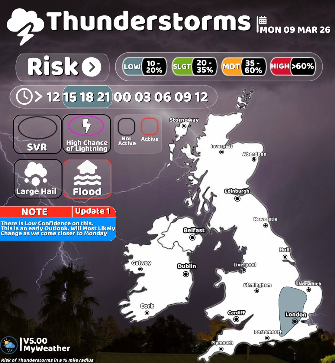
Monday Thunderstorm Outlook ⚡ Note: We are still more than 24 hours away from the potential event, so the forecast and graphic are likely to change as we get closer to Monday. Description: An area of increased instability (moderate CAPE values) is expected to move north–northeast from northern France and the English Channel during Monday afternoon. As this instability moves into southern England, showers are likely to develop across the Home Counties and London during the early afternoon. These showers may become thundery as the afternoon progresses, producing around 10 mm of rainfall, with up to 20 mm possible where thunderstorms become more persistent or locally heavier. Localised surface water flooding may occur in areas with poor drainage if heavier storms develop. Key Takeaway: Thunderstorm development will depend on several factors. Firstly, the timing of the arrival of the instability (CAPE) will be important. If it arrives too early, most of the activity may move out into the North Sea before storms have time to properly develop. If it arrives too late, there may not be enough daytime heating remaining for thunderstorms to form. Secondly, cloud cover will also play an important role. Some sunny breaks will help increase instability, which would improve the chances of thunderstorms developing. If cloud cover is more persistent, storm development may be more limited.